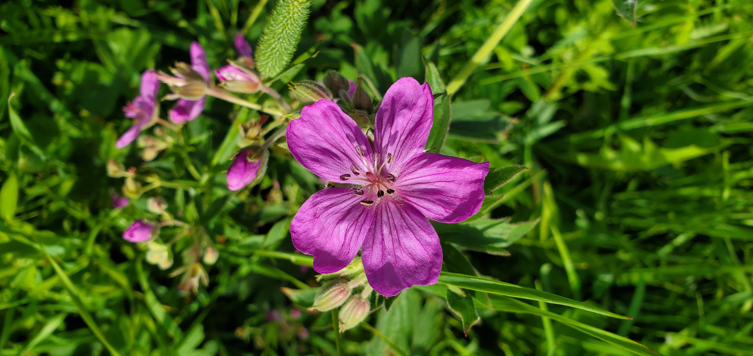
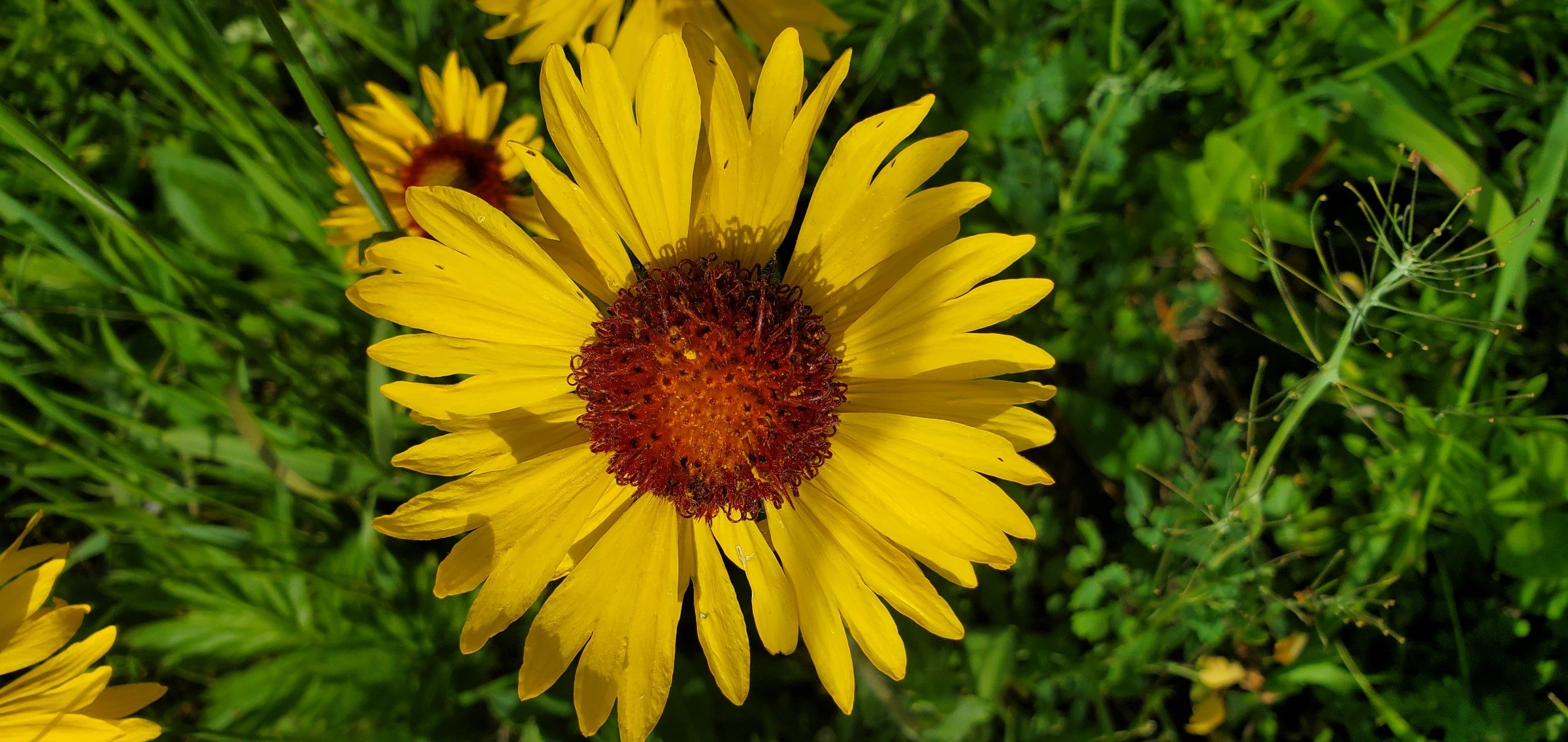
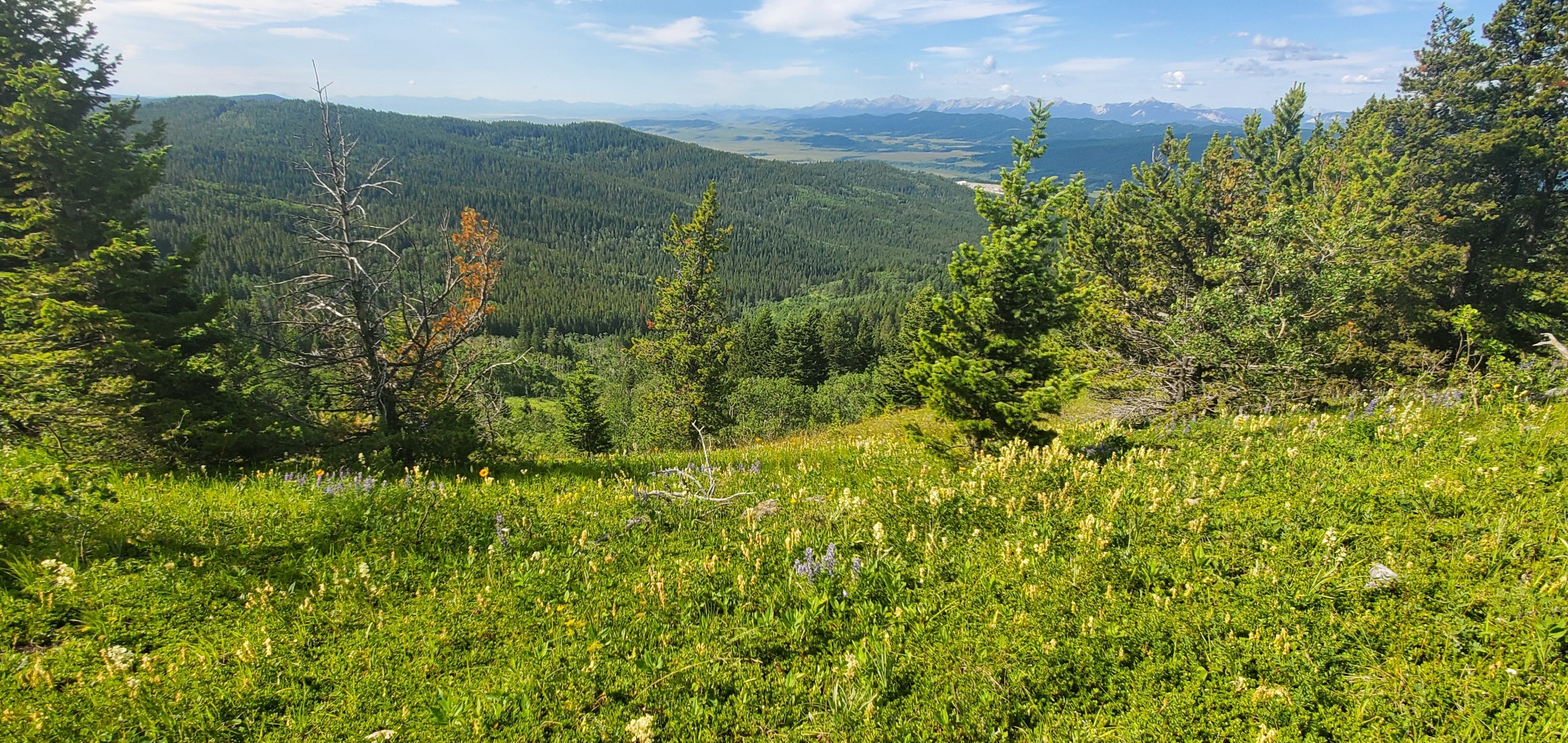
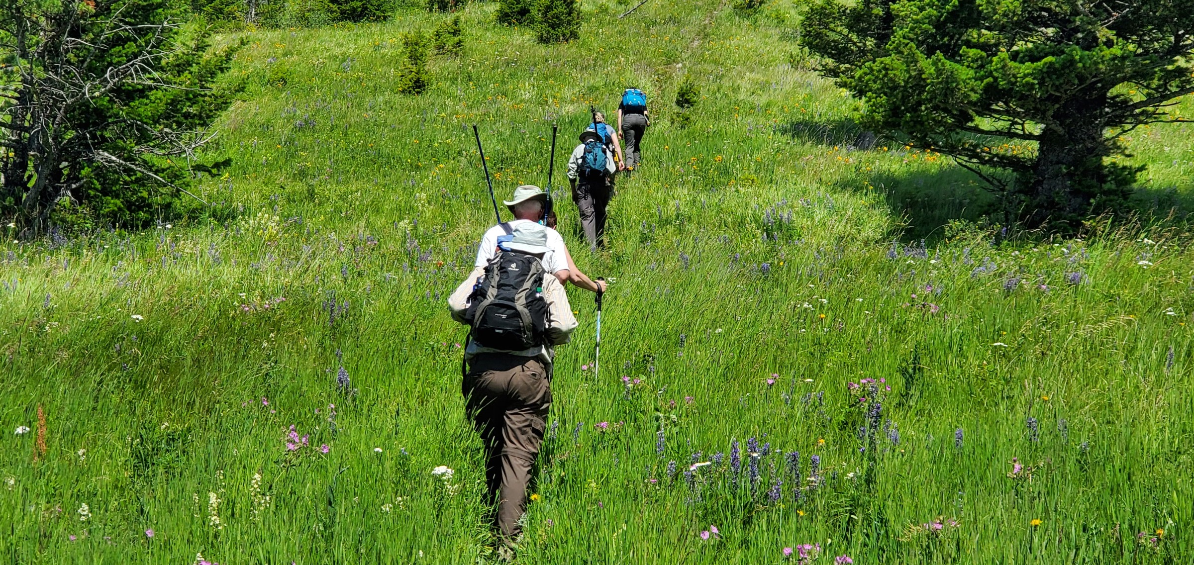
2020 Photo Gallery
Check out all the fun everyone had on our adventures in 2020!
(Looking for stories and photos from 2021? Click here or see the “past adventures” menu above.)
Here are the adventures with stories from 2020…
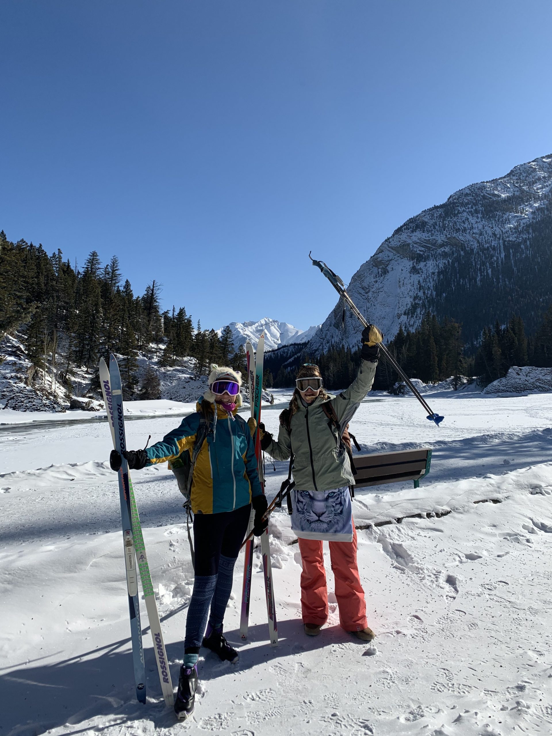
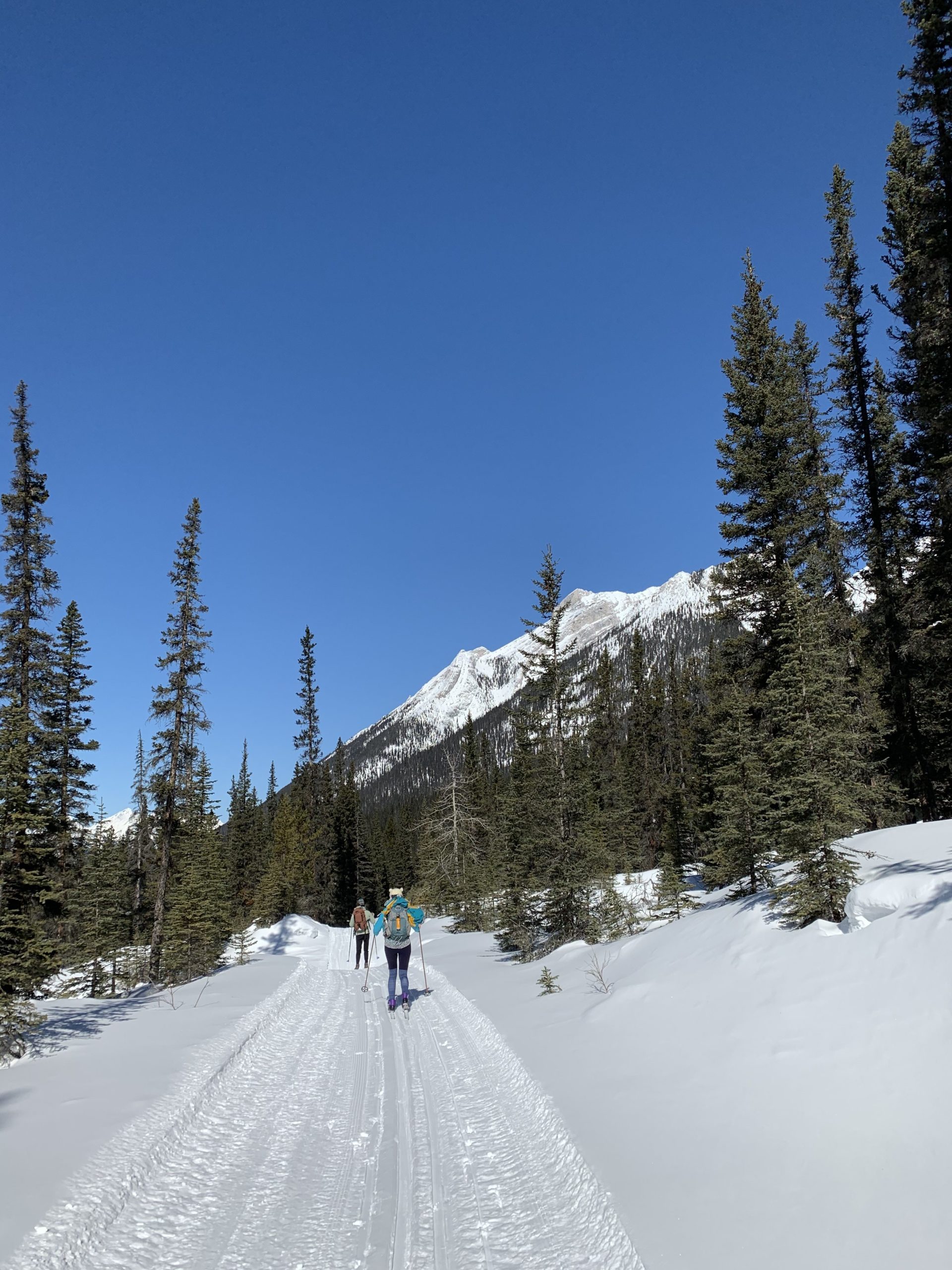
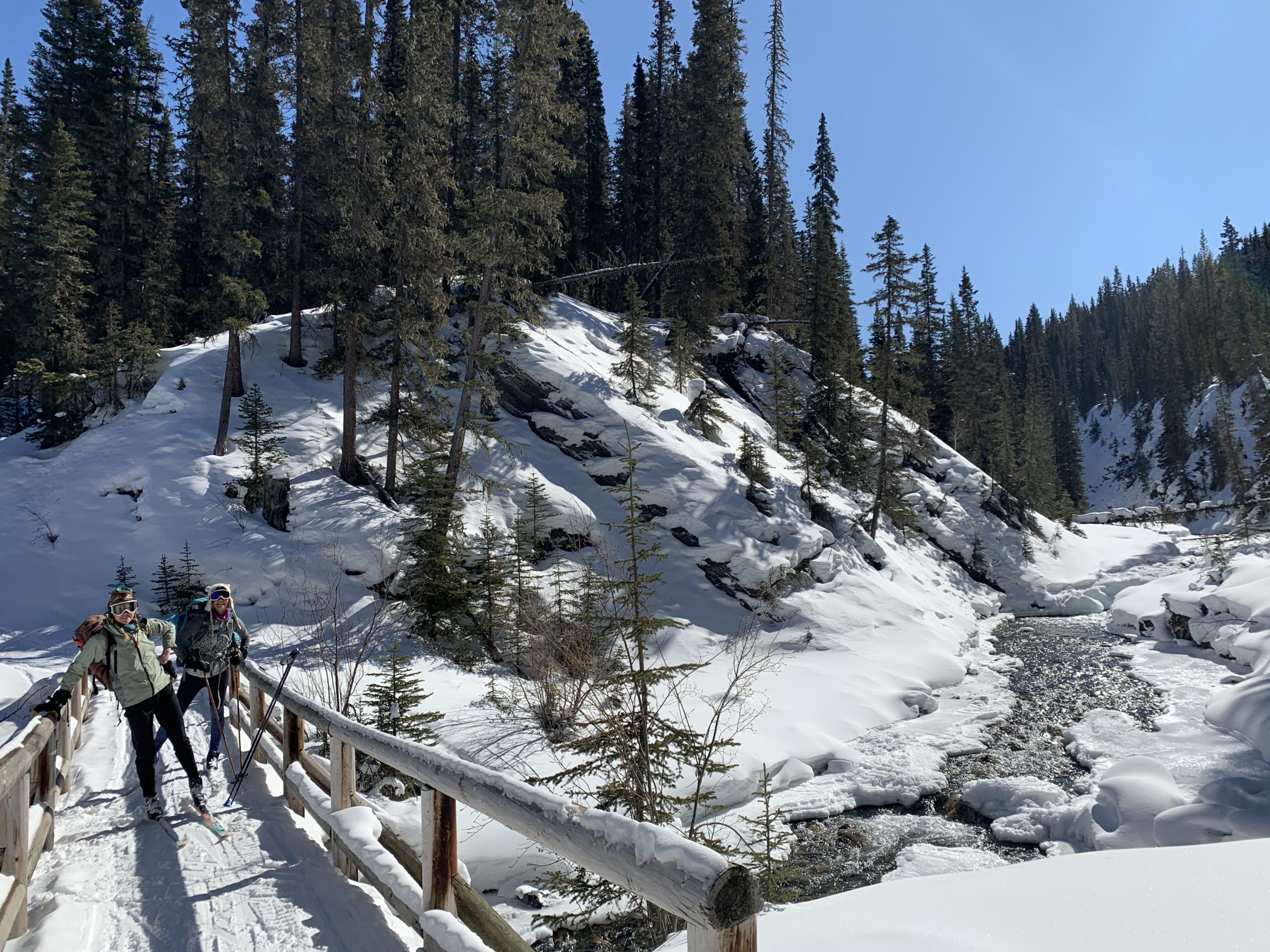
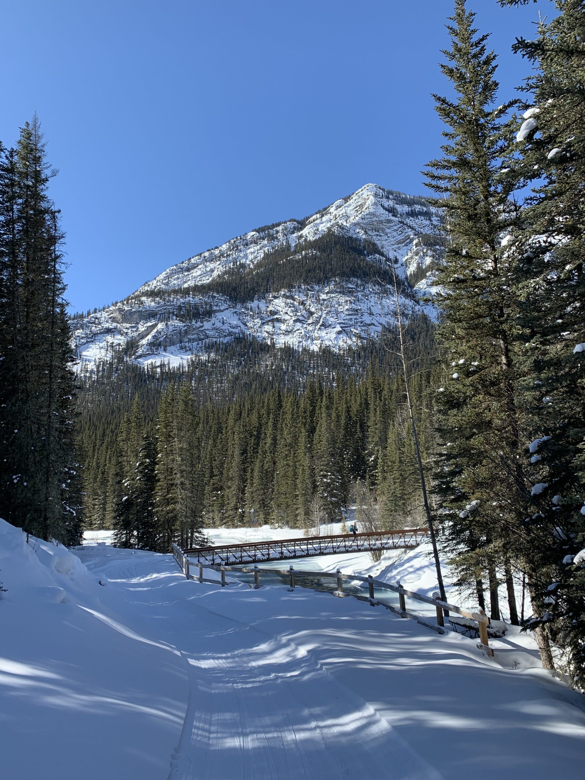
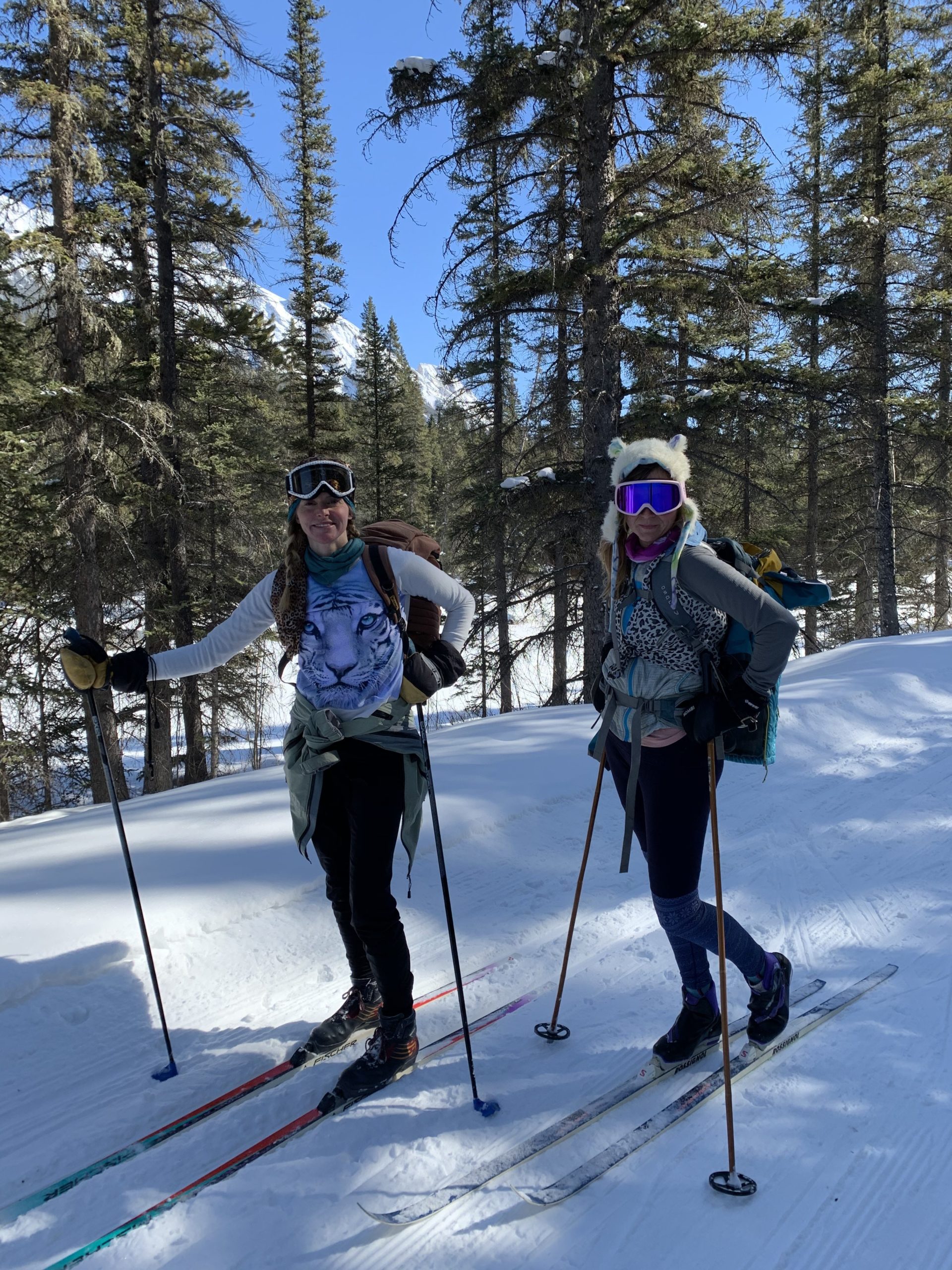
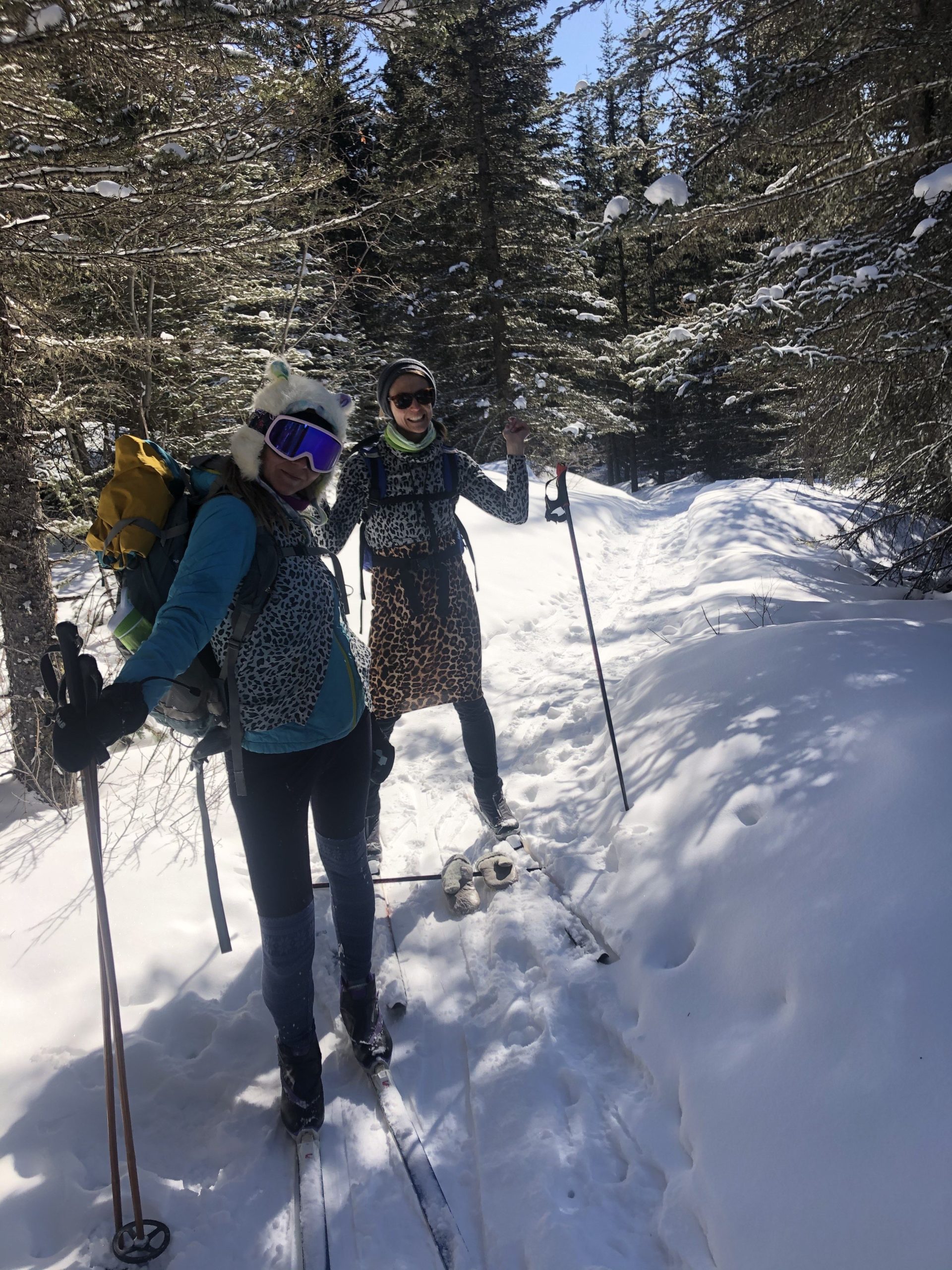
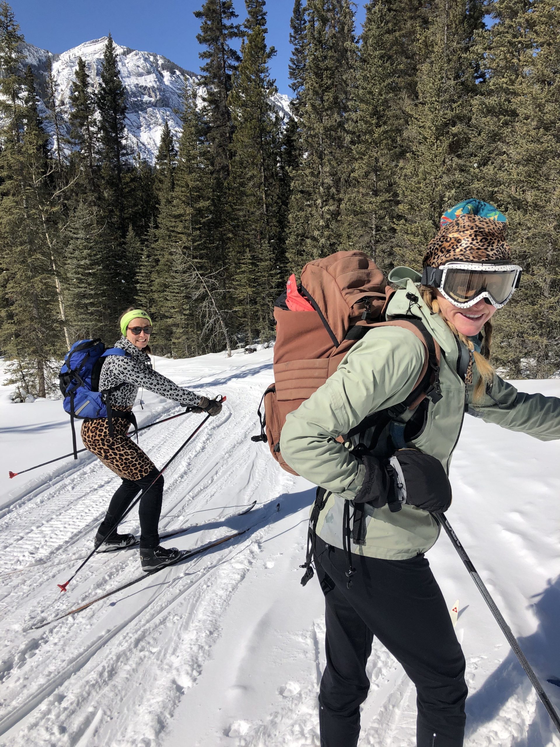
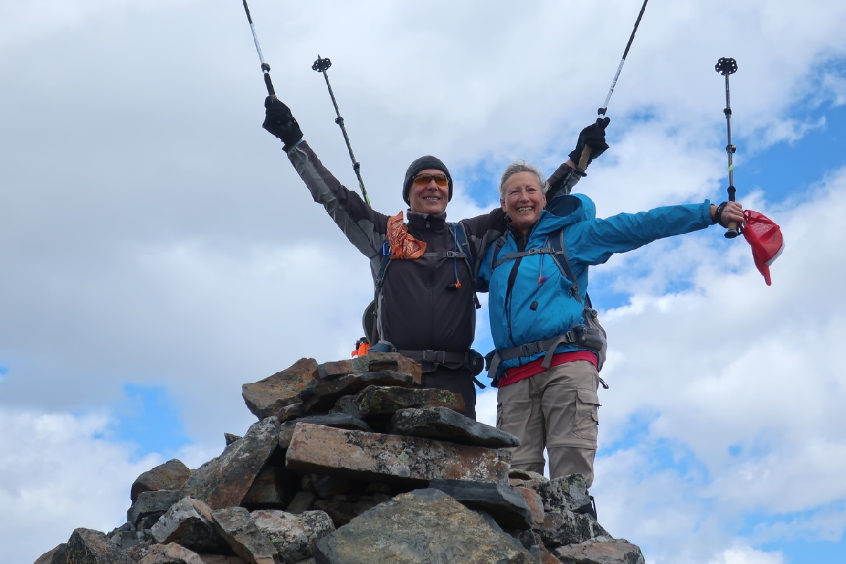
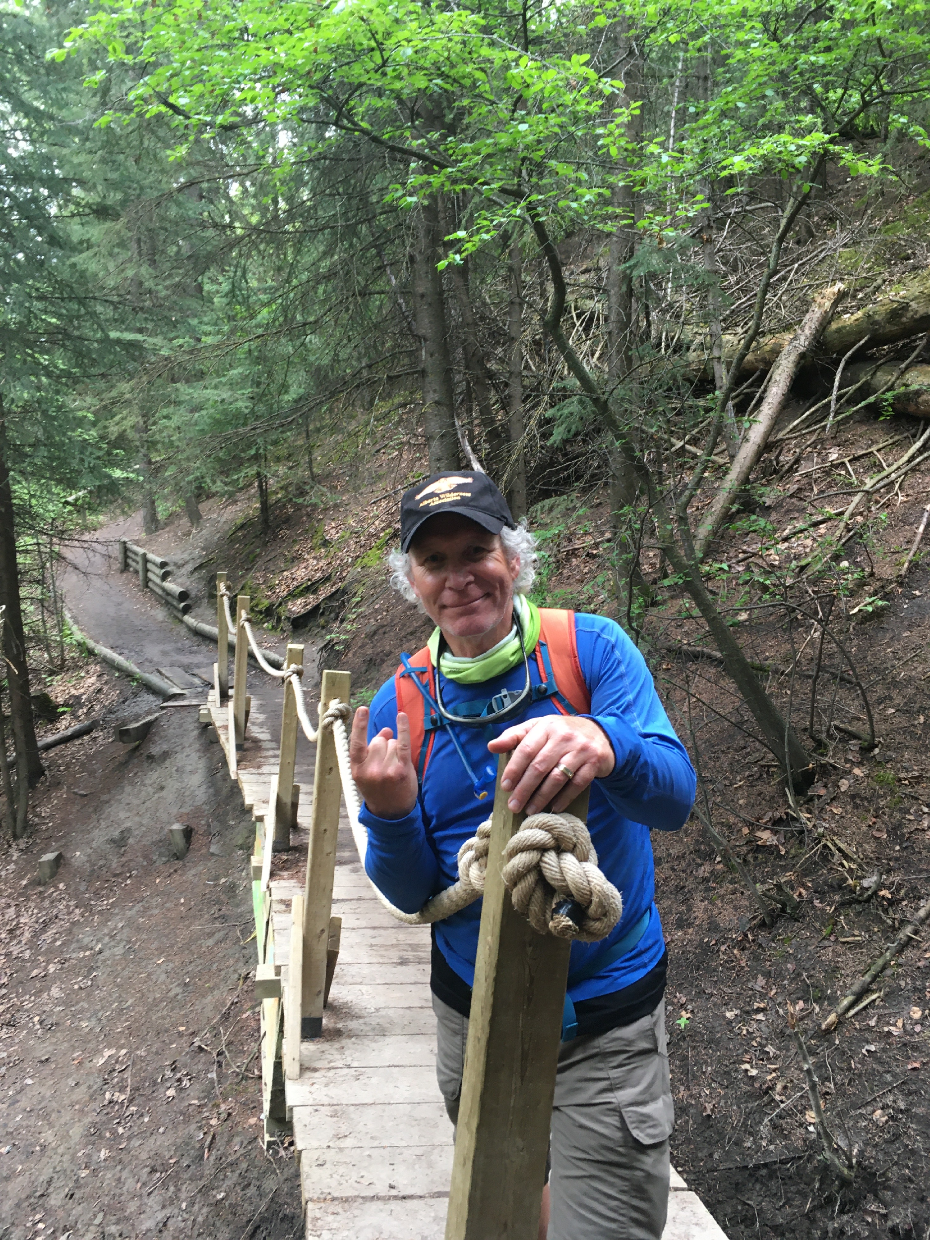
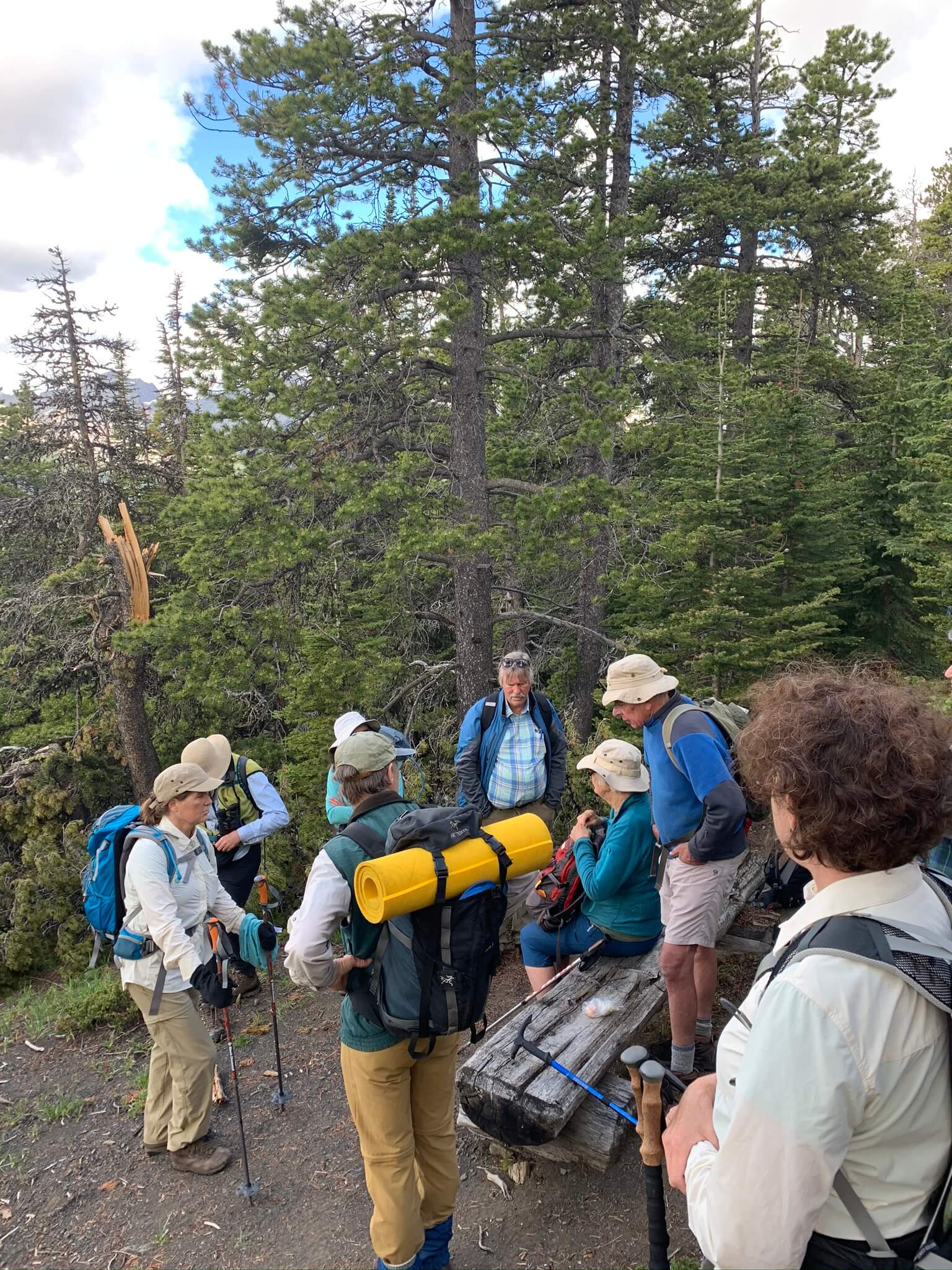
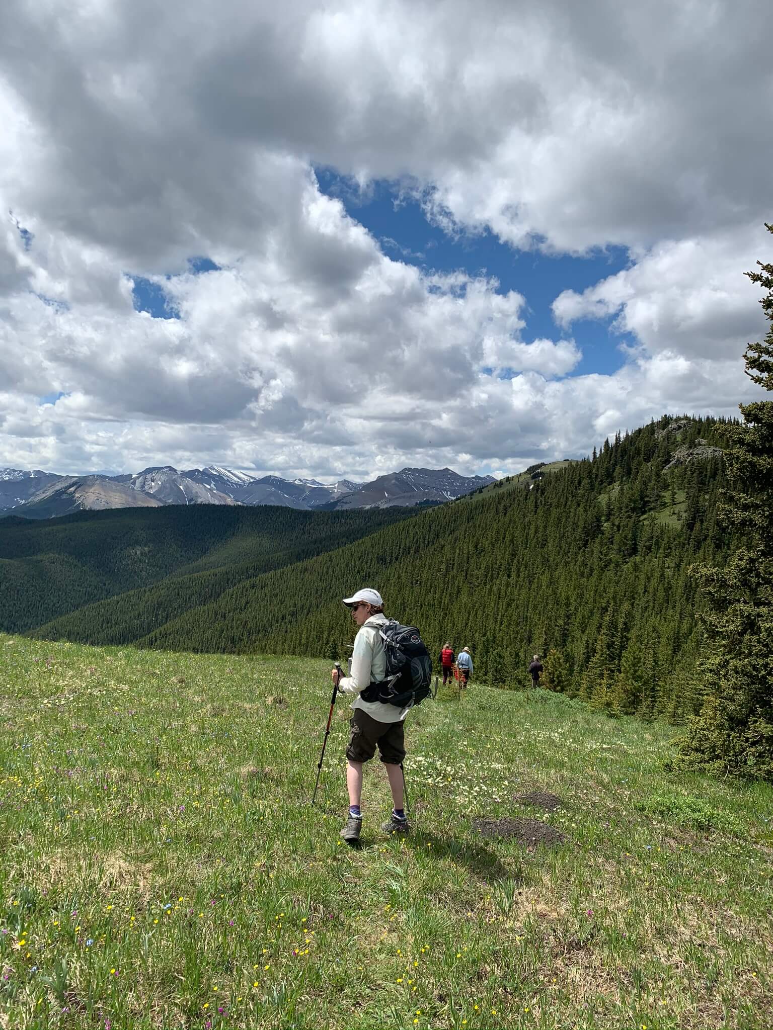
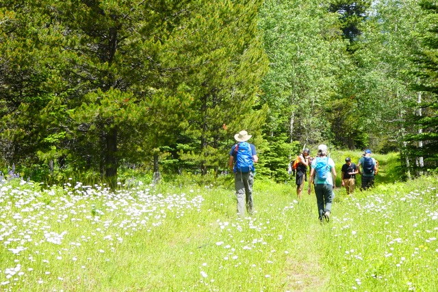
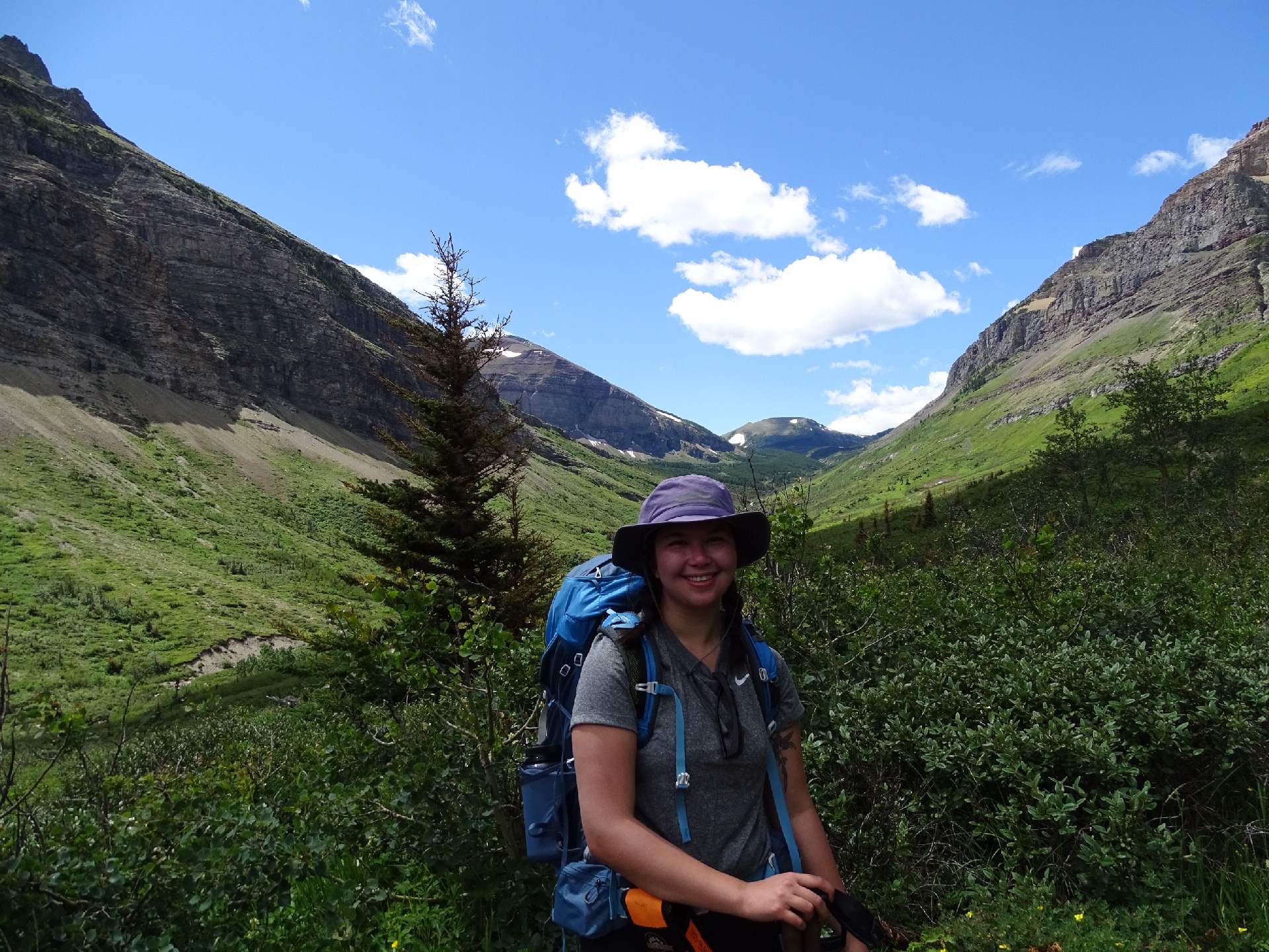
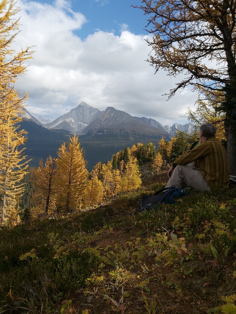
X-country Ski Canmore to Banff
with Jamie Jack, on 15 Mar, 2020
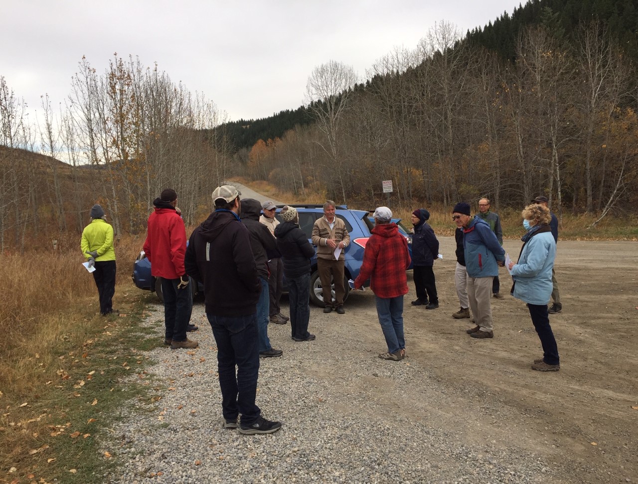
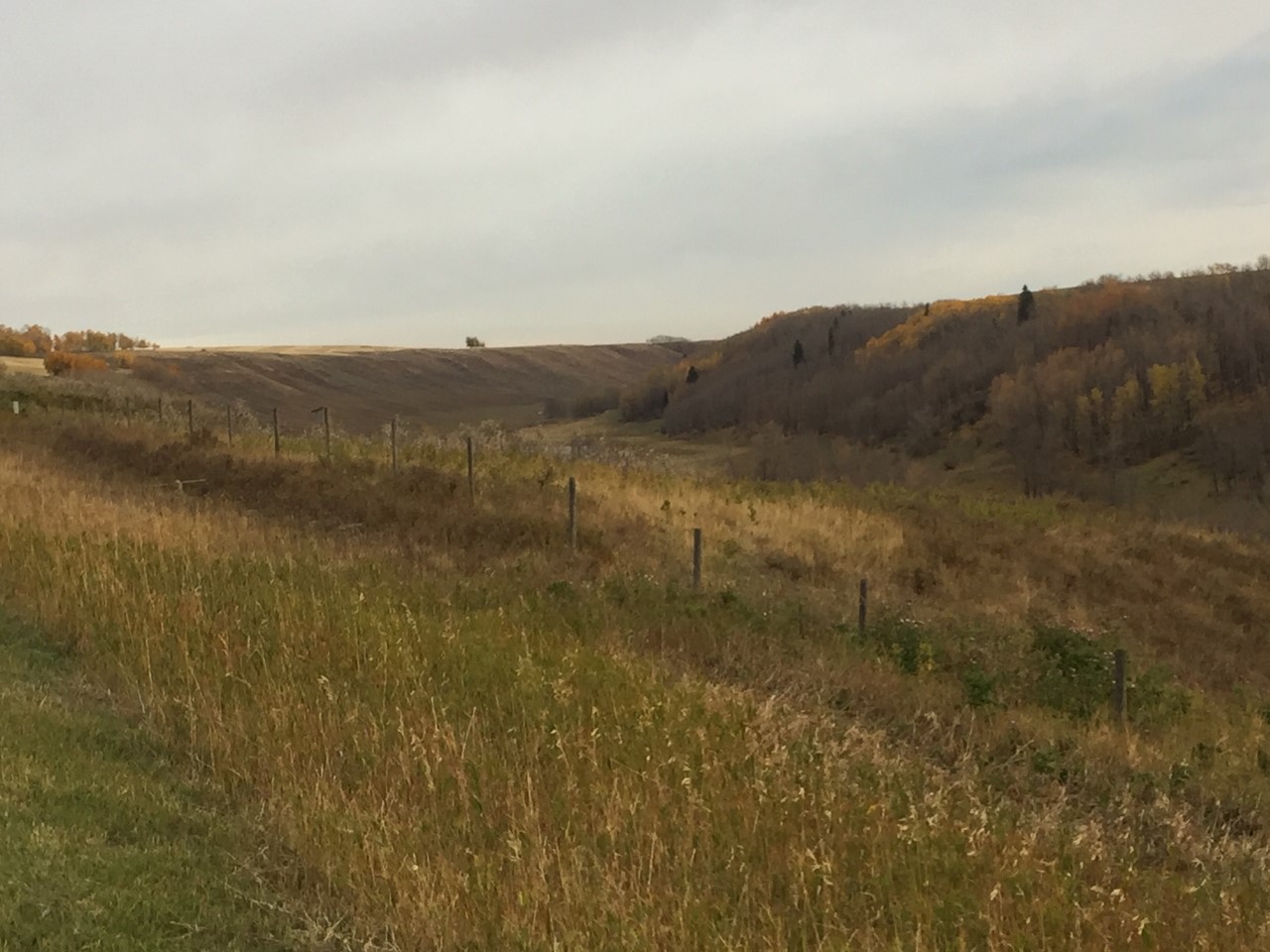
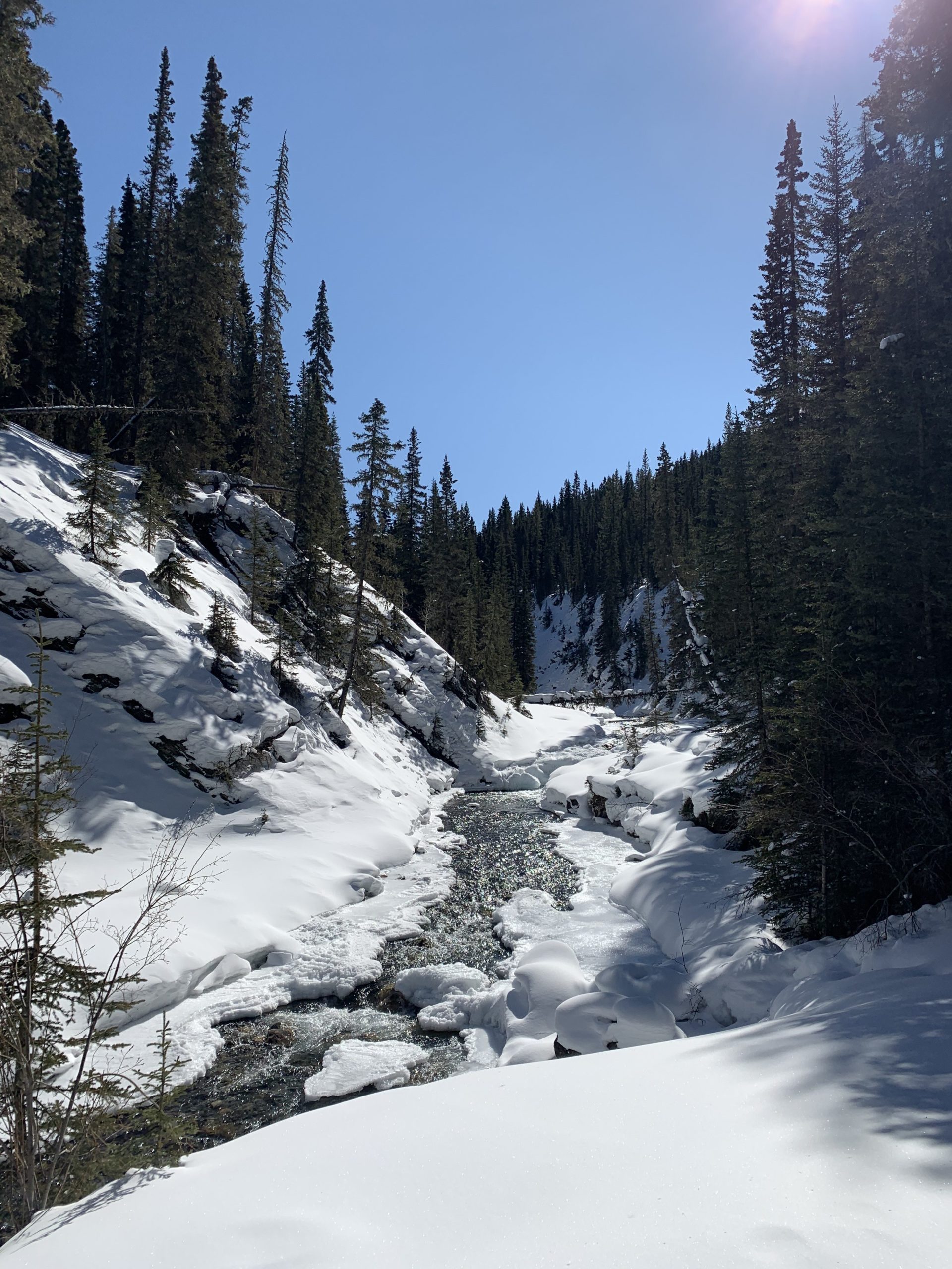
Sometimes you just need to put your phone down, turn off the news, and go on an adventure. As the weekend arrived, a winter storm warning was blowing in – but we were hopeful for sun. After only a one day delay, we headed off into the wilderness!
Discovering the logistics of getting to the trailhead was only the start of our adventure. Confidently, in our finest animal print, we skied 19 km along Goat Creek and Spray River trails. Fresh, trackset snow and a bluebird day made for forgiving steep descents, and a relaxing trailside picnic. Aware of the recent grizzly sighting, we sang, yodeled, and laughed for four and a half hours! Reconnecting with nature gives you the opportunity to reset emotions and refresh your perspective. To everyone who sponsored our Adventure for Wilderness – Thank you! Remember to get outside, and appreciate Alberta’s natural beauty.

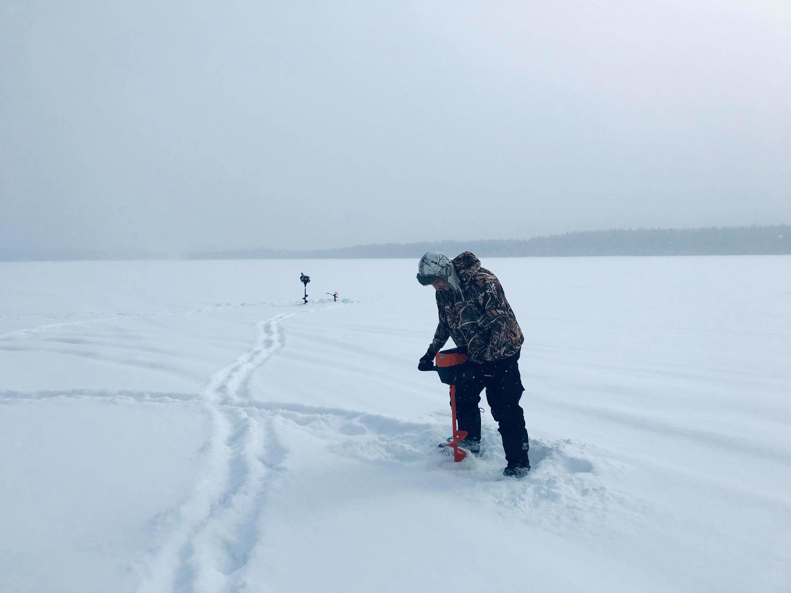
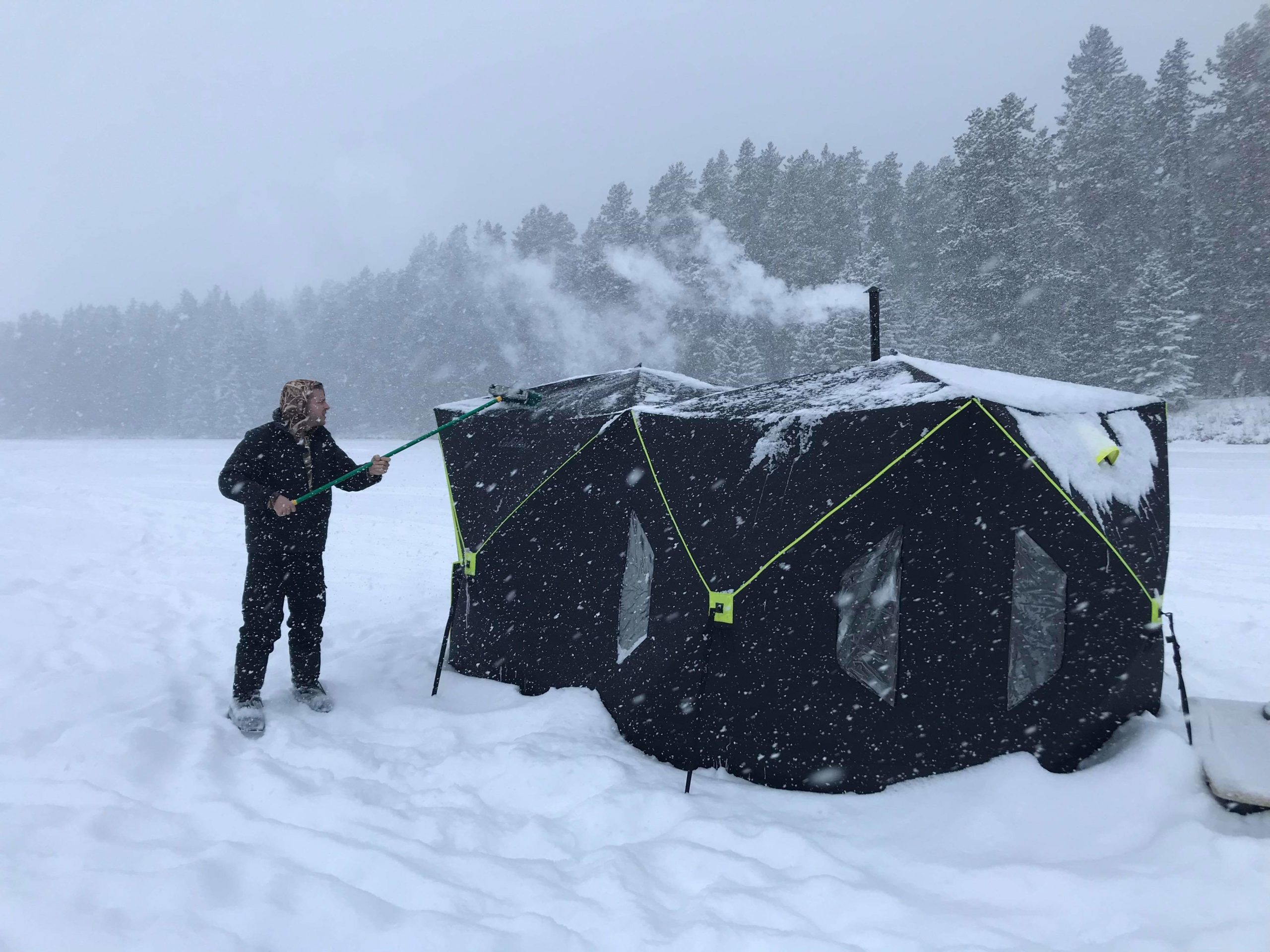
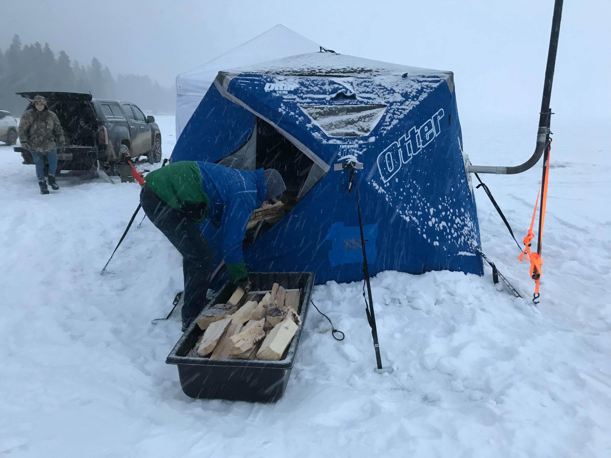
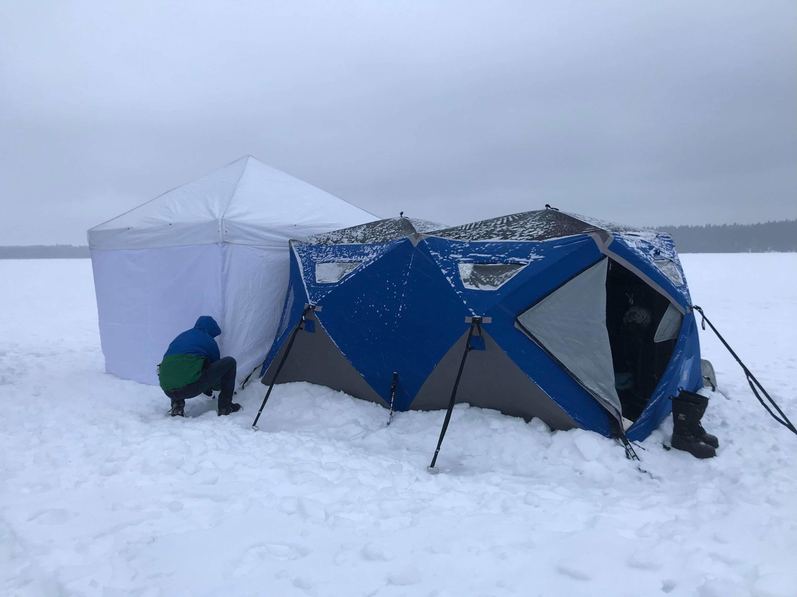
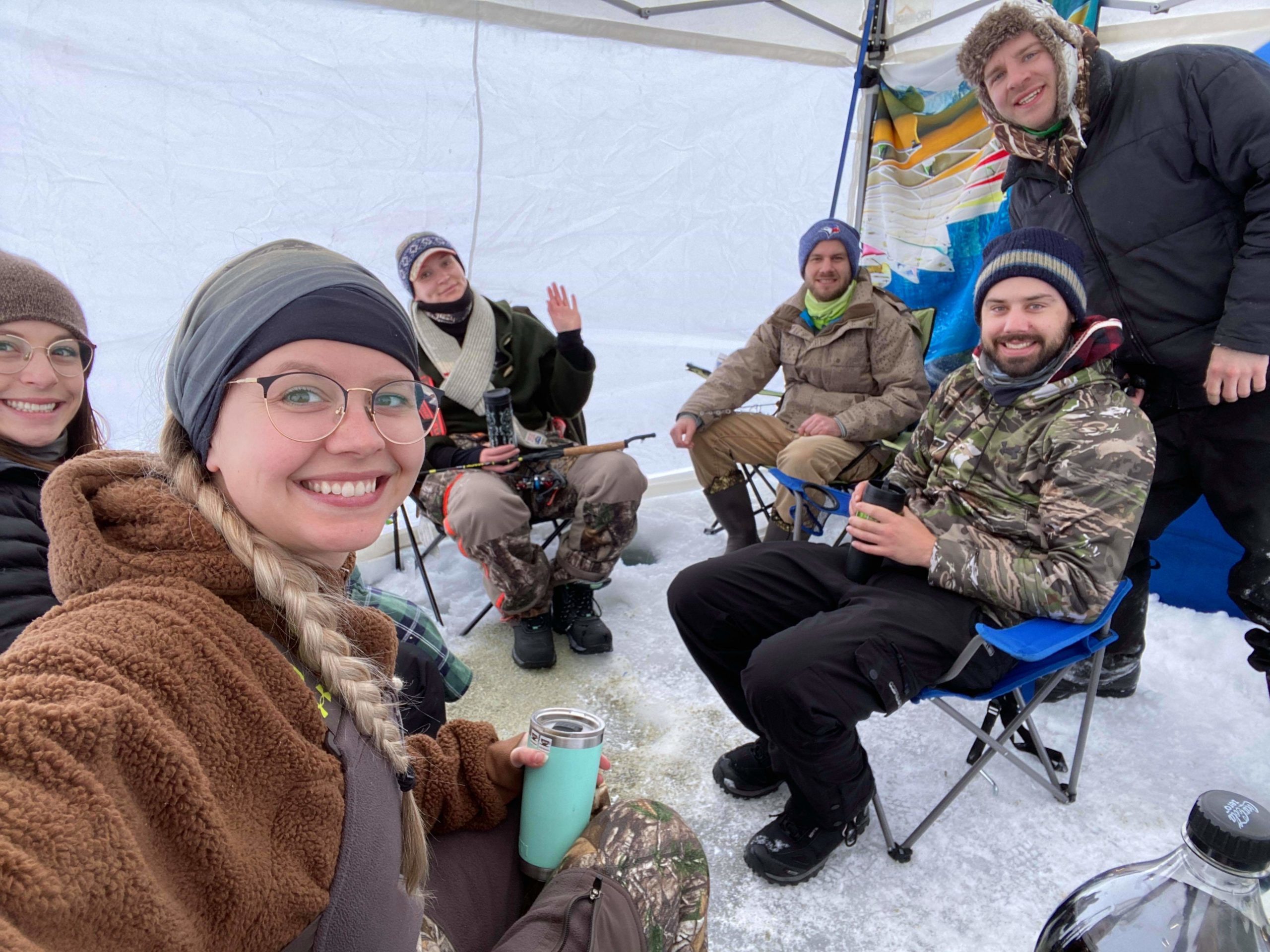
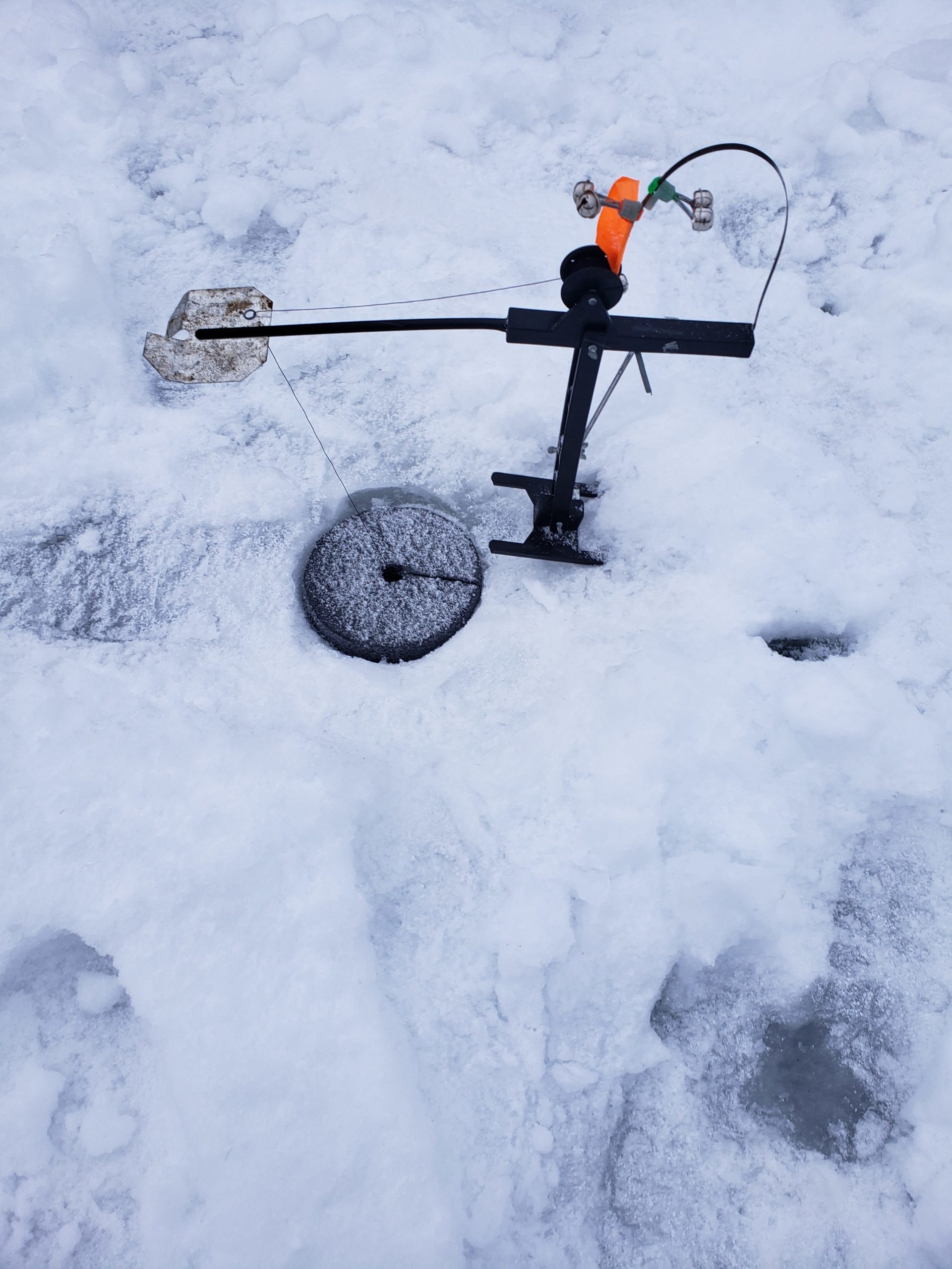
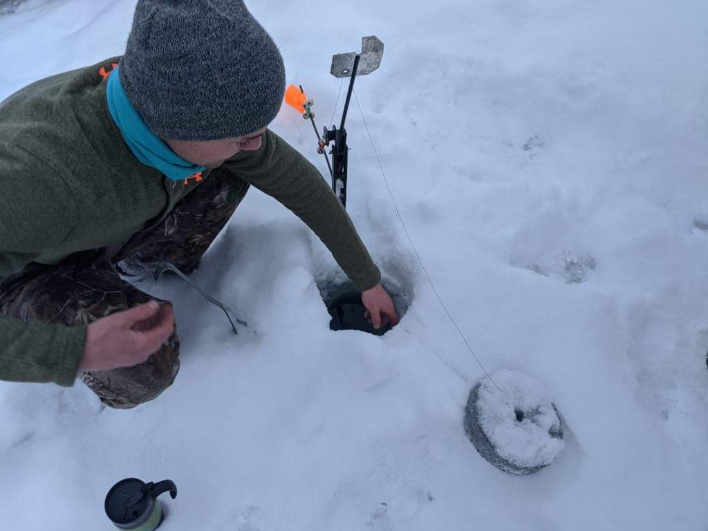
Friends Fish-A-Thon
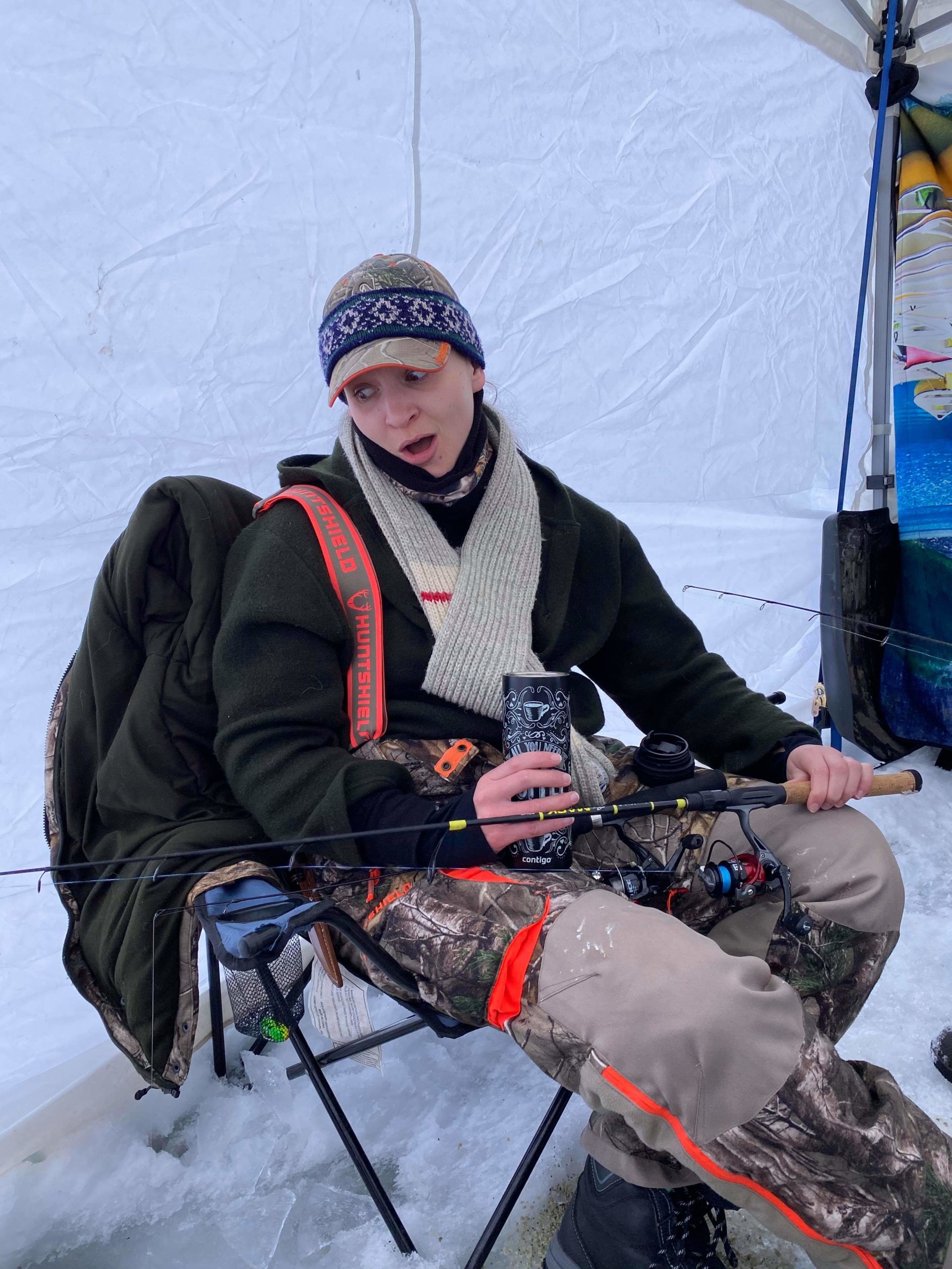
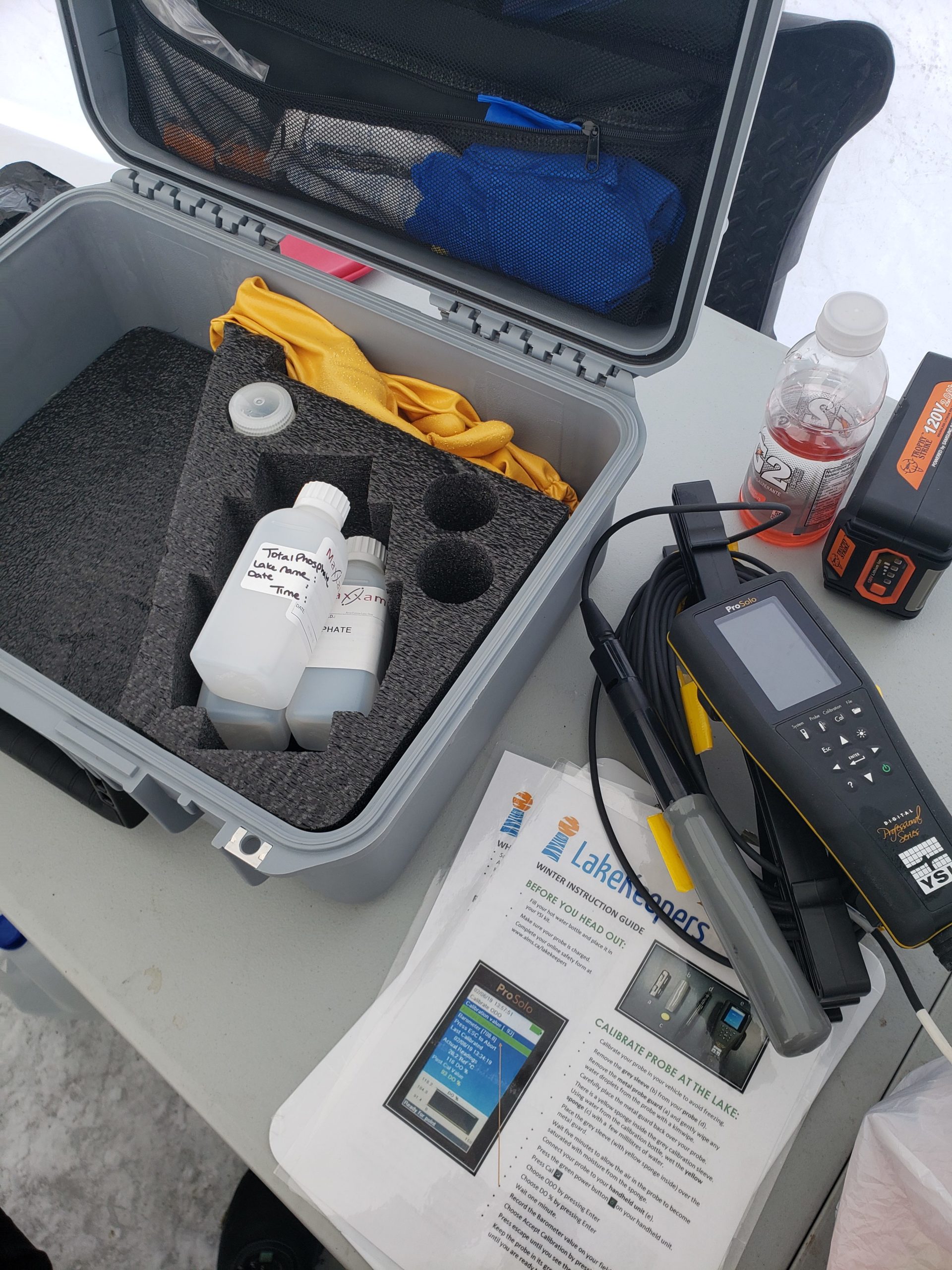
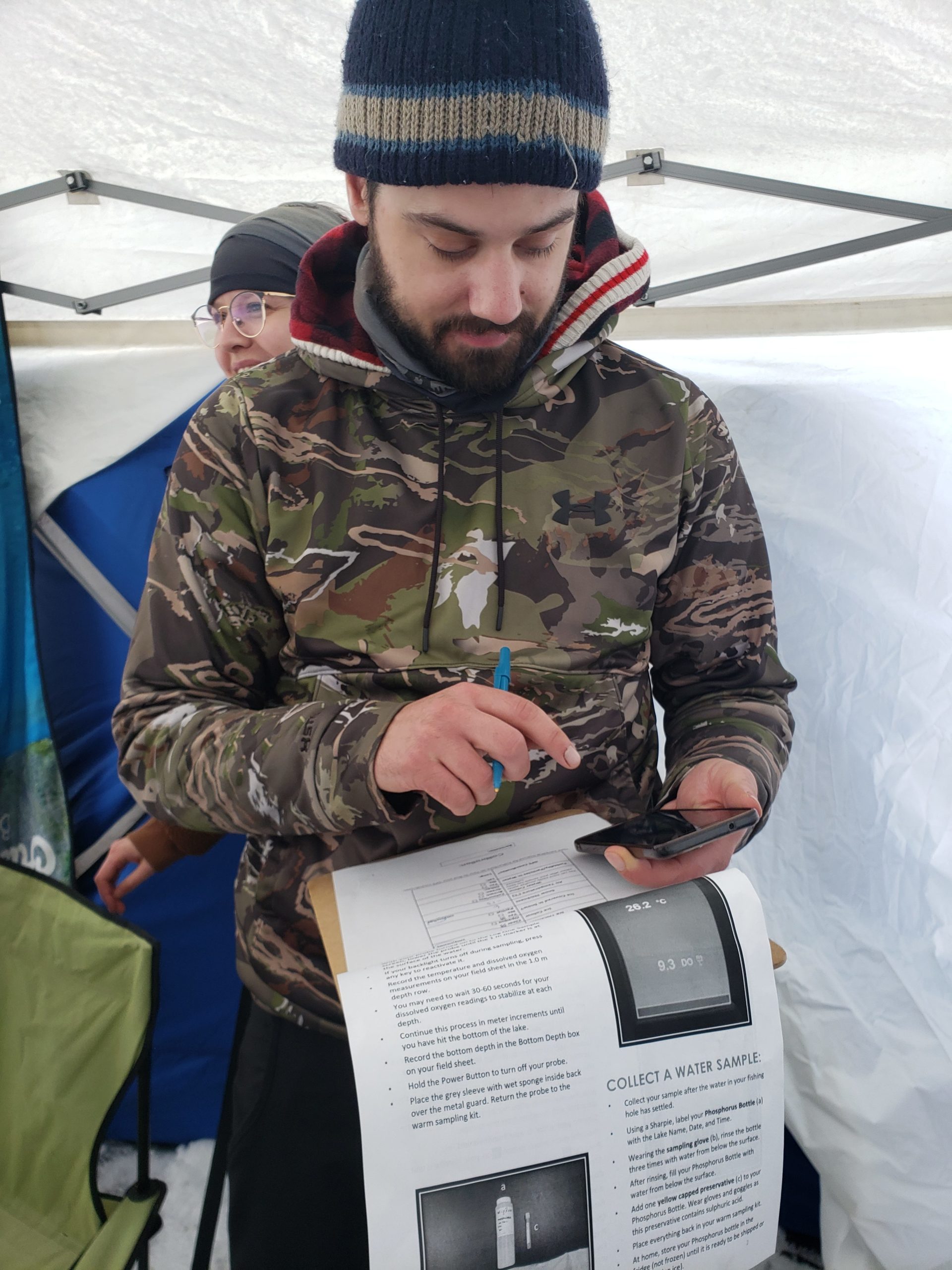
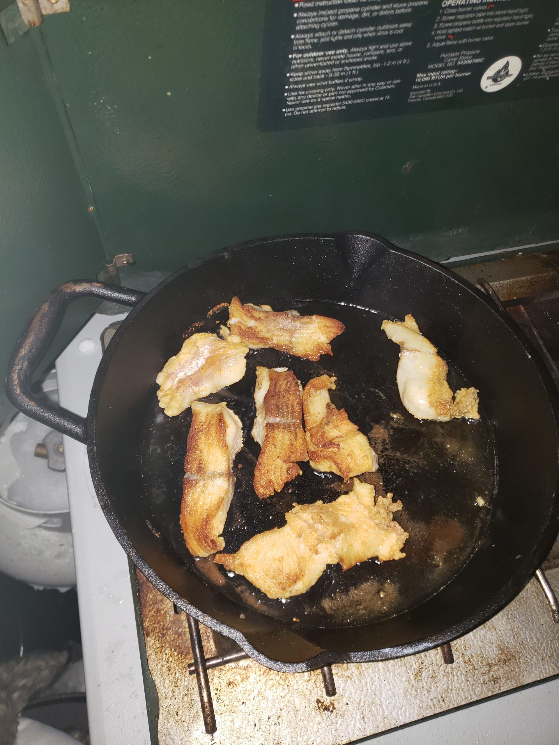
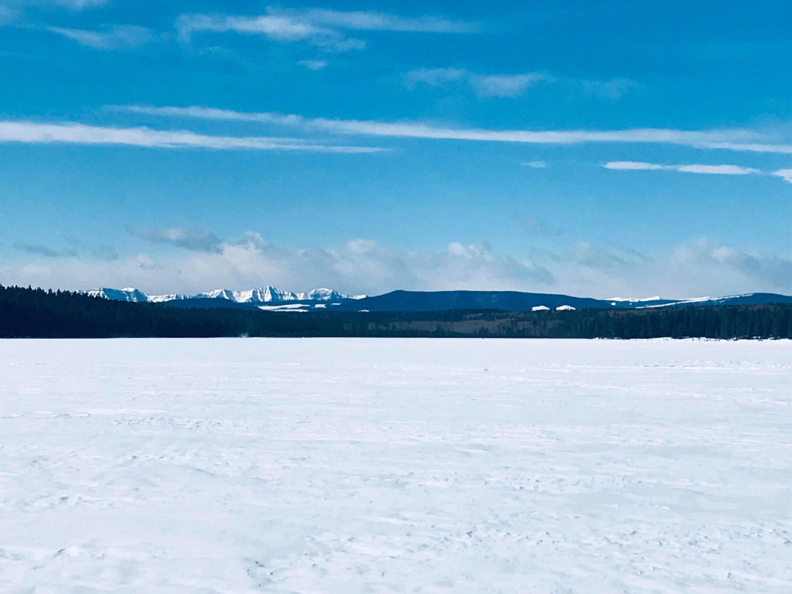
with Nissa Petterson, on 7 – 8 Mar, 2020
Our adventure started on Friday with a race against time; we boogied to set up our staging area and drill our holes in the ice before the weather socked in and the blowing snow kept us huddled by our fire. By Friday evening, we had 4cm of snow, with more to come. We bunkered down in our tent, hoping to catch some late roving and hungry walleyes. Saturday morning we woke up to -20C, and welcomed some more friends that popped in for a day visit. We roamed around the lake, drilling holes and using a fishcam hoping to spot some schools of perch, or even just a single monster pike. We also took time to help our friends at Alberta Lake Management Society with one of their citizen science programs, the Winter Lakekeepers Program. We recorded the total dissolved oxygen at various depths of the lake, and took a sample of the water to test Total Phosphorous-all of which help indicate the overall health of the lake. As the day progressed, more snow arrived and some of our friends who couldn’t overnight on the lake had to leave. As the snow continued to fall, we resumed our posts hoping to pair our dinner with a side of fish, and eventually, our efforts paid off! We caught a 26 inch pike on a tip up located outside of the tent. It ended up being the only fish we caught over the weekend, but at least we can say we weren’t completely shut out! The catch rejuvenated our spirits, and we celebrated over a tasty meal. Sunday morning came, and it was time to pack up and head home, however it seemed that Mother Nature didn’t to want us to leave. By Sunday morning, a total of 9 cm of snow had accumulated bogging down our vehicles, in addition to a couple of frozen vehicle batteries. With some shoveling, pushing, and a little bit of kitty litter, we eventually made it out safely – with stories to tell!


Pollinator Power!
with Heather Hadden, from 19 Apr, 2020
Our family has been involved with the Climb For Wilderness for as long as I can remember. I have been participating and volunteering with the climb since I was in high school back in the ‘90s. It was always a highlight for me to raise awareness with my friends and co-workers about the Alberta Wilderness Association and they were always happy to support me to do the climb by giving generous donations. Back then, climbing the stairs of a skyscraper was kind of a crazy idea! Often I would get asked “Do you climb up the outside?”.
Over the years, the climb evolved including a poetry competition, stairwell painting and even changing venues. Our daughter inspired her classmates, friends and their families to join in the fun and we often had a group of 10-20 people join us to participate in the climb every year. It was a fun and educational event that just always happened.
When we got the news the climb would not be going ahead this year and the AWA was needing to adapt the event – we were shocked. And of course we wanted to know how we could support the AWA as the climb had always been their major fundraiser.
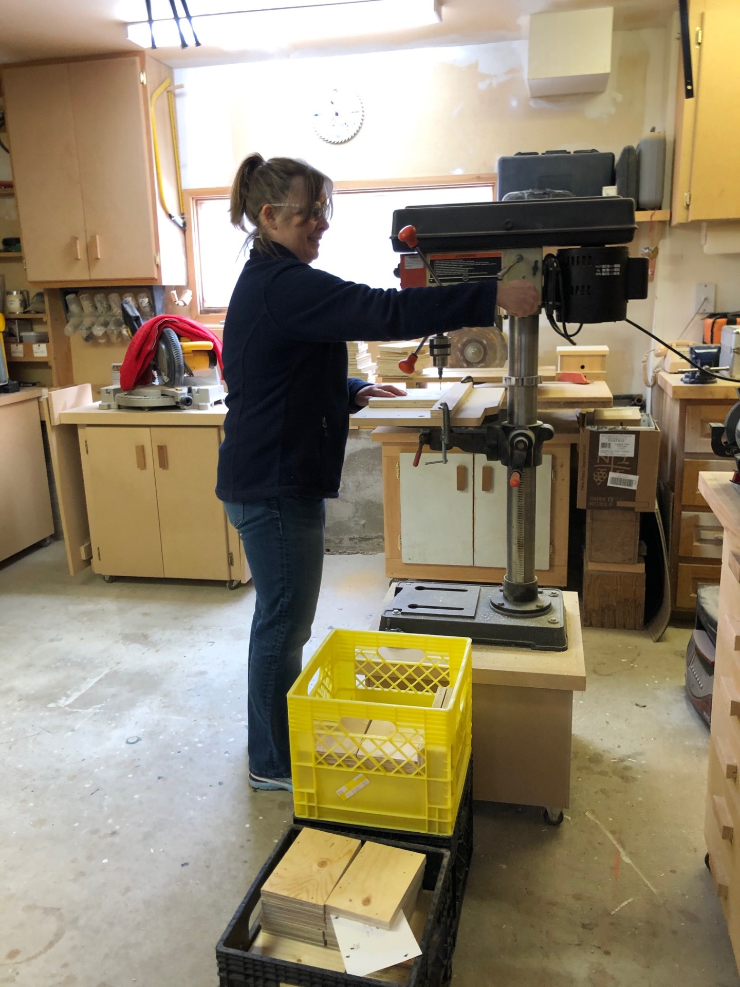
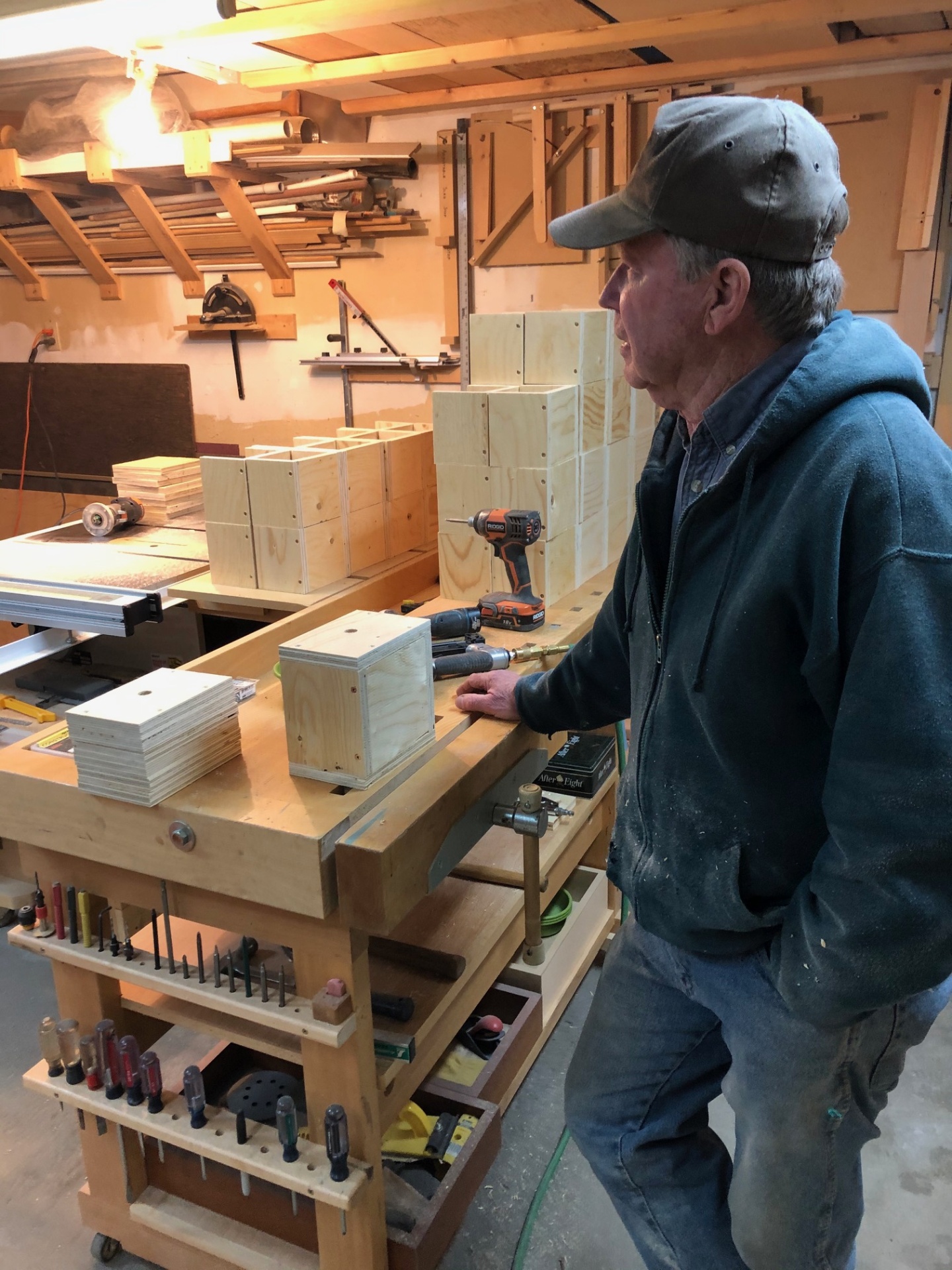
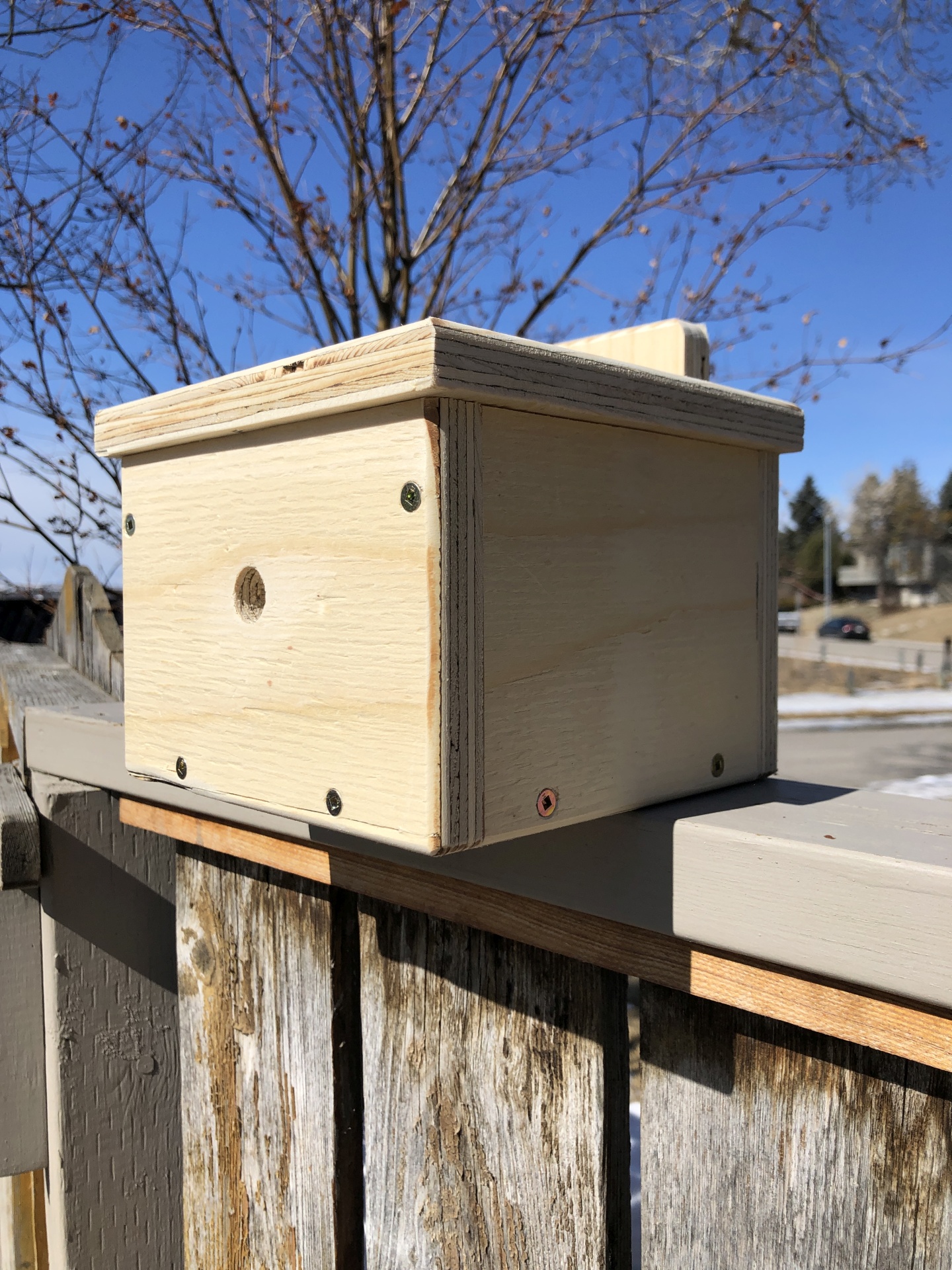
The Adventures for Wilderness was born out of an idea of having people become actively involved in the splendor Alberta has to offer. Building an adventure for Adventures for Wilderness has been an adventure in itself! Our family had been learning about Alberta’s Native Bees and thought maybe this would be a good starting point for an activity where participants could make bee boxes that are appropriate for Alberta’s native bee populations. And it is always fun to do a scavenger hunt so why not incorporate technology and do a GPS scavenger hunt around our coulees in Edgemont? What a fun afternoon that would be – Pollinator Power! But I knew we would need help. Enter Dan Olson – carpenter extraordinaire! We needed a blueprint for a bee box and the materials to make them. He took the challenge and as you can see from the photos, the result is amazing. What bee wouldn’t want to live in one of these?
But as February turned into March a pandemic was sweeping across the world and Alberta. We knew we would have to change the event as social distancing became the new norm. I learned how to use a drill press and a hand router. Dan and I built 48 bee boxes over the course of a few days – keeping our 6ft distance, of course.
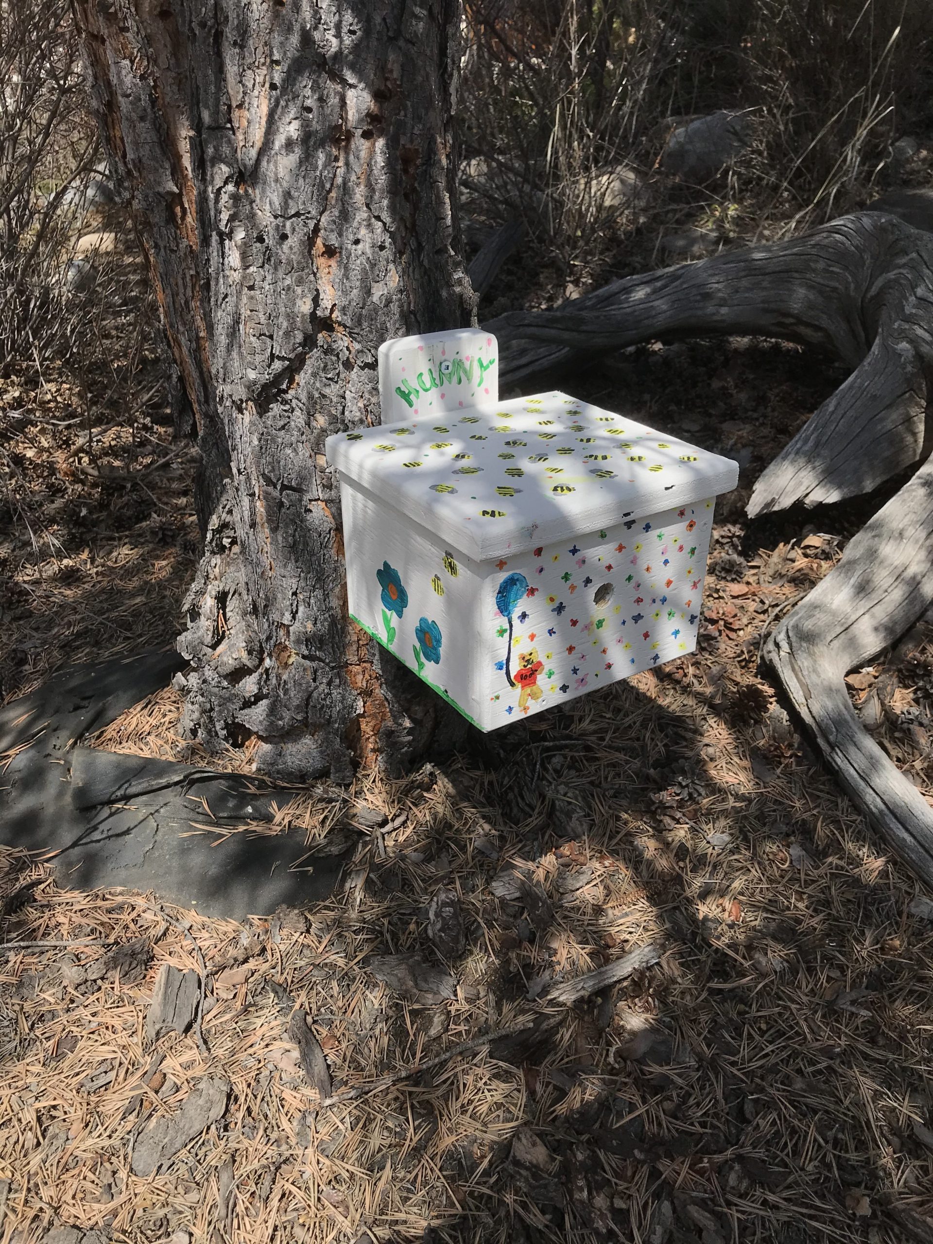
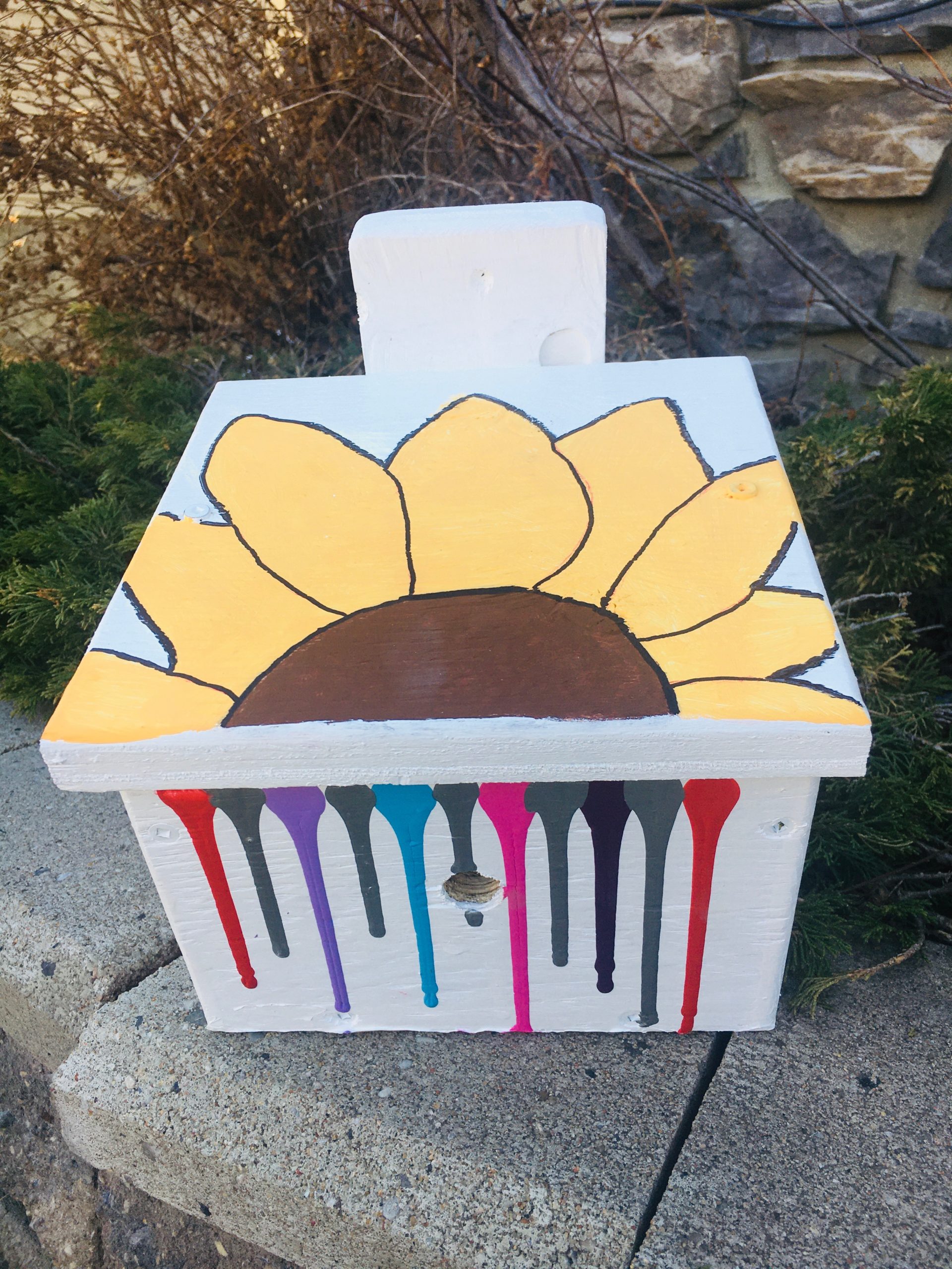
The event Pollinator Power! turned into a social distance success. For a minimum $50 donation a hand made bee box would be delivered to your doorstep – with all funds going straight to the AWA! Bee boxes started flying out the door. People are excited to invite native pollinators into their gardens and support the AWA.
Pollinators perform an extremely important job and Alberta’s Native Bees need our help. By putting a bee box in your garden, you are making a difference. Even the smallest yard or balcony can welcome native bees. If you have a bee box in your garden, you can also participate in a citizen science project with the Alberta Native Bee Council to help them gather data. They will even come to your home to collect the nest if your box is colonized. The more bee boxes we have the better it will be for all of Alberta’s native flora and fauna. In fact, as I write this, we only have 17 bee boxes left! We are looking forward to next year, hoping we can go with the original plan of gathering, learning, building and having fun together. But for now, enjoy the quieter world and hear the bees.


Getting Dave to the Summit
with Ed Hergott, from 26 May, 2020
Last week, Ed Hergott and crew had a wonderful success in their quest of Getting Dave to the Summit. It was a beautiful day for all and the team safely helped Dave Wodelet, now legally blind, to the Summit of Junction Hill.
After retiring early due to glaucoma, Dave spent some years hiking with the Mountain Manics until it became too dangerous to continue on the difficult terrain that the group frequents. The Manics have missed him greatly, so when the AWA Tower Climb ended and various fundraising efforts were encouraged, Ed suggested to Dave that they could guide him to a summit as a fundraiser. He accepted and the rest is history.
On May 26, the Mountain Manics guided Dave to the Summit of Junction Hill in Kananaskis, with teams in place to scout the trail and rid the pathway of obstacles, provide emergency support if needed, and guide and advise Dave on the journey to the top.
In the end, the group far exceeded their fundraising target and embraced a spirit of camaraderie, volunteerism and adventure that is the core of AWA’s Adventures for Wilderness program. We cannot say enough about what an inspiring initiative this turned out to be.
-
- Dave and Kathy Wodelet at the summit of Junction Hill. Photo by Ed Hergott.
Bob & Jim’s Adventure for Wilderness – Motto “Don’t Let the Old Man In”
with Bob Patterson & Jim Campbell, on June 6th, 2020
The ambition of this Adventure was to celebrate Bob’s 65th Birthday with 65 km of self-propelled travel, and what a great day it was! As per usual with outdoor adventures some of the route had to be made up as the team went along.
The Bow River though in flood would have been manageable for two experienced paddlers such as Bob and Jim but rather than risk soggy representatives of the AWA being pulled from the current by the Calgary Fire Department they settled on a early morning paddle across Ghost Lake and back again in Bob’s two person kayak. Remarkably, for almost two hours theirs was the only craft on the lake, and the water was mirror calm. An enchanting first leg to start the day. (14 km)
Next up was a cycle along the Bow River paths on the north side of the river from Bowness Park past the Calgary Zoo to 17 Ave SE, returning on the south side past Harvie Passage – quick snack break here – through the urban wilderness of Eau Claire back to Bowness. We are truly blessed to have such an extensive and thoughtfully laid out pathway system that brings all Calgarians so readily close to nature. A huge “shout-out” to the late Mayor Jack Leslie who resisted the efforts of “Calgarians for Progress” to move the CPR railway tracks and a four lane roadway right next to the Bow River. Can you imagine? (46 km)
The final leg was a fast up and down, and up again run through the trails of the Douglas Fir Trail next to Edworthy Park. Paths reminiscent of wet days on the West Coast Trail were encountered but did not dim the teammates’ spirits and likely even enlivened them. (6 km)
Total distance 66 km – a bonus 1 km as every good Birthday Boy deserves.
Thank you to everyone who donated to Bob and Jim’s Adventure for Wilderness. Your thoughtful generosity far exceeded our expectations. Your cumulative donations provided more than $7,200 to promote conservation of Alberta’s wildlife and wild places.
Be alert – plans are underway for next year!

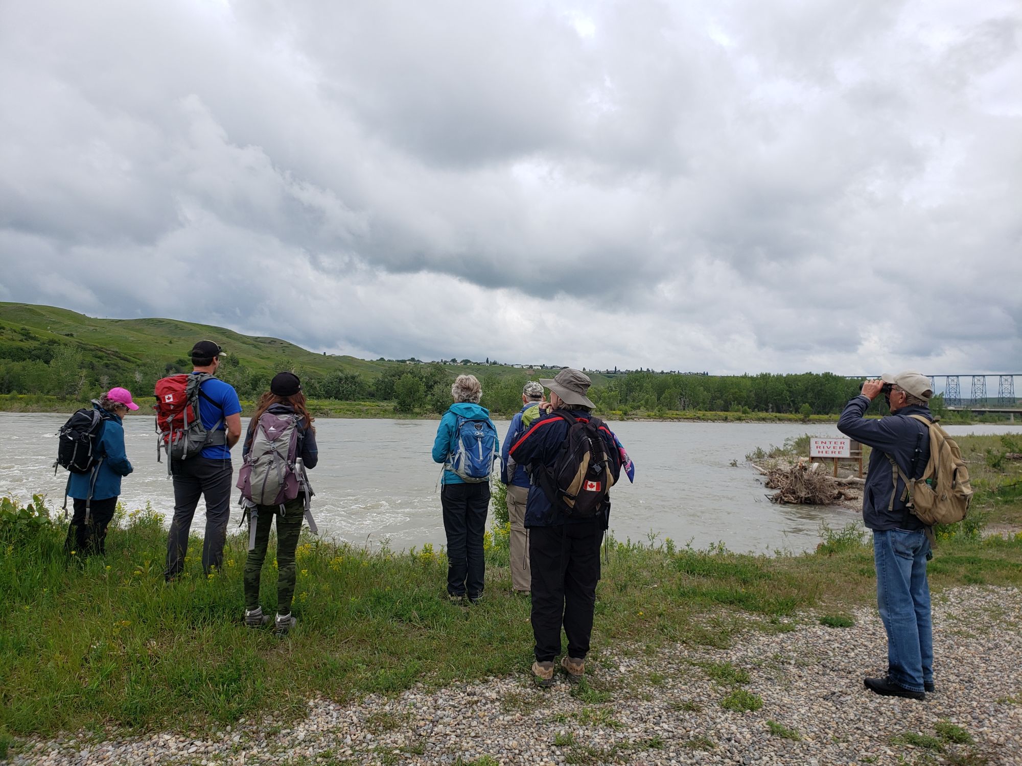
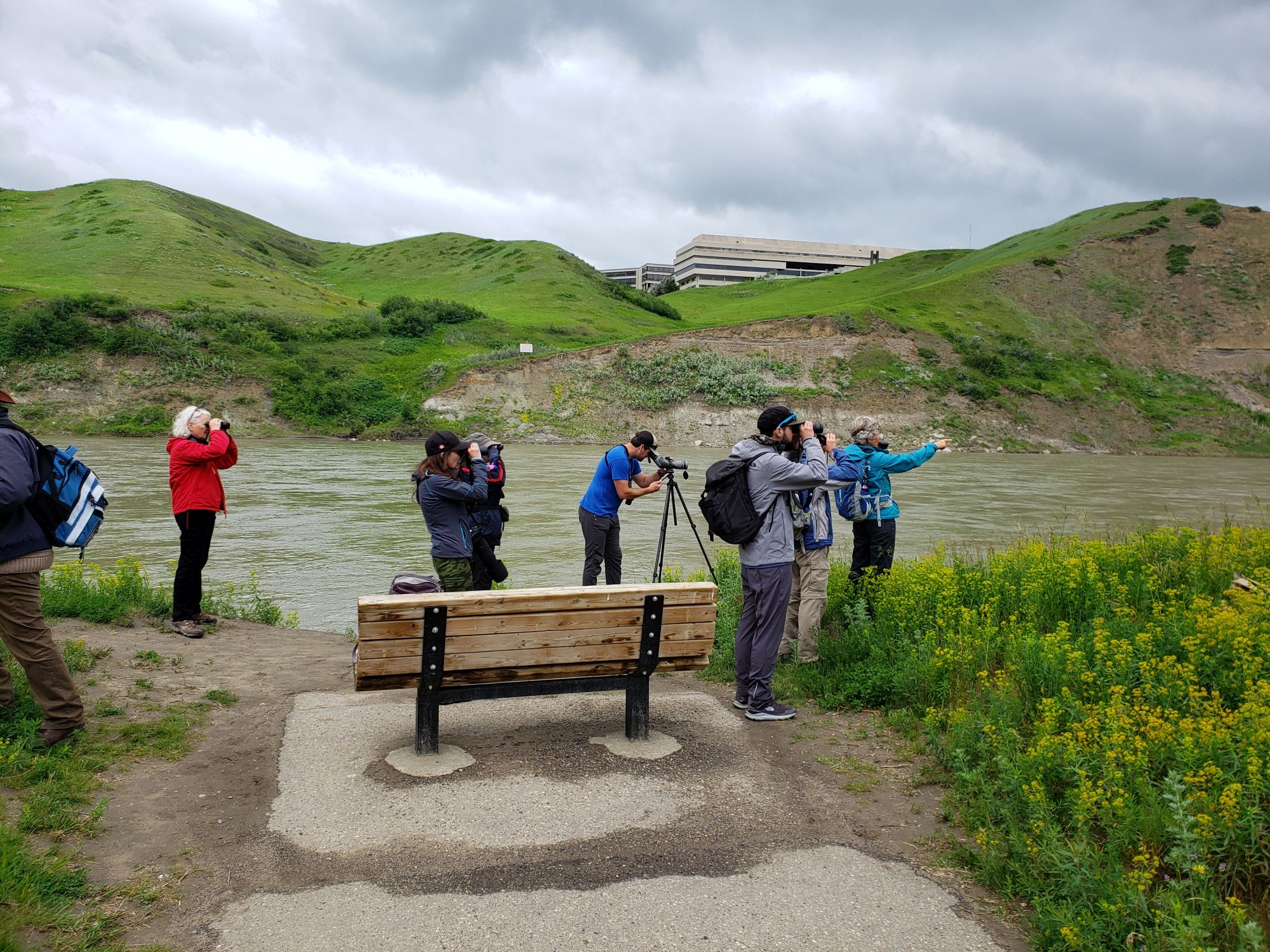
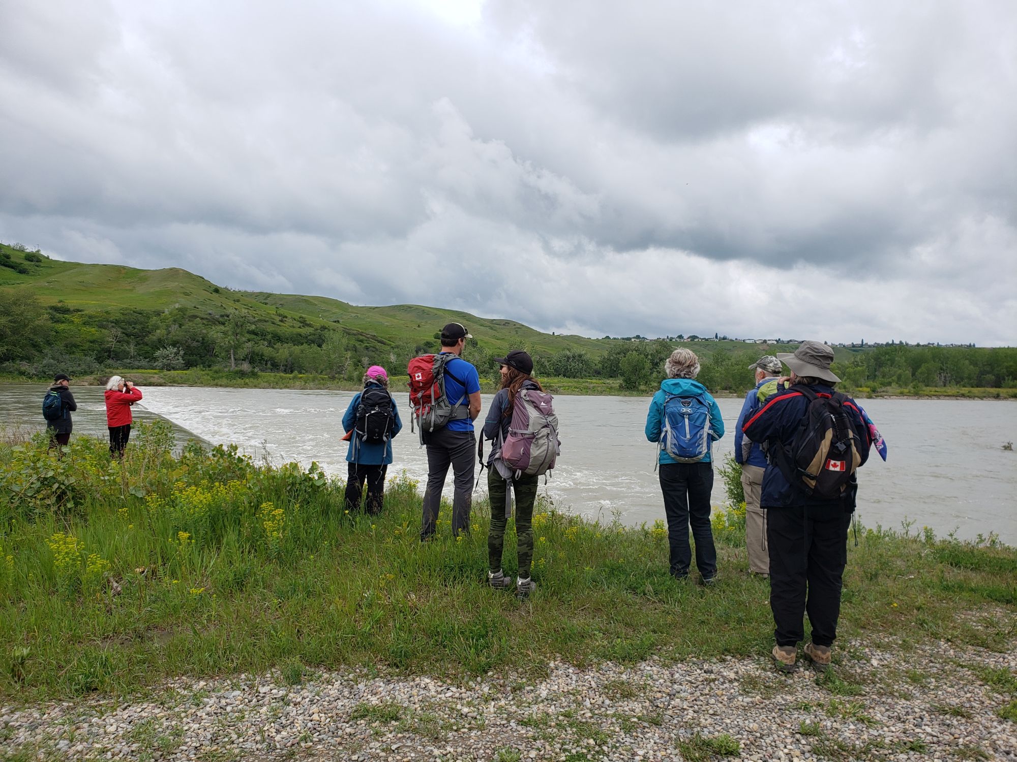
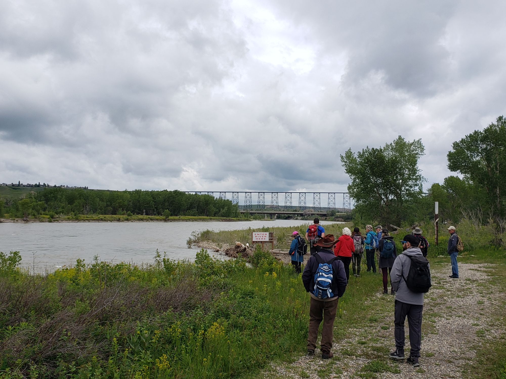
Lethbridge Coulee Birding Tour
with Nissa Petterson, on June 18th, 2020
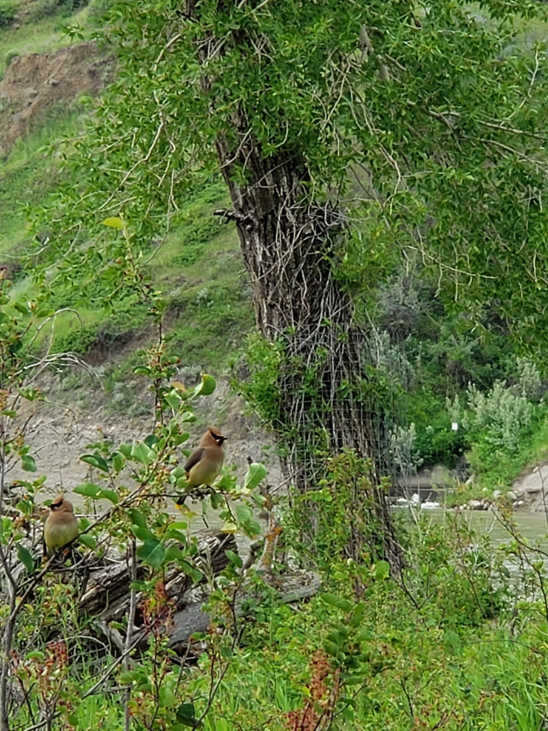
Cat Birds and More!
Did you know that birds can see in the UV spectrum, or that red and yellow shafted northern flickers have hybridized in Alberta’s Foothills and are becoming more indistinguishable as subspecies? Dr. Everett Hanna filled our birding in the Lethbridge Coulee Adventure with fun facts and shared his tremendous knowledge with 12 would be birders and naturalists!
With binoculars in hand, our group set out early in the morning to tour the beautiful pathways alongside the Oldman River, with the river valley greeting us with an orchestra of bird songs. The overcast morning made our chances of spotting and observing birds considerably better. As we meandered down the path, small groupings of pelicans flew above us, as beaver motored alongside us in the adjacent stream.
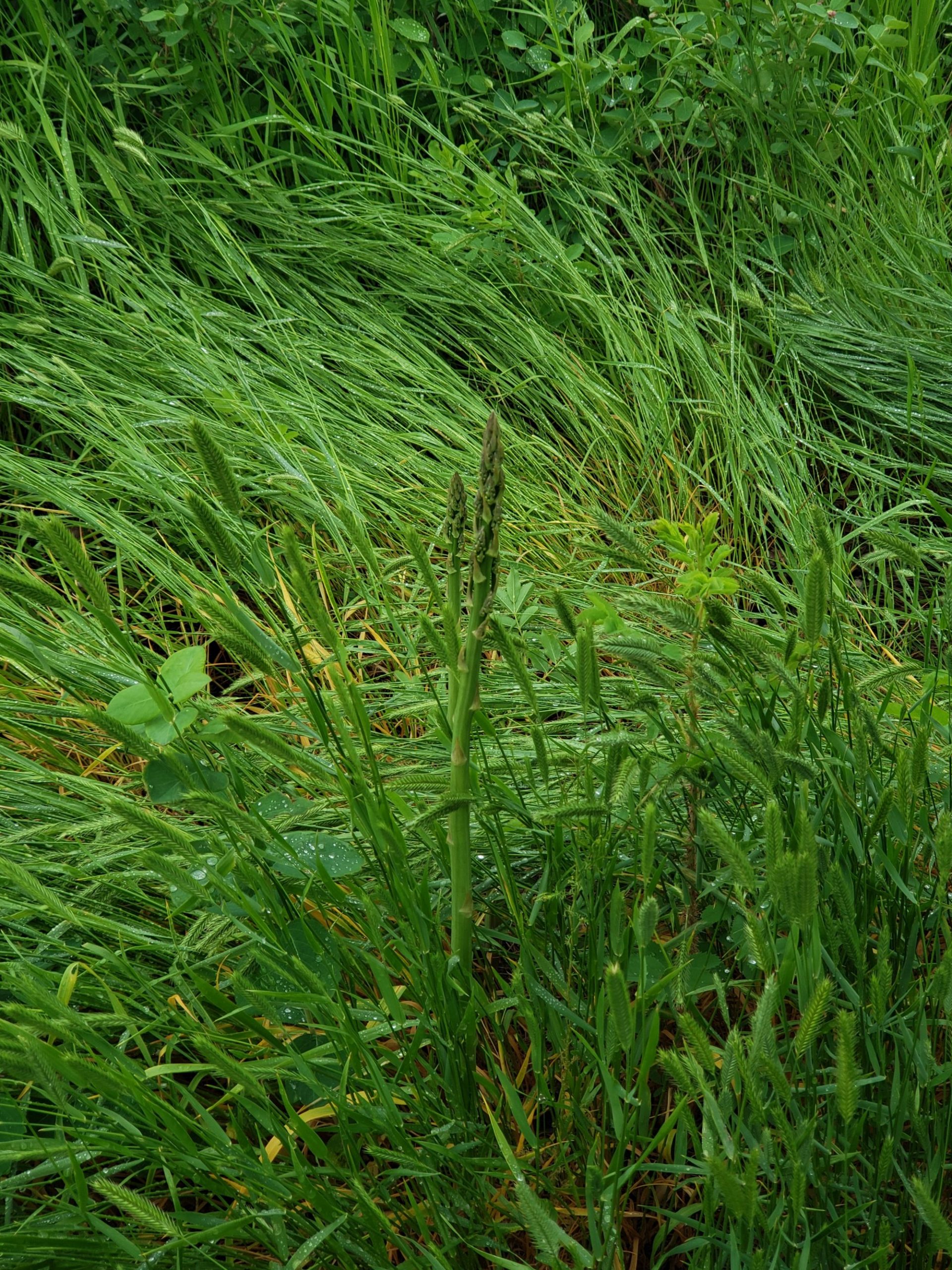
Over the course of a few hours we spotted nearly 40 different taxa of bird, in addition to learning some sounds and calls of different species, the most peculiar of which may have been the “meow” of the gray catbird. We had hoped to see a rattlesnake cross our path, at a reasonably safe distance, but that was not the case. We did however see a shoot or two of wild asparagus while admiring the sights and smells of the blooming wild roses.
This adventure was a great opportunity to not only to explore the biodiversity of the coulee and to increase our knowledge of native birds, but it was also an opportunity to appreciate and learn more about the importance of Alberta’s urban wild spaces.
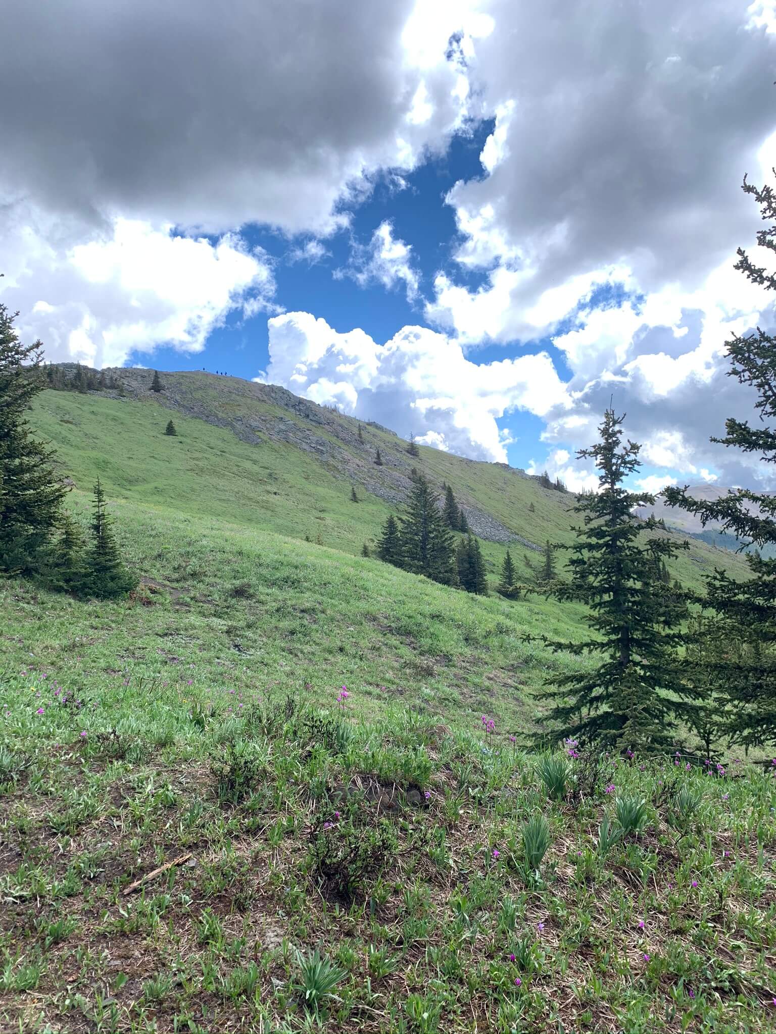
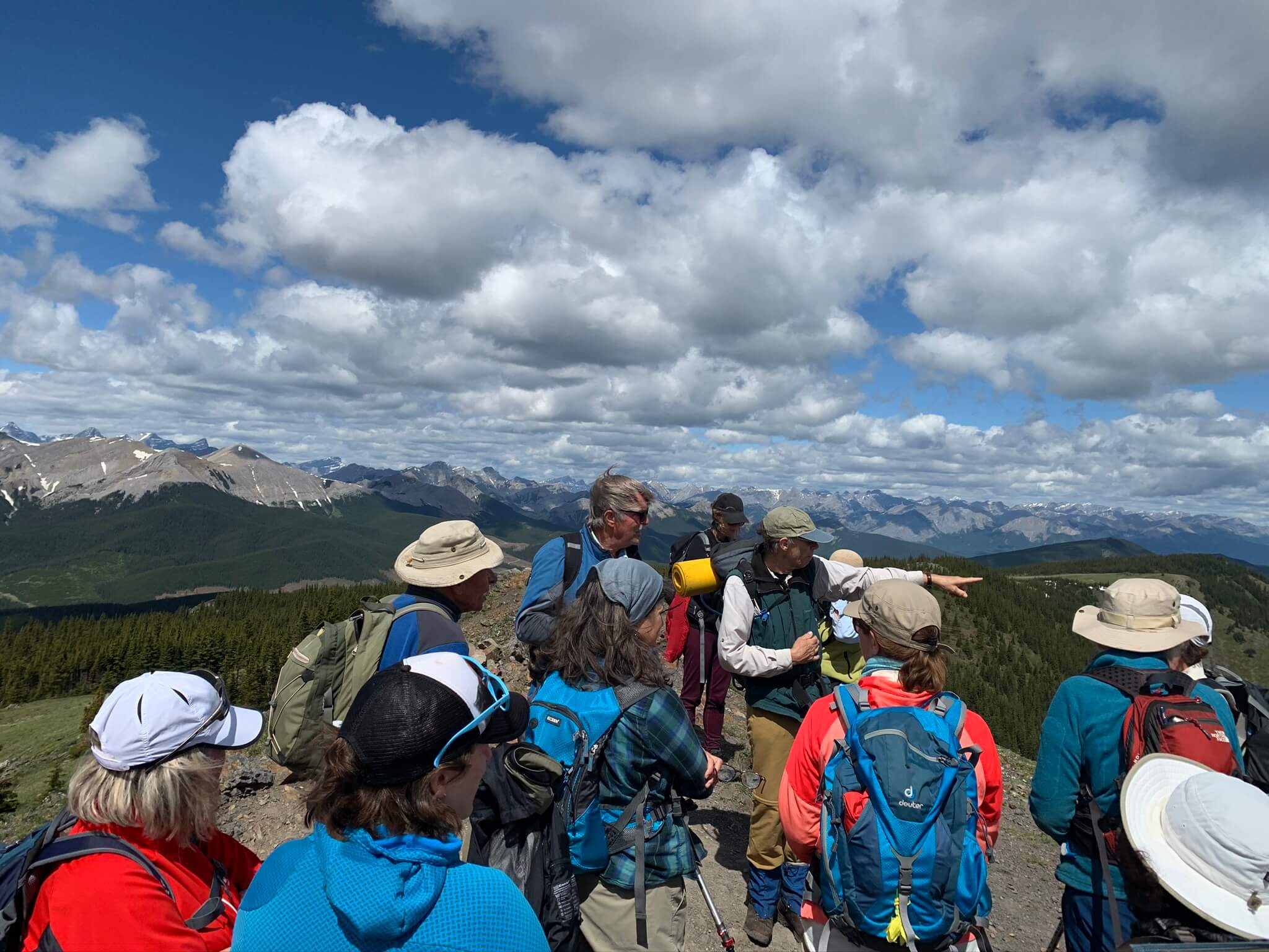
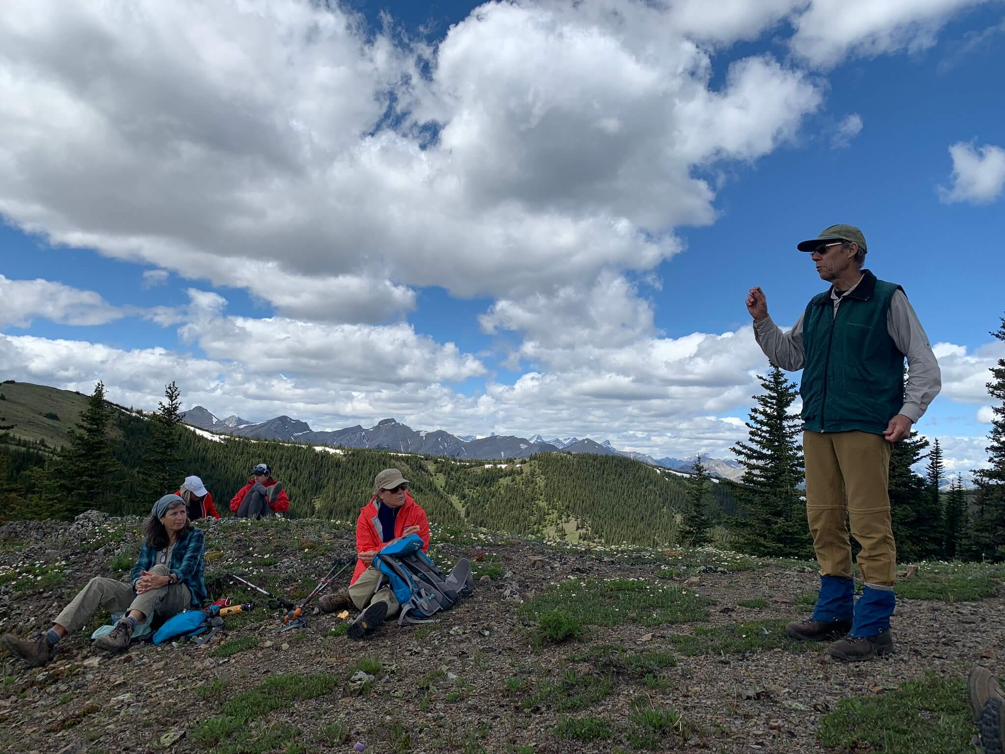
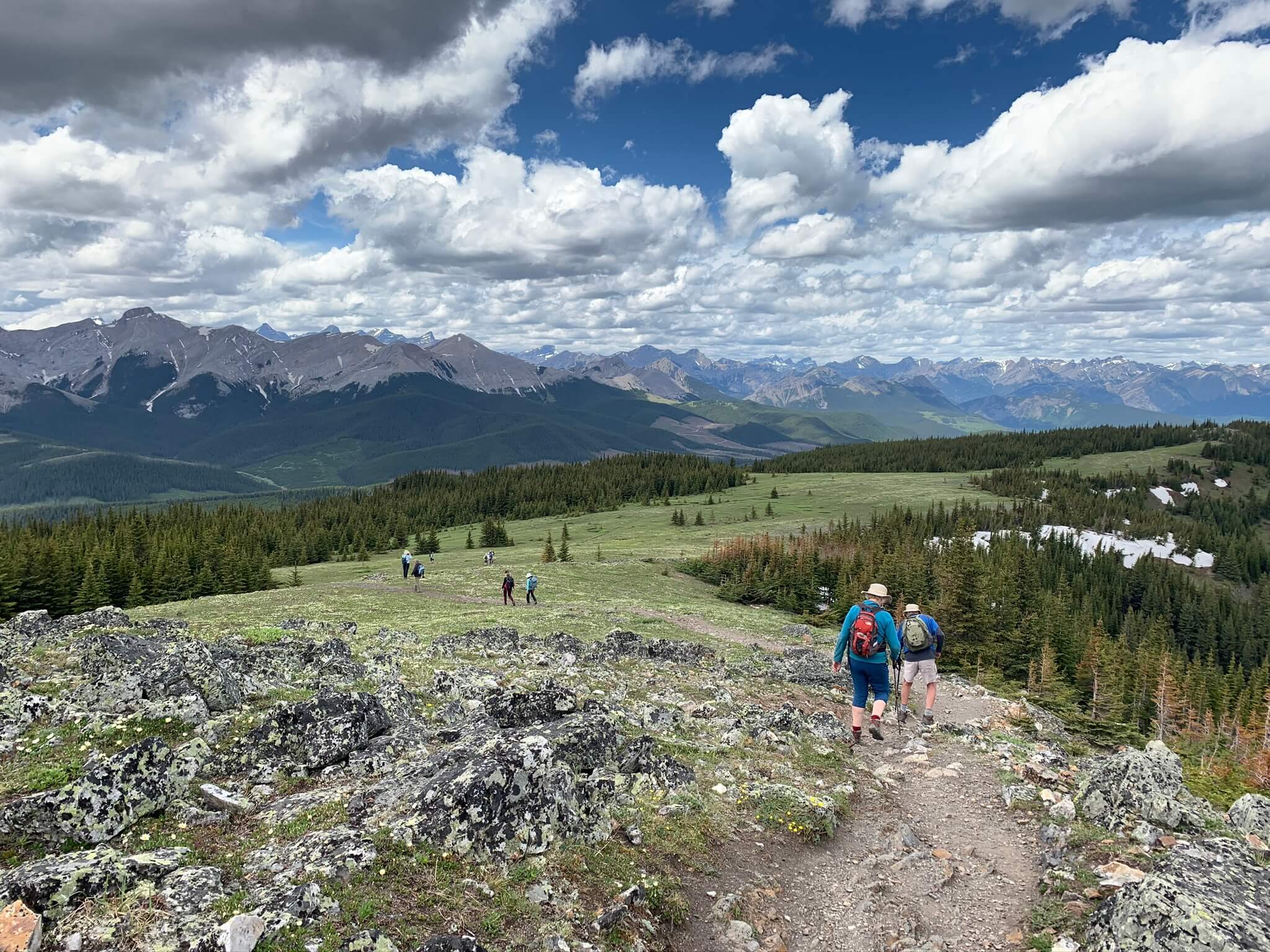
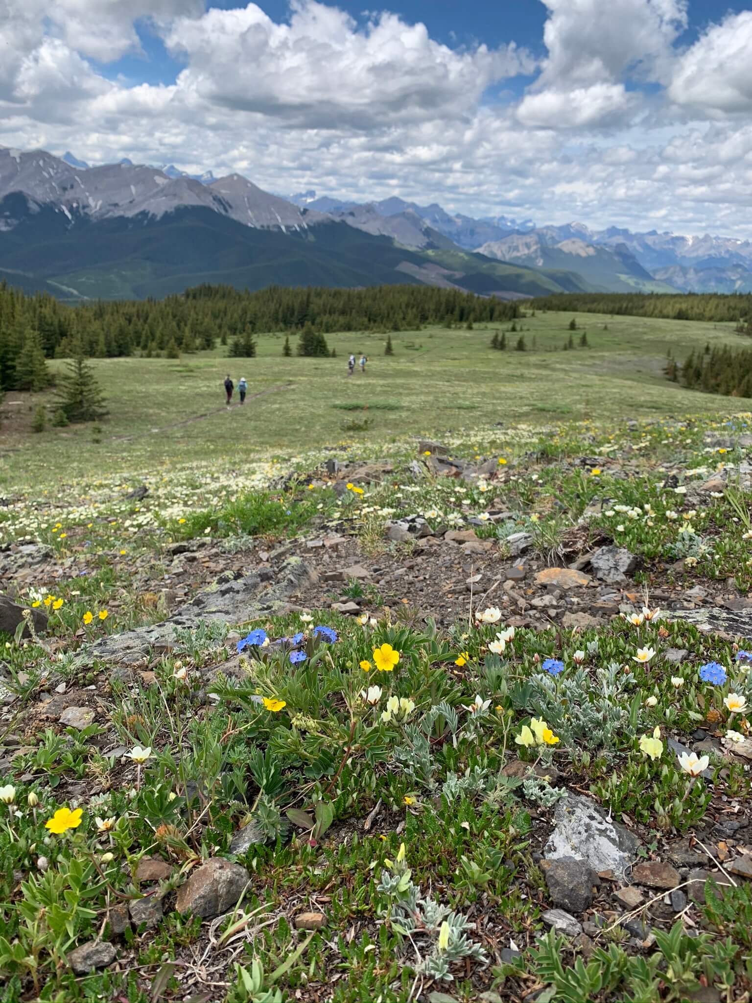
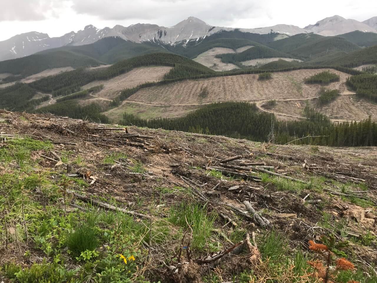
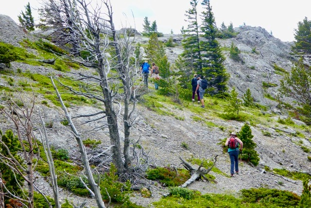
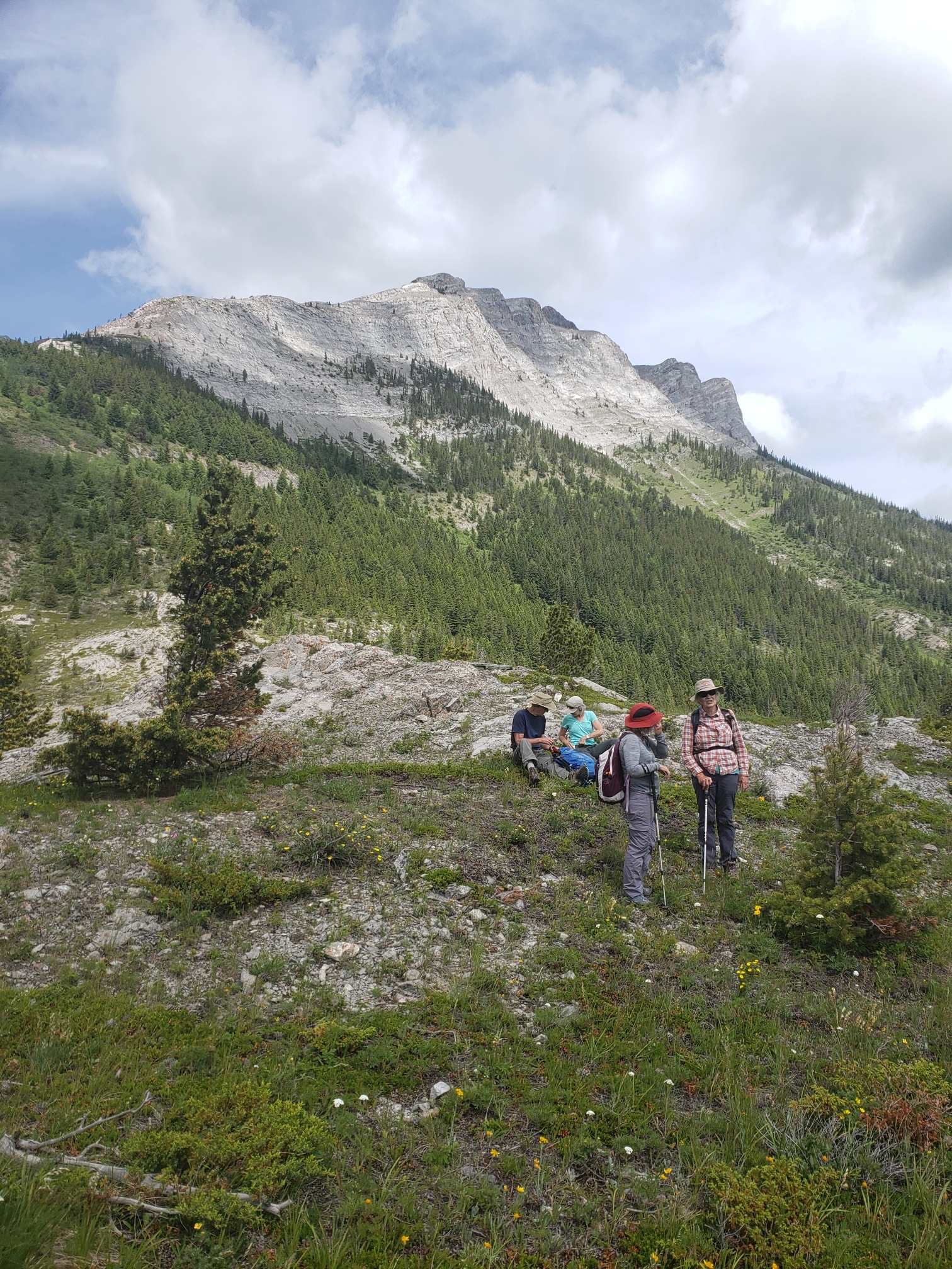
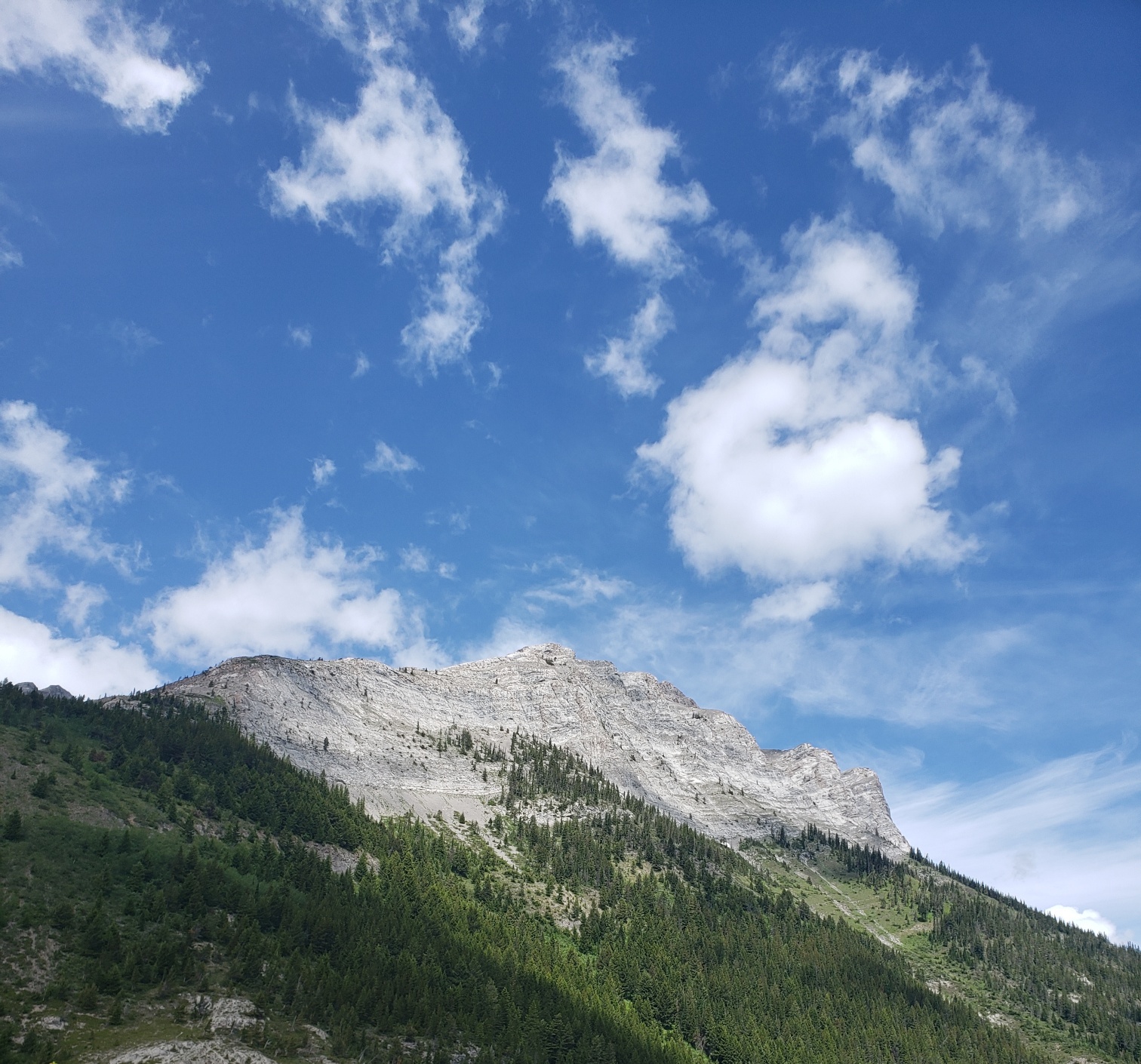
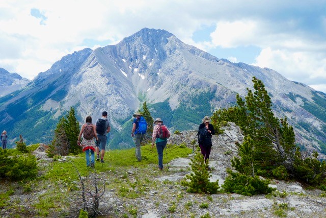
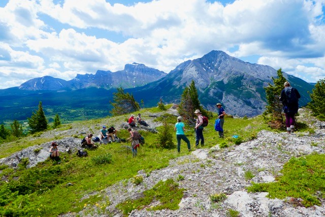
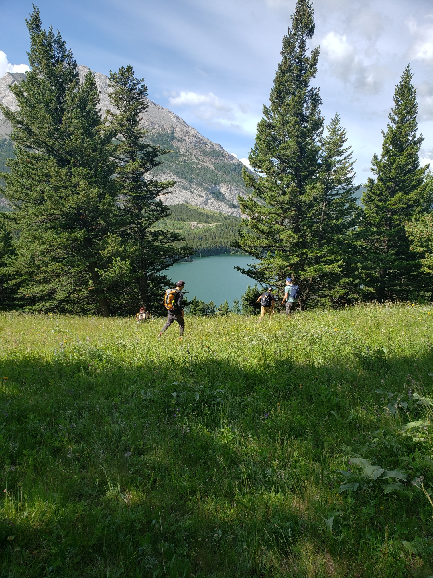
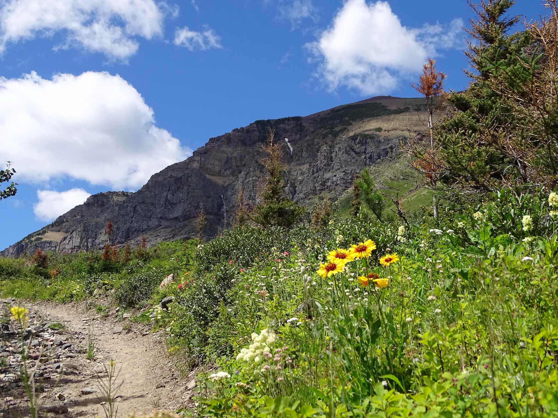
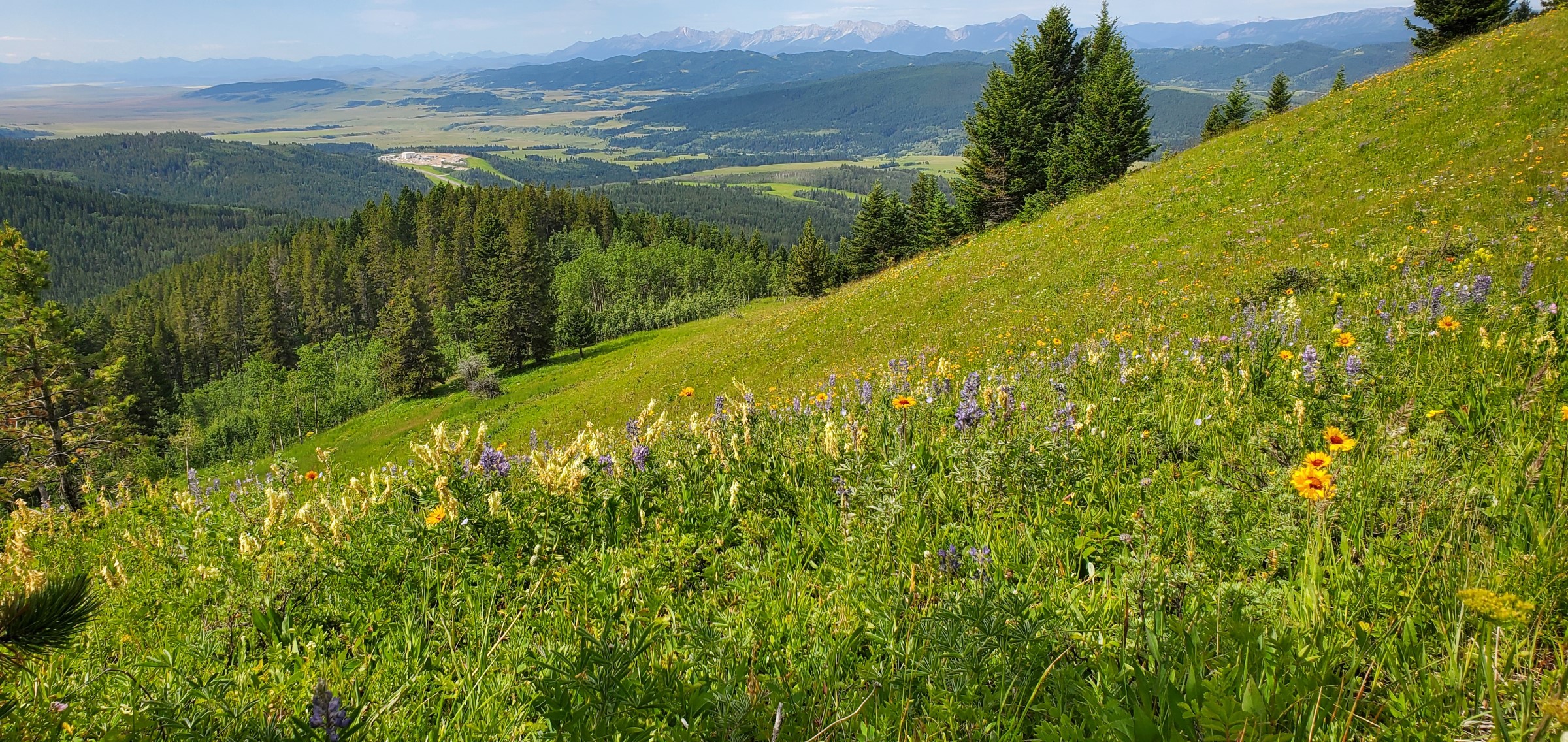
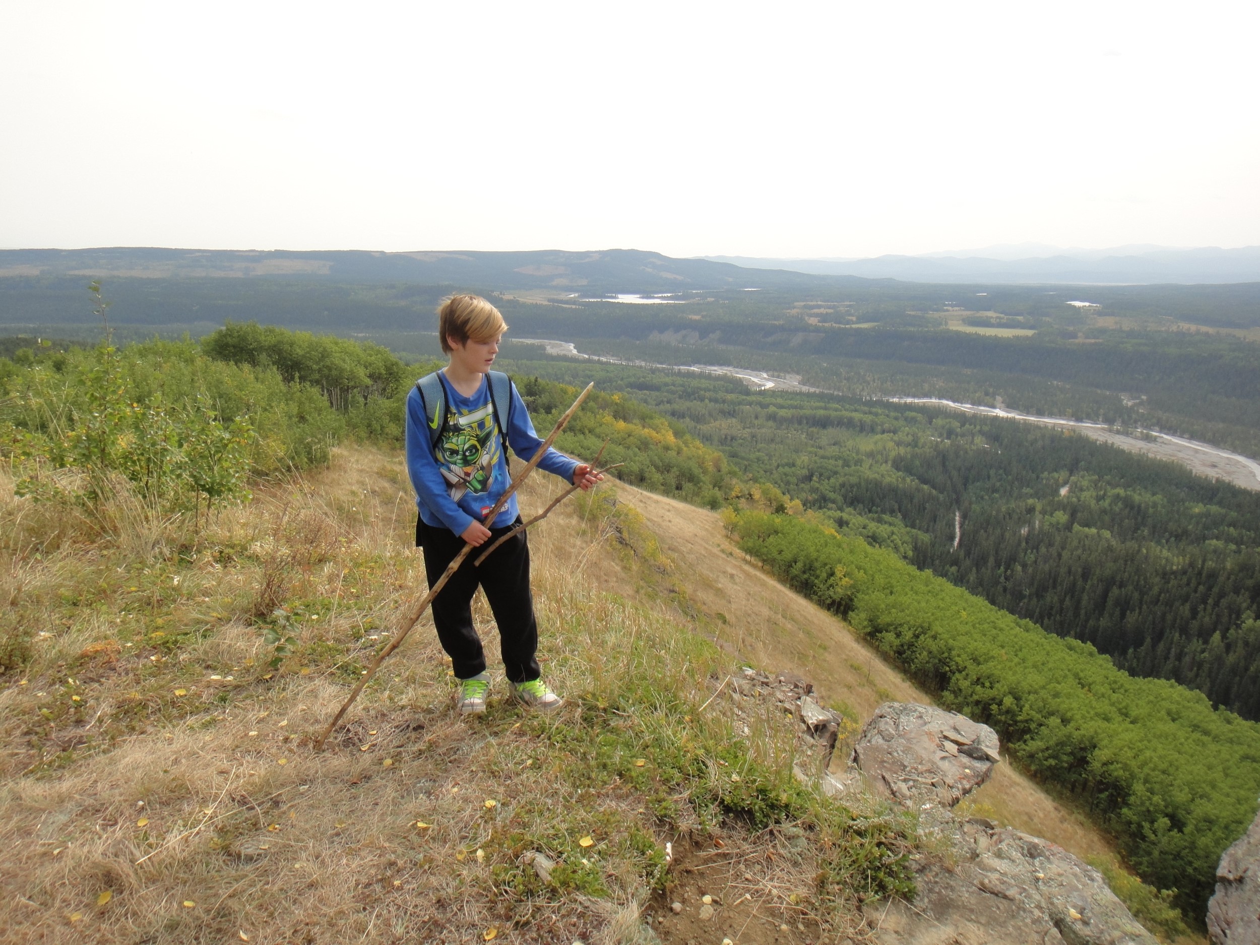
Jumping Pound Mountain Circuit Hike
with Chris Saunders, on June 27th, 2020
Spectacular views and forest issues
At about 10 am on June 27, 2020 14 hikers assembled on the Powderface Trail ready to start on the path up Jumping Pound Mountain from the west. The weather was warm and sunny, contrary to the day’s weather forecast for Calgary.
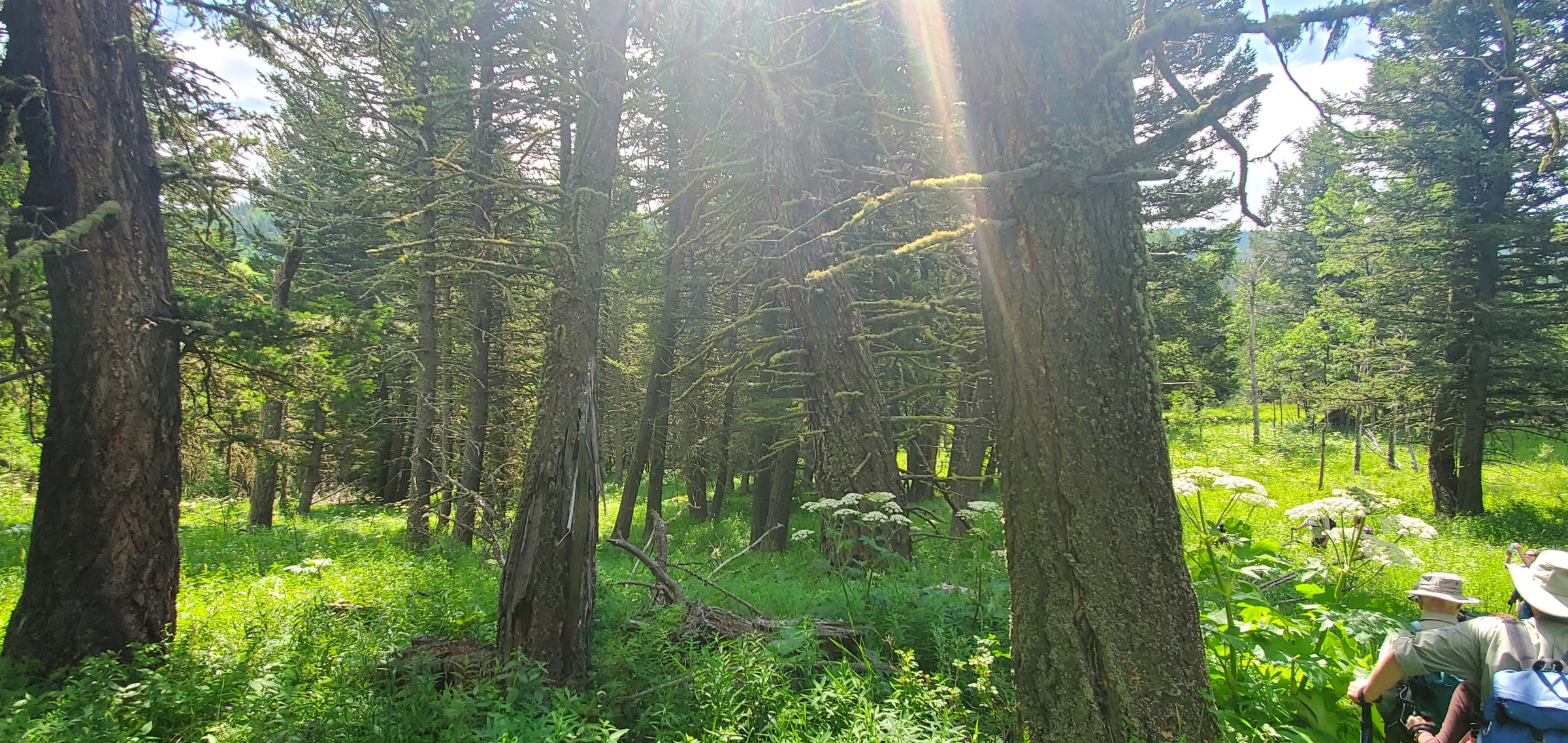
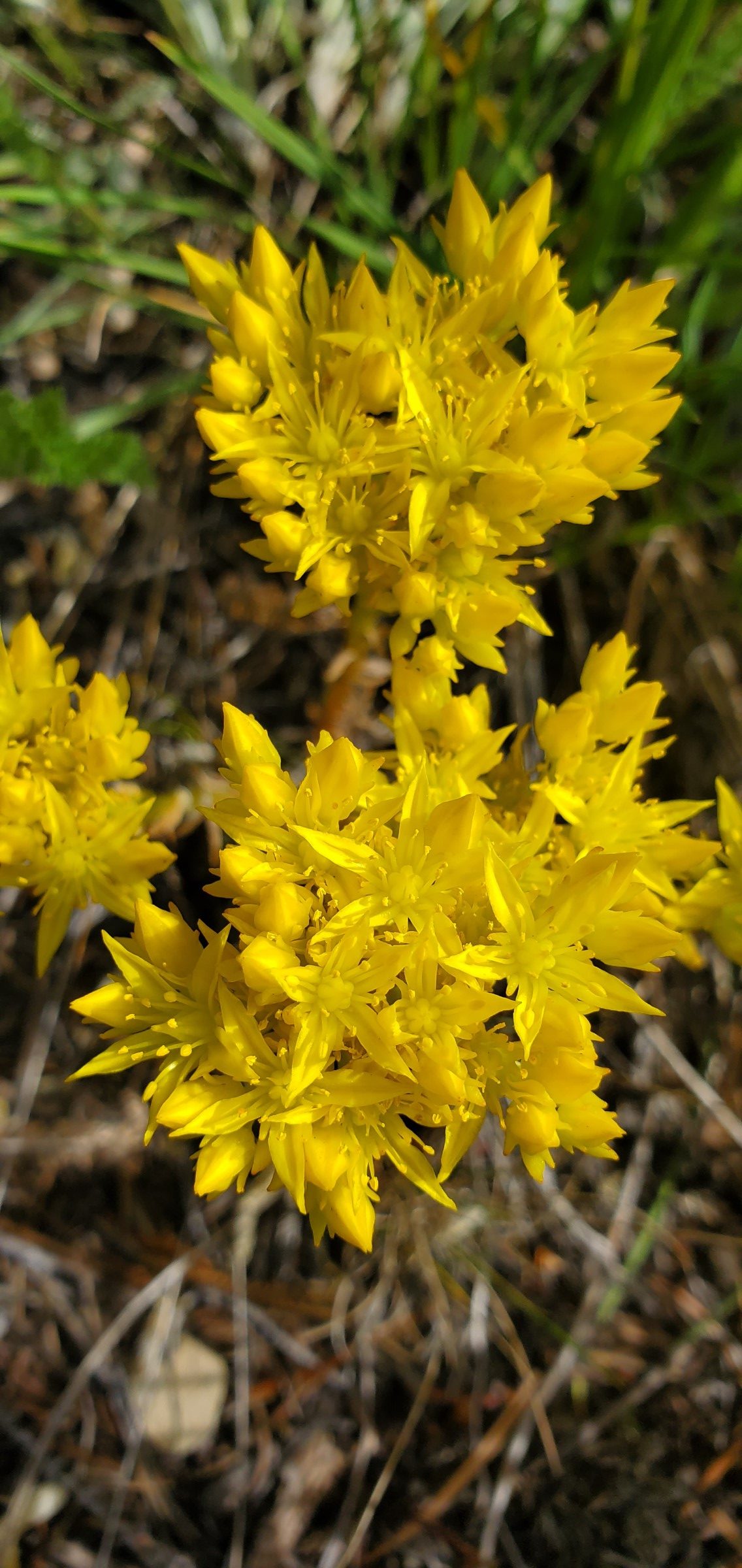
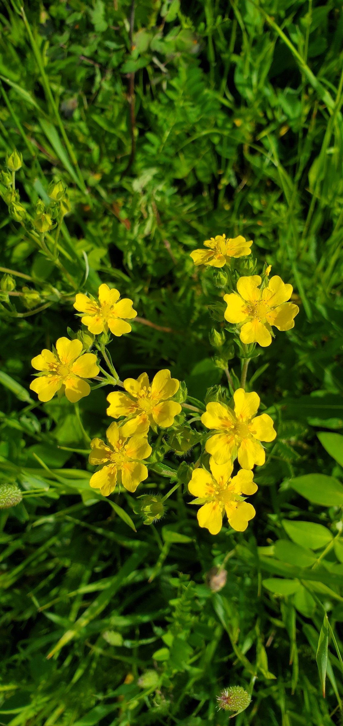
We walked steadily uphill through beautiful mature forest, comprising largely lodgepole pine and spruce, with trees of different ages and sizes. At times the path followed clear bubbling streams, and at others there were gaps in the trees to see views of ranges of mountains to the west. After 2.5 km we arrived at the flower-strewn meadows on the west side of Jumping Pound Ridge with spectacular views of Moose Mountain and its various ridges to east. We followed the path through the meadows to the summit, an altitude gain of 417 metres (1,370 feet). After 20 minutes of absorbing the 360 degree views of mountains and prairie at the summit we followed a ridge further east to a meadow where lunch was eaten. A portion of the group took a short excursion further east along the ridge to see an exceptional meadow of flowers, again with superb views in all directions.
After lunch we returned to the summit and set off to the north along Jumping Pound Ridge. The mountains to the west and north, along with the building clouds, made for some spectacular views. However, the destruction of huge patches of forest in the valley between the ridge and the mountains to the west, through clear cut logging was only too evident. Among other things this logging has destroyed the habitat of wildlife, created significant topsoil erosion and silting of streams, and ruined the forest’s delicate filtration system which provides important flood protection. The group asked does the value created from the timber products obtained from the logging in any way offset these losses?
The route continued along the open ridge for a further 3 km with short sections through spruce trees and a climb down a big shaded snow patch. The trail then went back into the forest and descended into the valley through many switchbacks. In one section it passed directly through the devastation of a recent clear cut with no evidence of any replanting. It is clear it will take many years for new trees to grow to replace the forest lost.
As we arrived at the finish point heavy rain started to fall. We had an excellent day with exhilarating views and beautiful carpets of flowers on the ridge and summit. We had also seen at first hand the costs of logging in the area.

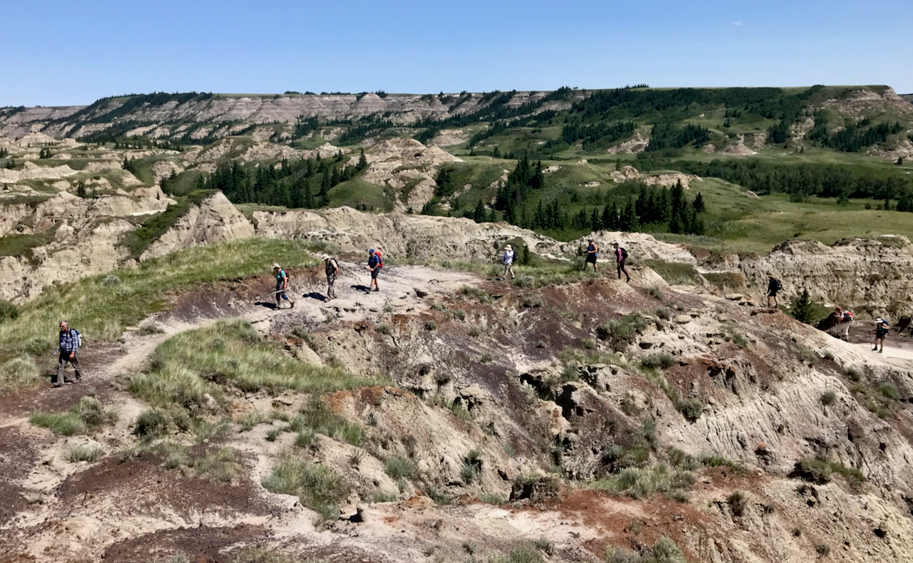
Dinosaurs and Badlands
with Rob and Tjarda Barratt, on 2 & 3 July, 2020
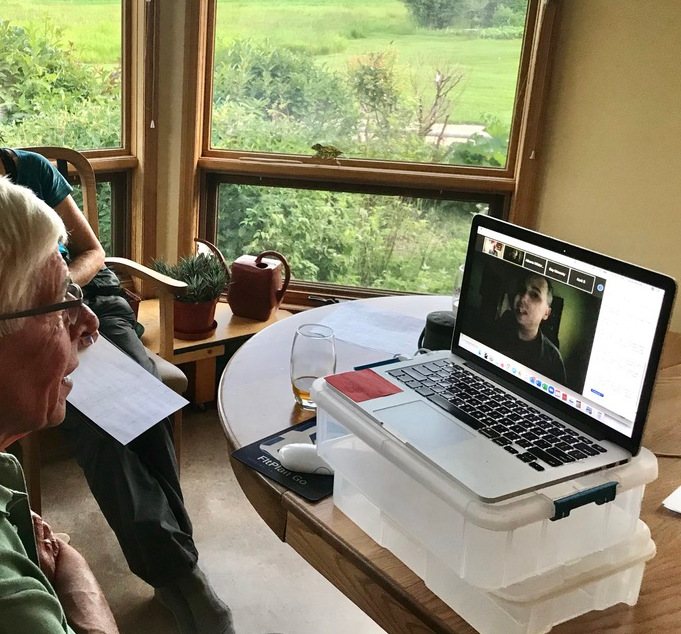
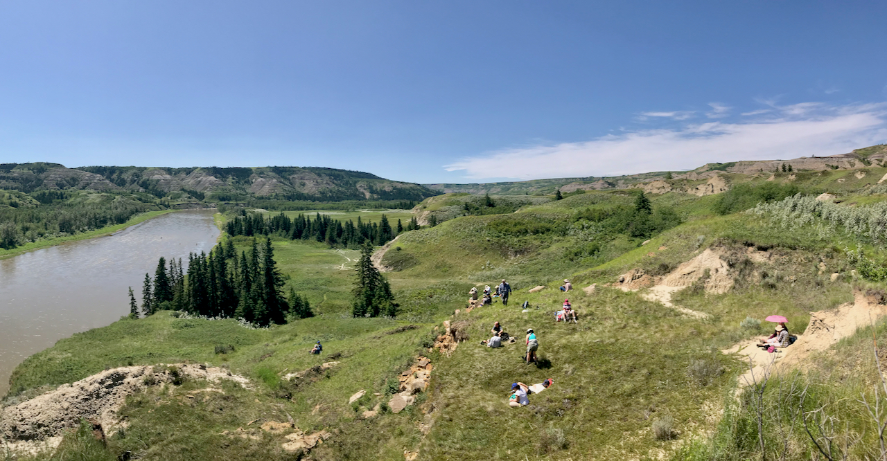
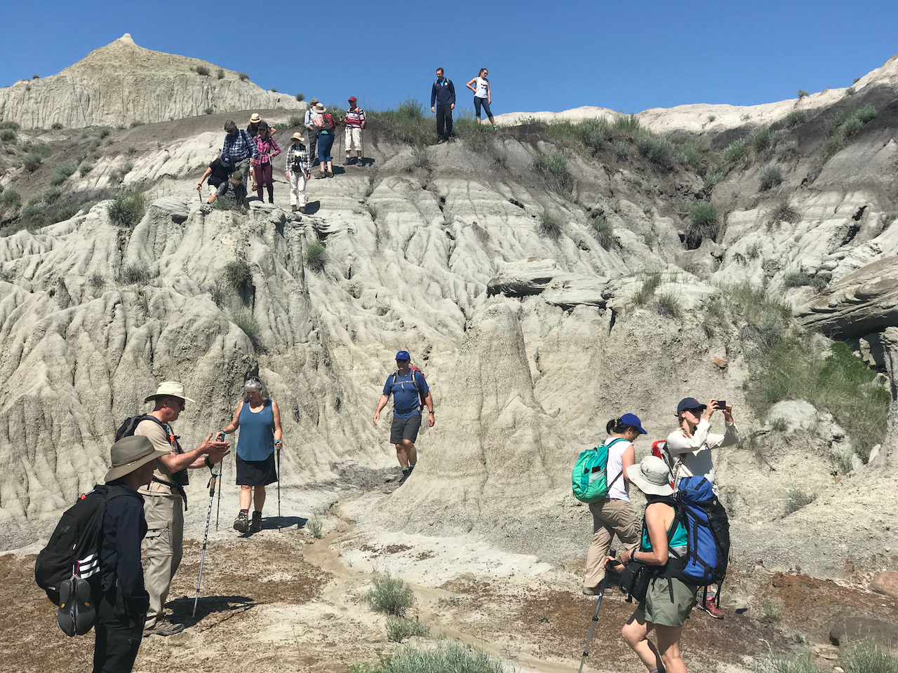
AWA’s two-part adventure, “Dinosaurs and Badlands”, was held on July 2nd and 3rd, 2020. The first part of this event was an evening slideshow presentation on “The Palaeontological Wonders of Alberta” delivered on-line via Zoom by one of Alberta’s prominent palaeontologists, followed the next day by a hike to the world renowned Albertosaurus bone bed in Dry Island Buffalo Jump Provincial Park. The hike portion of this event was fully subscribed with 18 participants, with an additional 15 registering for the presentation only; for a total of 33 participants.
“The Palaeontological Wonders of Alberta” by Dr. François Therrien, Curator of Dinosaur Palaeoecology at the Royal Tyrrell Museum:
This was a captivating presentation on the abundance and diversity of dinosaur fossils found in Alberta. We are one of the top five places in the world for finding dinosaurs. Dr. Therrien explained why Alberta is so rich in dinosaur fossils, which is a combination of three factors: rocks need to be of the right age, that formed when dinosaurs were alive; they need to be sedimentary rocks, which are the only type that will preserve dinosaur remains; and these rocks need to be exposed at the surface for dinosaur fossils to be discovered. Alberta has the perfect combination of all three. Dr. Therrien described the many important dinosaur discoveries made in Alberta over the past 120 years, with emphasis on the Albertosaurus bonebed originally discovered in 1910, the full significance of which only came to light after Dr. Philip Currie of the Royal Tyrrell Museum resumed excavations in 1997. What is interesting is that many of the dinosaur discoveries in Alberta were made not by professional palaeontologists, but by the general public and industry. At the end of the presentation Dr. Therrien answered in depth many interesting questions which added greatly to our knowledge of this interesting subject.
Hike in Dry Island Buffalo Provincial Park:
We had a perfect day for the hike, bright and sunny, and the wildflowers were out in full bloom. The excellent presentation the night before prepared everyone well for the hike. We also had the added benefit of having AWA member Tako Koning, a professional geologist, on the hike to explain the geological features and rocks we saw along the way.
As we walked and scrambled down fascinating badlands, crossing millions of years of geological history, we tried to imagine the lush subtropical forests and flood plains that existed here 70 million years ago during the age of dinosaurs. The park is home to two world renowned palaeontological sites: the Albertosaurus bonebed and Pisces Point. The rock formation at Pisces Point represents the last 900,000 years of the age of dinosaurs. Fossils of freshwater fish found here show that many lineages of modern fish originated in the cretaceous period and survived the Cretaceous–Paleogene (K-Pg) mass extinction. This is very significant and has drawn worldwide interest. The Albertosaurus bonebed is significant for the large number of Albertosaurus found here. Domination by this animal in a single quarry suggests that these animals were living together as a pack at the time of their deaths.
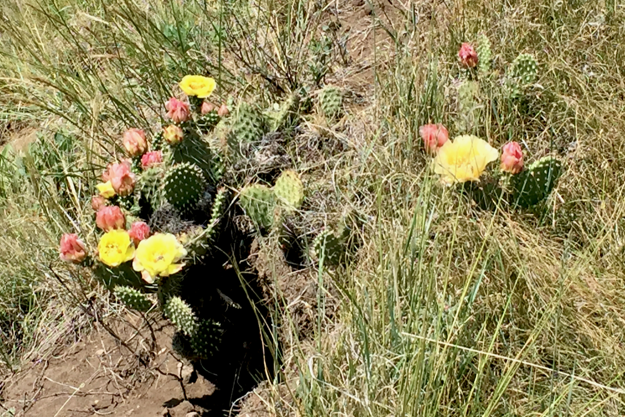
We stopped for lunch on a grassy bench overlooking the Red Deer river surrounded by beautiful wood lilies and flowering cactus. After lunch we followed a deer trail across a lush wooded coulee before breaking out onto an open plain at the foot of the Dry Island mesa and walked across beautiful grassland and prairie fescue. Our route home took us over the top of Dry Island which offered great views of the Red Deer River meandering through this magnificent landscape with the Buffalo Jump in the distance.
From the positive feedback we received, the combination of a captivating presentation followed by a wonderful hike in one of Alberta’s unique landscapes, was a memorable and thoroughly enjoyable AWA adventure.

Tecumseh Adventure
with Nissa Petterson, Carol and Terry Ostrom, on 8 – 9 July, 2020
On June 8th the clouds spent the day pressing up the western slopes of the mountains that denote the border between B.C. and Alberta. Just as the first campers arrived, as though planned as a greeting, the rain started. “Its nothing,” I reported, “We are in the top of a mountain pass, it will pass.” The rain lasted just long enough for all the campers to arrive and locate a place to pitch their tents. From there it was all sunshine and coming together around the campfire as we put the night to bed.
Dawn introduced another beautiful day as folks crawled out of their tents to be greeted by sunshine, songbirds, and couple of dogs willing to help with breakfast details. By 9 the remainder of hikers had arrived and we headed out with a great mix of local and visiting participants.
Spring was late in coming in 2020, but as a result we have experienced an amazing ongoing display of wildflowers. The vibrancy of nature’s bouquet with reds, yellows, blues and purples was outstanding and everchanging as we traversed several different natural regions and were rewarded with spectacular views.
We purposefully mapped out the hike to stay on private lands, Nature Conservancy lands, or public lands that have limited access. It is increasingly difficult to find a place to quietly recreate as the Crowsnest has become the go-to place for OHVs. About 9 km into our hike we entered the Livingstone PLUZ (Public Land Use Zone) and immediately were witness to a group of OHV enthusiasts who were idling by a sign designating the trail up the side of Tecumseh as closed. After an obvious discussion about whether to proceed, off they roared to tear up the headwaters that well out the side of the mountain. I am pleased our government has finally agreed the trail needs to be closed, now I just need to write letters advocating for enforcement. One small step, one small voice at a time, we can stand up for the environment that sustains us.
It was 11.6 km by the time we completed the loop, with four hundred metres’ gain when we sat at the summit for lunch. The weather was wonderful, the flowers fabulous, and the company was congenial. We can hardly wait to lead another hike next year.
– Carol Ostrom


Weekend for Wilderness
with Grace Wark and Joanna Skrajny, on 18 – 20 July, 2020
It’s 6:34 a.m. and I’m searching for my car keys. I need to pick up Joanna by 7.a.m. so we have enough time to load 50 to 60 lbs of gear, snacks and water into the car, hit the QE2, and make it to the trailhead before high noon. Not the earliest start by backpacker standards, but early enough that we stop at Tim Horton’s for a final boost of caffeine to get us through the day.
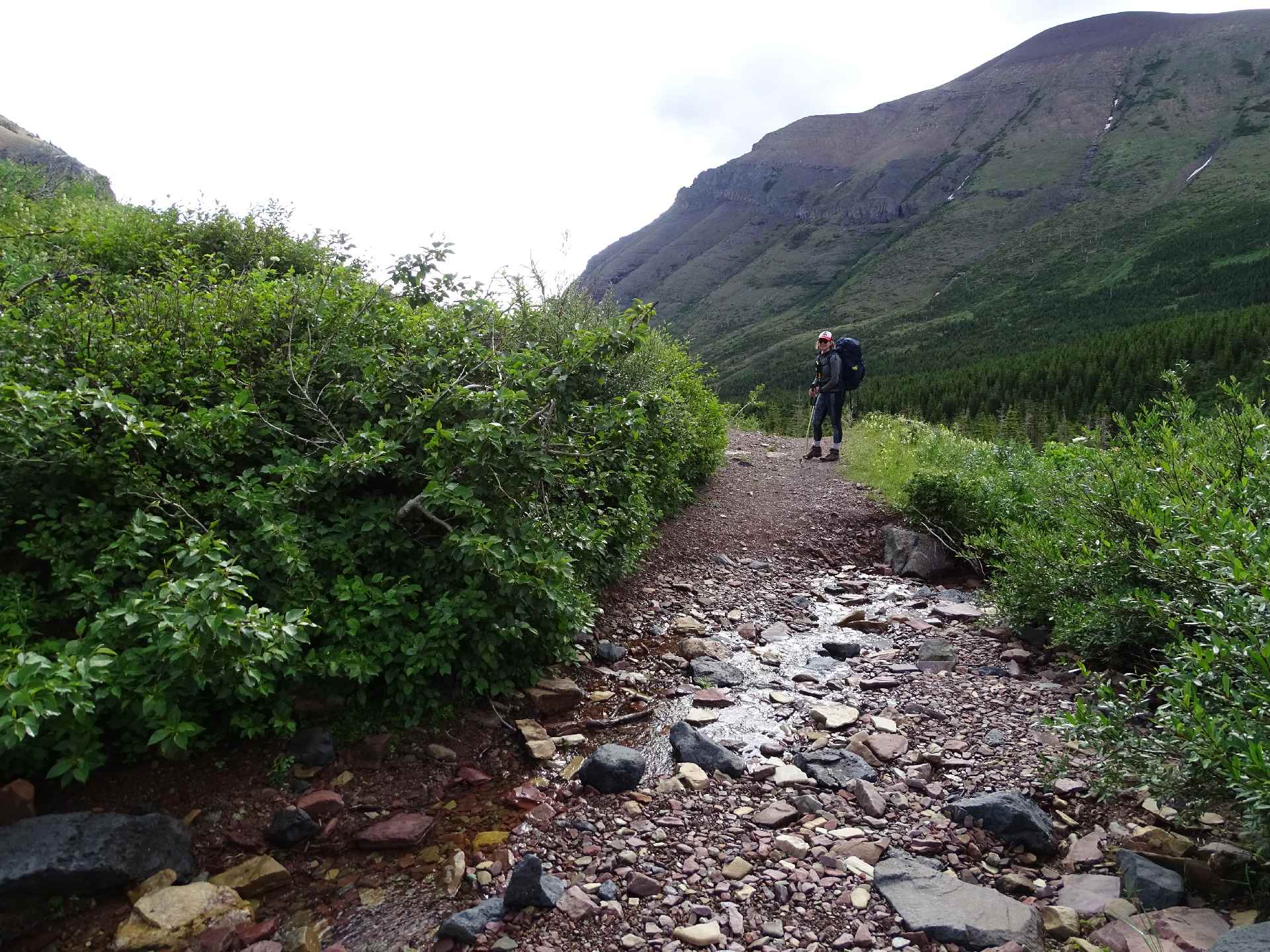
This is my first time in the Castle Wildland, and after taking my first and second glances at the dusty red Front Ranges, I can already see what sets them apart from the rest of the Eastern Slopes. These mountains feel shorter, more rounded and almost less intimidating than the towering peaks in Banff and Kananaskis Valley. The east-west ridges of the Front Ranges are stacked like dominoes towards Waterton Lakes National Park. Our valley of choice runs up South Drywood Creek, with a final destination of Bovin Lake. All in, a 20 km round trip with 750 metres of what I would call steady elevation gain.
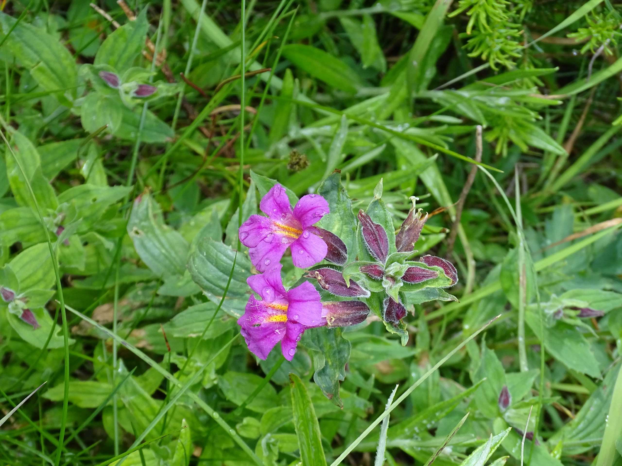
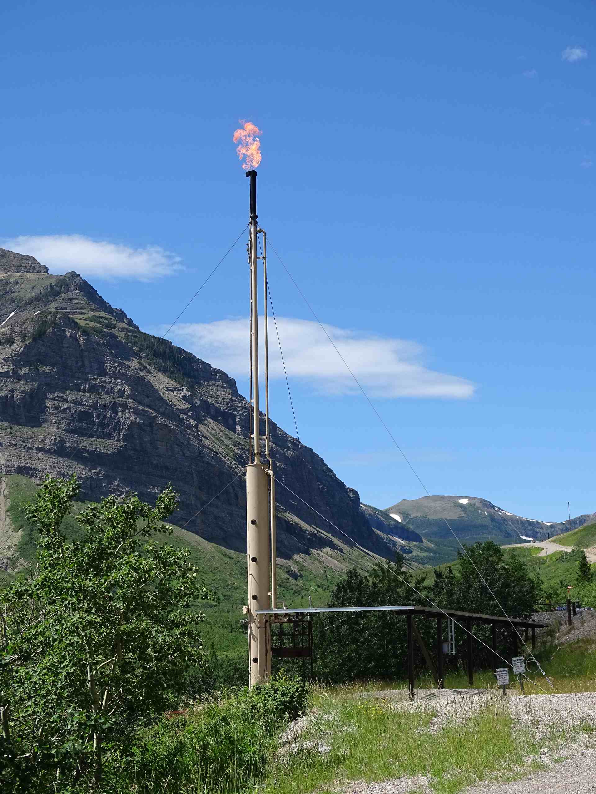
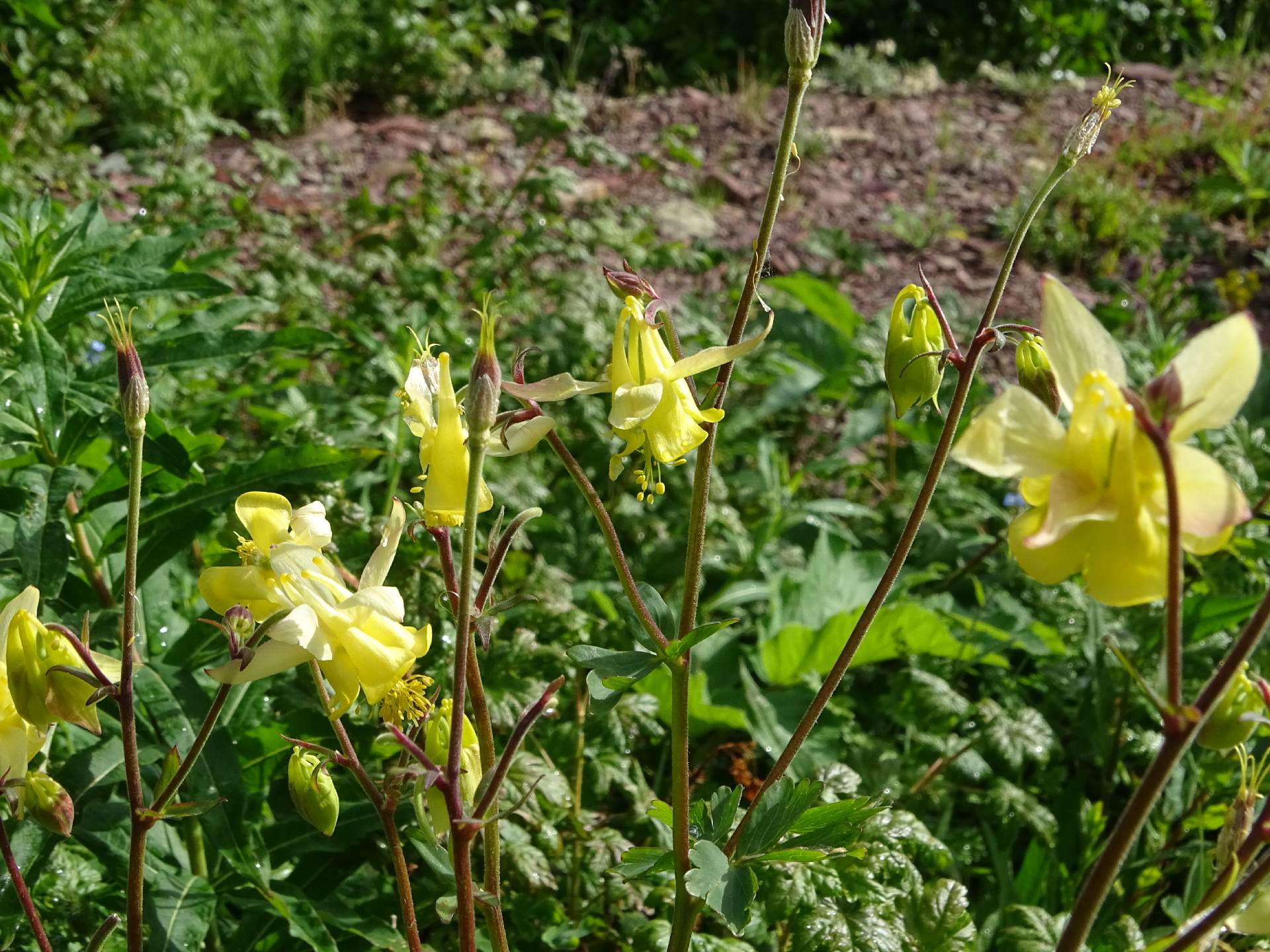
The first four kilometres of the trail follow the grated Shell Road. Not so far from the road, we can still hear the rumble of active well pads, well-marked with warning signs for passersby. After those four kilometres, the difference between the designated hiking trail and the Shell road is night and day. The echo of well pads is slowly fades into the distance as we clamber up the pathway into an explosion of bright and colourful wildflowers. Diversity here absolutely thrives beyond the reach of road-introduced invasive species and free-roaming cattle. From our collective memory, we spot forget-me-nots, columbines, lupines, sticky geranium, paintbrush and even provincially rare pink Monkeyflower.
Before turning corners or ambling into thickets of willow and dogwood, we find ourselves instinctively shouting “Hey bear!” or “Is there anybody out bear?” (to the tune of Pink Floyd’s Is There Anybody Out There?) to make sure we don’t startle our company. Mountain valleys like these are perfect for an ambling grizzly bear, full to the brim with bearberries and currants, and quiet, save the low roar of the creek, bird calls, and “chirping” Richardson’s ground squirrels.
This area is distinctly different from the Castle Provincial Park lands to the north, valuable in their own way but more heavily trafficked. Here in the Wildland, away from the road and the busy off-highway vehicle trails, these lands have very few signs of disturbance. We were almost shocked to reach the old OHV gate at the top of the trail, as we almost forgot this was once used as a motorized trail. Since the phase-out of motorized trails from this area in 2018, the landscape has already started to recover the large erosion gullies and braided trails from heavy flooding and motorized use.
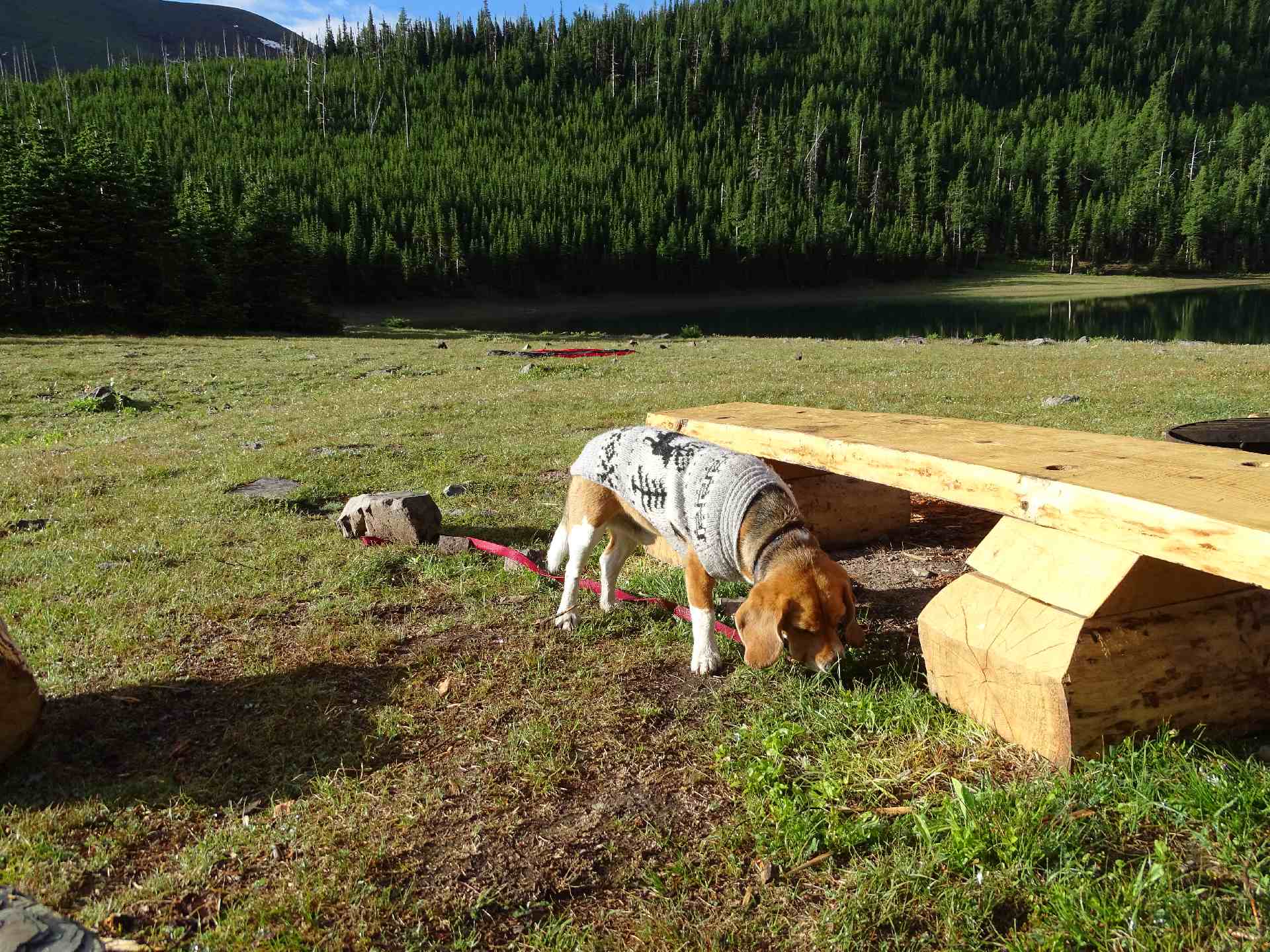
After reaching the lake, setting up our tent, and recharging our electrolytes, we scramble up the ridge and find the perfect spot to sing Bruce Springsteen’s cover of Mountain of Love (a very specific sponsor request). Perched on top of a bleached old tree in full view of the valley, we were indeed feeling pretty “high on the mountain of love”. How could you not fall in love with the views, the emerald blue lake and choice company provided by a couple other groups of hikers and a chunky beagle named Hoser.
Despite the achy joints, the midnight thunderstorm and the persistent horseflies, there was absolutely nothing that could have spoiled this picture perfect two-day backpacking trip up the Front Ranges. If you have the chance and are able, I would highly recommend a day-trip or overnight hike to Bovin Lake. It was just what I needed to not only recover from my long-stay at home and otherwise busy schedule, but to remind me why we fight so hard to protect the Castle. I invite you to fall in love as I have, and join us in stirring up some trouble to keep it this way. More on that here.
Happy trails,
Grace & Joanna


Porcupine Hills Hike
with Joanna Skrajny, on 23 July, 2020
The morning of the adventure everyone made their way through thick fog to meet in Chain Lakes Provincial Park and convoy to the staging area at the bottom of the Porcupine Hills Ridge. The plan was to first ascend the North side of the ridge, but after learning that a locked gate may pose a problem, we parked our vehicles at the staging area atop the ridge. By the time we arrived at the staging area the sun had burned off the morning fog and we were immediately rewarded with a crystal-clear view overlooking the Southern Eastern Slopes dotted with welcoming cotton ball clouds, and diverse communities of wildflowers greeted us with their vibrant colours and the familiar aroma of summer in Alberta.
A short distance from the staging area a small clearing in the trees provided the only view to the East, which stretched across the landscape so far the horizon and sky mixed into a soft blue medley. After trekking across the ridge, we stopped to have a quick snack near a hoodoo before we set out on a challenging decent through an ancient old growth forest and chest-high fescue grass. Upon reaching the end of the trail we enjoyed a relaxing lunch in the cool shade of an aspen grove.
Once everyone was feeling refreshed, we began our ascent back up the ridge, and we took an off-trail route through the forest to avoid some of the steeper, less forgiving sections of the trail. When we reached the top of the ridge Joanna Skrajny entertained everyone with fun facts and stories of the region’s history and conservation struggles before making our way back to the staging area. This adventure was the perfect combination of pleasant weather, remarkable scenery, and delightful company.
– Joel Van Riper


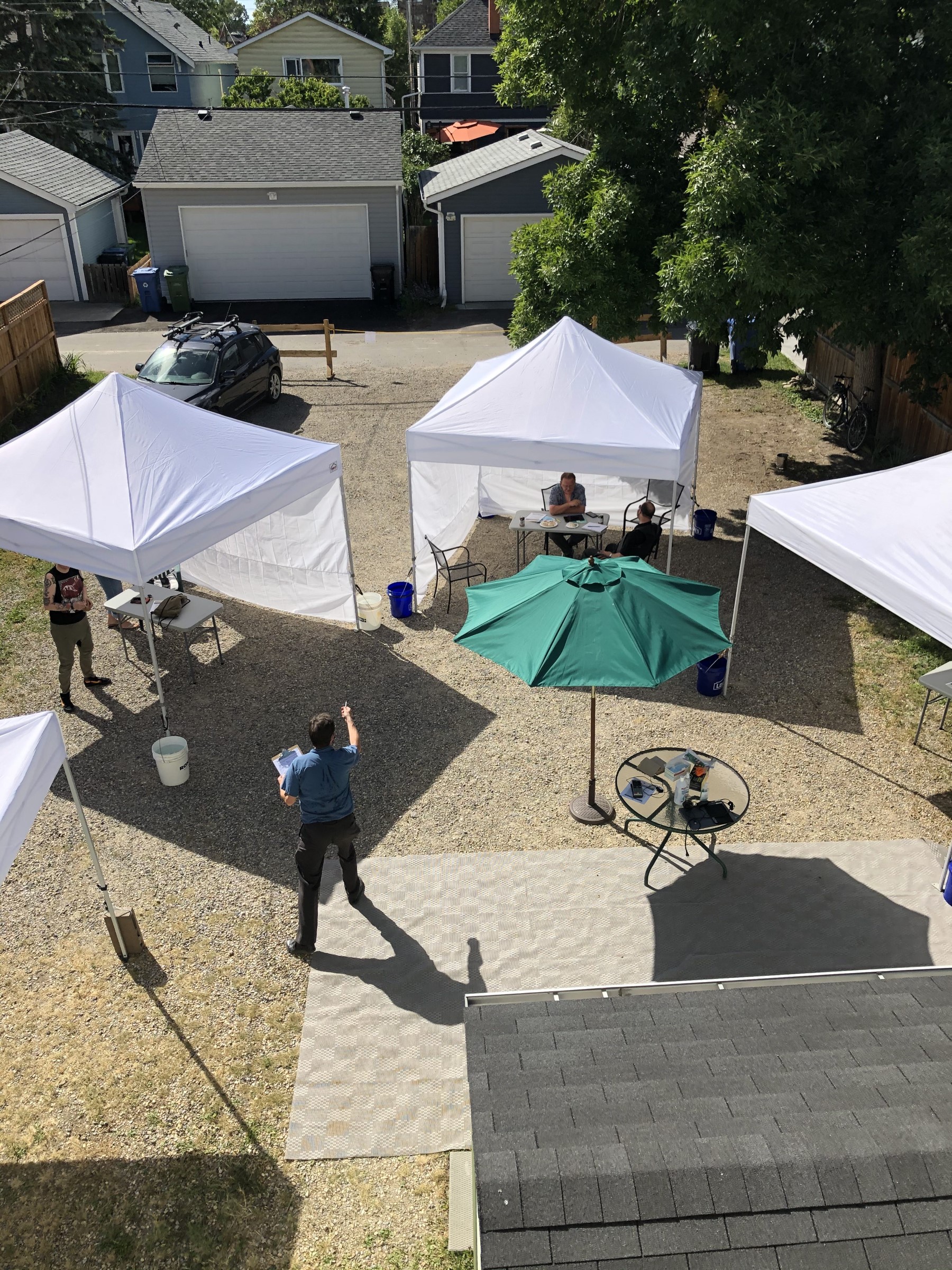
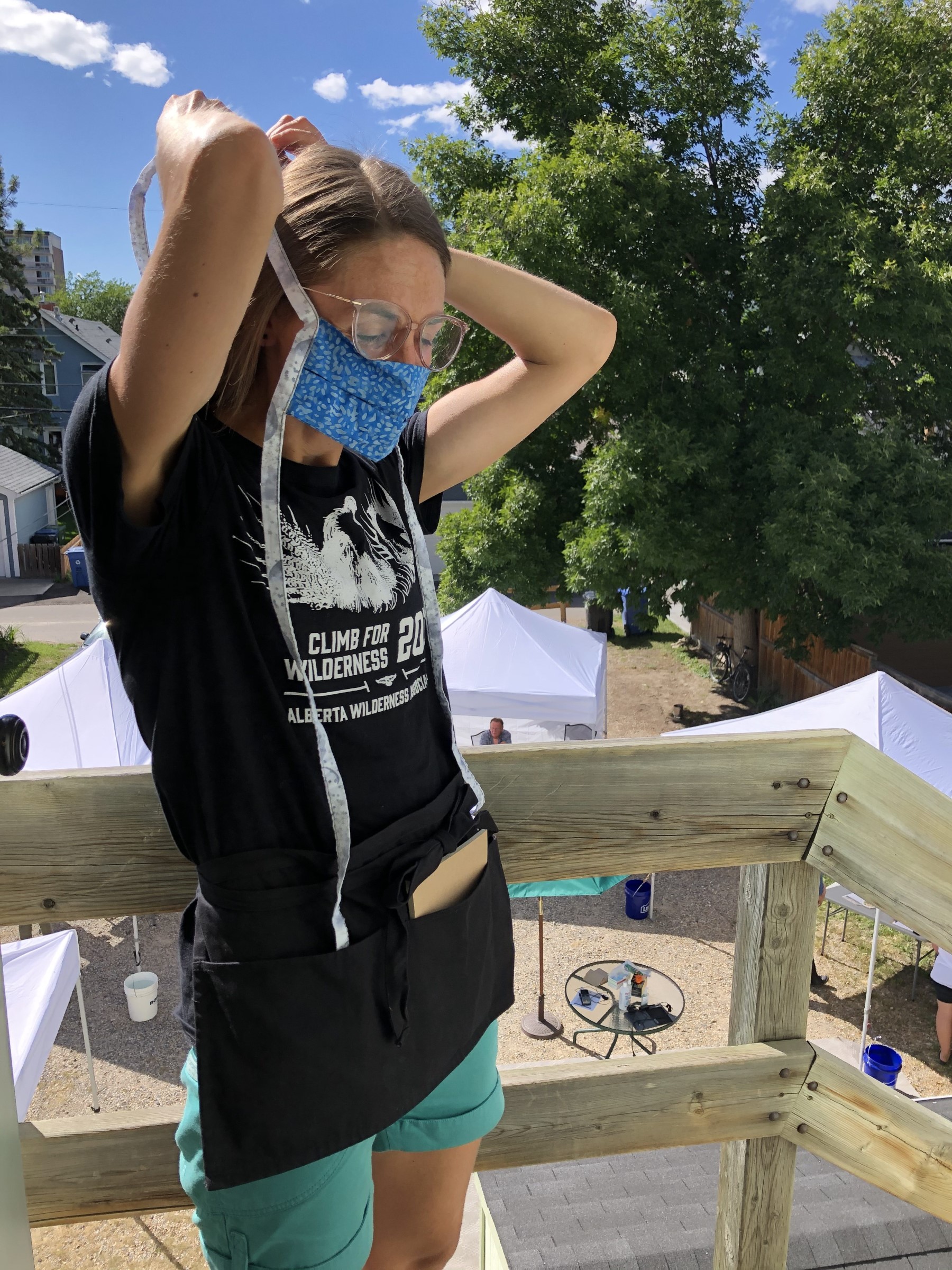
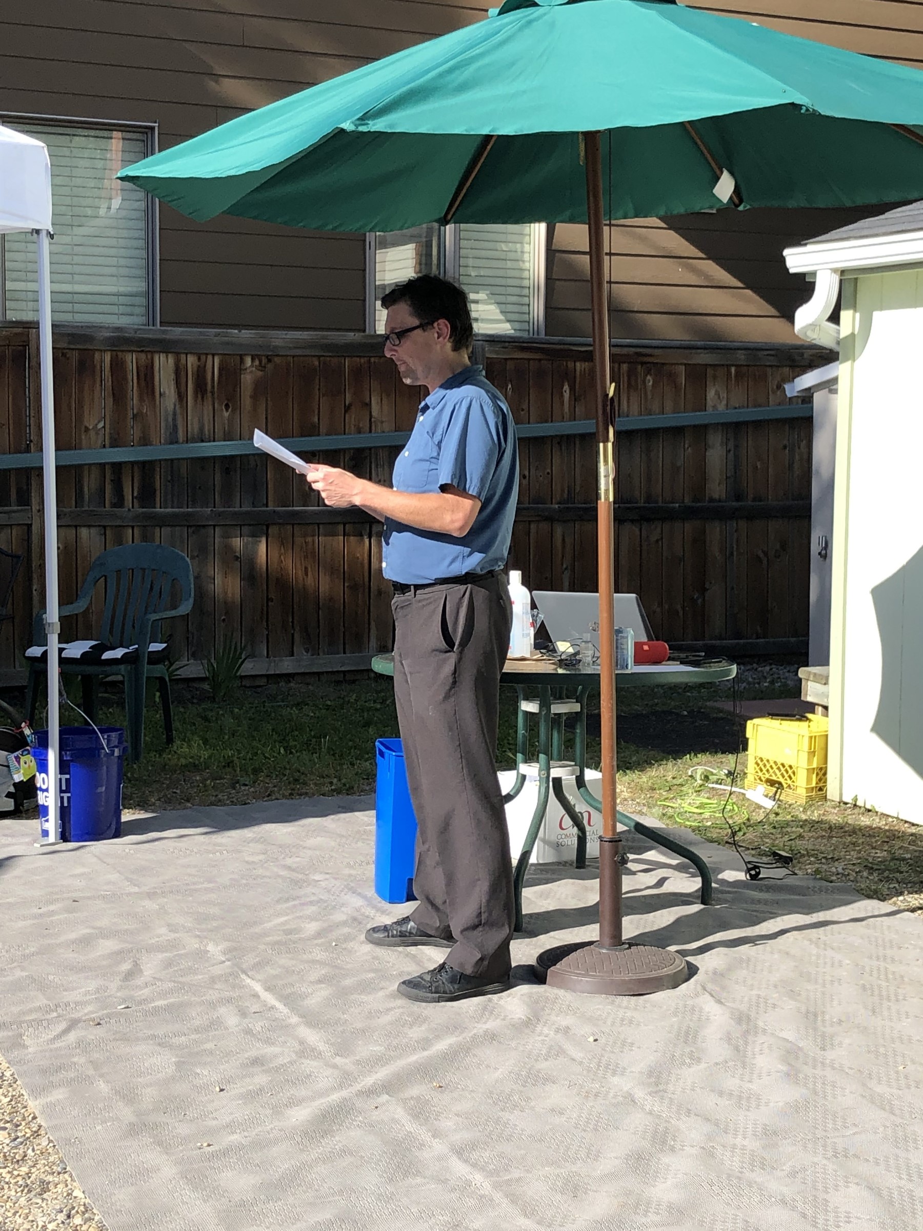
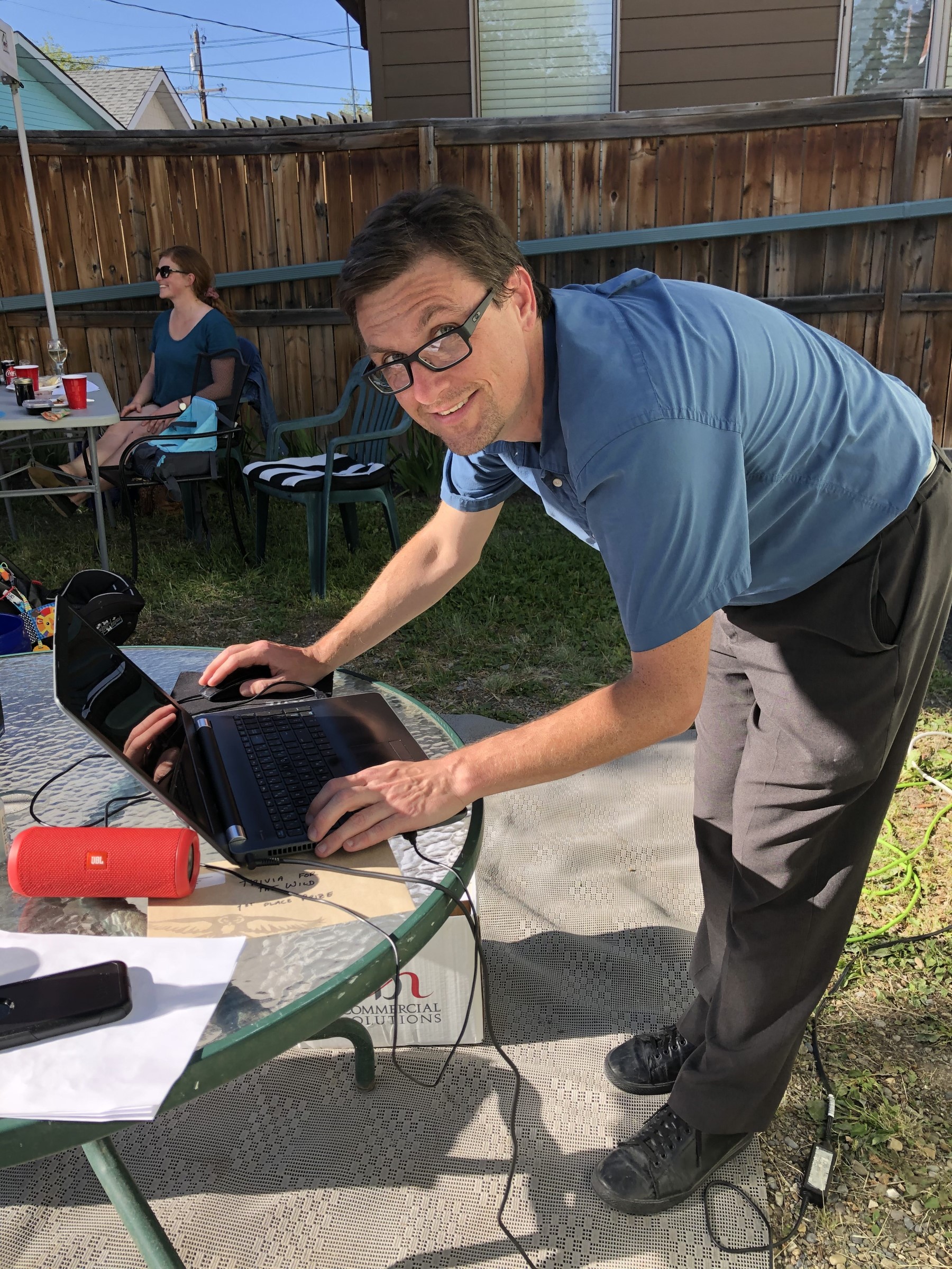
Trivia in the Garden
with Sean Nichols, on 15 August, 2020
For most of the ten days leading up to AWA’s Trivia for the Wild adventure on August 15, the weather was looking to be pretty miserable. Our otherwise splendid August notwithstanding, the forecast was predicting rain, wind and cool – if not downright chilly – temperatures. With some nervousness, I began trying to decide how to apportion space heaters to the tents so the contestants wouldn’t be freezing, and trying to figure out how to host and emcee a trivia contest, with a computer, while standing out in the rain.
When AWA first began planning the Adventures for Wilderness schedule back in January, and was brainstorming ideas, a charity trivia contest seemed like a great idea. It goes without saying, of course, that AWA strongly advocates getting out into the wilderness and experiencing Alberta’s wondrous natural beauty firsthand. So naturally most of the adventures in the program affirm that philosophy. It’s heartwarming seeing the map of Alberta fill up with adventures taking place, and getting adventurers out into, all corners of the province. But there are of course many Albertans for whom an outdoors and possibly physically demanding adventure, taking up an entire day or more, is not a realistic commitment. Holding a trivia night closer to home, where we could include education and presentations championing the defence of Alberta’s Wilderness, seemed like a great complement. So we quickly added it to the schedule, and as a certified (and certifiable) trivia hound, I quickly volunteered to host.
How much the world has changed since January!
Through much of the spring, and the weeks and months that followed, we put the trivia night on hold, unsure when, or how, to hold it; or indeed whether it would be feasible at all given health concerns and all that 2020 seems determined to throw our way. Until finally we hit on the idea of holding it outside, on the AWA grounds in Hillhurst, with a reduced number of teams granted individualized tents, sitting at a socially-responsible distance from each other.
Trivia for the Wild was re-christened Trivia in the Garden, a Saturday afternoon date was set for mid-August when we hoped the weather would be nice, and it was game on!
Thus with a slightly sinking feeling I kept watching the weather forecast as inclement weather was predicted, wondering if “game on” would turn into “washed out.”
Hurray and huzzah, the day before the tournament gave proof to the wisdom that one should never trust a Calgary weather forecast as the rain held off and we were instead treated to a glorious warm and sunny afternoon. We set up the tents, now to shield the contestants not from the rain but the sun, and I was glad for having many cold drinks on hand to provide the weary warriors.
And true warriors of wisdom they proved to be. As host and question-setter, I knew there might be some true trivia veterans in the field, but possibly also some teams with Wilderness lovers out for a fun afternoon, who might have less “insider experience” with some of the tropes and standards of the trivia circuit. Of course I wanted to ensure that questions were fair for everyone, but also, that all teams would have a fun afternoon, regardless of what place they came in.
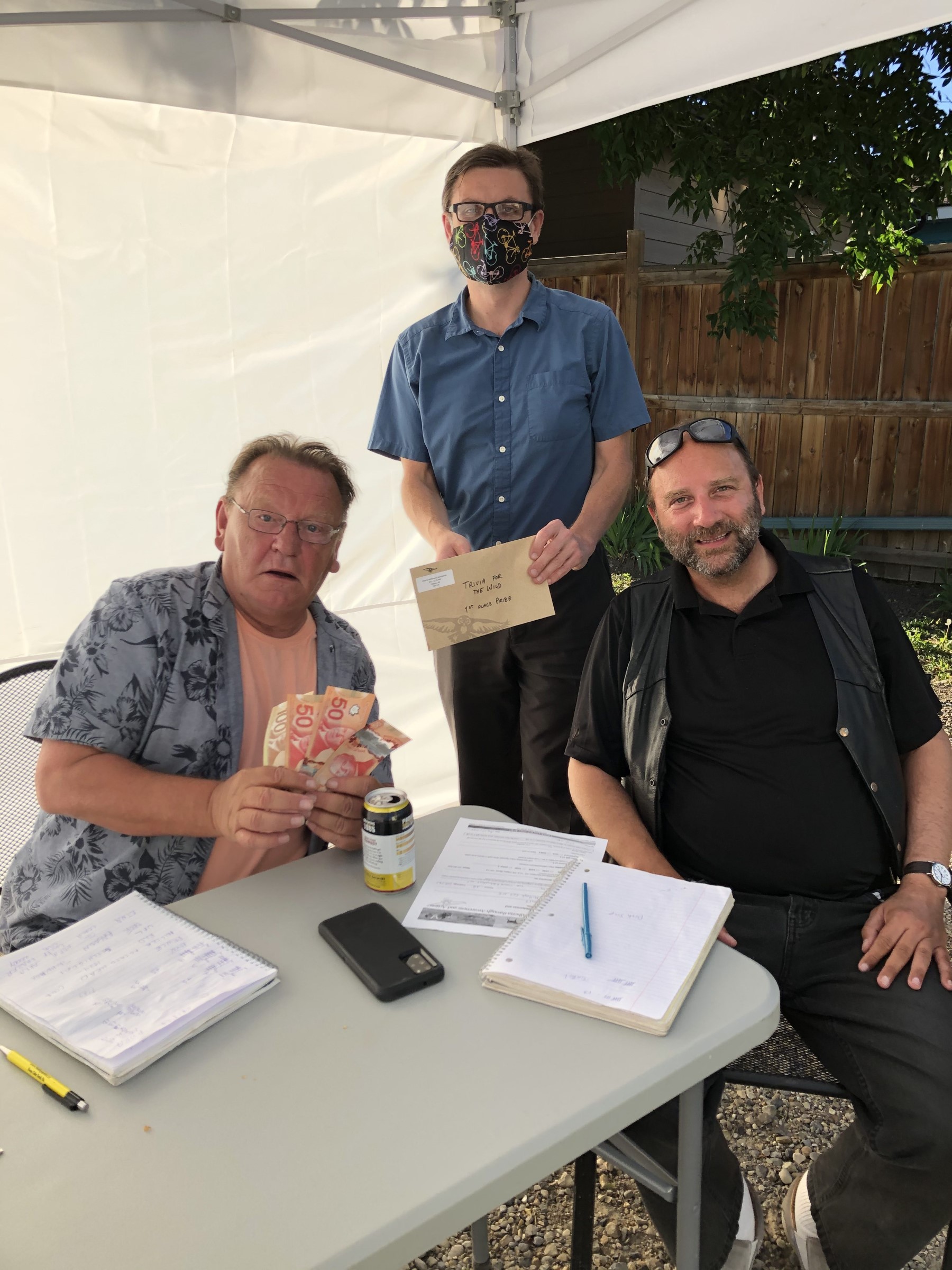
I needn’t have worried. With the restrictions in place we indeed had a reduced number of contestants, but the quality of the competition was as strong as ever, across the entire board. Most questions were answered correctly, many by all teams present, and at the end of the day, but a few points separated the teams on the roster.
Indeed it was a team of trivia veterans (team “One Ball Short”) that took home the top cash prize (and more importantly, bragging rights!) but they were chased all the way there by a whip-smart team (team “Trivia Challenged”) that, though less-experienced, came within a question or two of winning. They themselves were not far ahead of the bronze place winners (team “Sweet Wild O’ Mine”).
And of course it was not all hard work! We made sure that it would be a fun afternoon for everyone, and even teams that did not come out on top went home with prizes including AWA-branded bandanas (useful as face masks!) and home-made jam, for best wrong answers:
Question: What do the initials “TCBY” stand for in the name of the chain of dessert restaurants?
Answer: “Thanks. Come back, You.”When it was all over, everyone went home with smiles on their faces and a greater appreciation for Alberta’s Wilderness, having had a fun afternoon. What more could we ask for in these strange times?
Sean Nichols
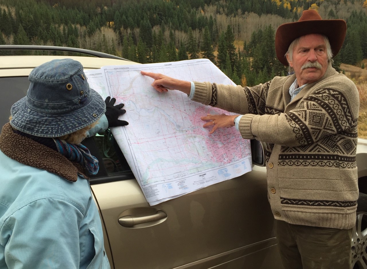
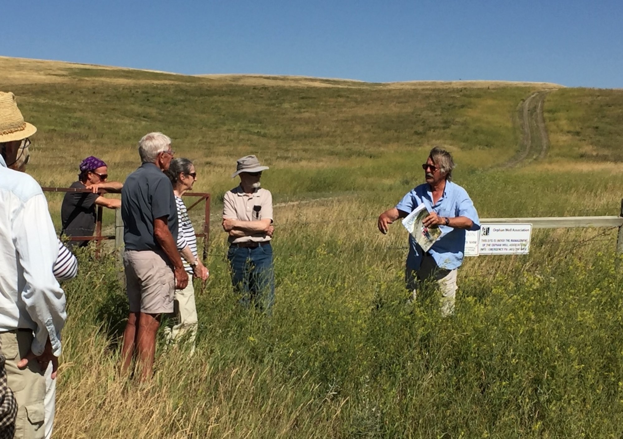
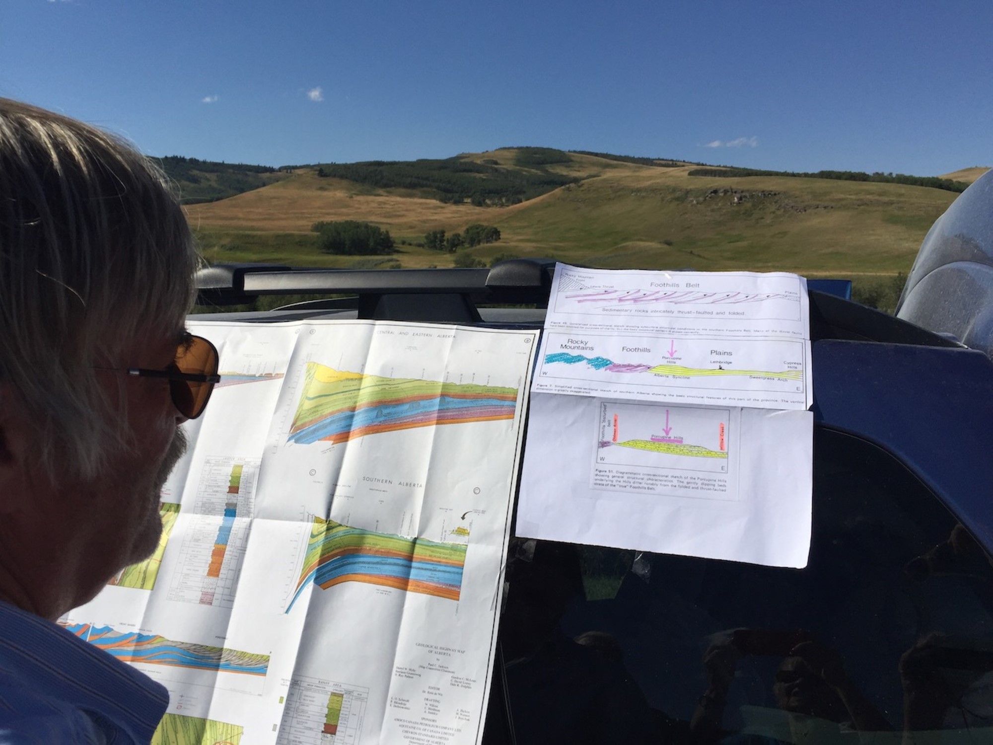
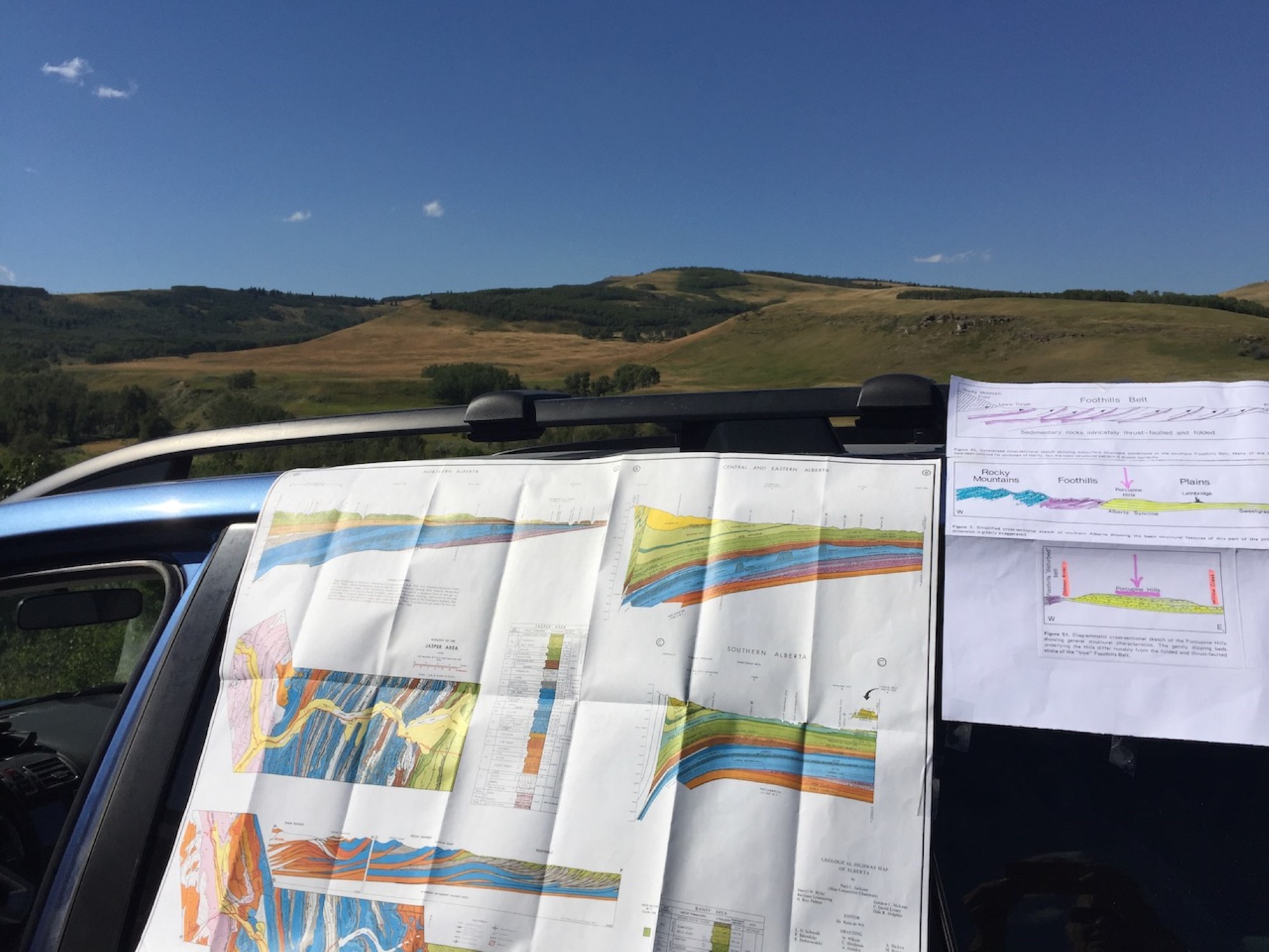
Field Tripping Southern Alberta
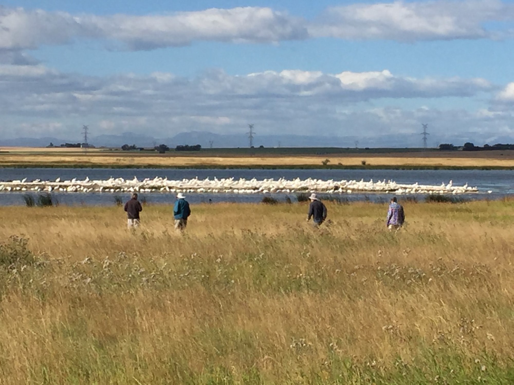
with Tako Koning, on 22 August, 2020
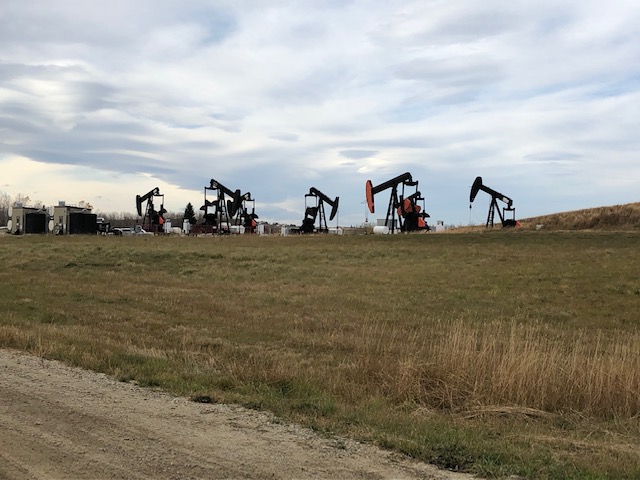
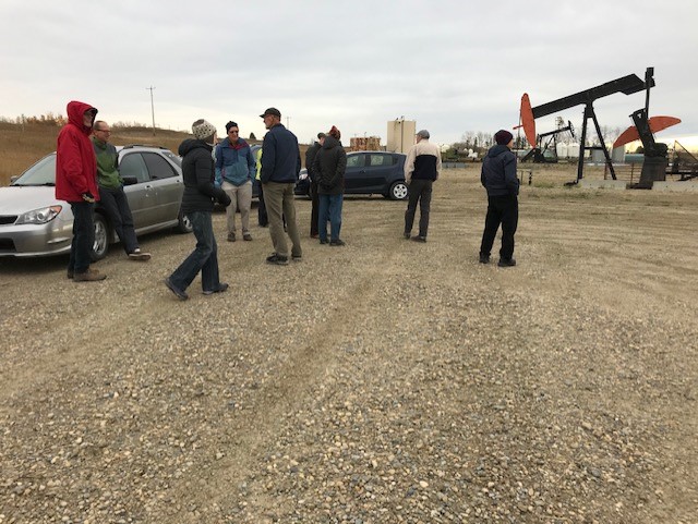
The group consisted of 14 participants and as we drove towards the bird blind at Frank Lake, five km east of High River, we saw over 200 beautiful white pelicans resting on a small island near the western edge of the lake. So, this was an excellent start to our field trip. Encouraging also was that the weather was excellent with just a touch of autumn in the air.
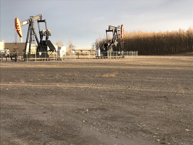
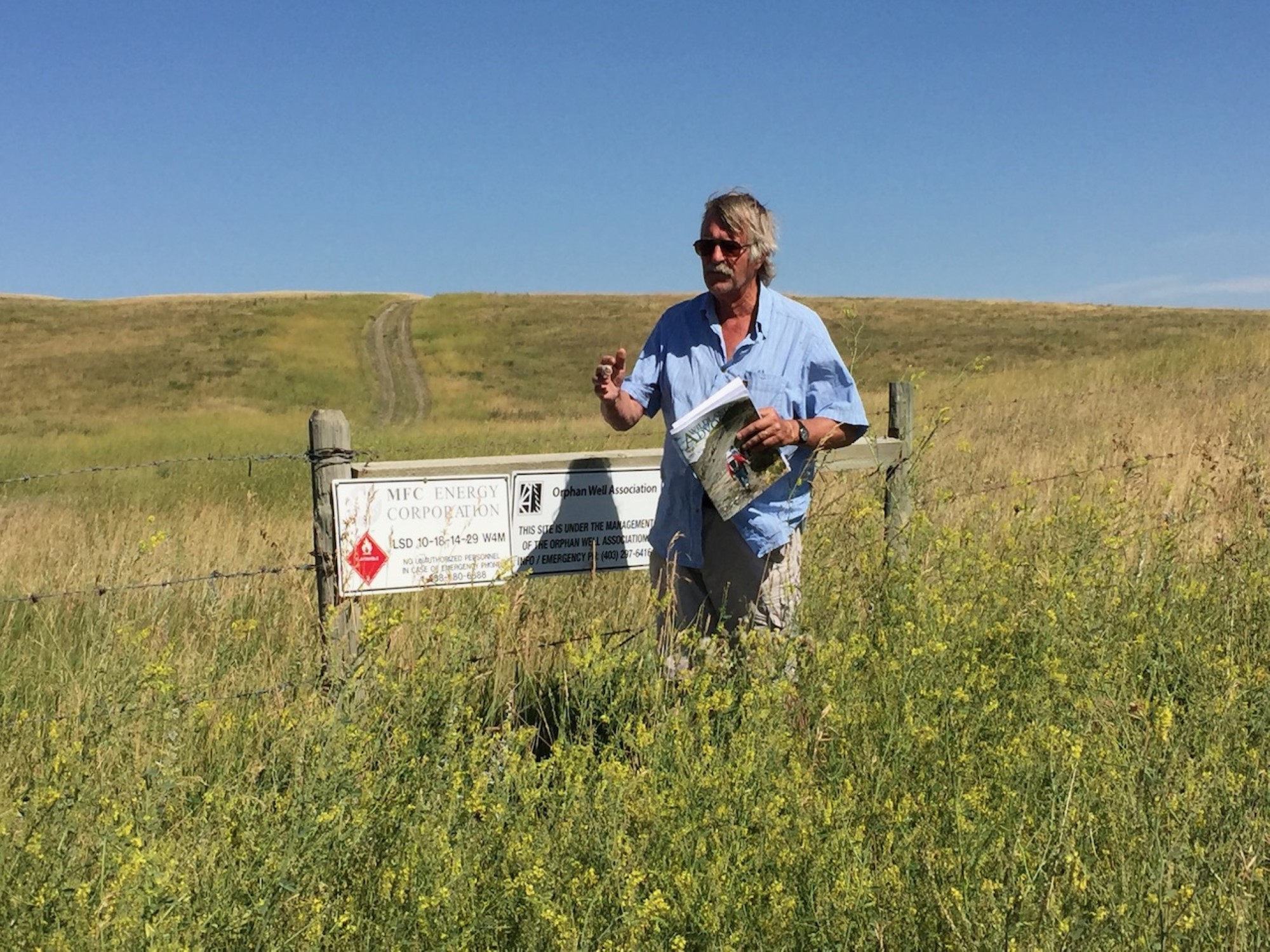
After visiting Frank Lake and photographing the pelicans as well as numerous water fowl and shore birds, we drove a couple of miles northwards and stopped at a sign indicating the presence of a nearby gas well which was “left behind” when the oil company went bankrupt. This well is an “orphan” gas well which has been left in a suspended state for 15 years and needs to be properly abandoned and the well site environmentally remediated. The Orphan Well Association, funded by the oil industry and Alberta government (thus we the taxpayers) will need to cover those costs. About 1,500 such orphan wells occur in the area from Vulcan to Frank Lake and down to the southern Porcupine Hills.
We then stopped along the road near the large, 35-year-old Mazeppa Gas Processing Plant which was also abandoned by the same oil company and needs to be dismantled and the site environmentally brought back to its original state. The cost of this will be many millions of dollars. One cannot but wonder how many more such abandoned facilities exist in Alberta. A lively discussion took place about this huge problem. We were fortunate to have a diverse group of attendees such as an engineer, accountant, lawyer, greenfield horticulturist, corporate business consultant, geophysicist and myself being a petroleum geologist engaged in the discussions.
We then proceeded southwards to Stavely and then westwards to the Willow Creek Reservoir which is an important source of water for that area for irrigation as well as sports fishing. The small and beautiful Willow Creek Municipal Park was our lunch stop. Further westwards we visited another orphan gas well and then drove into the Porcupine Hills to enjoy stunning views at the crest of those hills and discuss the underlying geology. The trip ended in Longview where we stopped at a producing oil well located smack dab in the middle of the town. The participants were reminded that eventually that well and other producing oil wells in that area, when they stop producing oil, will need to be properly abandoned by the oil company, the well sites remediated, and all oil producing infrastructure removed. This will need to be done by the oil company and not by we tax payers.
This field trip taught the attendees that Alberta and all of Canada has much benefitted from the oil industry in terms of jobs, royalties, and tax revenues and has provided enormous funds for the building of highways, roads, schools, hospitals, universities, etc., but that there are also significant environmental issues which must be addressed.
Tako Koning

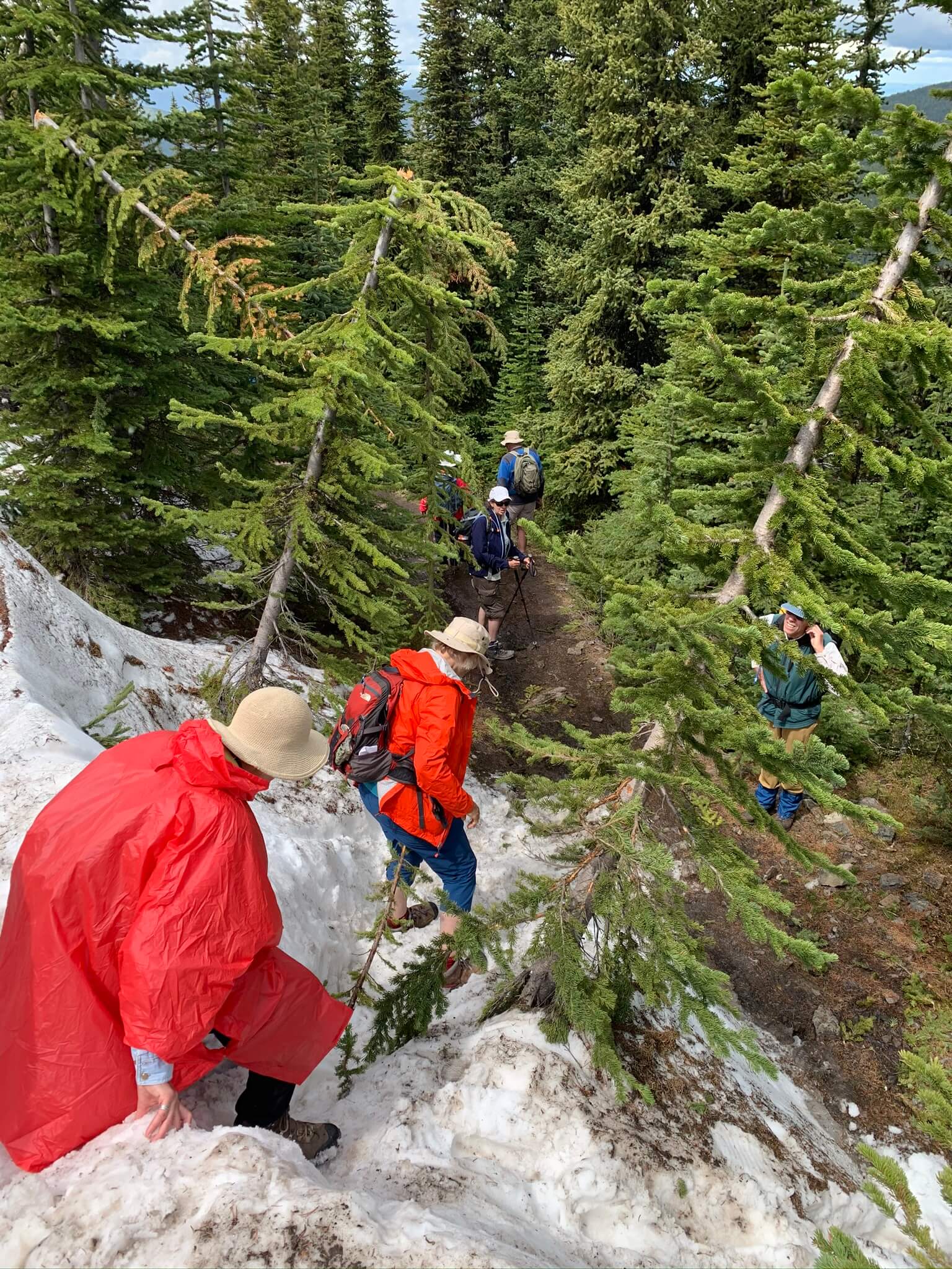
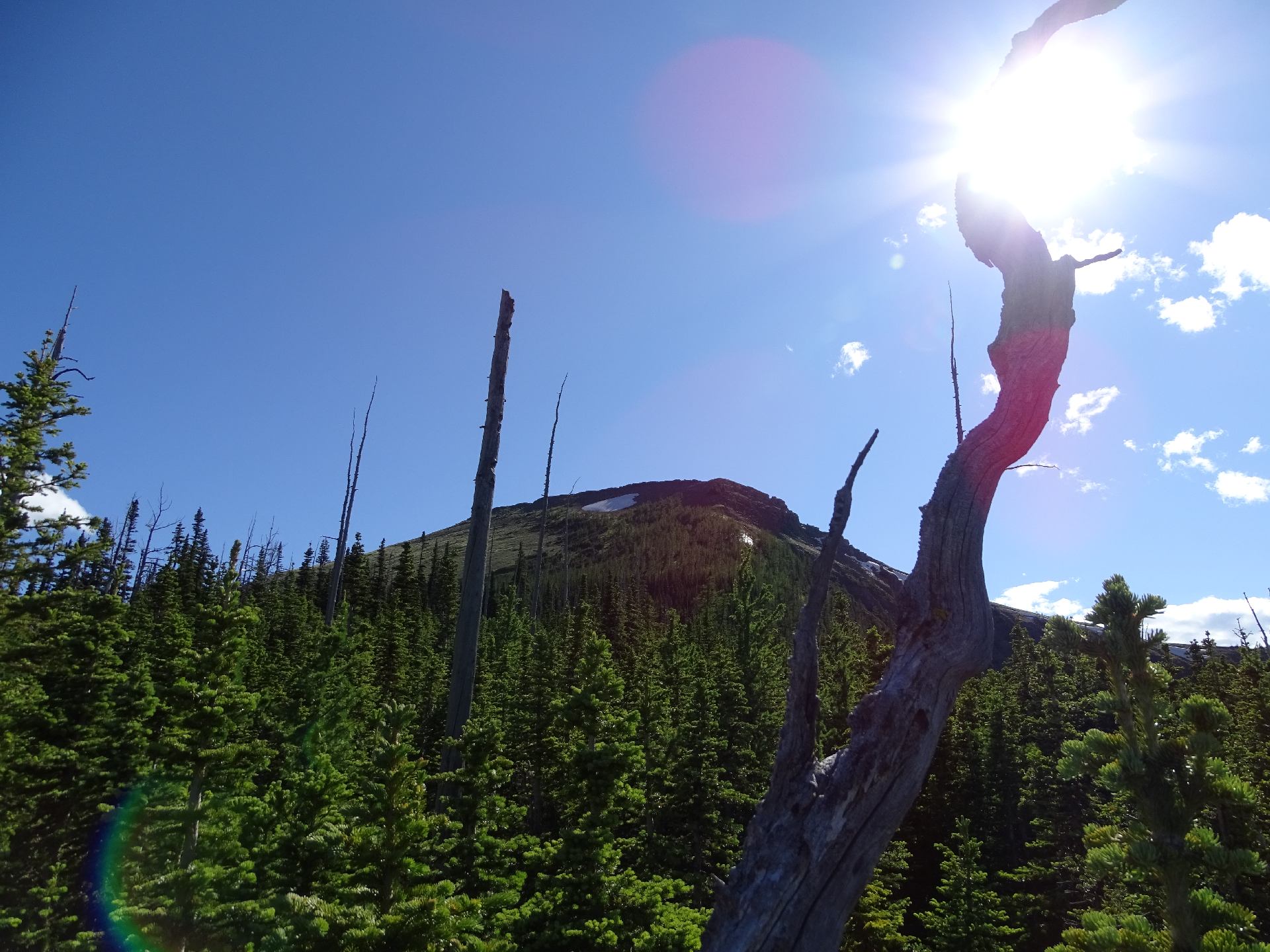
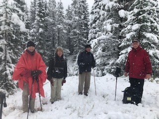
Mount Hoffmann Hike
with Julie Docken, on 7 September, 2020
Leaving Bragg Creek with snow pounding down on labour day, we were not sure how many hardy Calgarians would show for our hike to Mt Hoffmann.
7 were waiting for us in Turner Valley at which point we decided to drive to the trailhead.
We lost 3 more folks in the parking lot due to weather, but the rest of us trudged the 1km to where the Hoffmann trail takes off the Green Mtn route.
2 more turned back and 5 of us went 1 more km to a meadow where in 5 inches of snow, it was decided to turn around before the steep climb began.
Sun came out on our return, and we were treated to stunning mountain views while walking west along the Sheep river before the next squall hit!
The day finished at the Fahr brewery in Turner Valley enjoying their excellent beer and the warm and friendly company of the 3 who stuck with us.

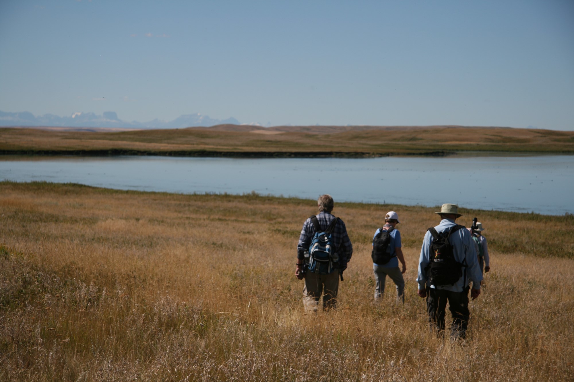
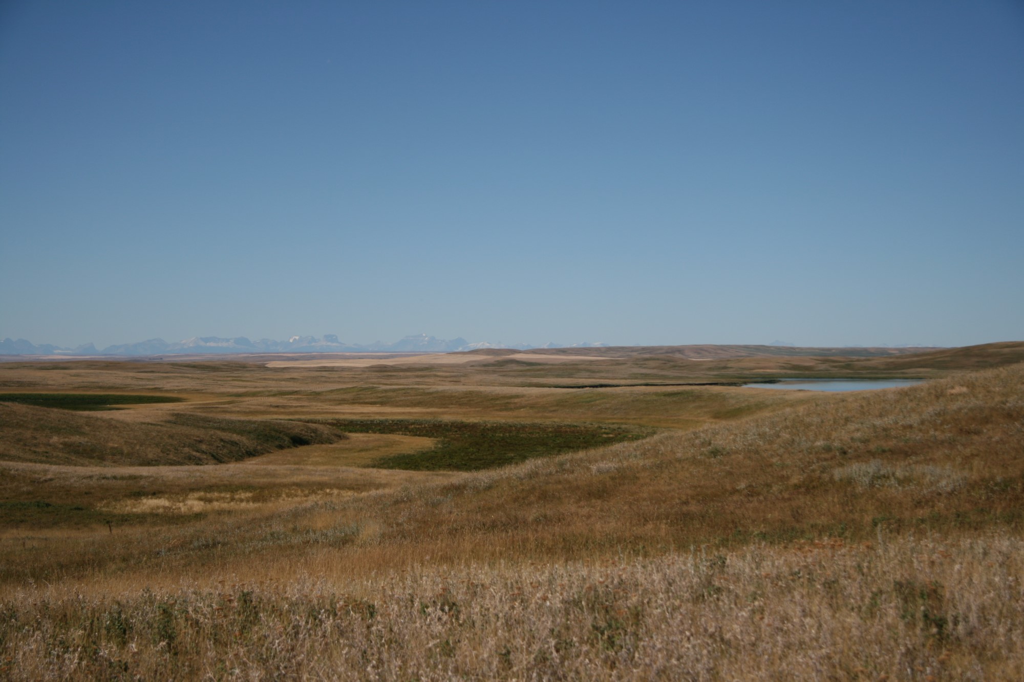
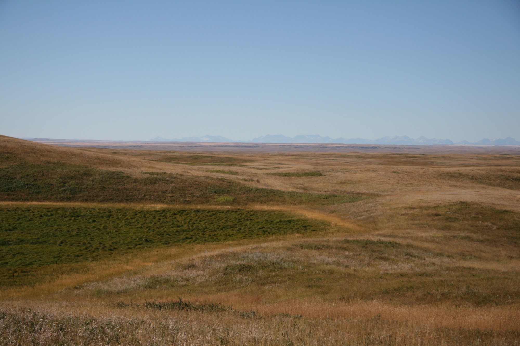
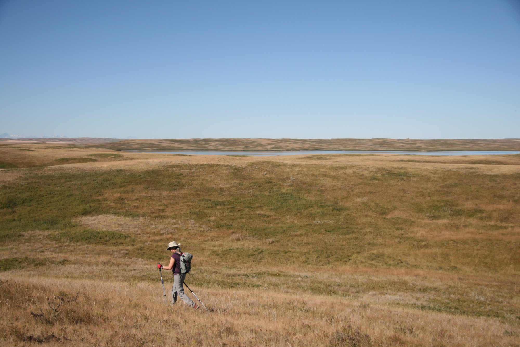
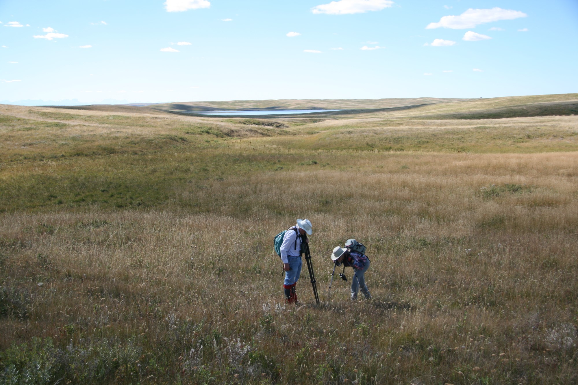
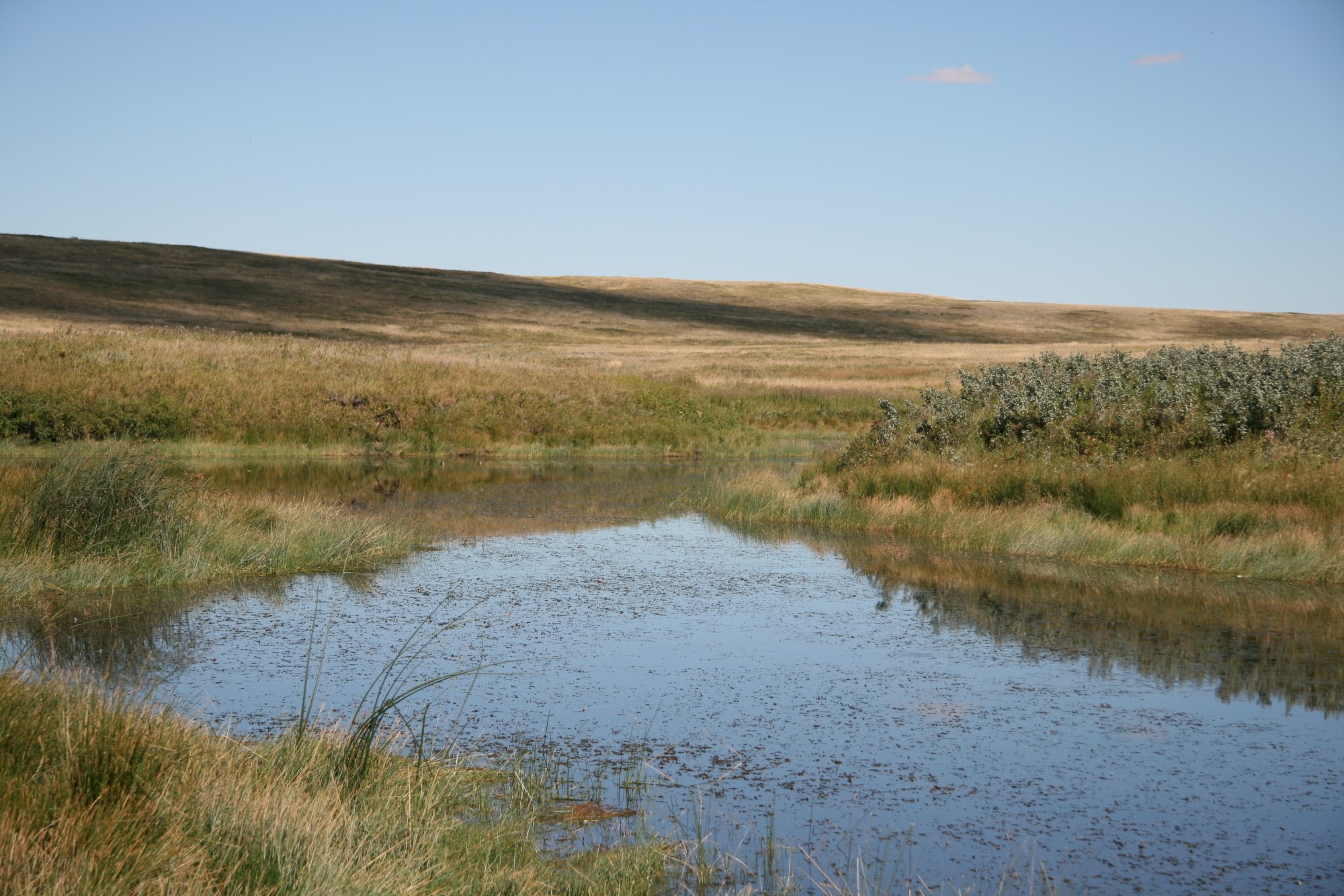
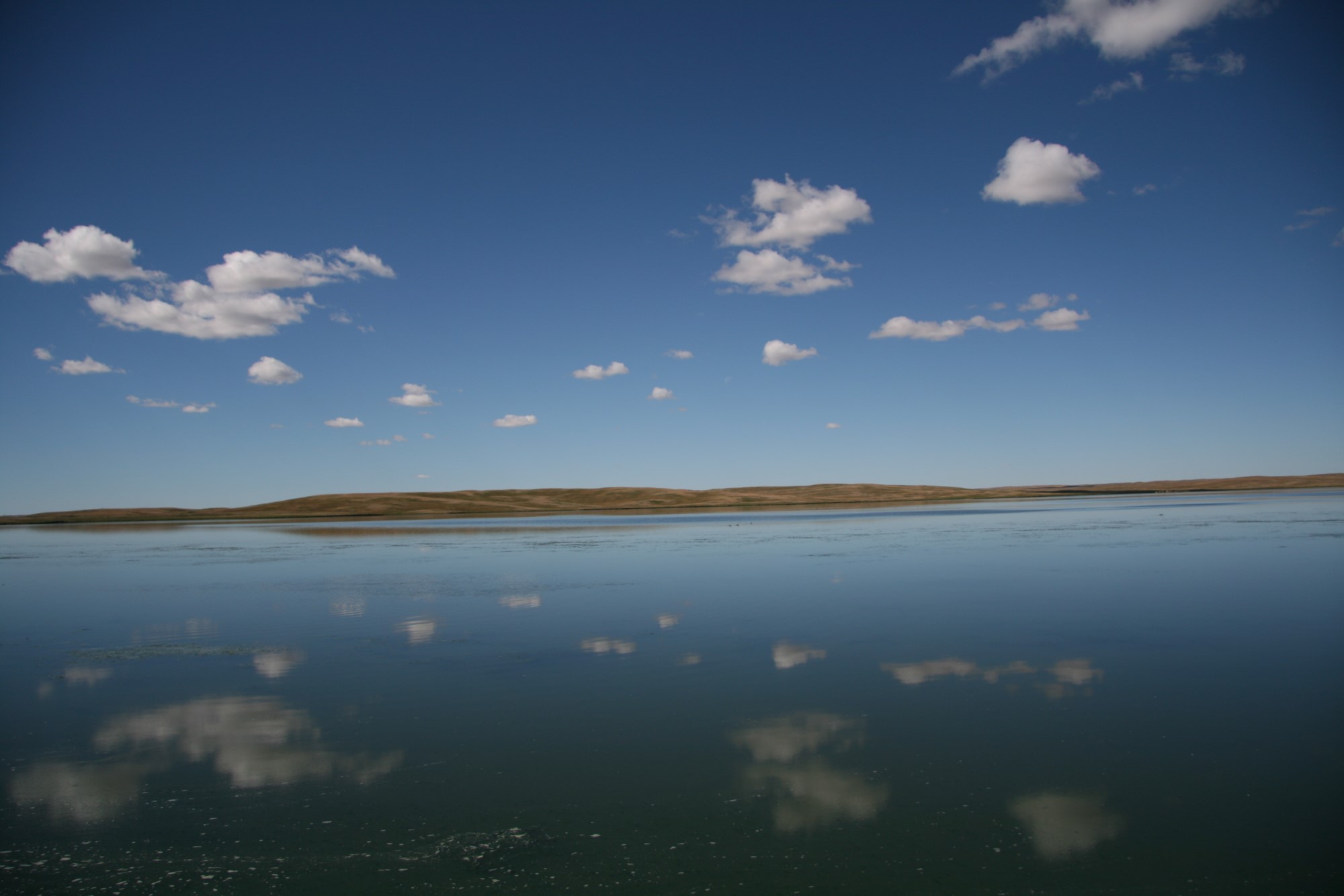
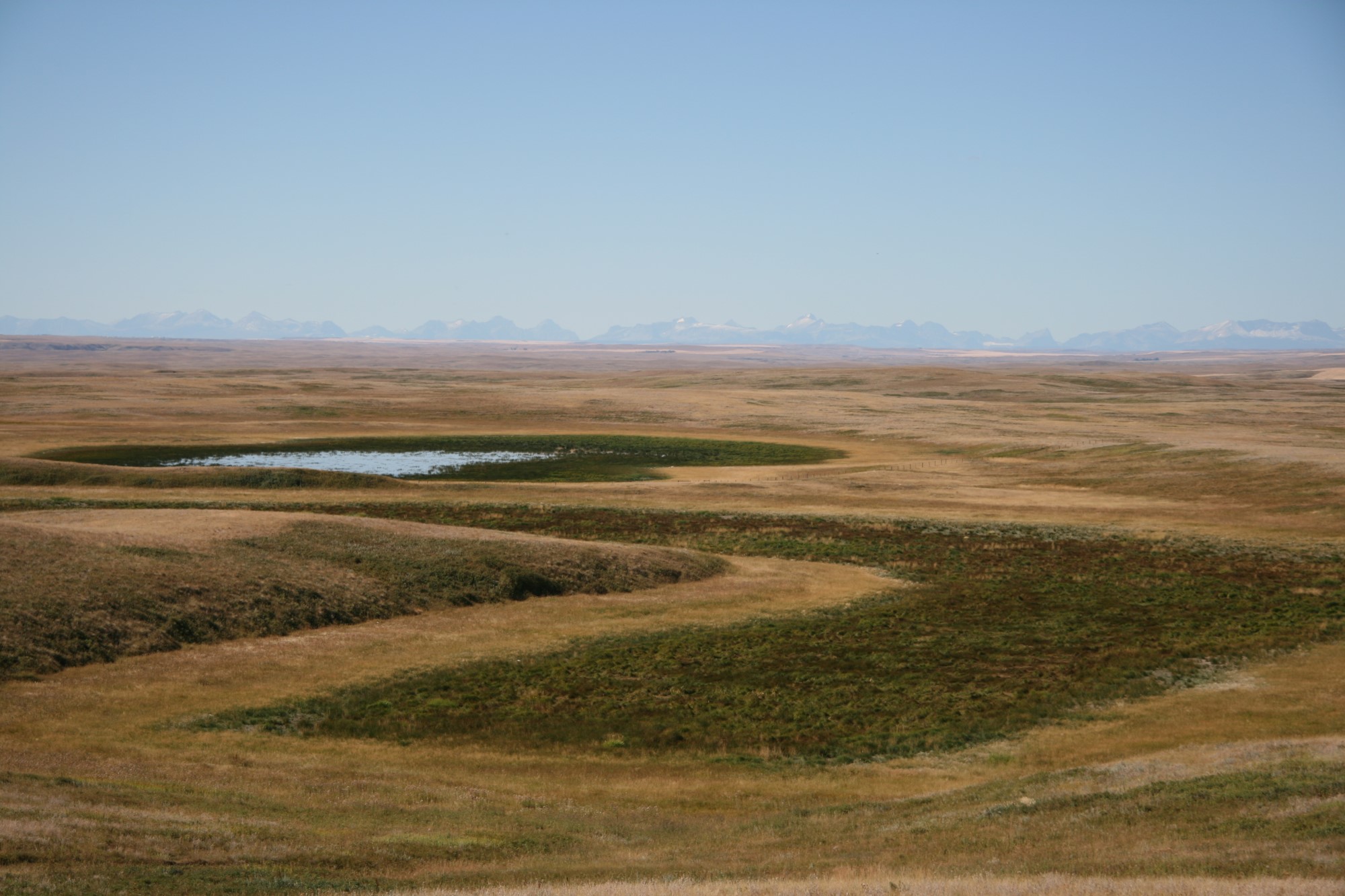
Milk River Ridge Ramble: Beautiful Grasslands and Spectacular Views
with Cliff Wallis, on 9 September, 2020
At about 9.30 am on September 9, 2020, 11 hikers assembled on the top of the Milk River Ridge at the Taylor Ranch ready to start on a hike in a westerly direction along the ridge. The weather was warm and sunny and, uncharacteristically for the area, there was no wind.
The Taylor Ranch leases a substantial amount of public land on the Milk River Ridge and grazes cattle on it. The Taylor Ranch is well known for high priority it places on the health of its grassland.
Before setting out the group was met by Audrey Taylor, one of the joint owners of the ranch. She explained her ranching philosophy which can be summarized as: the mission is to grow top quality grass and the success of all ranching operations flows from that. She indicated the Taylor Ranch seeks, as a very general rule, to leave 50% of the grass growth on the land and uses the other 50% to feed the cattle. She speculated that many other ranchers will use 80% for feeding which produces a significantly different landscape. She noted that the Taylor Ranch takes a different approach to many ranchers with respect to grazing by leaving more cow/calf units in place on a particular piece of land for only 1 month compared to much fewer units for 6 months. She believes this produces much better results for the grass and claims that a couple of weeks after the cattle leave the piece of land the grass has returned to its former state before the grazing started.
Audrey also described how she has turned down companies seeking to use her ranch land for oil exploration and production, wind power production and power lines.
After the meeting with Audrey, the group set off across the grassland, crossing 2 fences, to a magnificent viewpoint for lunch. This showed Miami Lake and related wetlands in the foreground and a panoramic view of the mountains to the west in both Canada and the US. Since there are no trails to follow it was necessary to simply walk through grasses ranging in height from a few inches to 2-3 feet. There are a lot of animal holes, created by badger, ground squirrel, foxes, coyotes and other animals. It was always necessary to look carefully to see where one was placing one’s feet. Falling into one of these holes could easily result in serious injury.
At lunch Cliff recounted his experiences, as part of AWA’s team, in helping to defend the Ridge from industrial development over many years.
After lunch the group walked down to the sandy beach of Miami Lake and took a different route back to the starting place, a total of about 9 km for the day.
Throughout the hike there was a tremendous variety of grasses, sedges and other similar plants to be seen, likely several hundred species. Cliff provided a wealth of information on what the group was seeing. In addition Tako provided interesting commentary on the geology of the area. For all of the participants this Adventure was a chance to learn a lot about the Milk River Ridge; its vegetation, wildlife, landforms and agriculture.
Chris Saunders, adventure co-coordinator


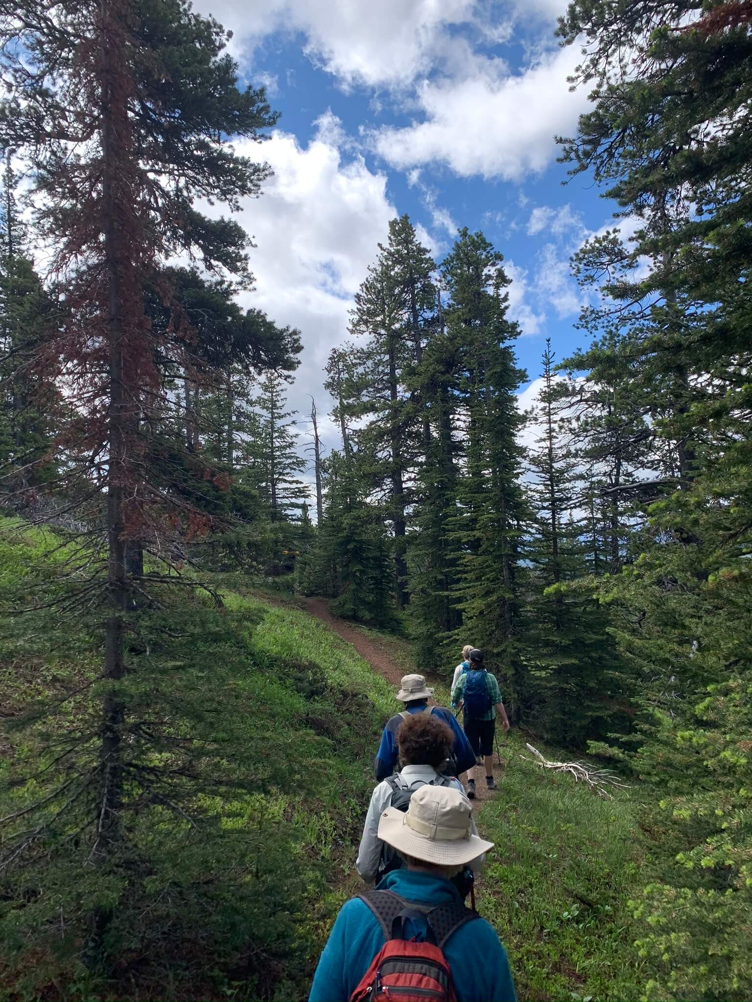
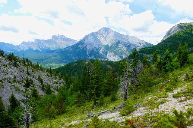
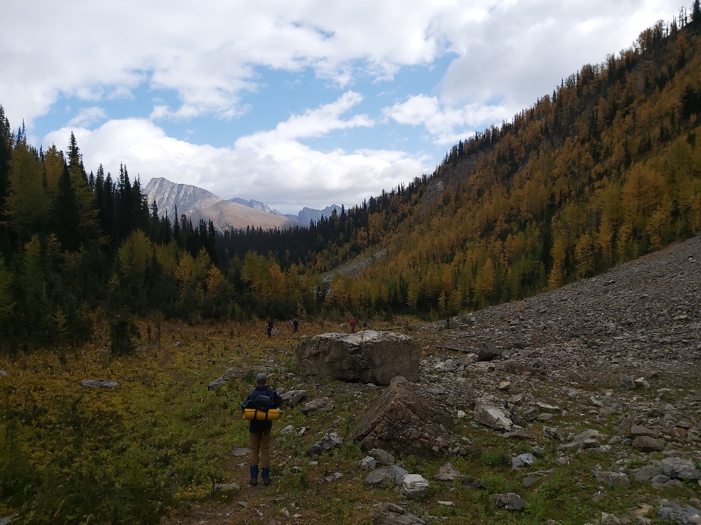
Fall Whaleback Exploration
with Nick Pink, on 11 September, 2020
Whether it is spring or fall, the Whaleback never disappoints. With golden prairies accenting the undulating montane wilderness to the west, the Whaleback is a picturesque gem of southern Alberta and I welcome any opportunity to explore it.
Our adventure began at the Maycroft Provincial Recreation Area, 15 km south of the Whaleback trial head which is located within the Bob Creek Wildland Provincial Park and Black Creek Heritage Rangeland. It was here we met our fellow adventurers. As you drive up the gravel road running parallel to the Oldman river, which was filled with fly fishermen looking to catch trout, the blackened ridges of this montane wilderness become more prominent, and the reason for its namesake a little more clear. Folks long before us perceived the prominent forested ridges of this area to resemble the spine of a breached humpback whale.
At the trail head, we met some bow hunters returning from an overnight reconnaissance trip, noting the beautiful views and warm weather. As we started on our journey, we quickly discovered our day would be a warm one. By lunch, we were mostly in t-shirts and shorts soaking up the sun on top of the ridges. The gnarly limber pines growing through the folded rocky outcrops were often rest points offering bits of shade and great photo opportunities. As we continued along our trail, our small group shared personal outdoor tidbits and facts about the Whaleback. This included tricks in identifying Douglas fir pinecones and balsamroot, discussing the threat of white pine blister rust to limber pines in the area, and attempting to spot Clark’s nutcrackers after hearing their unique call.
While our adventure group may have been small, our experience in the Whaleback was great in many ways. We shared stories and laughs, which made for a special experience in a beautiful place. I look forward to future adventures in the Whaleback to share its exceptional beauty and the friendship that it fosters.
Nissa Petterson

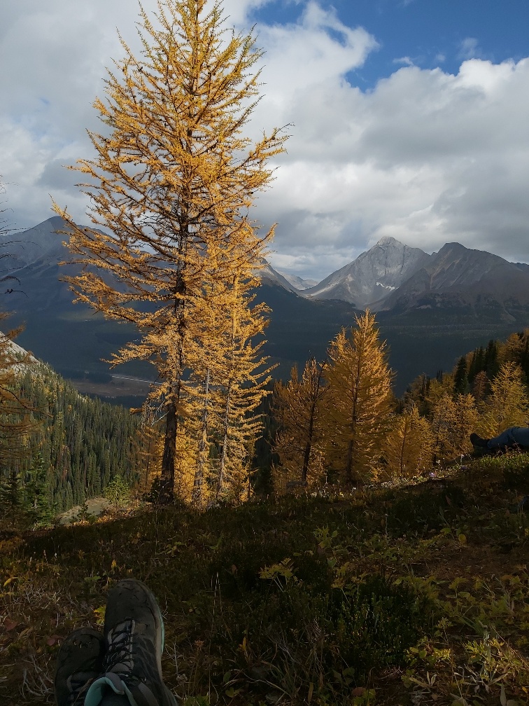
Tryst Lake Hike: Golden Larches and Spectacular Views
with Chris Saunders, on 20 September, 2020
At about 10 am on September 20, 2020, 13 hikers assembled at a parking spot on the west side of the Spray River just off the road to Mount Shark, ready to start on the hike. The weather was warm and sunny and the smoke that had dominated the sky in the previous few days had suddenly cleared. The purpose was to see the alpine larch trees around the lake at a time of year when their needles change from green to a spectacular golden colour.
The hike was in 3 parts.
The first was 1.5 km south along an old logging road, which was likely created in the 1940’s or 1950’s. The route then turned west at a cairn following a stream through the forest up the side of the main valley to a small hanging valley in which Tryst Lake is located. Some larches, all in their glorious golden phase, were seen in the upper parts of this section. Lunch was taken by the lake. There were sightings of a family of hoary marmots nearby as well as magnificent views of the golden-coloured larches on the slopes on the south side of the lake.
After lunch the group walked to a moraine beyond the west end of the lake where there were fine views of the cliffs of The Fist towering over the cirque.
The third section of the hike involved a steep climb up a bank covered with grass and larch trees to the ridge on the south side of the lake. The path along the top of the ridge wound its way through groves of larches of many different ages, all a bright gold colour. In addition there were spectacular views of the lake below and the mountains to the south, including the majestic Mount Birdwood partially shrouded in cloud.
The group concluded this was a spectacular hike and we were lucky enough to do it in perfect conditions.

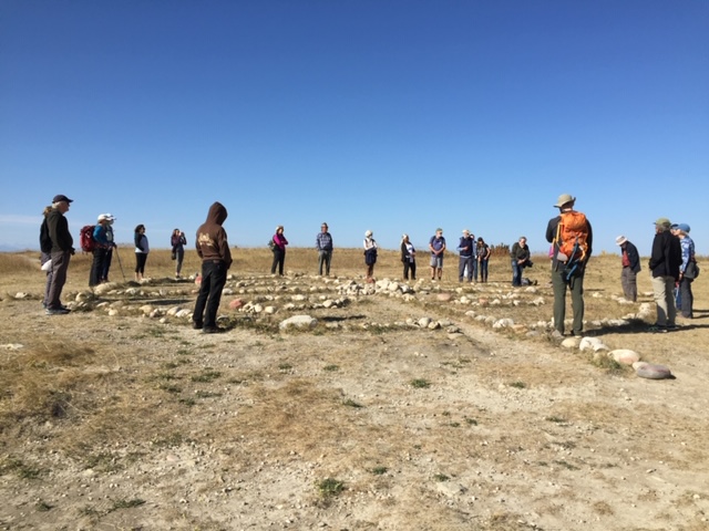
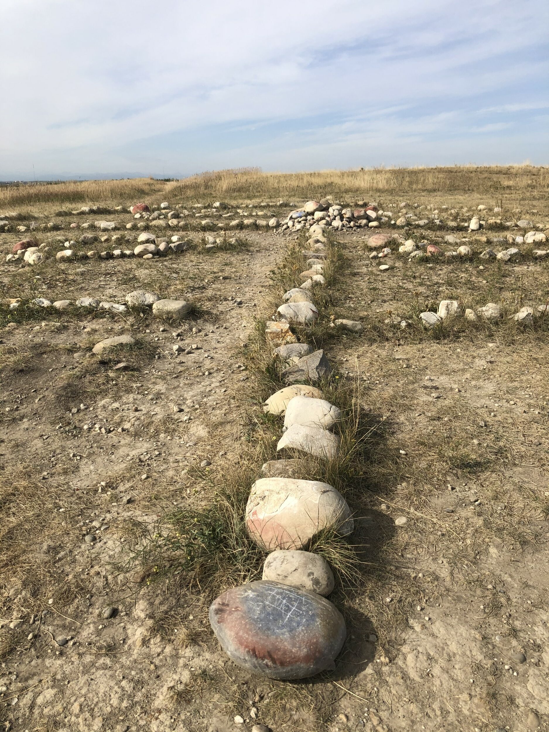
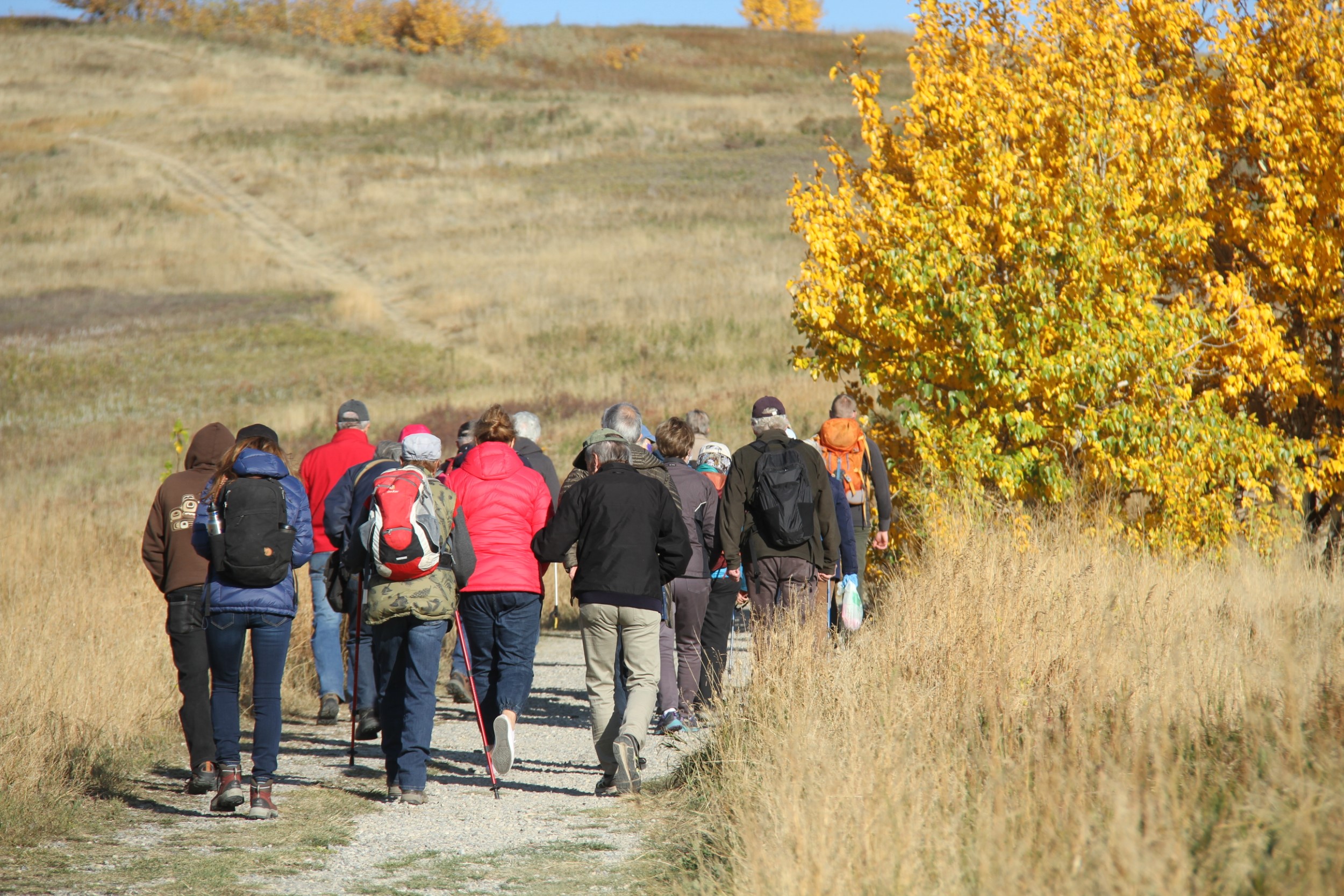
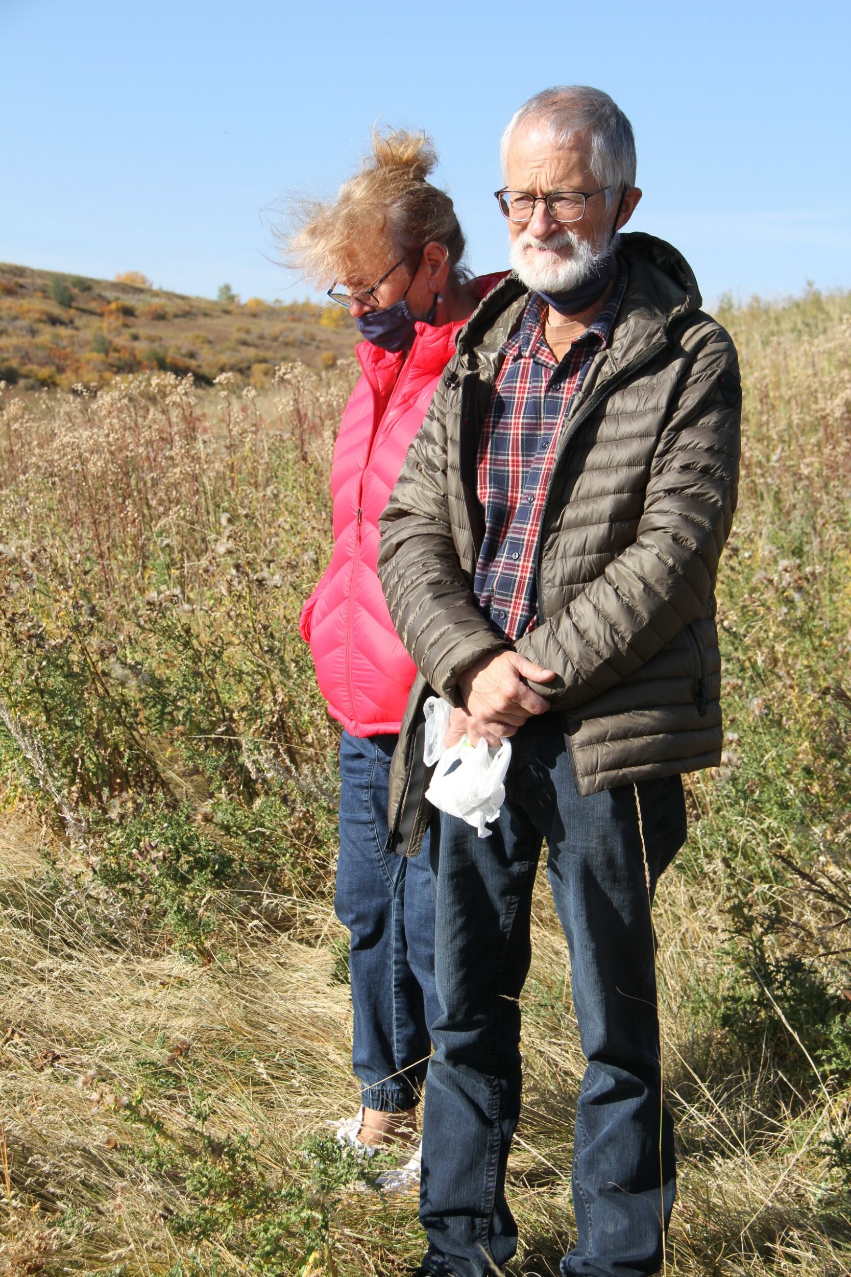
Nose Hill Ramble in memory of Gus Yaki
with Christyann Olson and Vivian Pharis, on 2 October, 2020
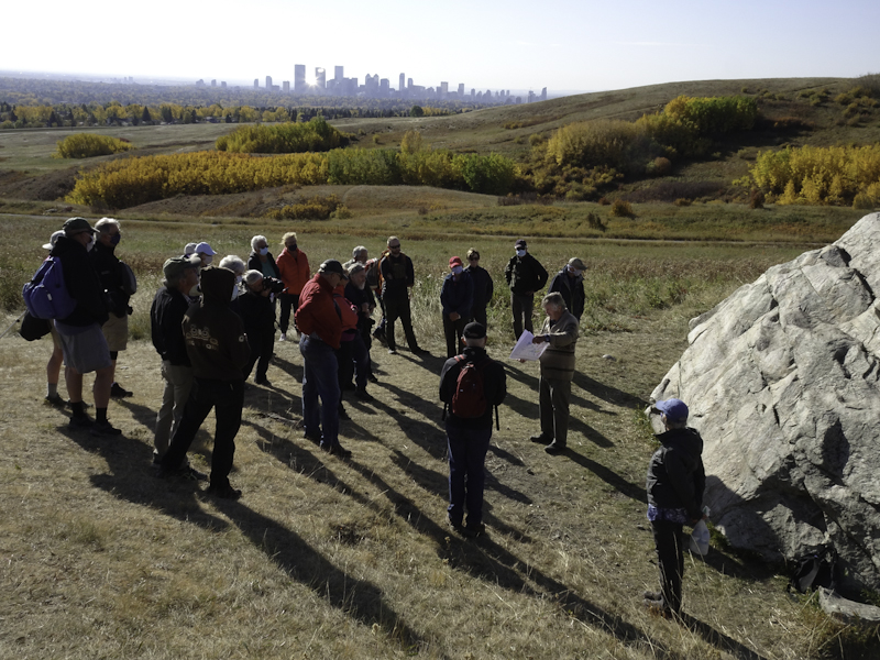
There was a cool wind blowing when we arrived at Nose Hill Park on Friday October 2, 2020. 0ur group was large; 29 folks eager to learn and to remember our dear friend Gus Yaki. Karel Bergmann, Tako Koning and Shawn Cornett helped Vivian and me make a fulsome ramble through some of the features of Calgary and Canada’s largest urban park that covers 11 square km.
We set off with a traditional land acknowledgement, then stopped at one of Gus’s favourite spots to teach about Balsam poplars and Aspen clones. While there Shawn Cornett told the story of community activism and the determination of those who had a vision for Nose Hill – that it needed to be protected as a park. She told of the struggles in earlier years to stave off developers and begin the administrative transformation to the much-used park it is today. She reminded us that not so long ago a request by the Winter Club to expand their parking lot required plenty of resistance to keep it from taking a piece of the park. One thing is certain, without community engagement and people like you being involved, this park remains vulnerable.
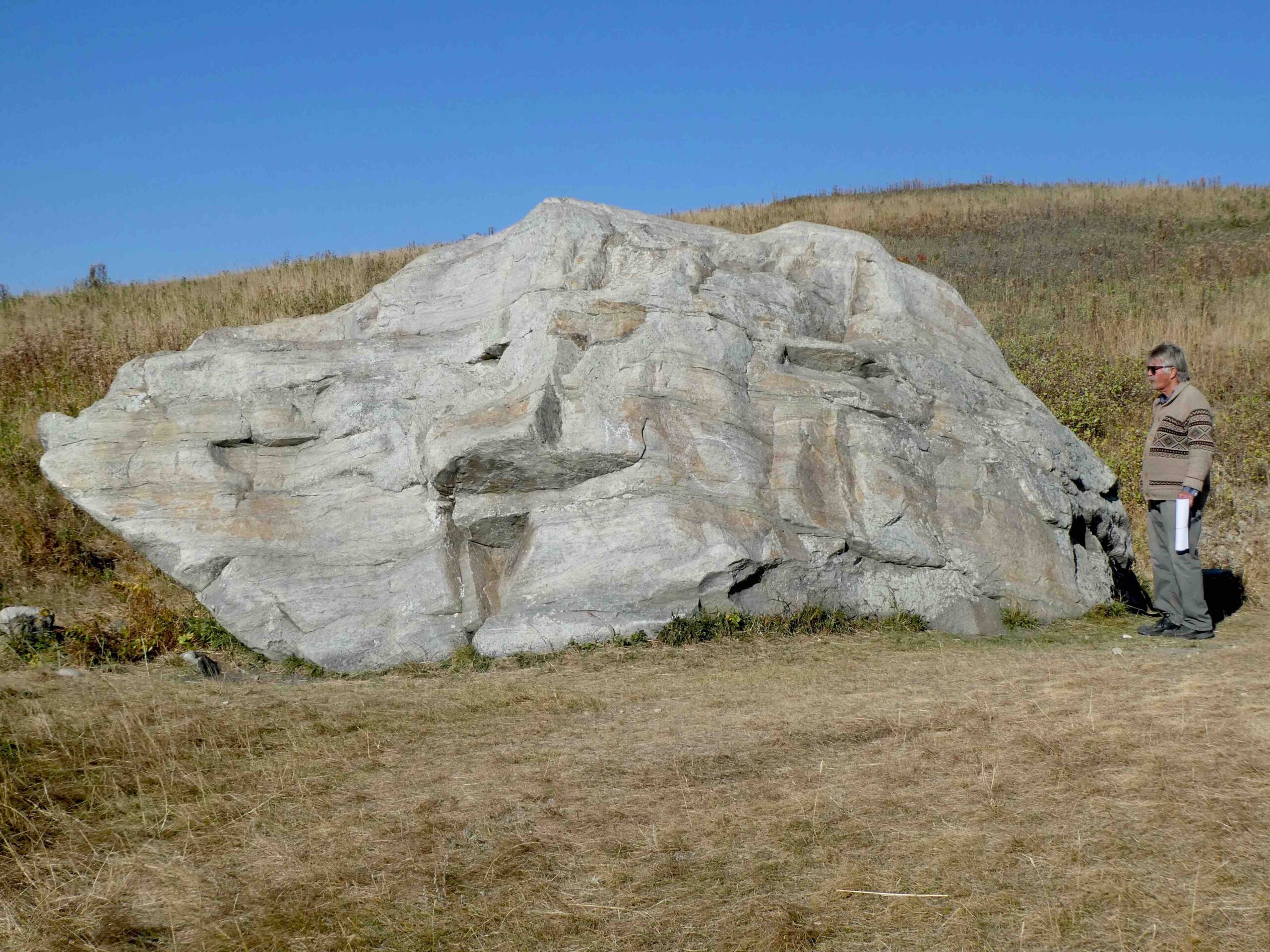
Our ramble continued to a string of sandstone boulders and a discussion with Tako Koning explaining the geology of the hill and where he pointed out fossil snails embedded in the boulders. As we moved along Karel and Vivian pointed out plants of interest as we made our way to a quartzite erratic the size of a bulldozer, that is a piece of Mt. Edith Cavell in Jasper. With its corners rubbed smooth by centuries of itchy bison, other parts of this rough erratic are covered with lichens. We scraped litter from under the boulder and added it to our litter bags, as we vowed to keep up Gus’s efforts at leaving no trace.
As we carried on we enjoyed stories about specific plants and debated about how they got where they did, about unusual land formations and boulders and shared dismay over invasive clematis and thistle that seems beyond control. Erosion in the main path needs repairs and we hope the City will do those repairs soon as they seem dangerously deep. Trail braiding and proliferation is an increasing problem all over the park. A north-south pathway led us toward the medicine wheel and through a lovely aspen grove filled with golden and orange leaves and the smell of fall.
As we neared the end of our ramble, we assembled at the Nose Hill Siksikaitsitapi Medicine Wheel where we formed a circle around the wheel to offer our thoughts about Gus and what he meant to us. We offered rose hips and dried cranberries to the spirits on entering the wheel from the east and before exiting to the west. The Blackfoot ceremonial elder who was interviewed years ago about this medicine wheel, spoke about it being a gift to the city and to the people who come to visit. He said, “they will know that somebody from the other side is looking out for them.”
Gus Yaki was remembered with joyful appreciation of the man who truly was a naturalist.
– Christyann and Vivian

Climbing Lesueur Ridge
with Heinz Unger, on 12 September, 2020
Lesueur Ridge is a steep sandstone ridge facing south overlooking the Ghost River Valley. It’s the first higher elevation feature when traveling from the Bow River through the foothills to the north. And it’s a short one-hour trip from NW Calgary to the trailhead where, on September 12, a small but diverse group met on a sunny but cool fall day. The ages of participants ranged from 12 to 76, and people clearly enjoyed meeting each other (some for the first time), and there were many good conversations during the hike. In addition to admiring the scenery and the local fauna and flora, the opportunity to meet, and converse with, old and new friends is one of the great pleasures of hiking with AWA.
Although the hike is rather short, there are some seriously steep sections that provide good excuses for brief stops to take in the increasingly far-reaching views and appreciate what was left of the summer’s wildflowers. The fall date was chosen to enhance the hike with fall colours which had just started to appear in their glory. Aspens, Black Poplars, willows, fireweed and various species of shrubs showed off in yellow and orange and red, in stark contrast with the dark and mighty Douglas fir trees that are quite common on and below the ridge.
Once the group reached the top of the ridge we stopped for a break to take in the view which ranges from downtown Calgary in the east to Black Rock Mountain and Devil’s Head in the northwest. Straight to the west were the high mountains of Banff National Park, and to the south, almost straight below us, were the winding channels of the North and South Ghost River. Close by, to the west, was Lesueur Creek, a tributary of the Ghost River, with its many wetlands created by beavers. A couple of ravens checked out the group, showed off their aerial acrobatics, and one of us responded with raven calls but otherwise is was beautifully quiet – close to a wilderness outing. We took a different trail down and walked out on the lower trail that runs along the creek, making it a beautiful loop hike. To round off the experience and let the good feelings linger, we still gathered for some refreshments and more talk at our place in Benchlands on Highway 40.
Considering the short distance from Calgary and the rather small effort and time needed to reach the top of the ridge, Lesueur Ridge is a worthwhile outdoor experience, especially when in support of AWA. I very much appreciate the generous support for AWA from all the participants, even those who could not make the actual hike.


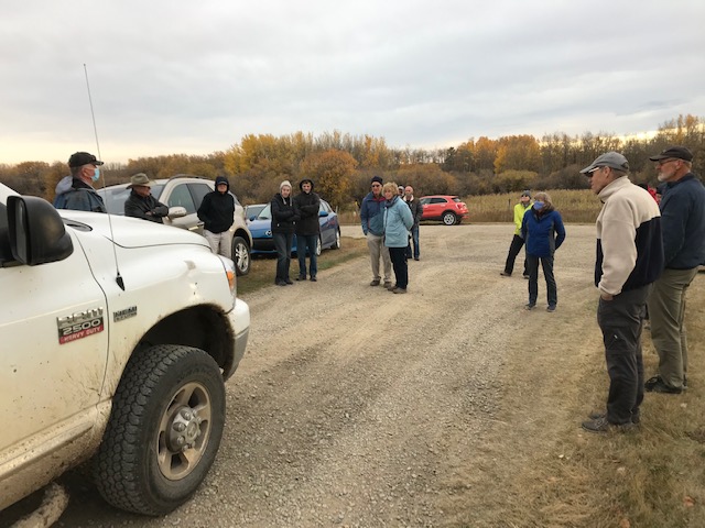
Cochrane & Lochend Areas Field Trip
with Tako Koning, on 9 October, 2020
Friday, October 9th began cloudy and cold but we had a bit of sunshine by the time the field trip began at 1:30 PM, with 14 attendees including 2 children, in the parking lot of Cochrane Ranche in Cochrane. We headed north for a short distance up 4th Avenue to the southern terminus of the Big Hill Springs glacial meltwater channel, a deeply incised valley which continues 20 km northwards. The field trip leader Tako Koning discussed the area’s glacial geology and Vivian Pharis talked about the efforts of the Bighill Creek Preservation Society to protect the unique flora and fauna along Bill Hill Creek which is located within rapidly growing Cochrane.
We proceeded to drive northeastwards and near Willow Creek, a community of acreages, we viewed from the road a pad with 7 pumpjacks which produce oil from the tight Cardium Formation sandstone. These wells consist of long-distance horizontal drain holes, drilled in multiple directions which have been hydraulically fractured. The oil production in the Lochend area has benefited the Alberta and local governments in terms of royalties and taxes and has created local oil field employment. However, in some cases the oil production has had worrisome environmental impacts for those living in nearby farms, acreages and homes.
We then stopped outside of the entrance to the Glendale gravel pit. The Cochrane – Lochend area has thick glacial deposits rich in gravel. Major gravel quarrying is increasingly being carried out throughout the area and some residents are very concerned about its impact on the area.
We also viewed a second well pad on the west side of Lochend Road where 4 wells produce from the hydraulically fractured Cardium. Howard Hawkwood, a farmer who has lived with his wife Nielle for forty years just east of Lochend Road (Highway 766), described to the group the negative impact of oil activities on their lives and on their farm. Heading northwards we saw another deeply incised melt water channel immediately south of the hamlet of Dog Pound. The field trip ended in the village of Westbrooke, located on Highway 22, also known as the Cowboy Trail, to view an oil production facility located on the eastern boundary of the village.