Fish Creek Snowshoe Adventure
Written on February 14, 2023, by Lindsey Wallis
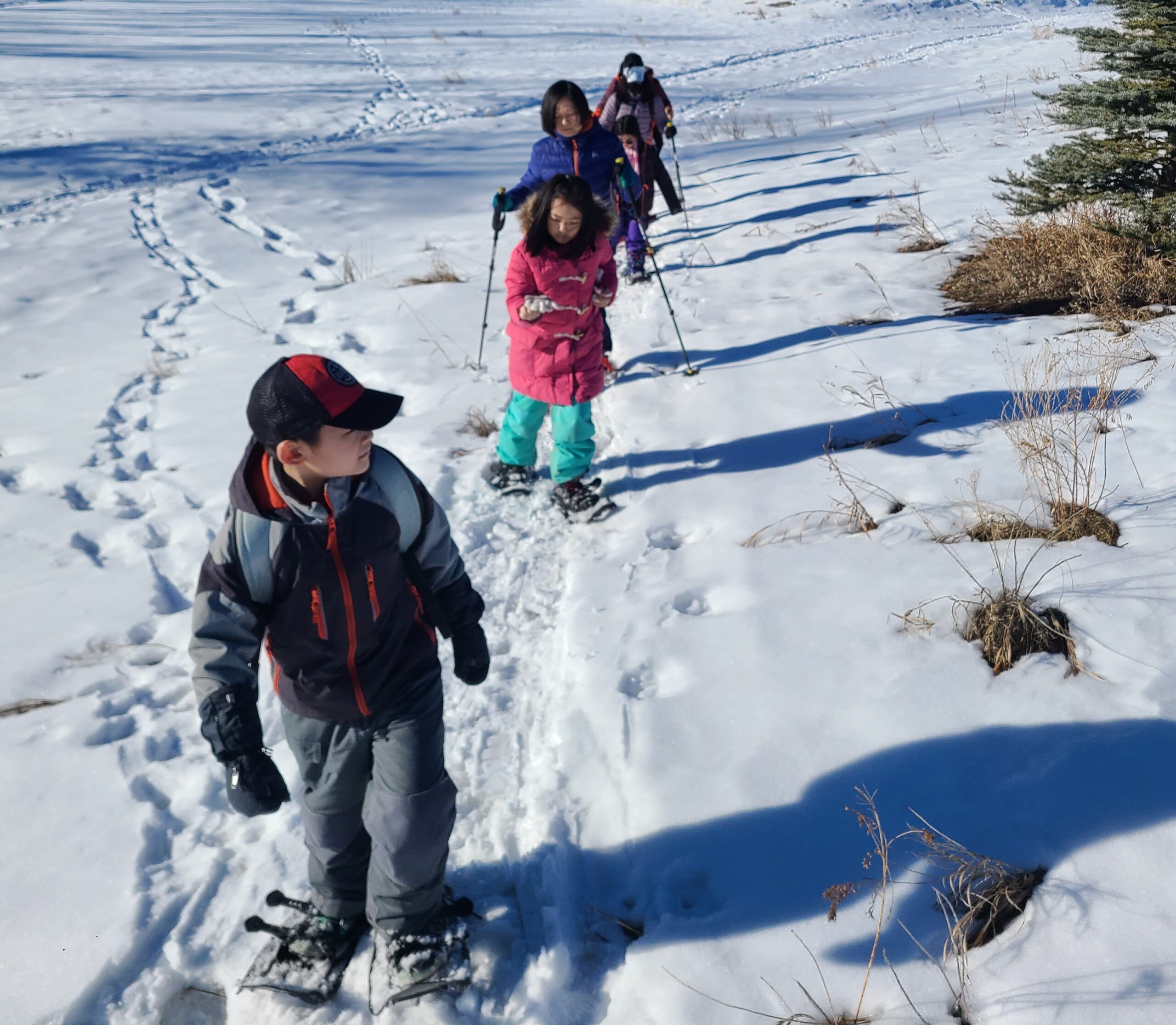
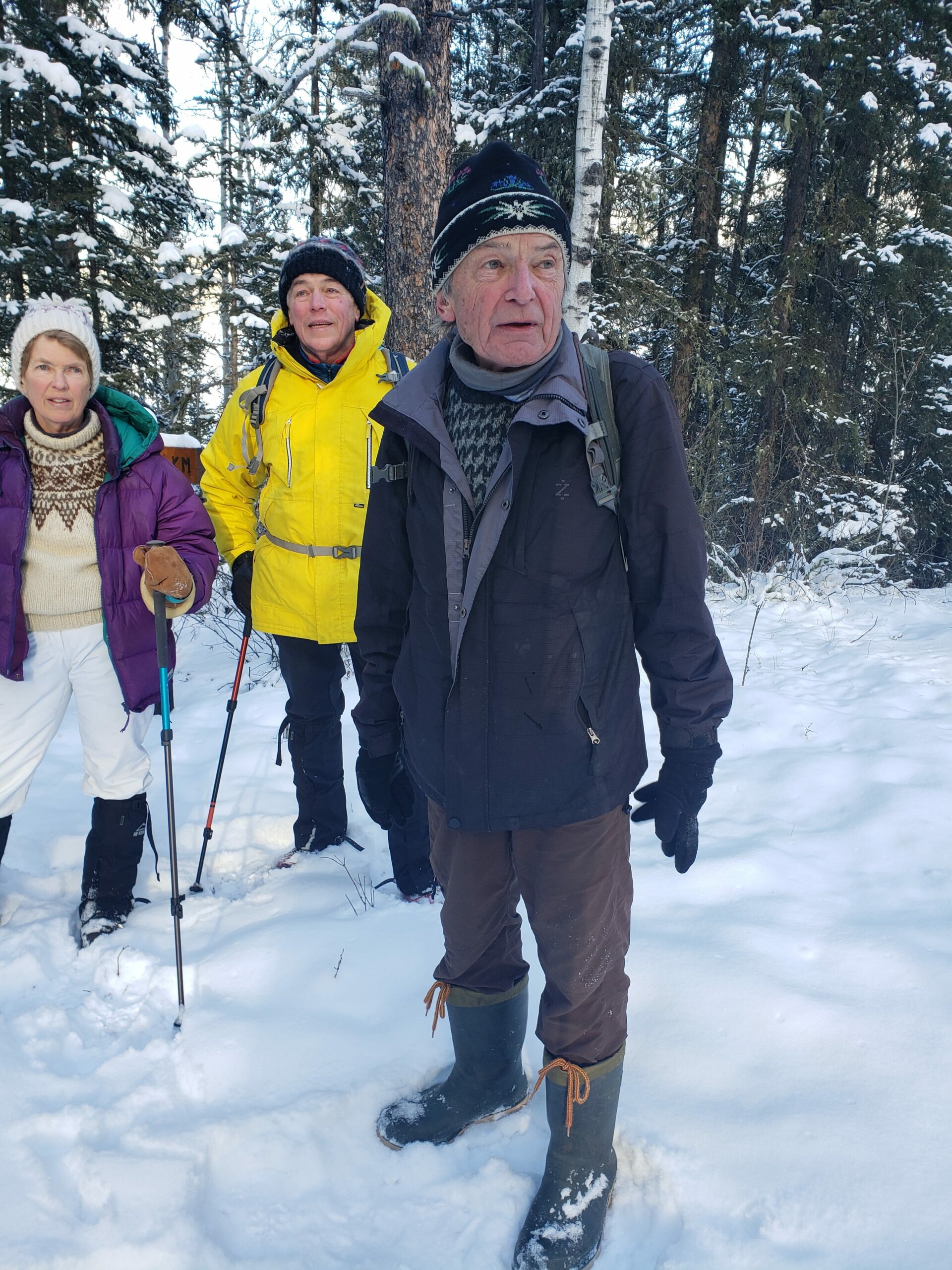
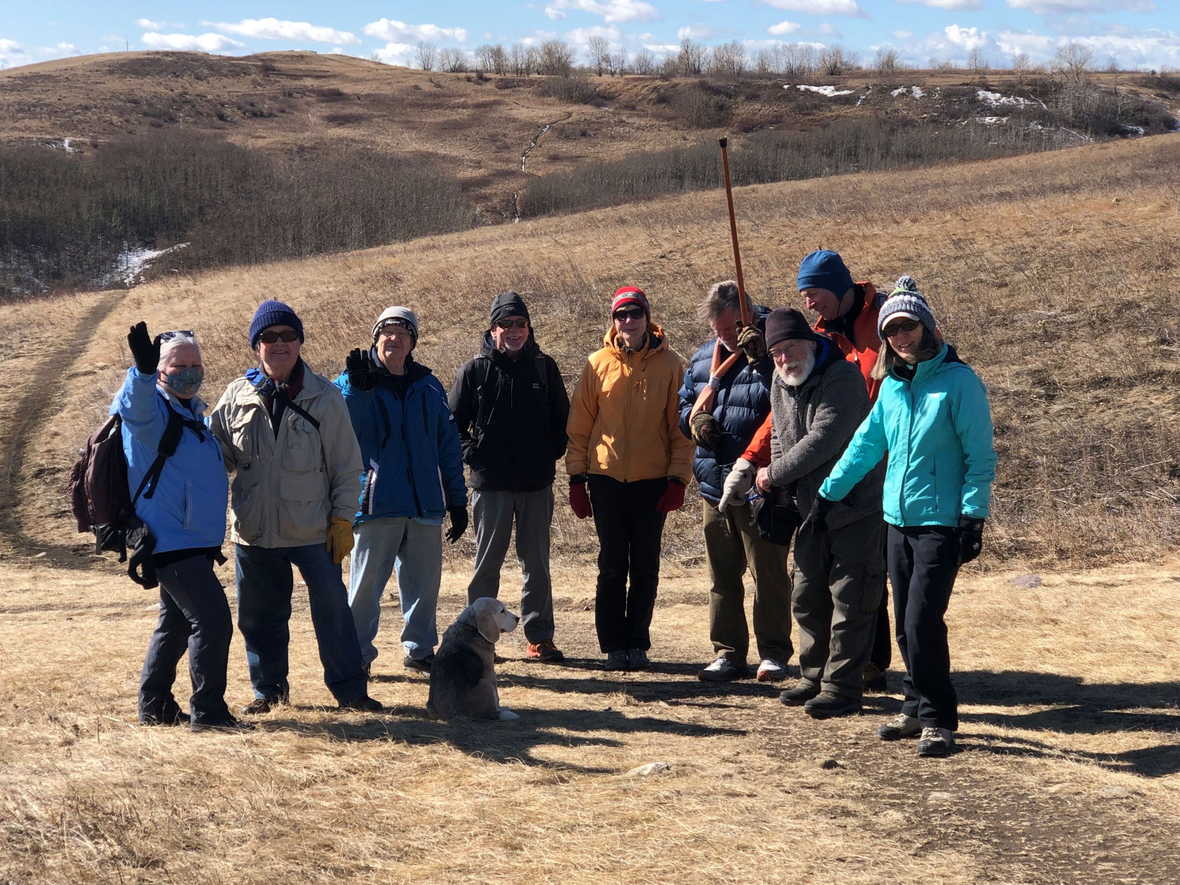
The first week of February 2023 was a frigid one. But a weekend chinook brought clear, sunny skies and temperatures above freezing for February 4, 2023. This was a good thing for snowshoeing for newcomers adventure, led by Lindsey Wallis. Participants were introduced to the activity with the great combination of fresh snow and a warm day.
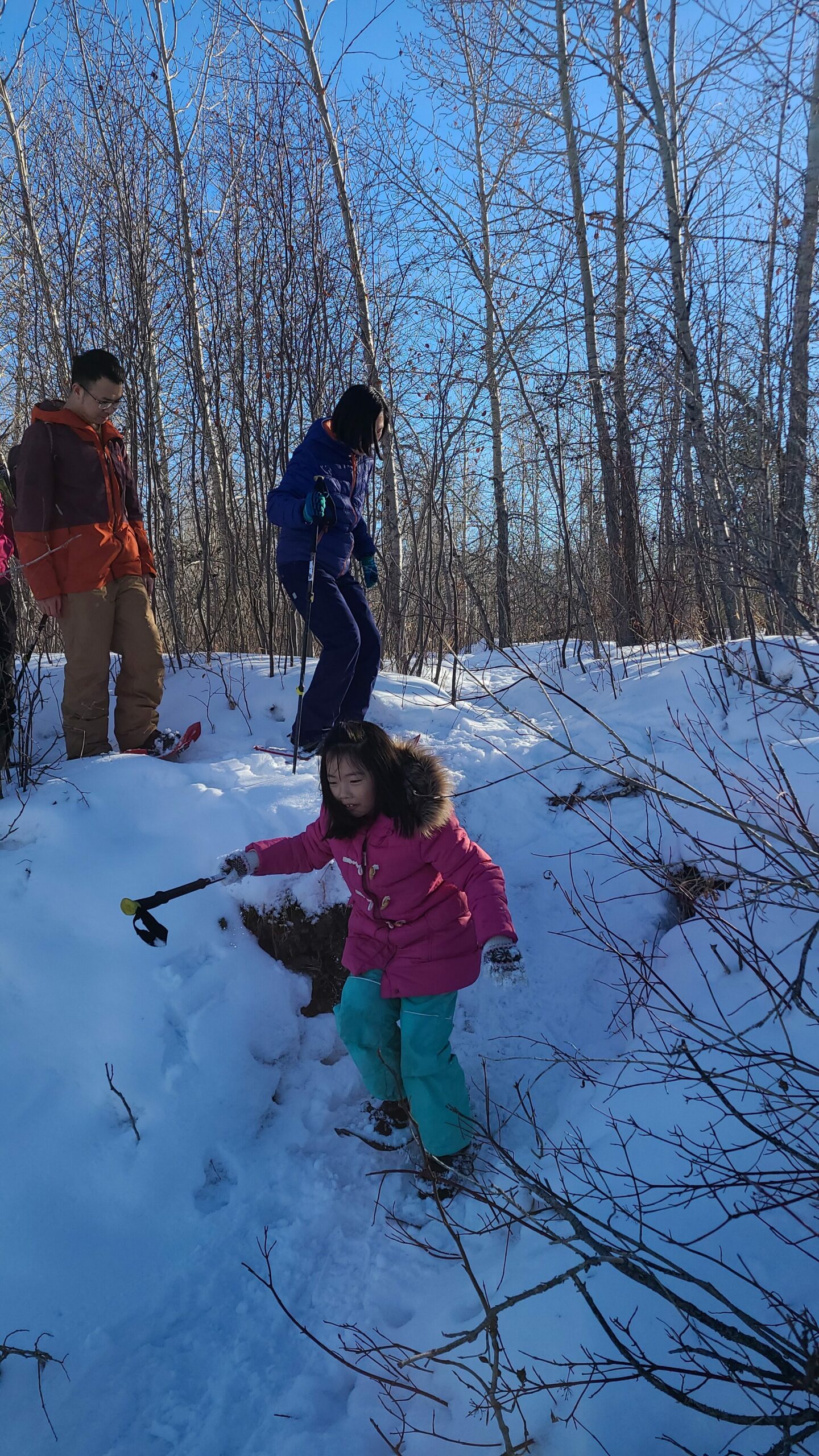
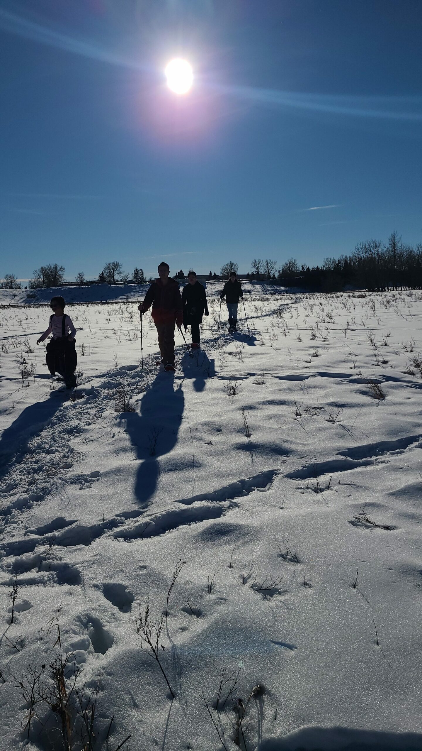
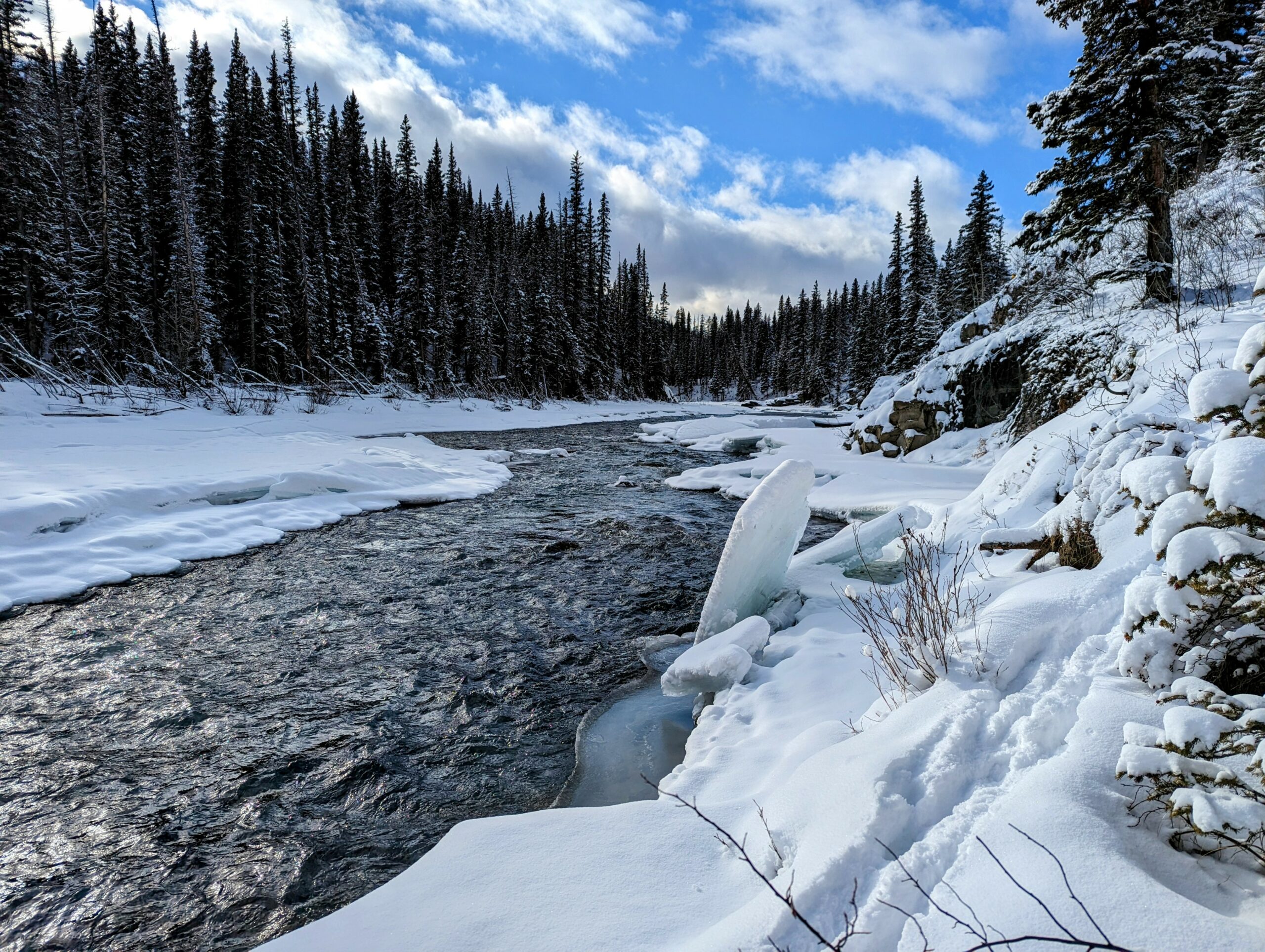
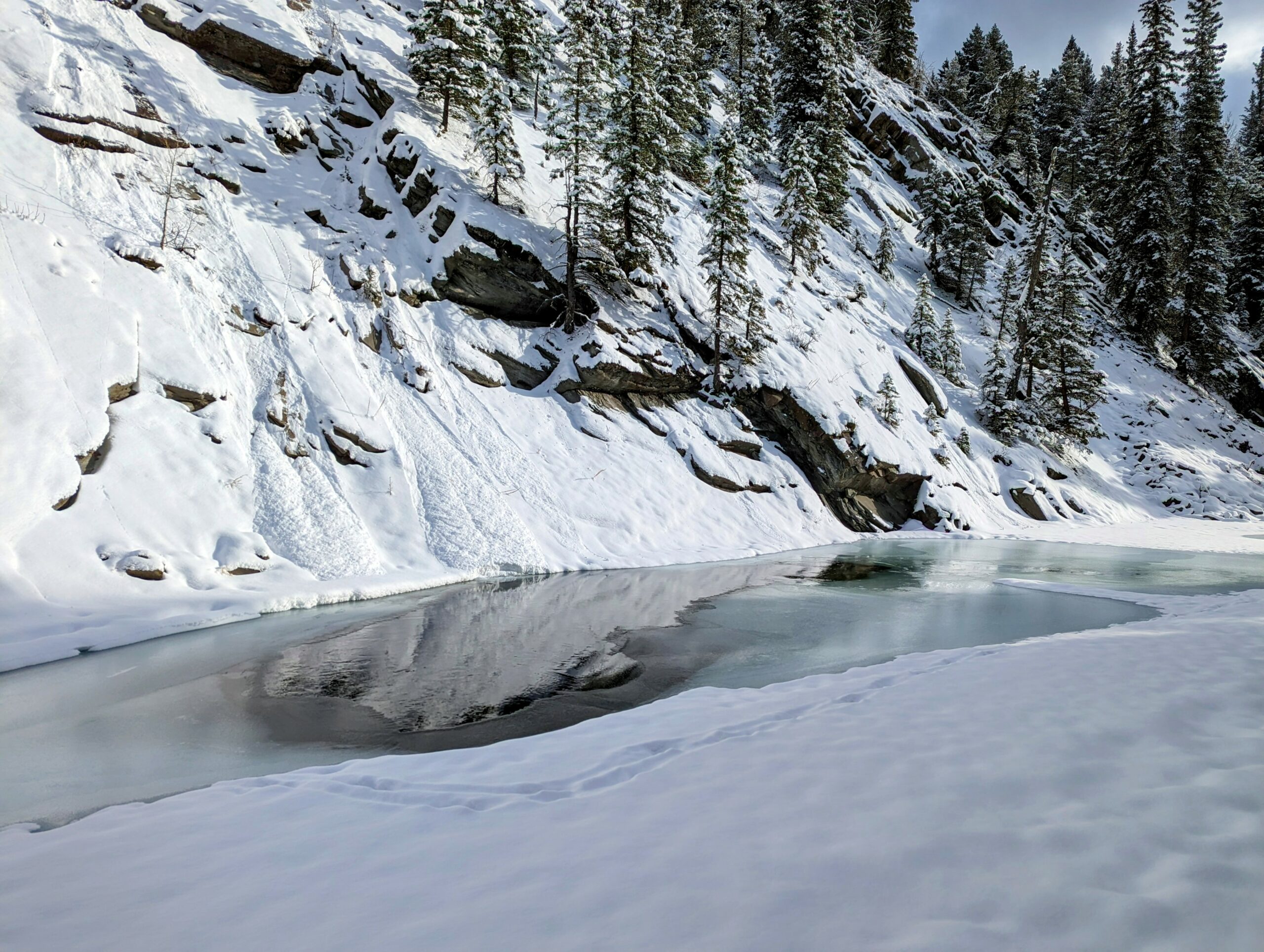
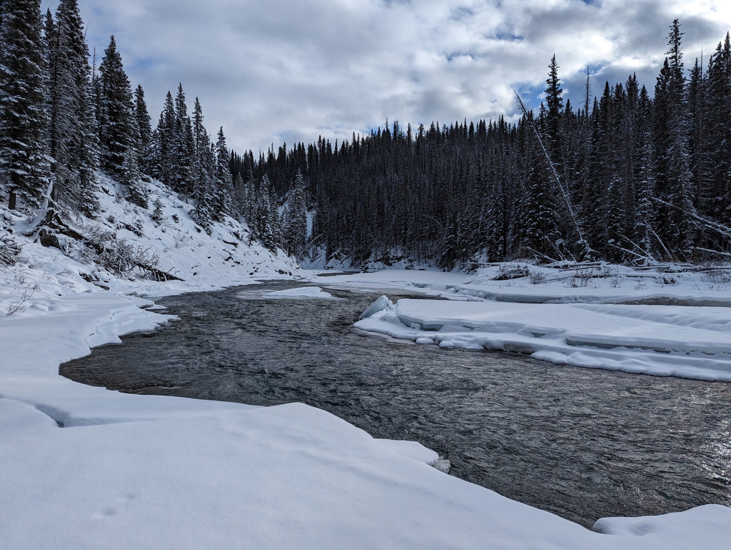
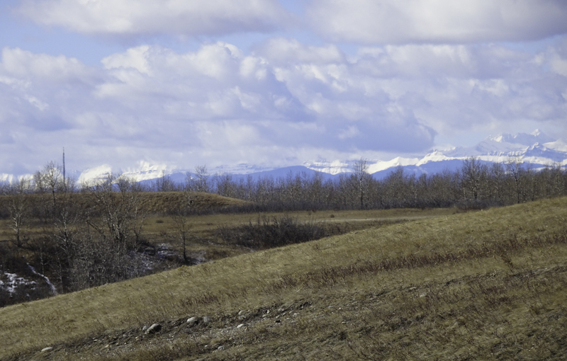
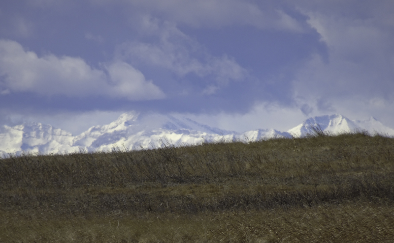
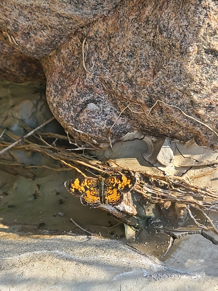
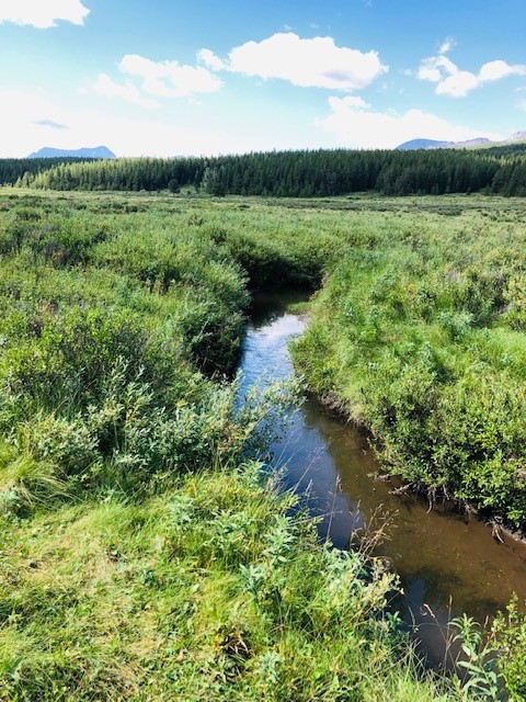
Both the morning and afternoon sessions met in Fish Creek Provincial Park, the only provincial park within the city of Calgary and a close-to-home nature getaway. That was certainly true on this Saturday for the families that joined us. Once everyone had their snowshoes on, we set out to explore the fields and woodlands that make up this stunning area. As the sounds of traffic faded away, we identified tracks, scat and houses of the animals who make this park their home. While the birds’ nests are empty this time of year, we were treated to the calls of flickers and the sight of chickadees, ravens and a bald eagle. The kids had particular fun making their own tracks, leaving shapes in the snow and enjoying a snowball fight.
Towards the end of the adventure, we stepped onto the frozen Fish Creek, the stream for which the park is named. Here, we learned important rules about ice safety and the “leave-no-trace” principle. Previous park visitors had built ice sculptures from blocks that broke off the creek. Our last stop was to admire these before heading back through the poplar forest to the parking lot.
Text: Willow Pawlak
Photos: Lindsey Wallis


Waiparous Ice Walk Adventure
Written on February 14, 2023, by Lindsey Wallis
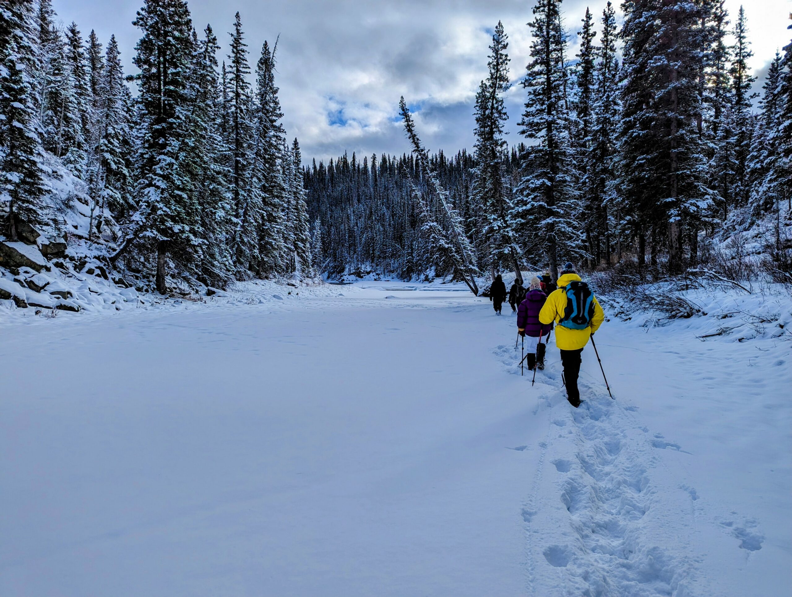
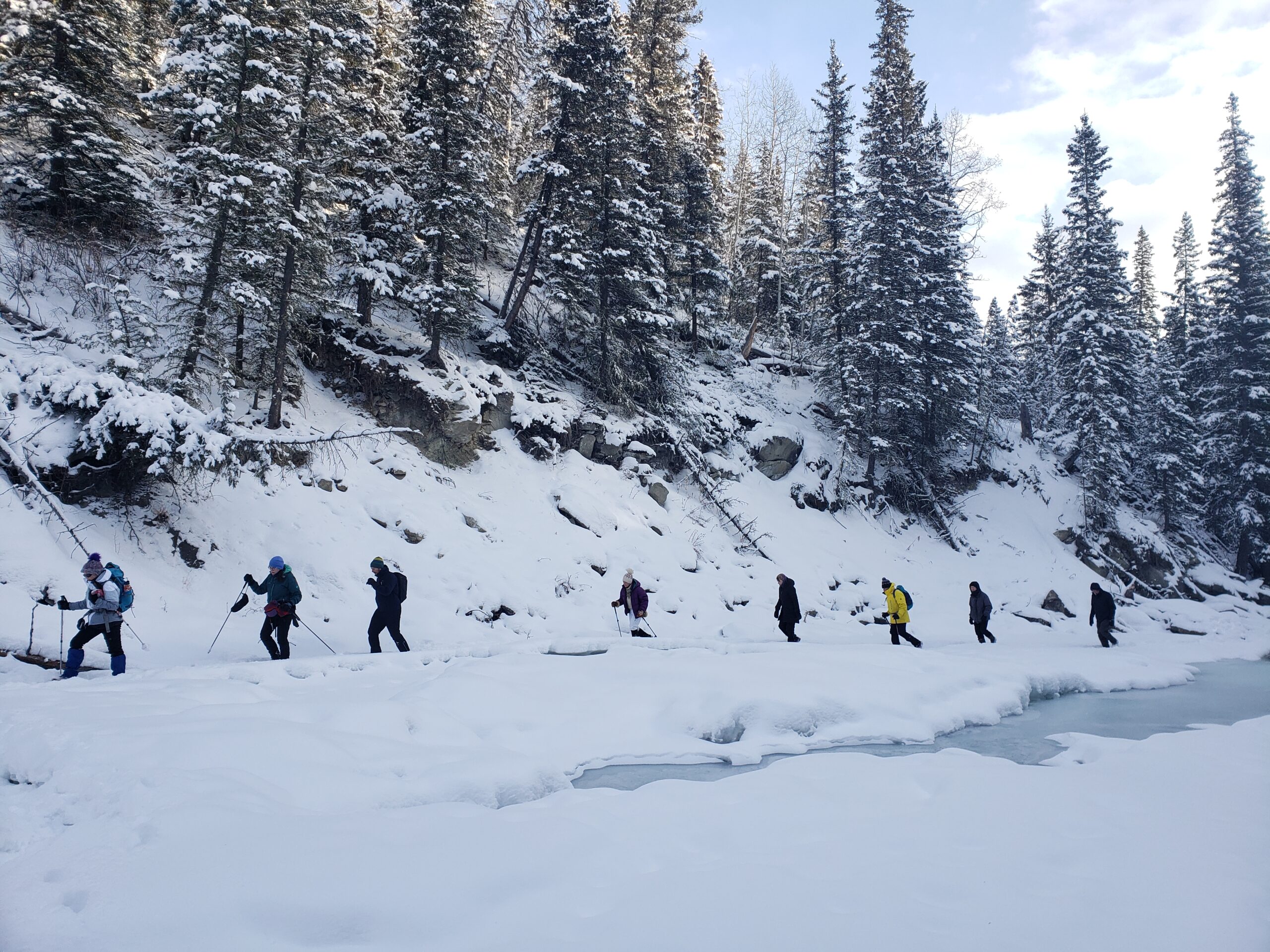
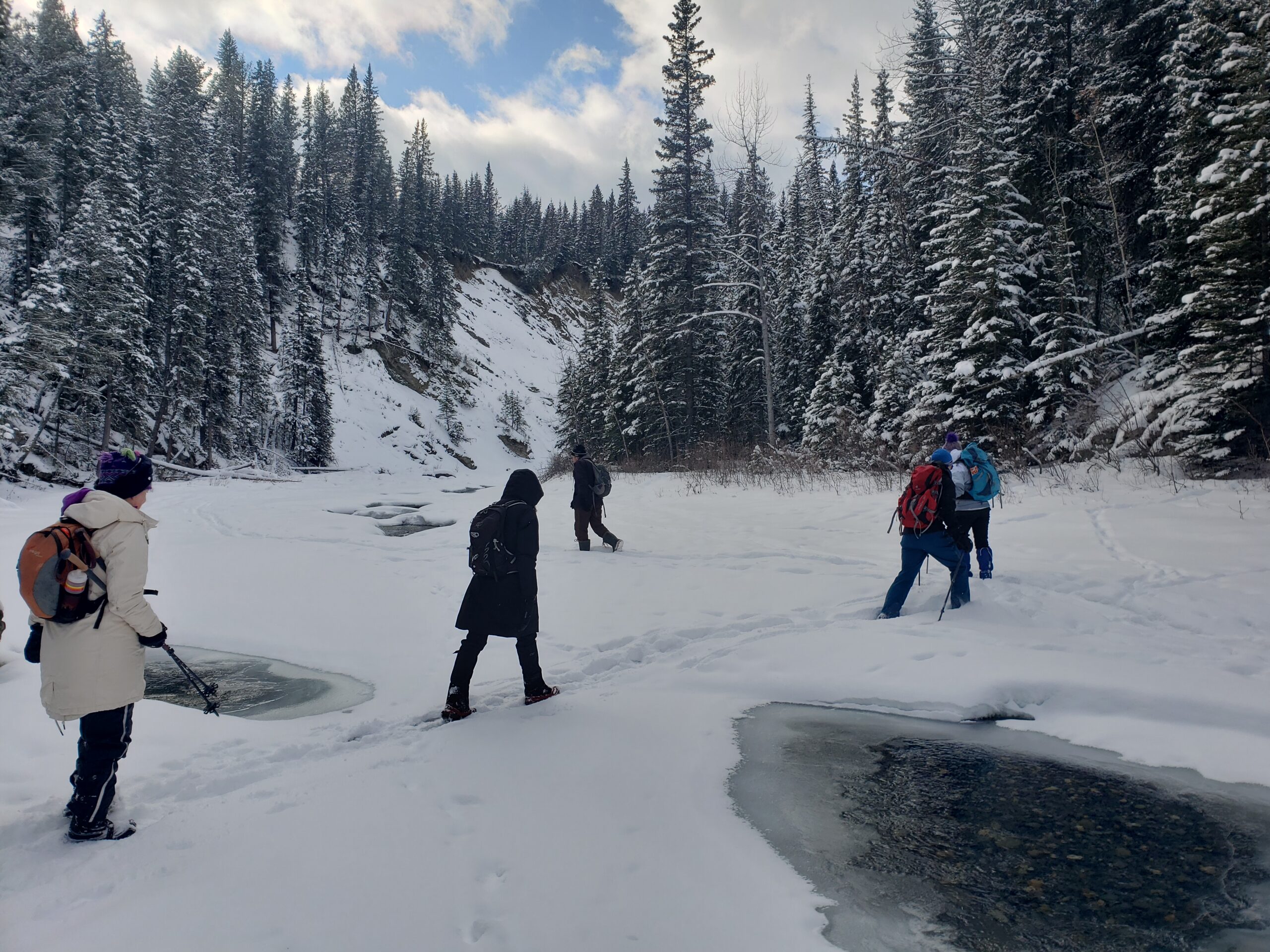
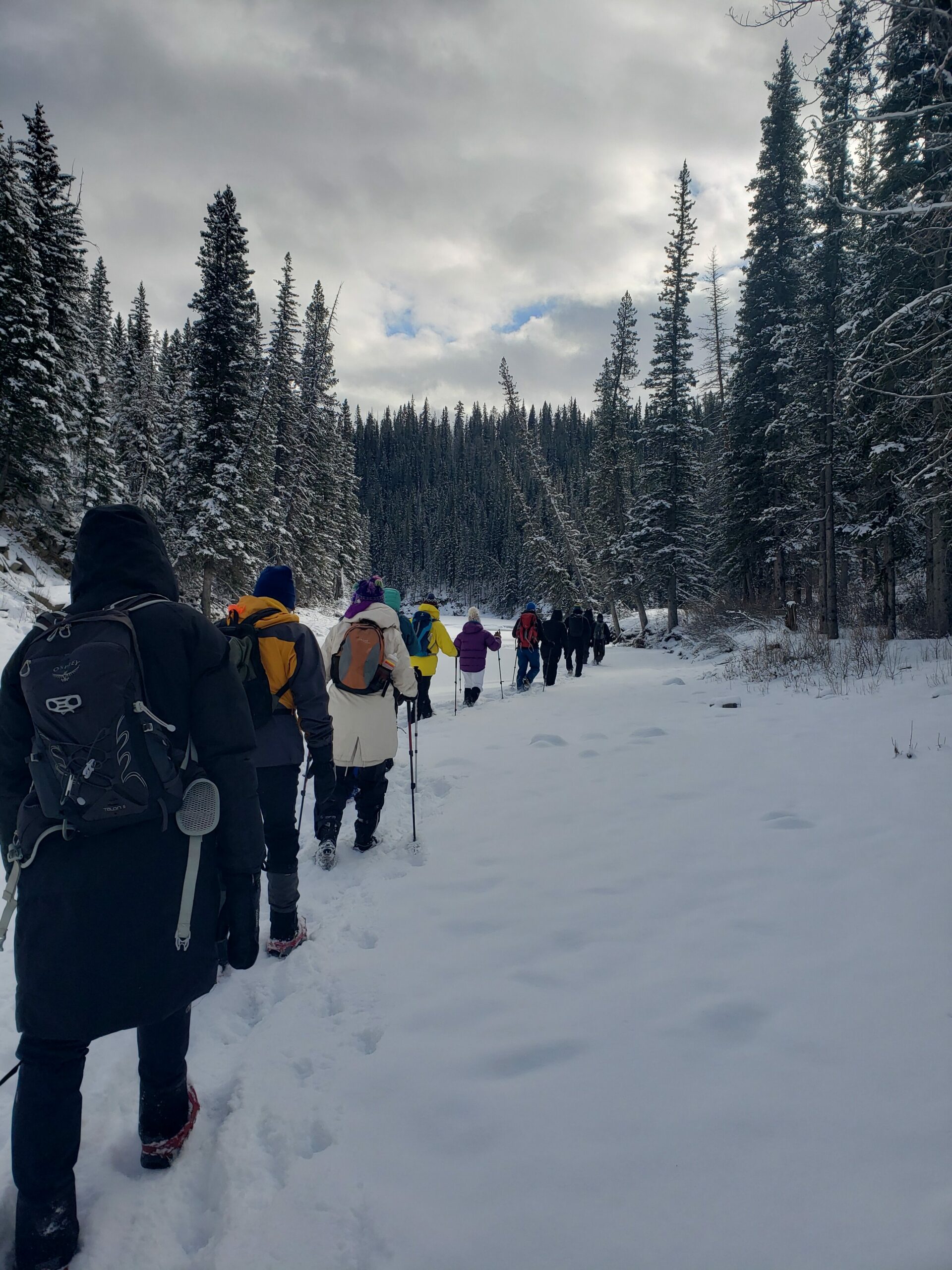
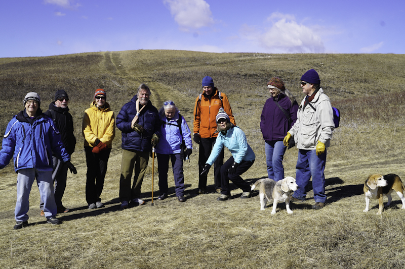
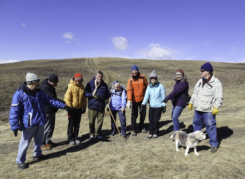
The prospects weren’t good: It was rather warm for January, there was little snow left and we were concerned the ice bridges were weakening. Then things got worse: it snowed quite a bit, the roads got rather treacherous and some seriously cold temperatures were in the forecast for the day of the hike on Waiparous Creek, January 28, 2023.
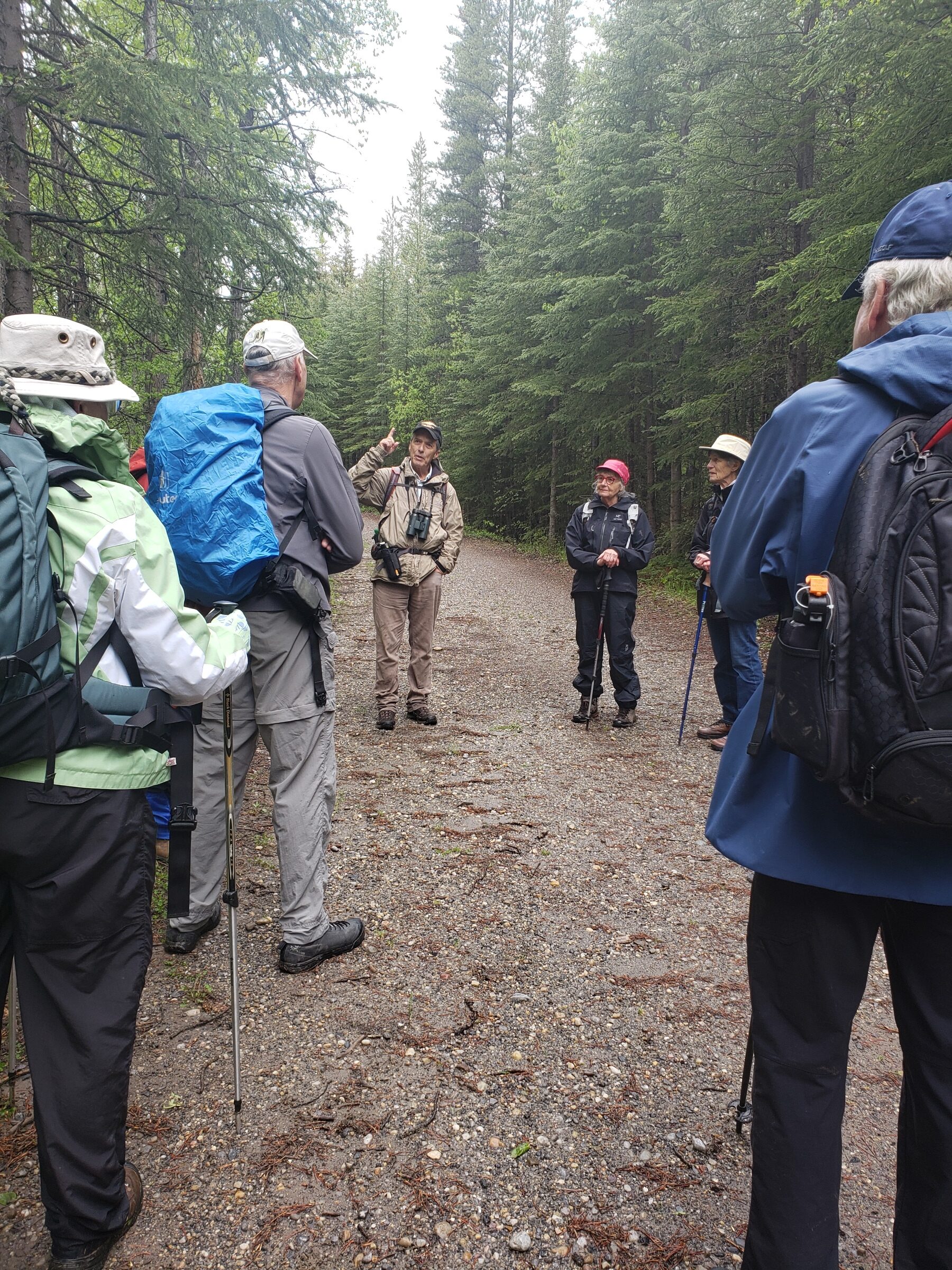
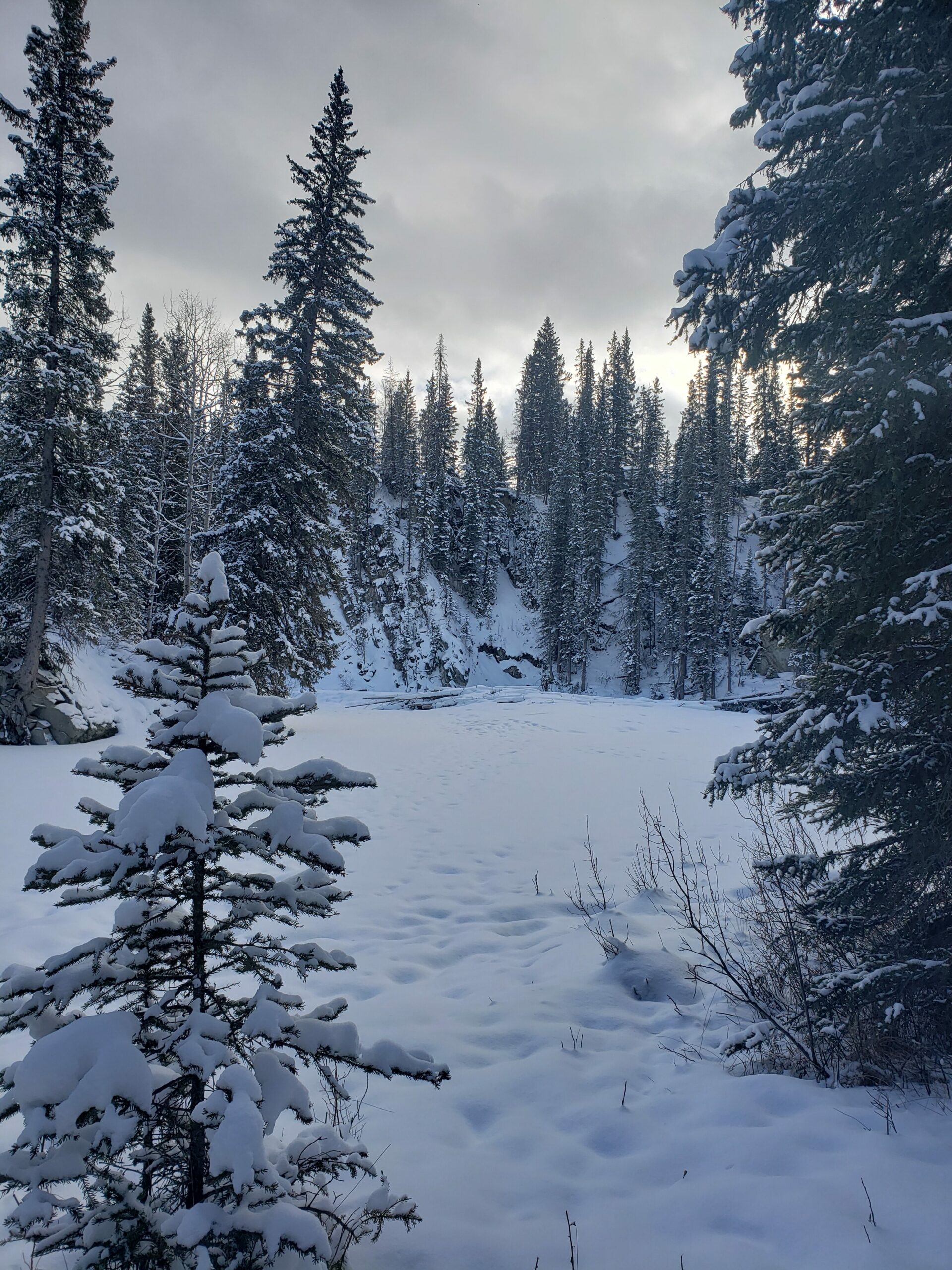
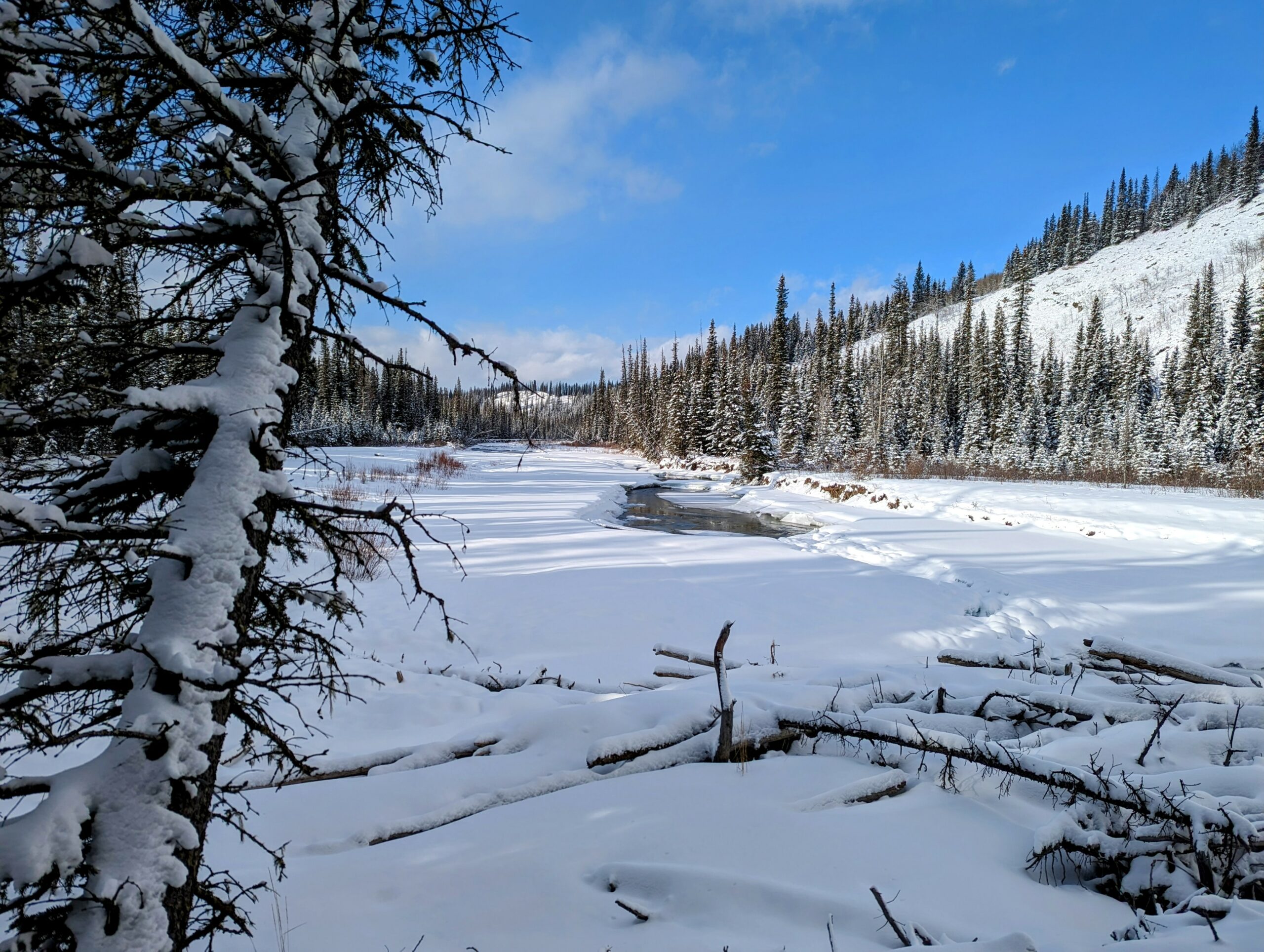
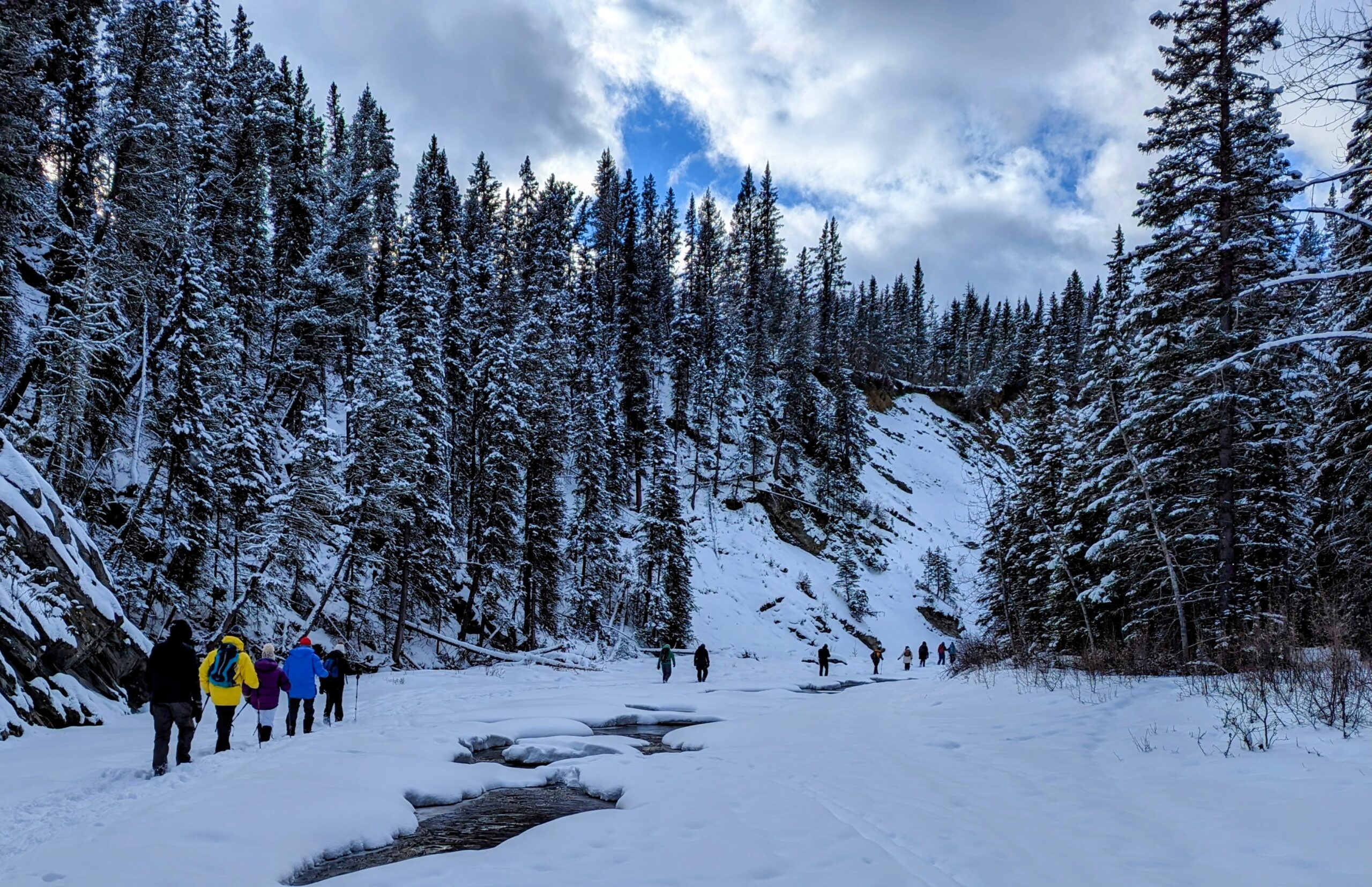
But you can’t have a good adventure without a little hardship right? We had a great turnout of some 15 hardy AWA supporters to join Heinz and Kris, the sun broke through occasionally and the new snow made everything more beautiful. Although it was also a bit of a slog tracking through the deep snow, we were distracted by the occasional ponds of open water, the sound of the river flowing under foot (under the ice), and the occasional air hole through the ice where we could hear and see the flowing water. The canyon walls were steep and high, with either forest cover or bare rock on either side.
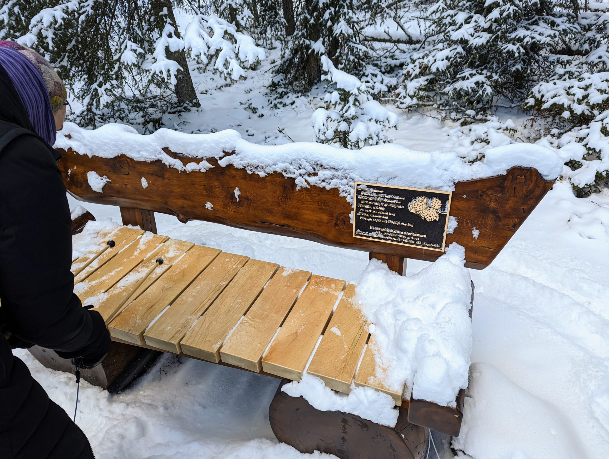
Eventually, after a brief break in the dappled sun, we hiked up along a flowing spring through steep forest back to the parking area via an easy walking trail. Along the way we stopped at a new memorial bench for David Lertzmann who died in an encounter with a grizzly bear at that spot almost two years ago. The hike was concluded with hot drinks and treats at the Ungers’ in Benchlands.
Text: Heinz Unger
Photos: Devon Earl and Catherine Wilde


What Happens with Abandoned Oil and Gas Wells: A Field Trip with Tako Koning
Written on November 15, 2022, by Sean Nichols
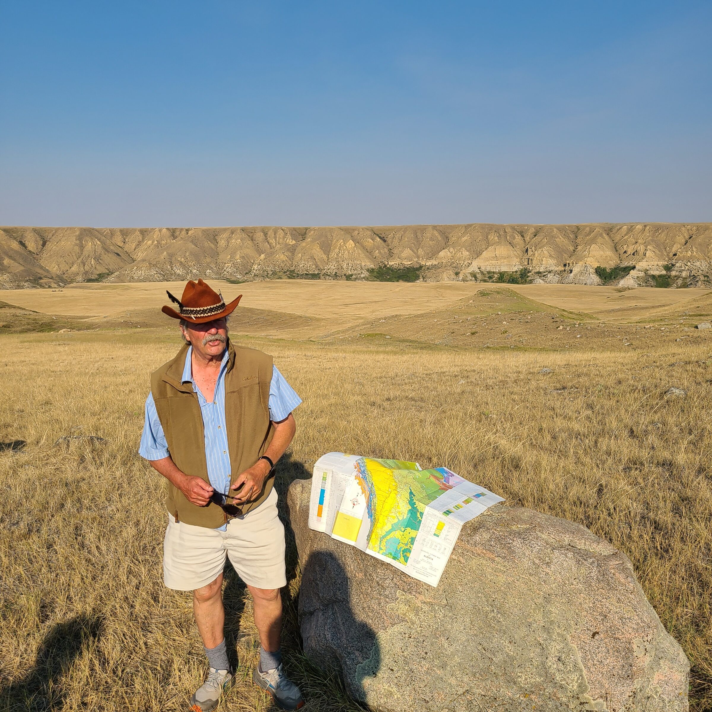
The day was cool, the sky cloudy with the distant threat of rain on the horizon. Not far from Frank Lake, cars were pulling up and people gathering for a road trip that would take us to eight stops in Southern Alberta, focusing needed attention on the abandonment of oil wells and the development of renewable energy. Tako Koning, a professional petroleum geologist with years of experience organizing this tour, led this August 27, 2022 field trip.
Story and photos by Ruiping Luo, AWA Conservation Specialist:
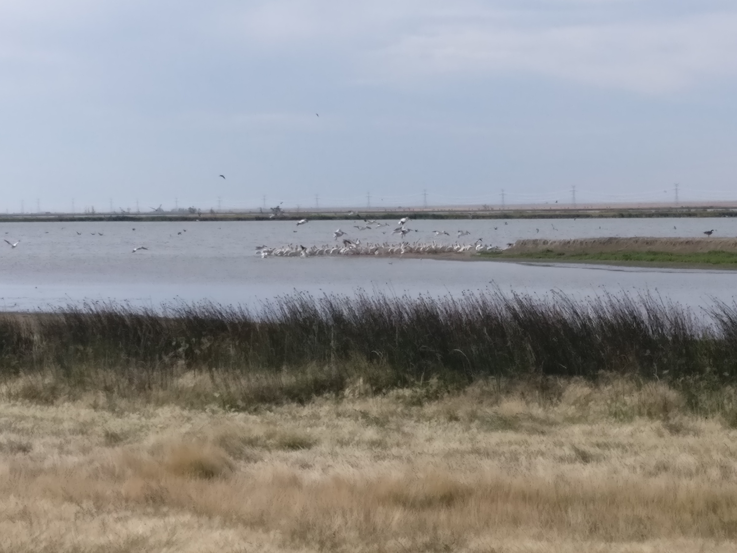
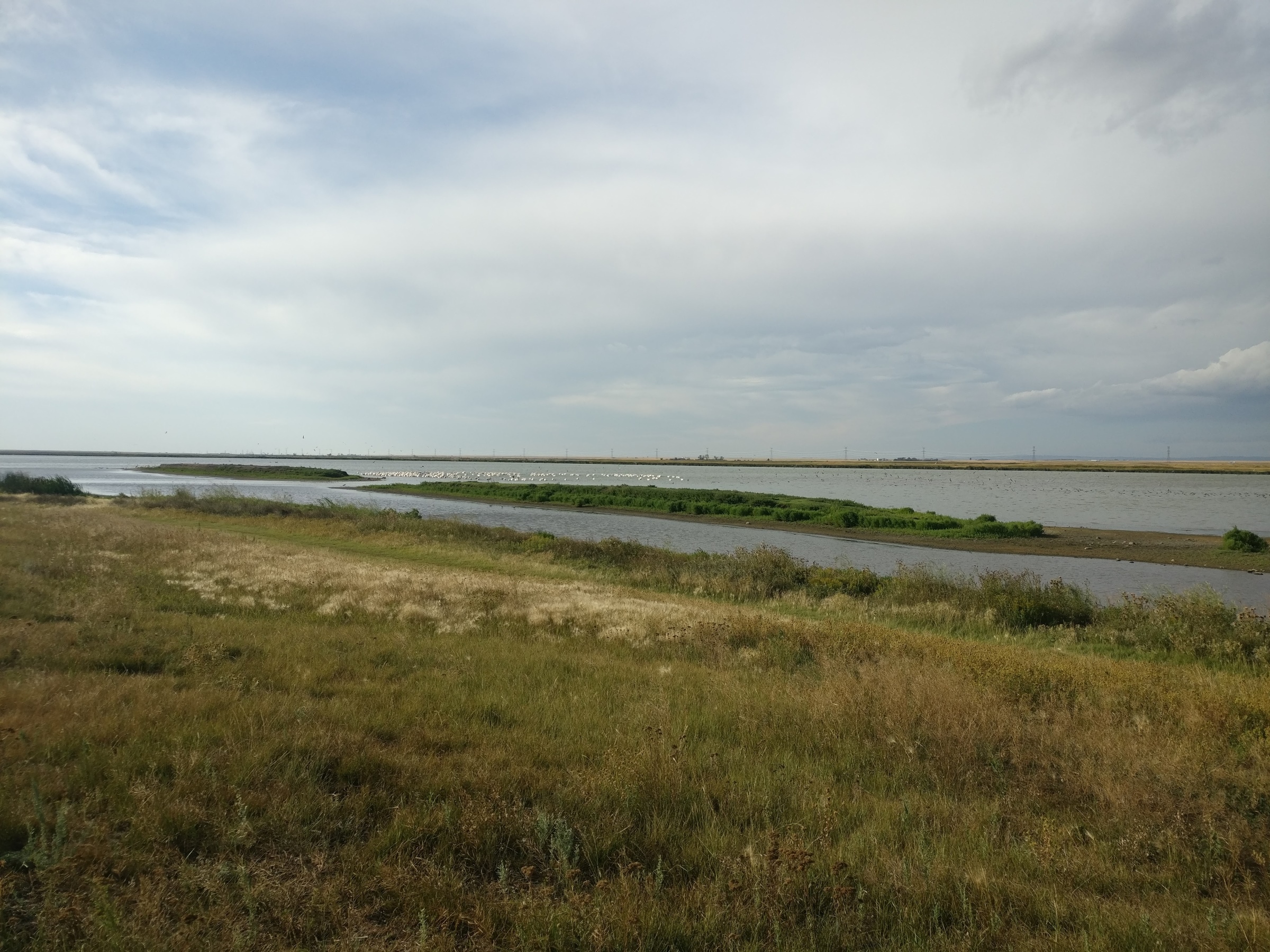
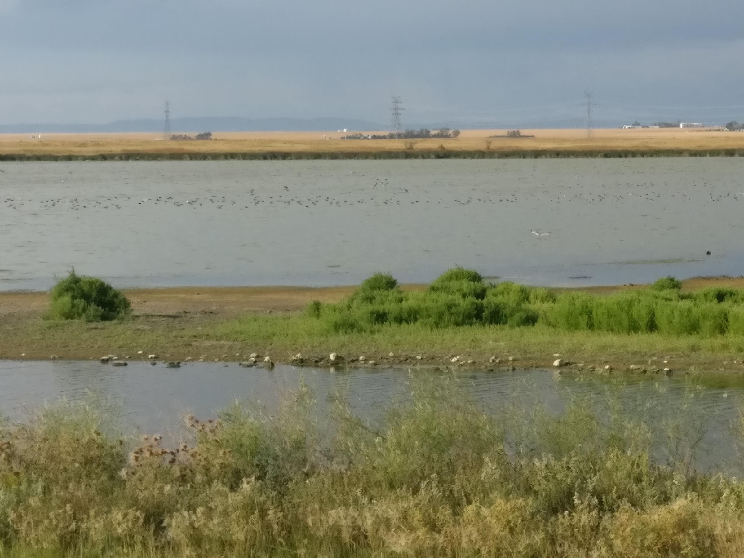
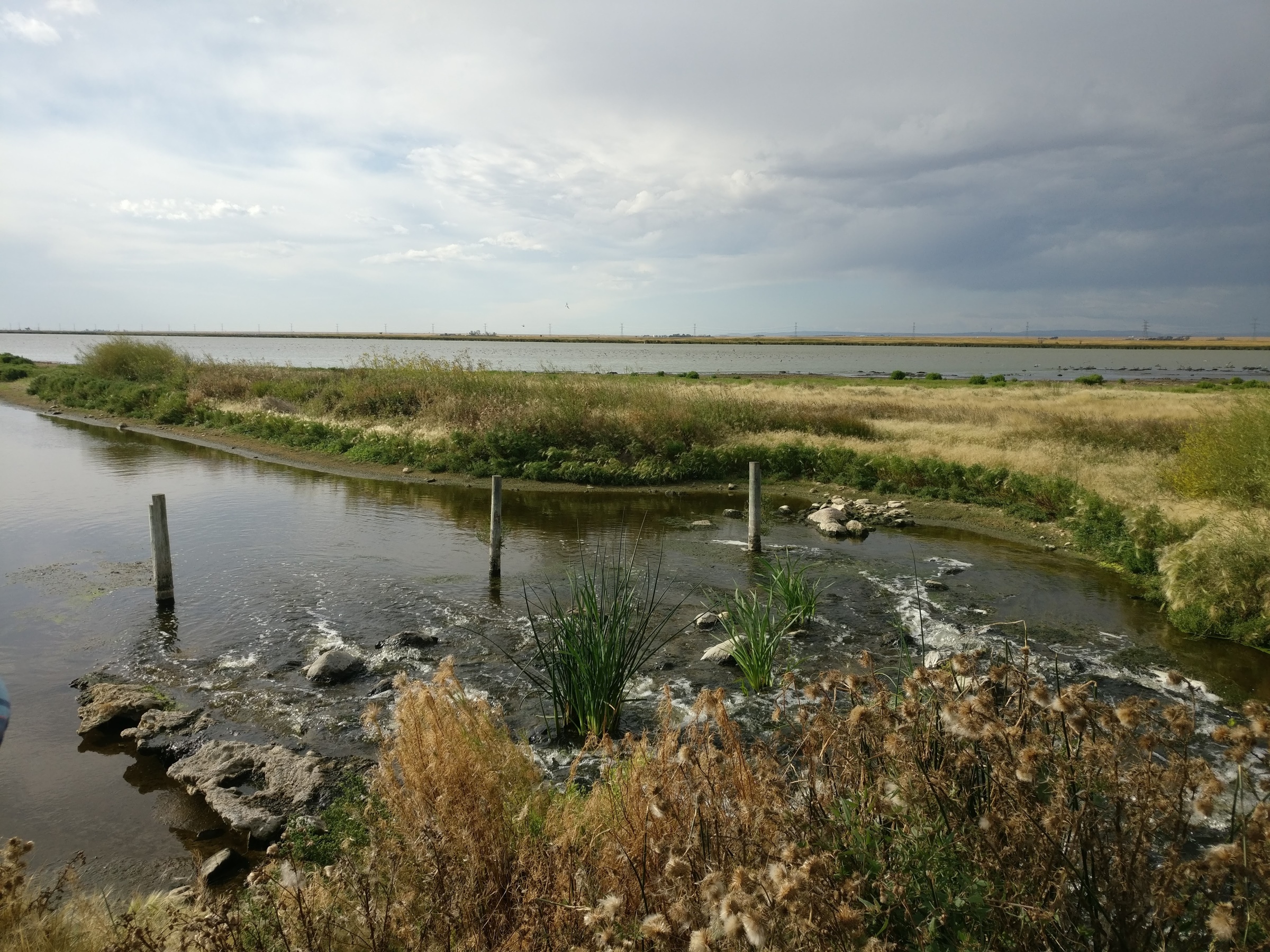
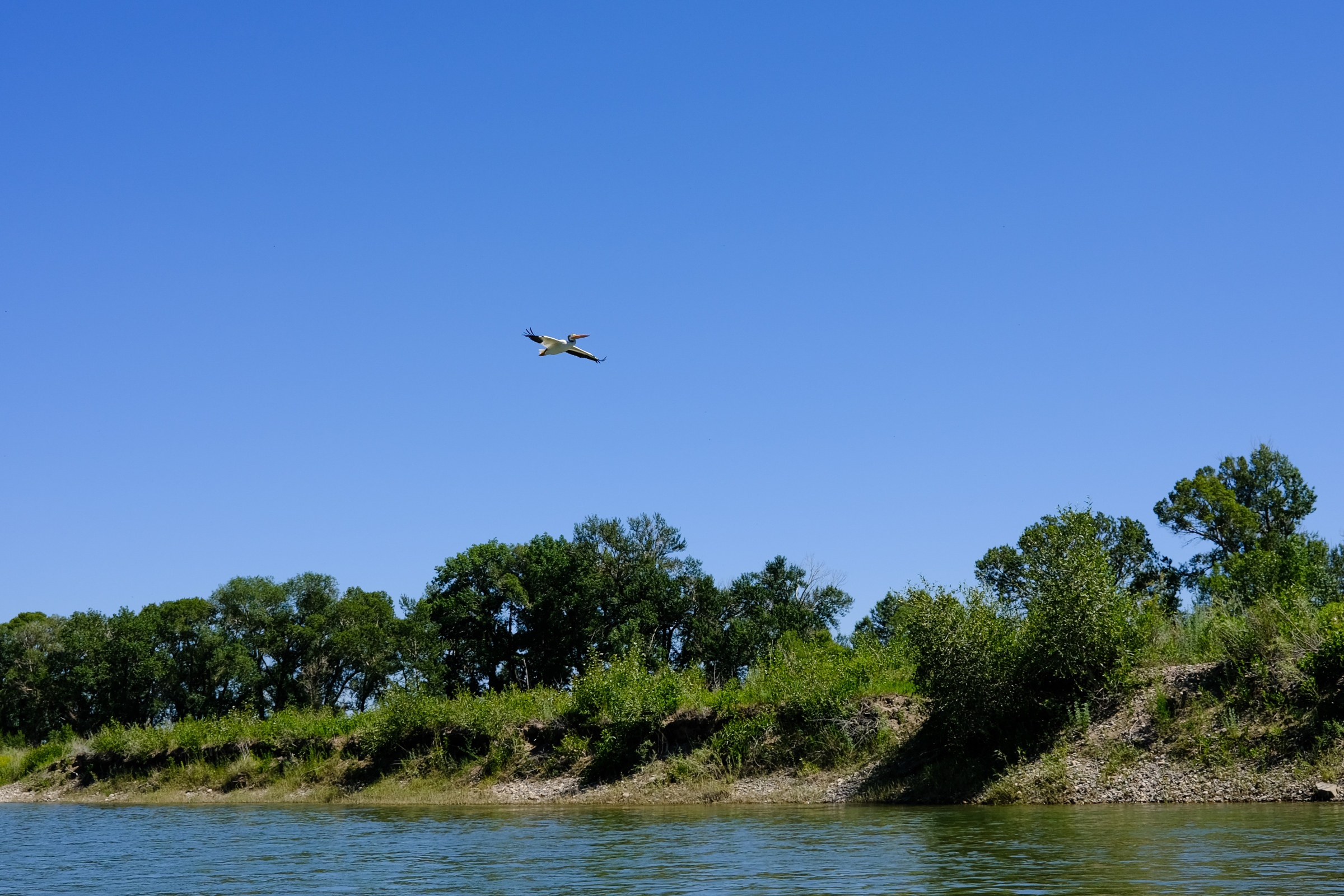
It was short drive into the Frank Lake Important Bird Area (IBA). From the shore, we watched pelicans and gulls soaring, floating in the rippling waters or standing on the islands. Frank Lake is a restored wetland and an Important Bird Area, and is recognized for the large congregations of birds, particularly for migration and breeding.
We wandered along the shore, through tall grasses to the inflow where treated wastewater flowed into Frank Lake. The water comes from High River and Cargill, and helps to keep water levels at Frank Lake constant. It was one of many adjustments made to stabilize water levels in Frank Lake, which once fluctuated between flooding and dry conditions with the seasons. To prevent severe contamination, Alberta Environment and Parks monitors and regulates the wastewater that enters Frank Lake.
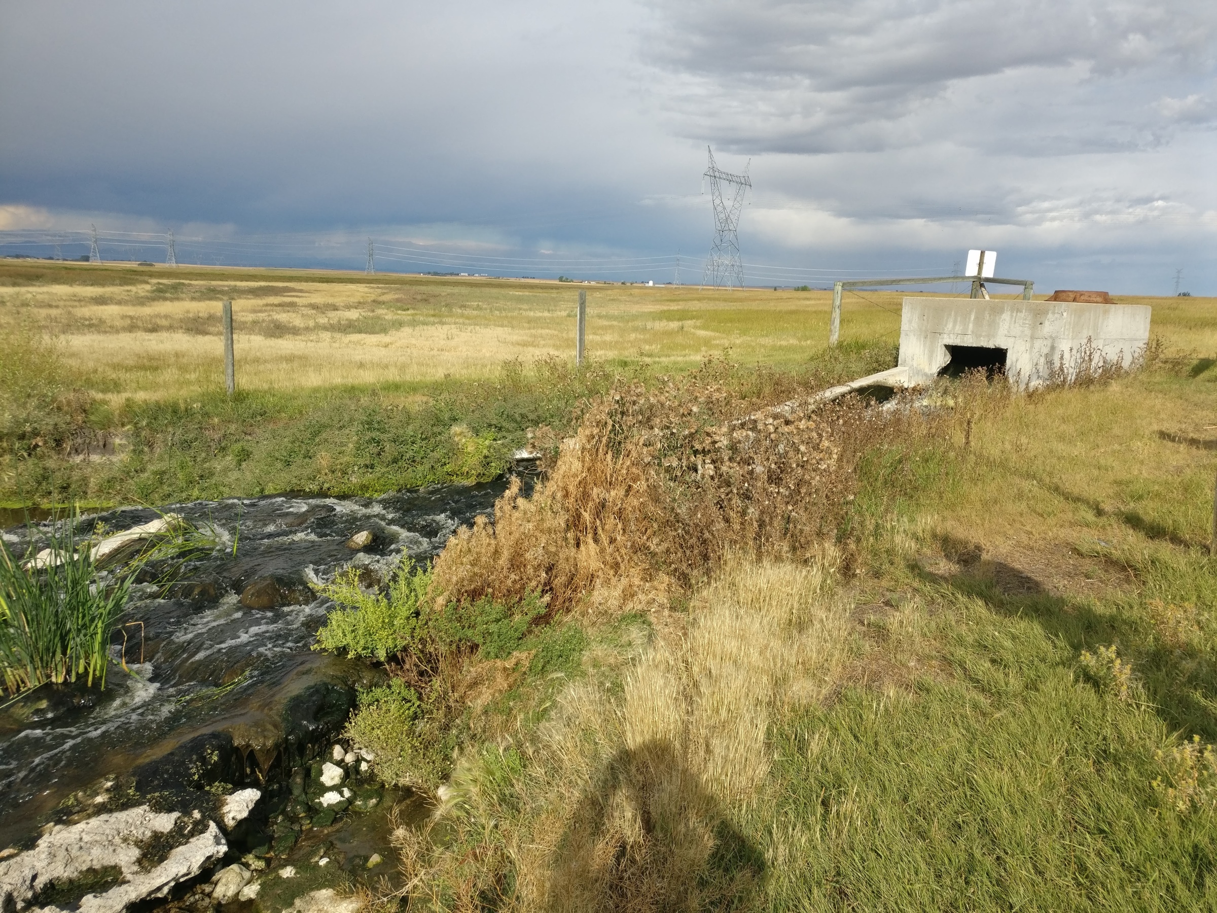
From Frank Lake, we drove north, stopping to note the signs indicating abandoned gas wells before arriving at the former Mazeppa Gas Plant. Built in 1986, ownership passed through various companies before the last owners, Lexin Energy Corporation, declared bankruptcy in 2017. From across the road, we could see what remained of the gas plant. The Orphan Well Association (OWA) has been removing equipment at the site and working on environmental restoration and remediation, with salvageable parts being sold to reduce costs. Many components have already been removed, including the taller structures, and only a few buildings remain.
Next we headed east, to the agricultural fields where Elemental Energy has proposed to construct the Foothills Solar Project. The project is proposed as a 150 MW solar farm covering over 1,600 acres. This is one of many solar projects Alberta has been developing in support of Canada and Alberta’s commitments to reducing carbon emissions. However, this project draws concern for its close proximity to Frank Lake. Birds can collide with solar panels and transmission lines, leading to injury and death. It is suggested that waterfowl may be attracted to solar panels due to the reflection of light off the panels being similar to that off water. While solar energy is important to reduce Alberta’s carbon emissions, placement is also important, and the proximity to Frank Lake risks many important bird populations.
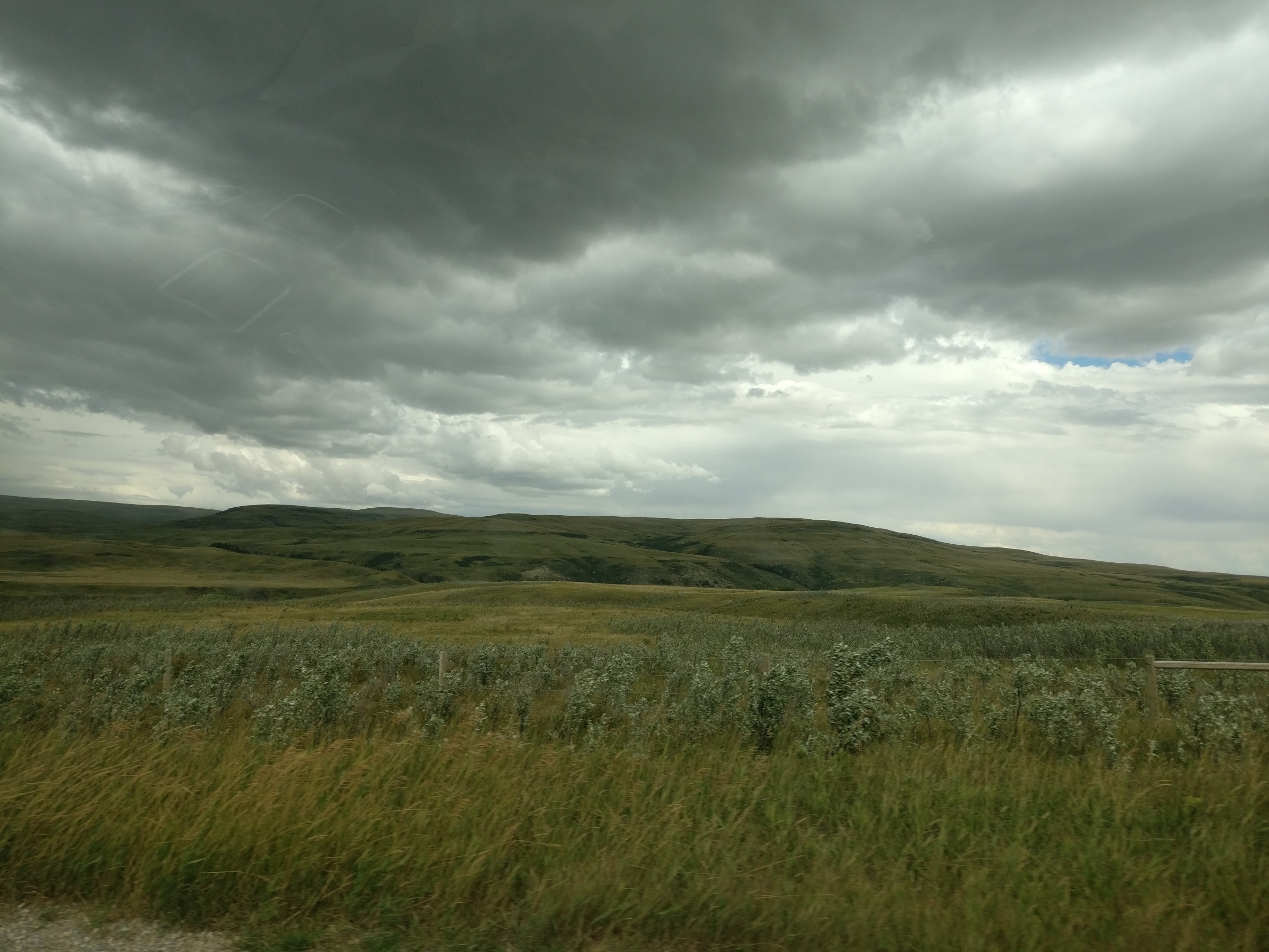
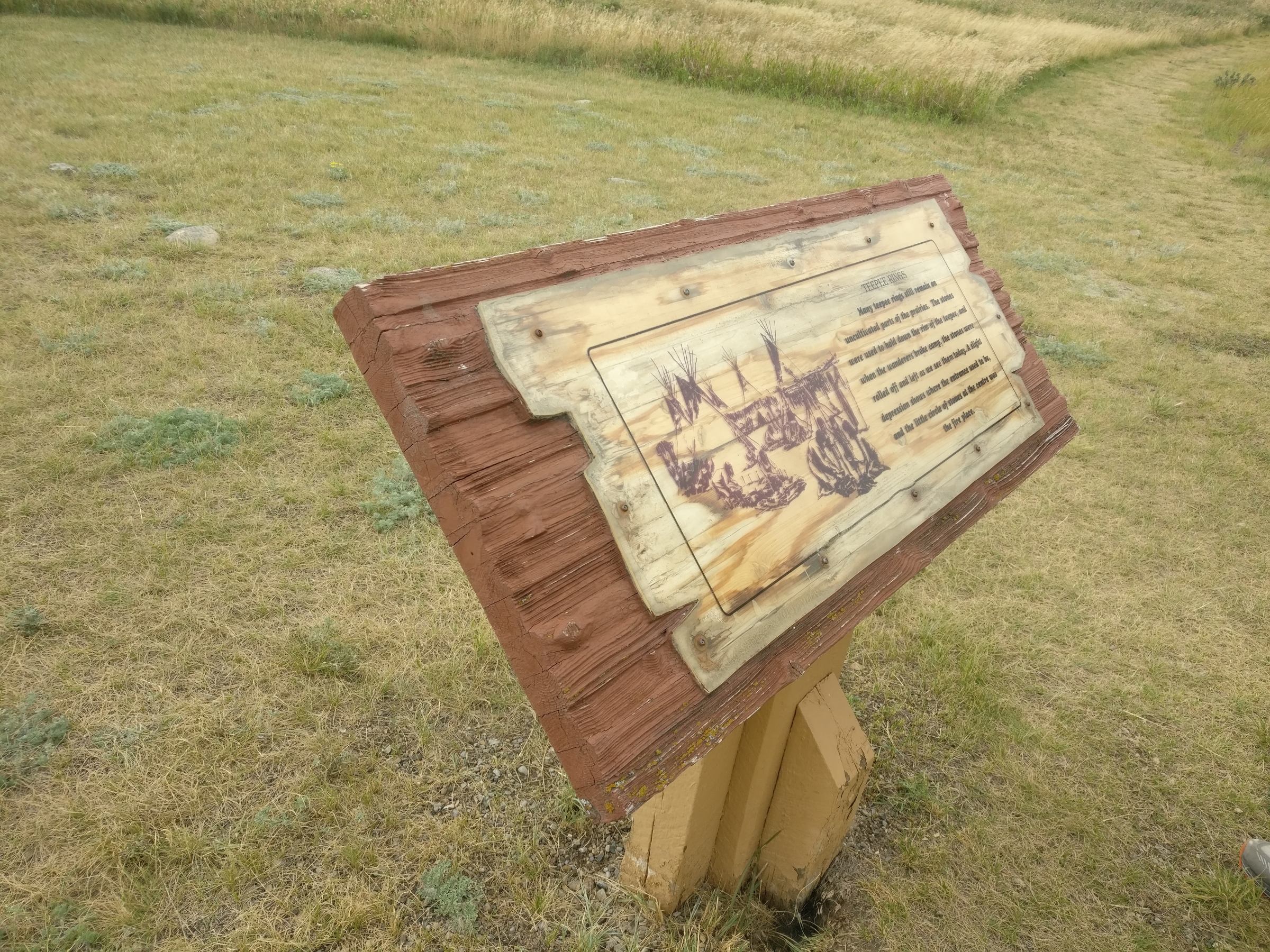
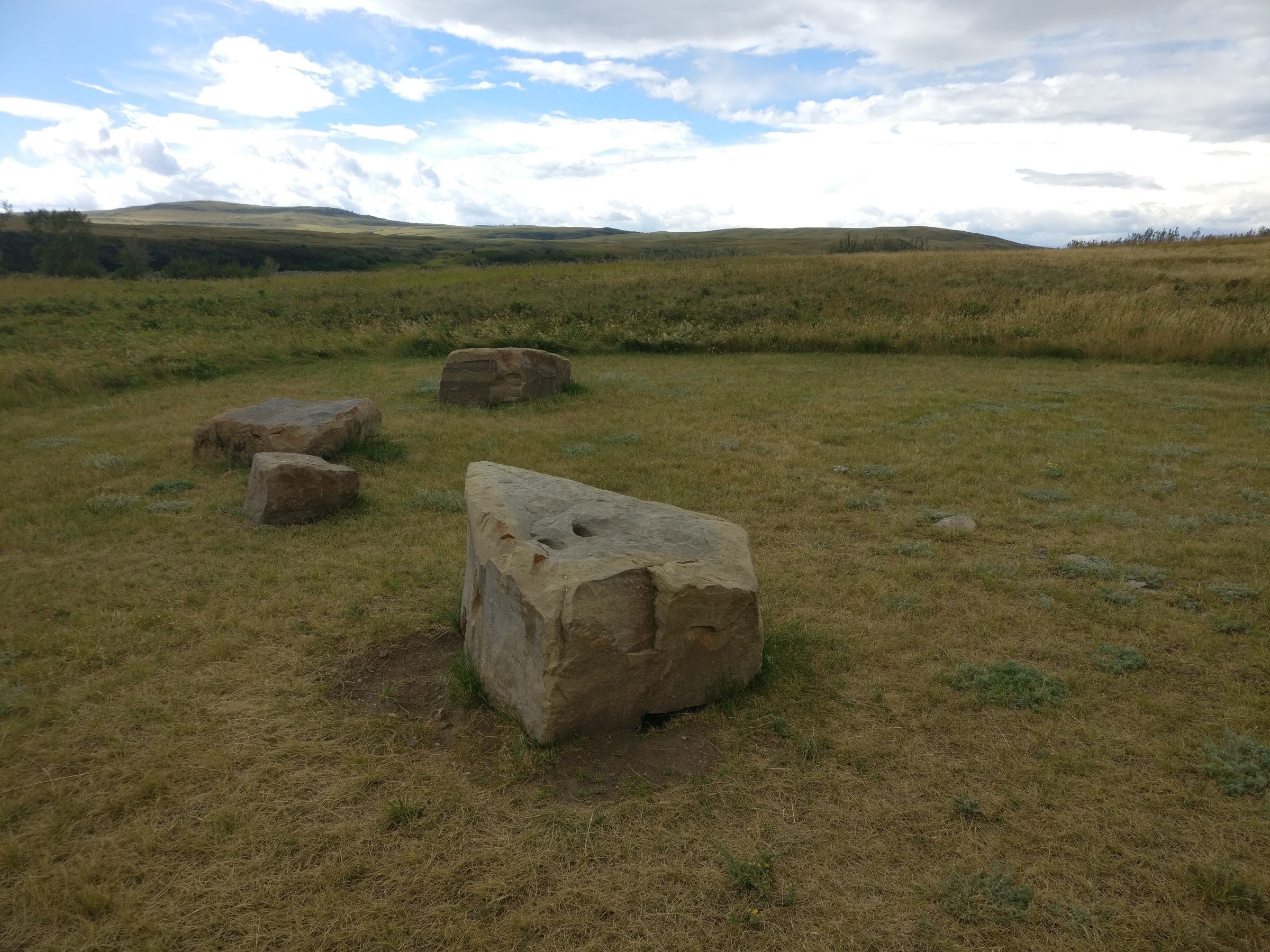
By the time we reached Willow Creek Municipal Park, a 200-acre park in a grassland valley, the rain had at last caught up to us. Climbing to the ridge, we were greeted by the open meadows, a few distant trees and shrubs, and the remnants of a tipi ring.
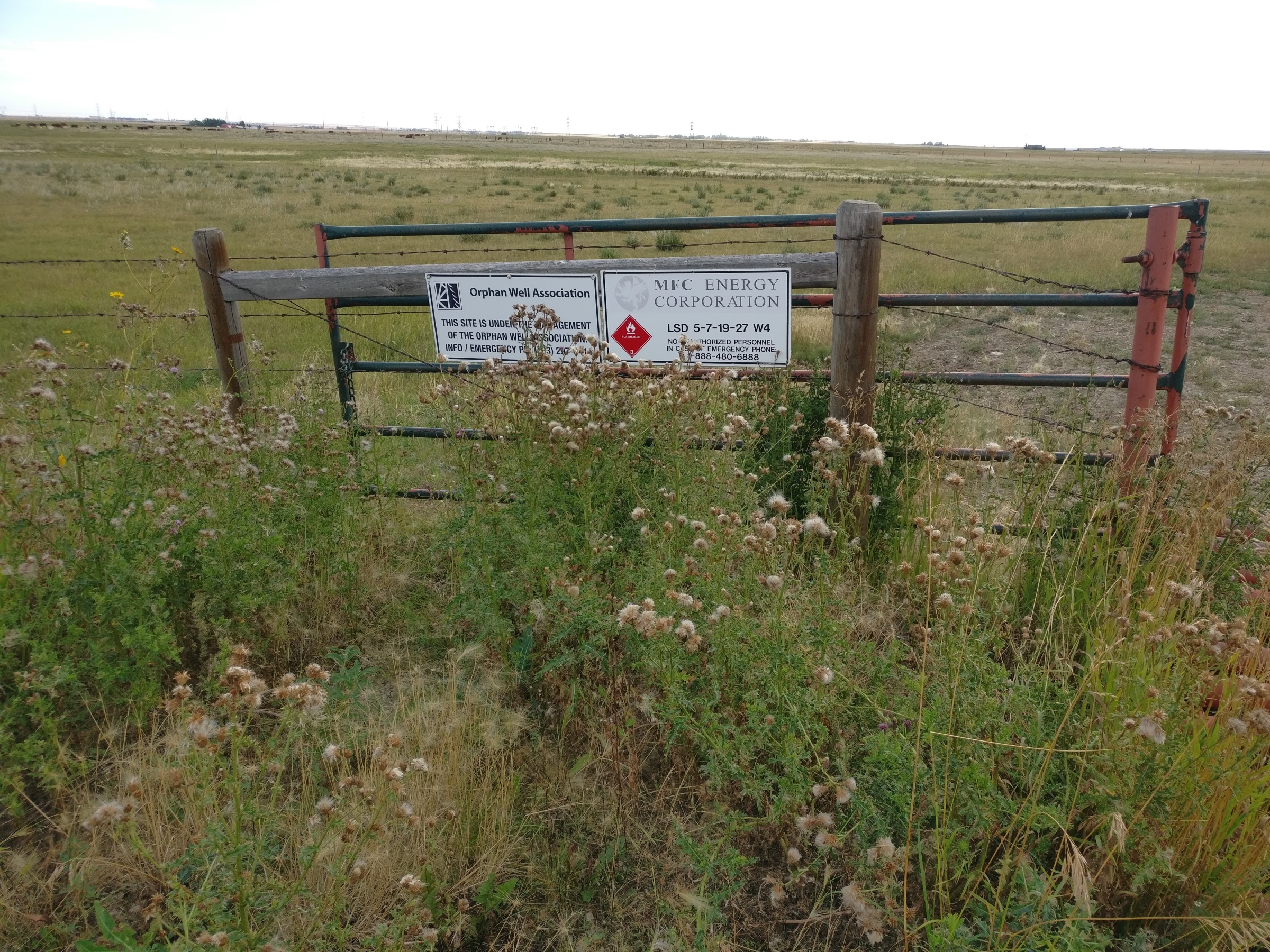
From there, we headed through ranchlands, passing the historic Flying E Ranch and entering an abandoned gas field and a well now under the management of the Orphan Well Association. The association works to manage and safely decommission oil wells that lack a responsible party, often a result of companies declaring bankruptcy.
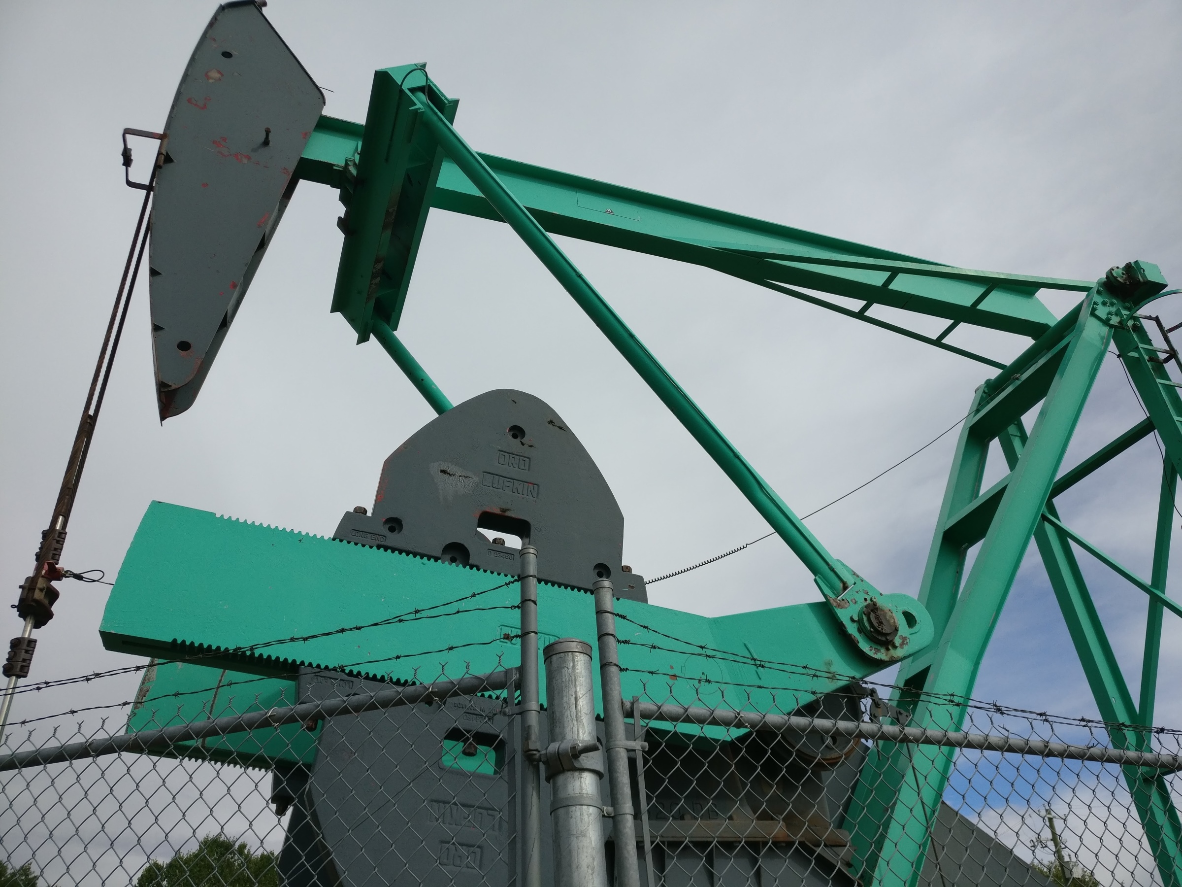
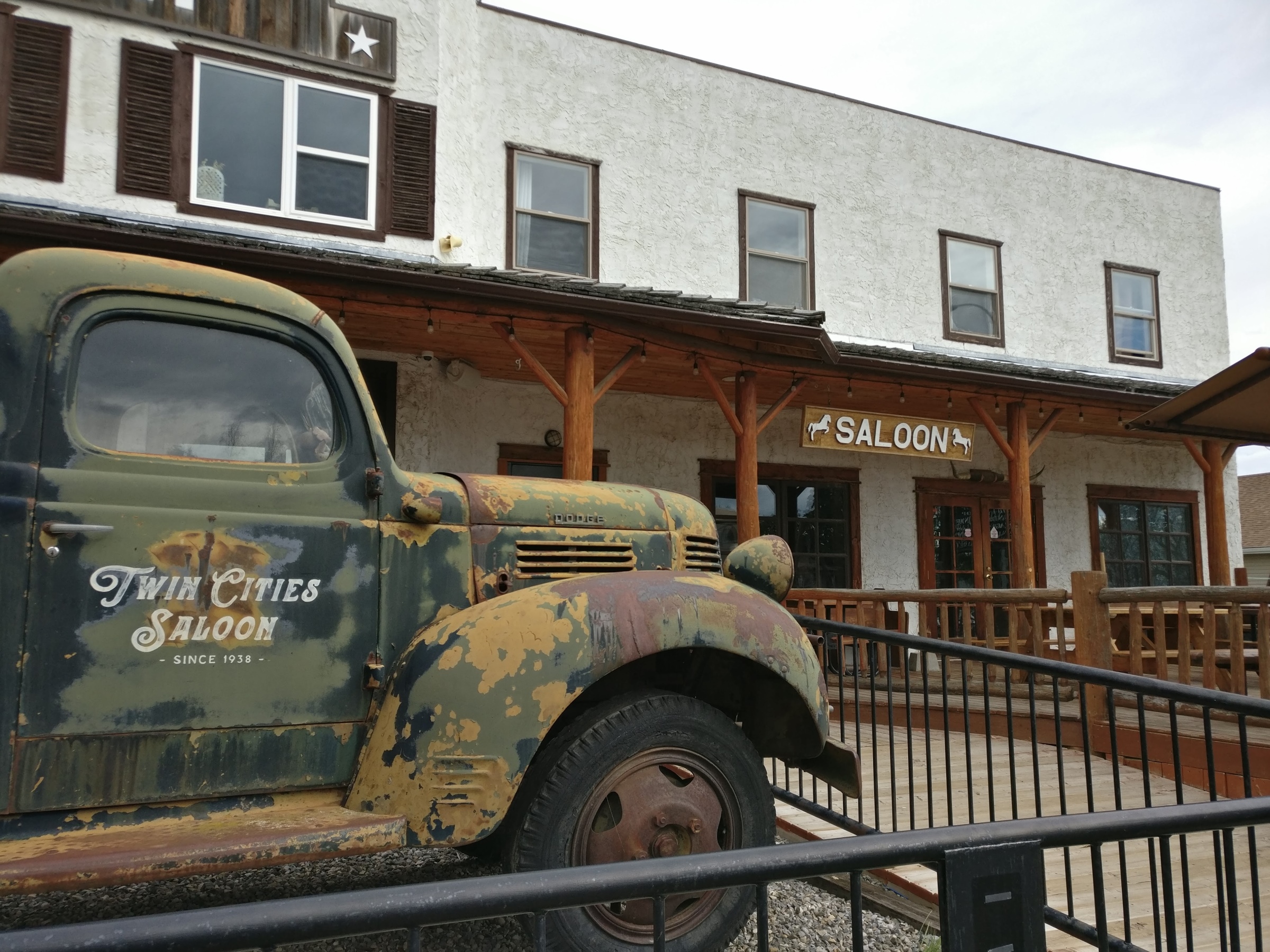
At last, we headed north, to the village of Longview, and an active oil pumpjack positioned in a residential neighbourhood. We finished the trip at the Twin Cities Hotel in Longview, a historic cowboy bar, where we gathered for a final discussion and a meal. It was an informative trip that not only spotlighted the fossil fuel and renewable energy industries, but also showed some truly breathtaking views of southern Alberta.


In memory of Margaret Main and Gus Yaki: Hunting for Crocuses on Nose Hill
Written on October 26, 2022, by Sean Nichols
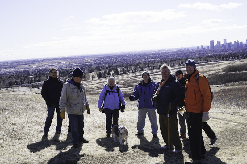
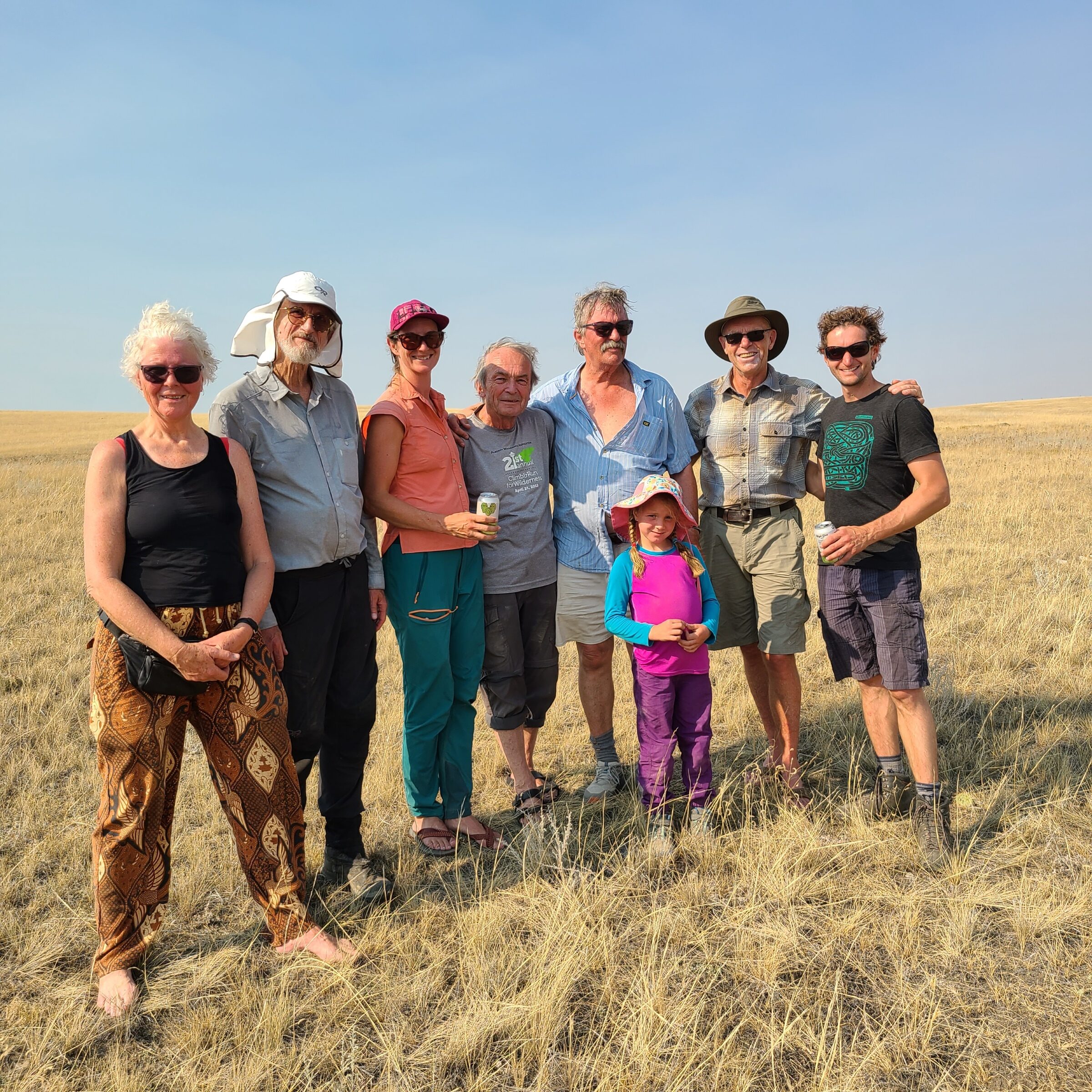
In springtimes past, former AWA Executive Director Christyann Olson would compete with longtime AWA friend and volunteer Margaret Main to find the first crocus blooms around Calgary. At the same time naturalist Gus Yaki, with his incredible talent for spotting even the most obscure buds or changes in his surroundings, was hunting crocus buds too. Although both Margaret and Gus are ow gone, Christyann continues the tradition by holding an annual Crocus Hunt on Nose Hill as part of our Adventures For Wilderness program. This year they were joined by 14 other participants, including geologist Tako Koning who shares with us how the day went.
Thanks also to Karel Bergmann and Barbara Amos for their photos from the Adventure.
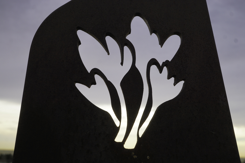
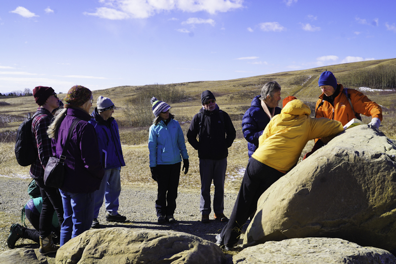
On March 24, 2022, Christyann Olson, AWA’s indefatigable Executive Director led a field trip to Nose Hill Park to hunt for crocuses. The group was a nice size, consisting of 15 attendees. But the purpose was more than just looking for crocuses. Indeed, this field trip was in memory of Margaret Main and Gus Yaki, two of AWA’s dedicated volunteers who have now passed – sadly they are no longer with us. The symbol of spring after a long cold winter – the appearance of crocuses meant so much to Margaret, Gus and Christyann that they traditionally had a friendly competition with the aim to see who could spot that very first crocus. And what better place in Calgary to spot crocuses is Nose Hill Park with its south-facing slopes blessed with invigorating spring sunshine.
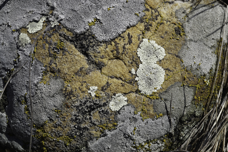
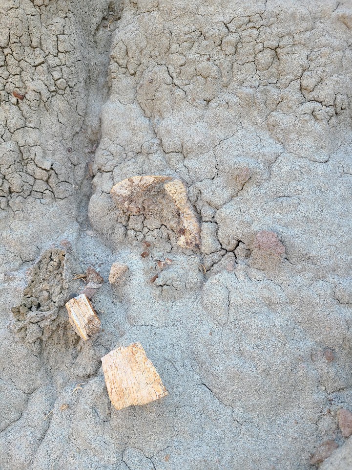
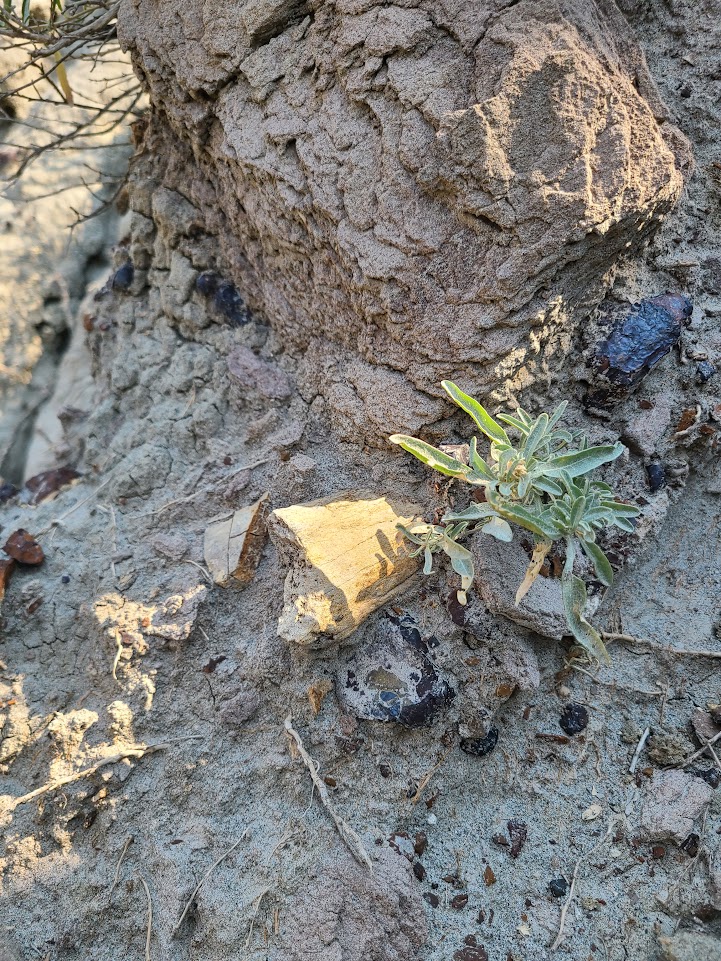
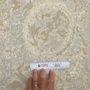
As we walked up the slope from the parking lot, Tako Koning, a semi-retired geologist identified some interesting fossils hidden within the boulders marking the pathways. These boulders are likely from a quarry where the Paskapoo Formation sandstone was mined years ago. They have been dated as Tertiary in age, perhaps as old as 30 million years which is young in terms of geological age. The fossils included shells in what looked like oyster beds plus fossilized algae which are sometimes called stromatolites and bits and pieces of fossilized wood.
We then hiked up to a large glacial erratic known as the Nose Hill Erratic. This erratic consists of quartzite which means that it is a very hard, highly compacted sandstone which over the millennia transformed from sandstone into quartzite. Layers of silt and fine sand grains are clearly visible. Some of this erratic is smooth since buffalo rubbed against it when buffalo grazed on Nose Hill. It is part of the Foothills Erratics Train which extends from Jasper eastwards to Hinton and south to the Alberta-Montana border. Ice flowed southwards from Jasper during the last glaciation which occurred only 12,000 years ago. The erratics train originated from large landslides of quartzite on Mount Edith Cavell and other mountains in Jasper National Park. These quartzites have been age dated as Lower Cambrian with an estimated age of 500 million years, equivalent to ½ billion years old. For geologists like me, this adds to the thrill of visiting Nose Hill Park.
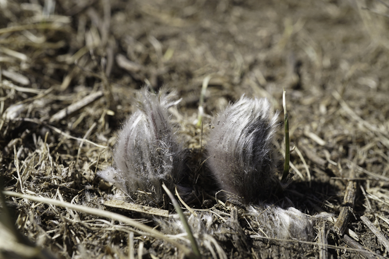
Karel Bergmann, a self-trained botanist, has held a lifelong passion for lichens and prairie flowers, and led the search for crocuses. For the first hour, no crocuses were spotted; comments began that perhaps we should have come one week later. We were all just a little disappointed but then just north and uphill from the large glacial erratic: voilà! Karel spotted the first crocus pushing its way out of the soil! The reaction was cheers and clapping of hands. Thereafter another half dozen crocuses were spotted. I somehow sensed that with the attendees there was this subconscious feeling that despite so many changes happening globally including the Covid-19 pandemic and Russia’s sudden horrible invasion of Ukraine, at least the Earth’s environment was still steady and the crocuses were budding as they always do in mid-March on Nose Hill Park.
Will this field trip be repeated again in the spring of 2023? You betcha! You can count on Christyann, Karel and I being there. And hereby we invite you the reader to join us next spring on Nose Hill Park!


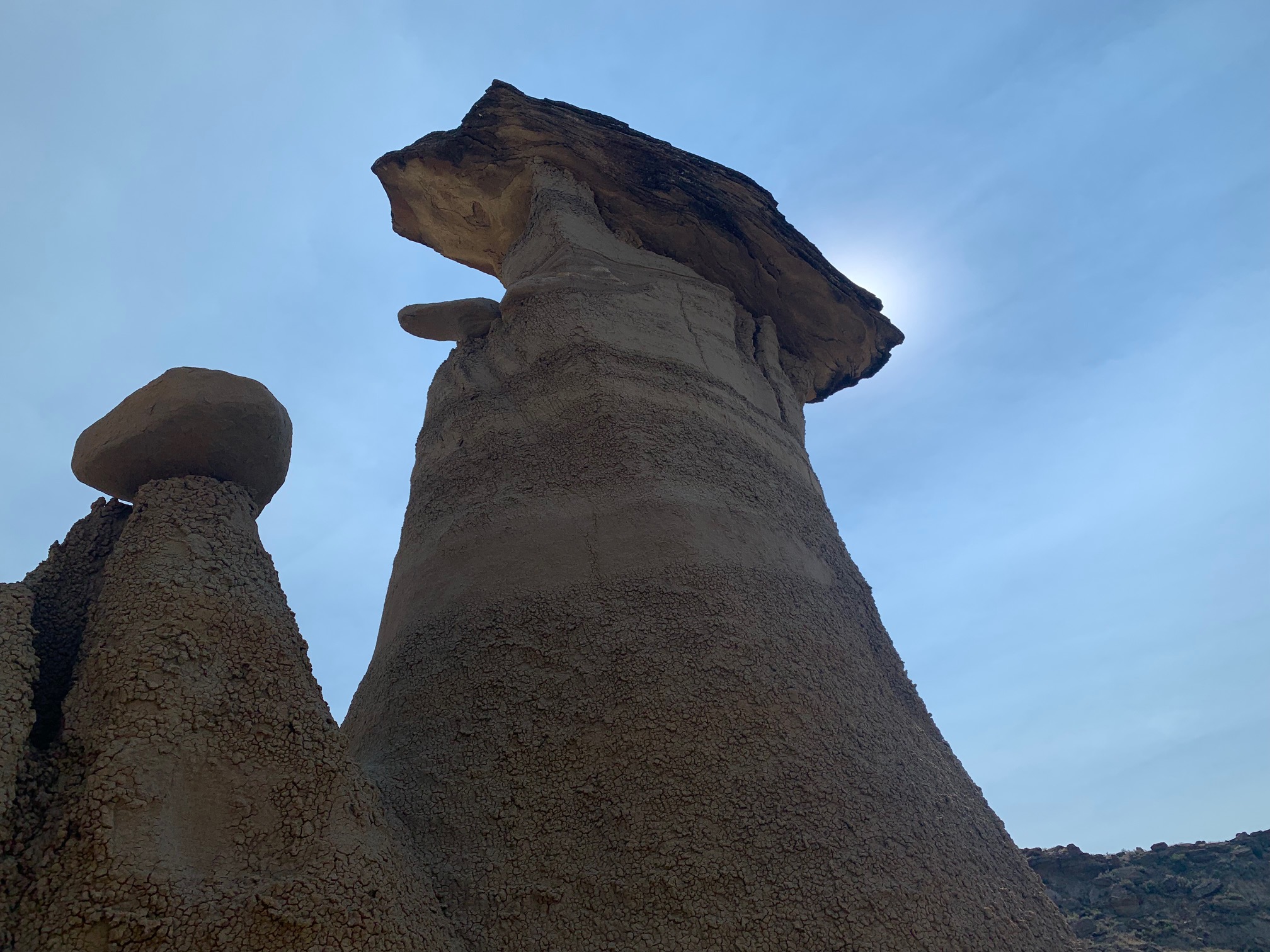
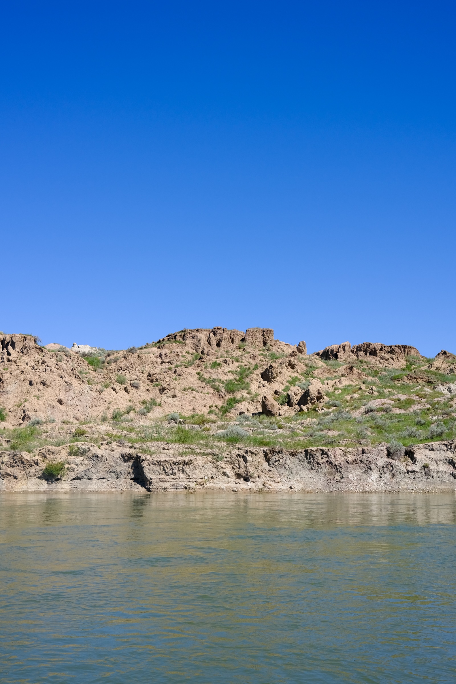
Dinosaurs in White Rock Coulee: A Fall Hike in Southeast Alberta’s White Rock Coulee
Written on September 22, 2022, by Sean Nichols
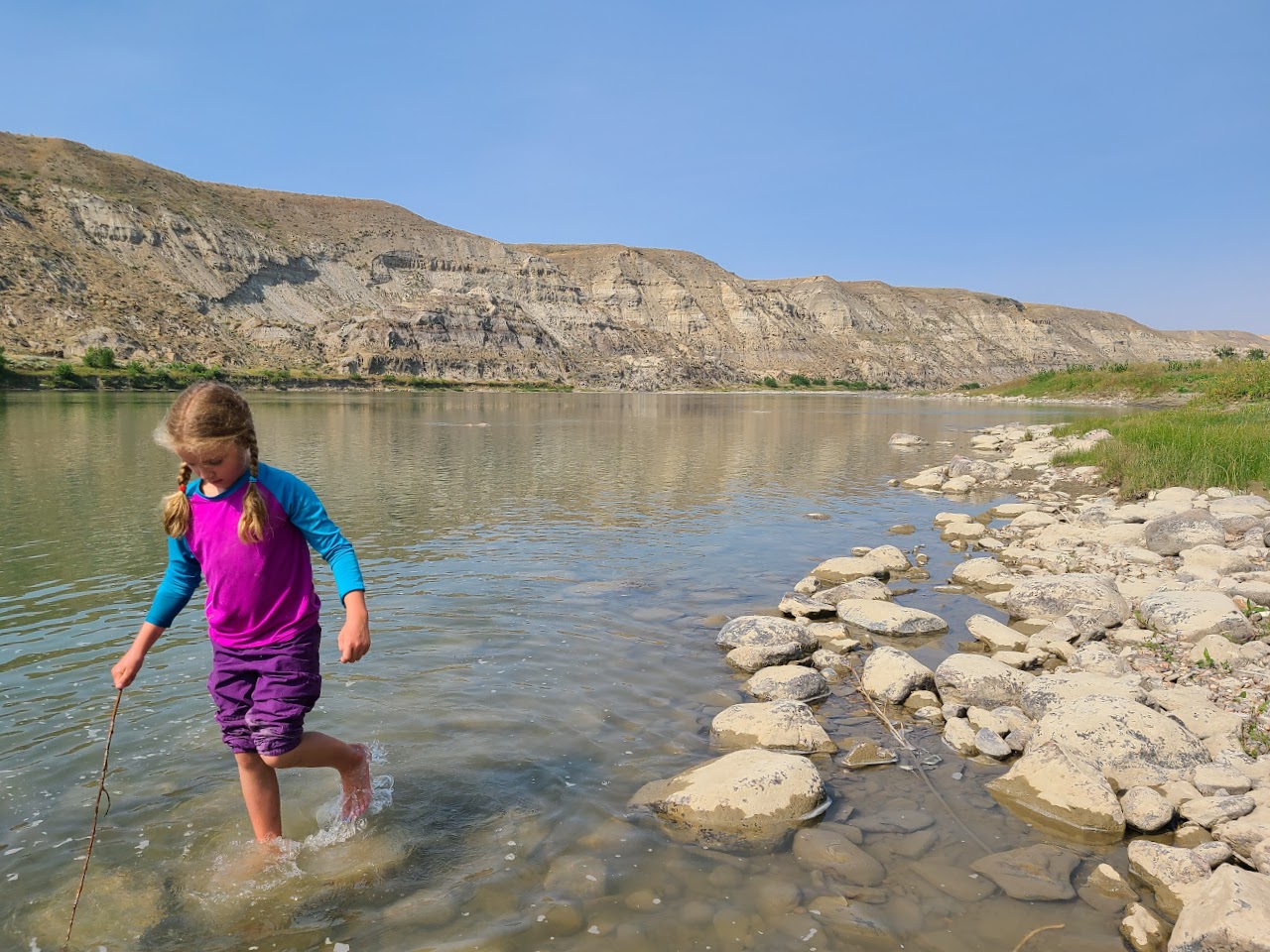
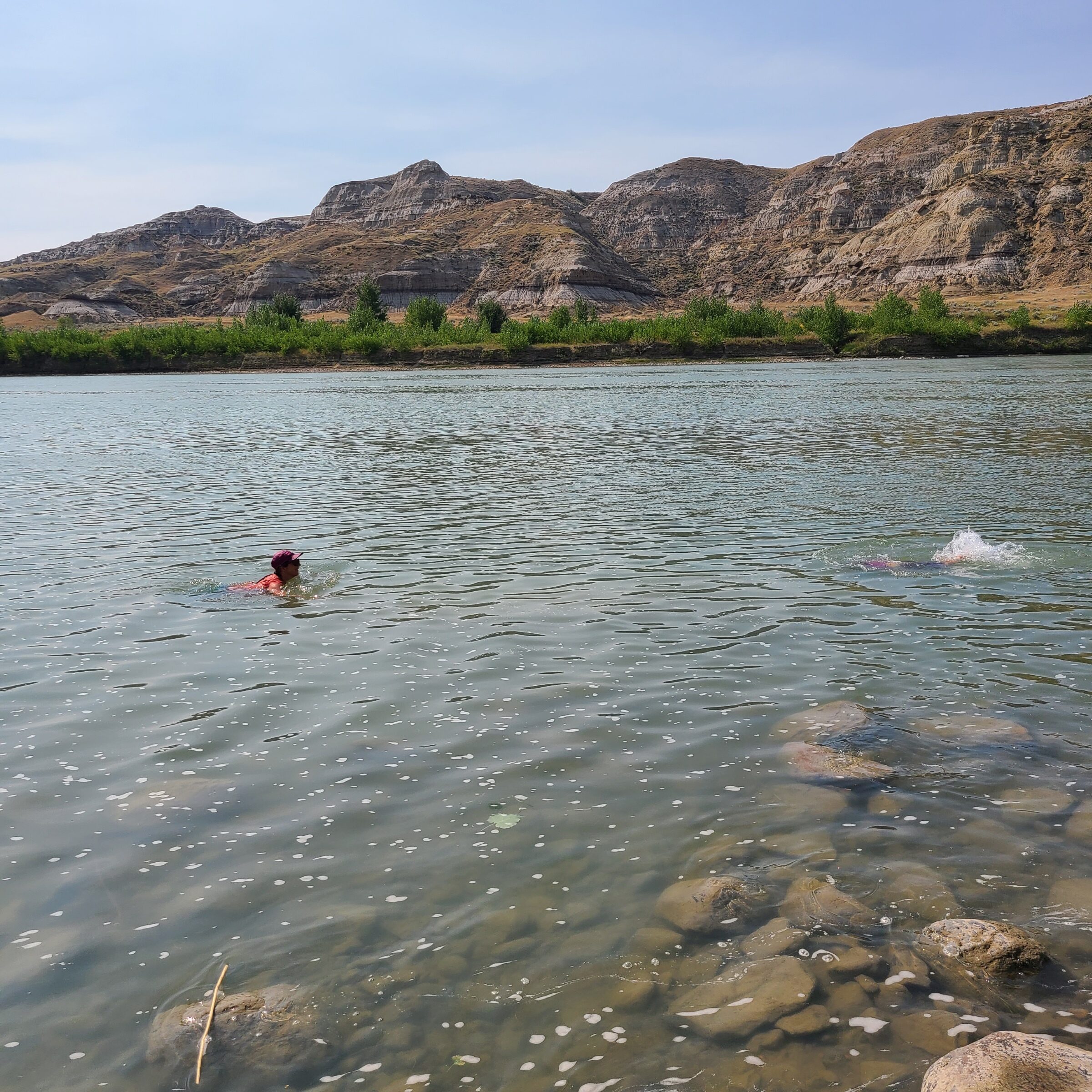
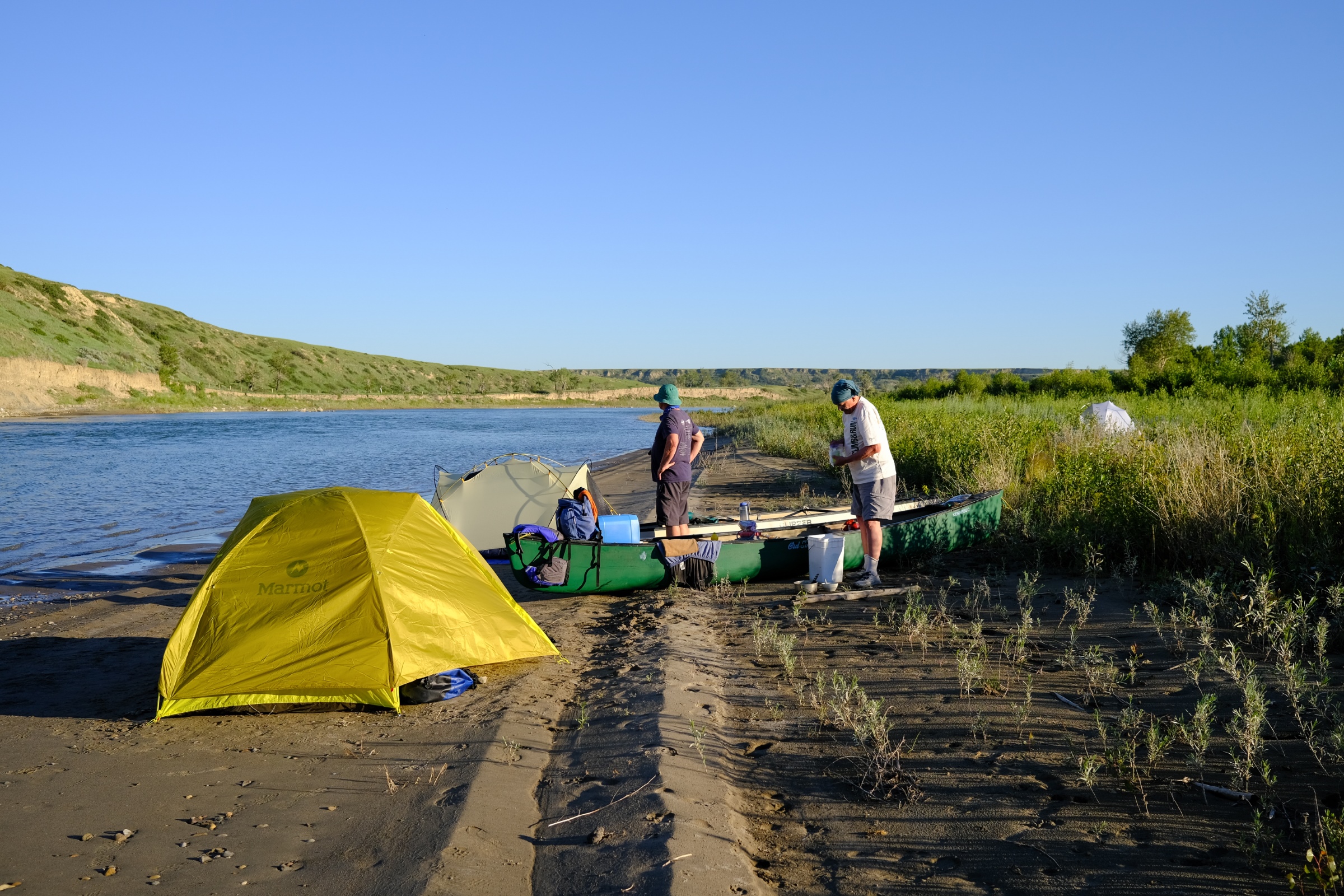
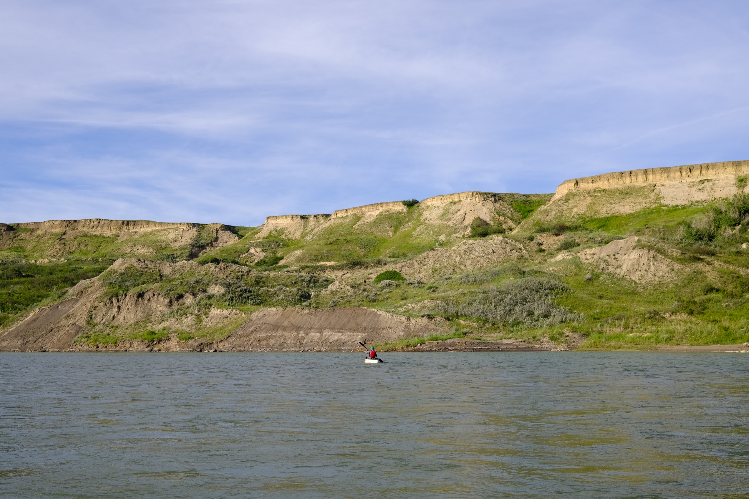
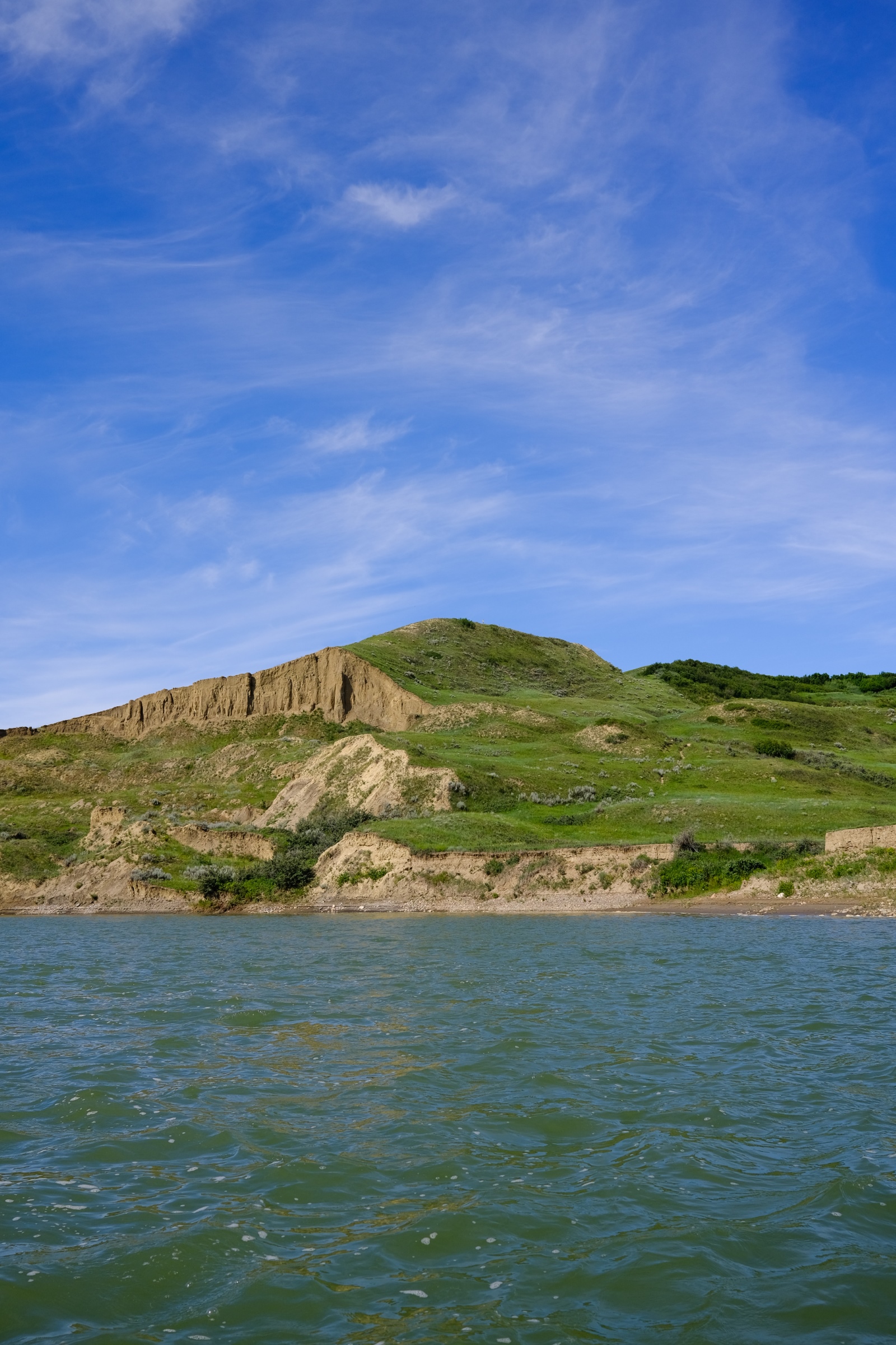
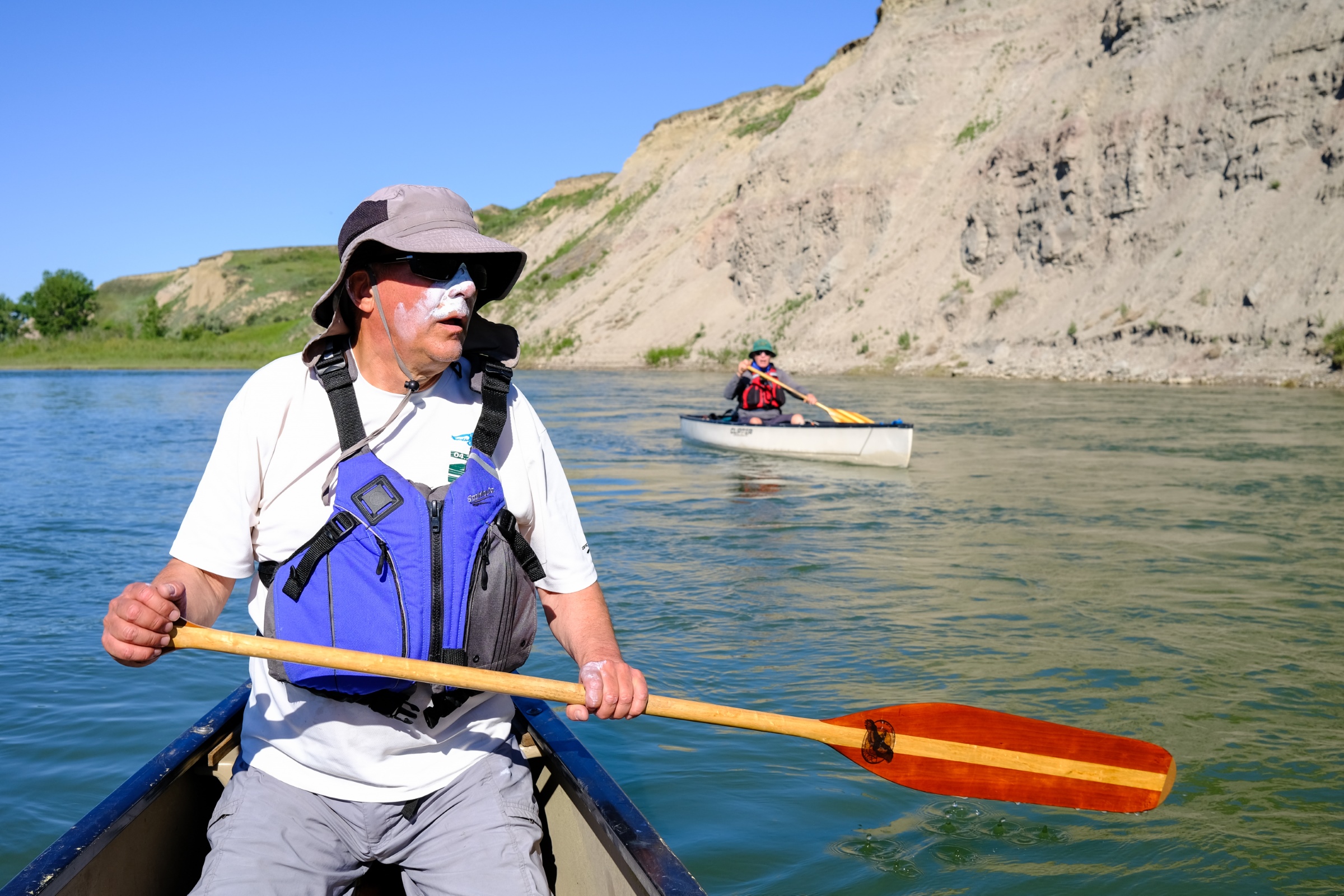
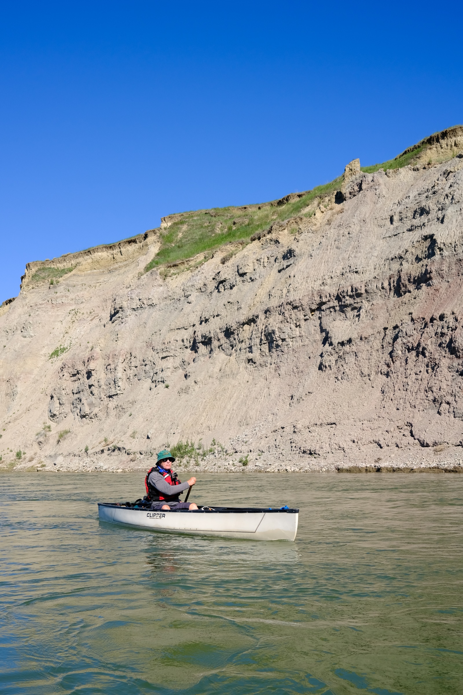
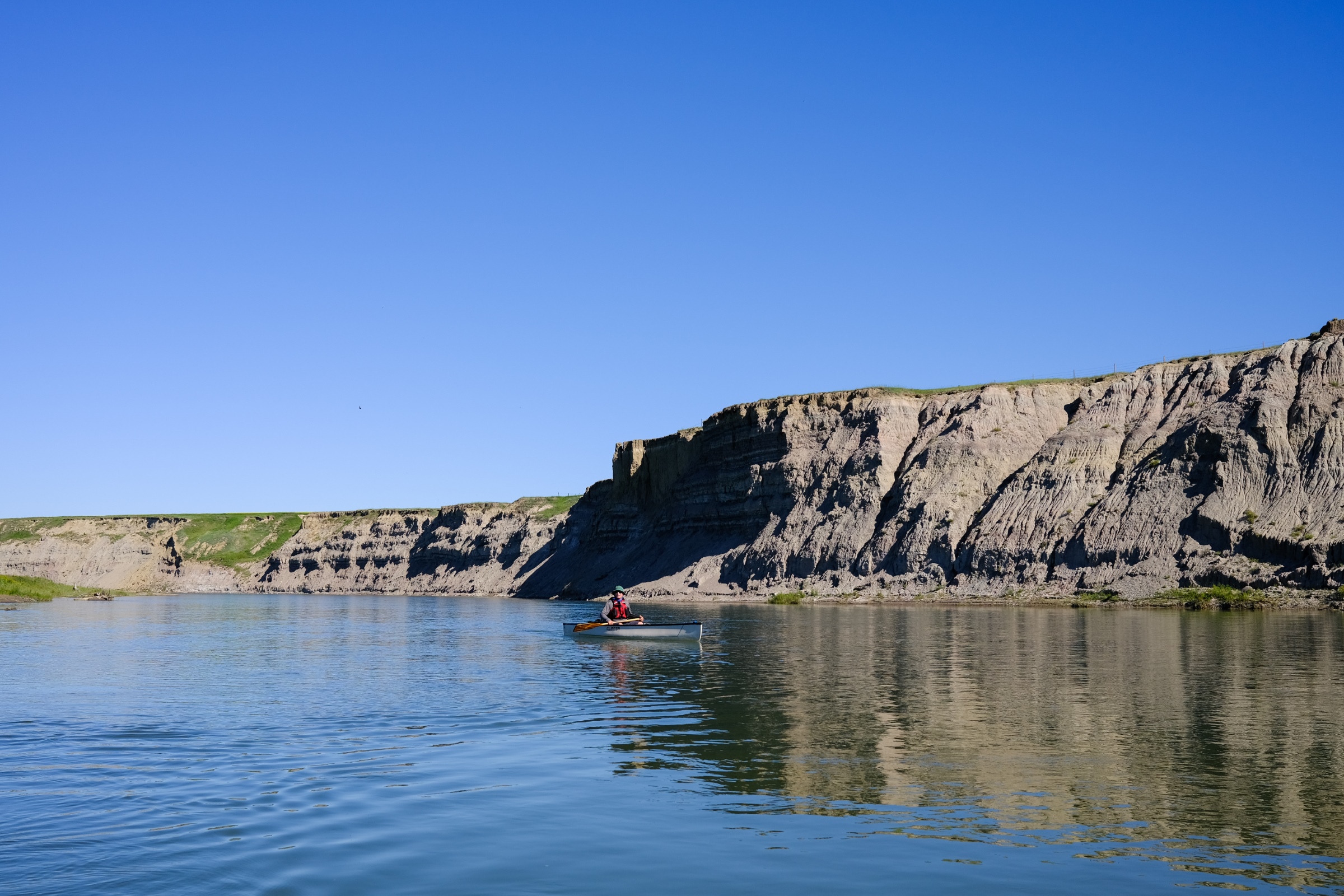
A glorious day in the coulees along the South Saskatchewan River! Despite the oppressive heat, a spectacular discovery of dinosaur bones, a refreshing river dip, and the spectacular landscapes of Southeastern Alberta’s badlands made for a day to remember. Lindsey Wallis recounts this fascinating adventure, coordinated by Heinz and Kris Unger on September 3:
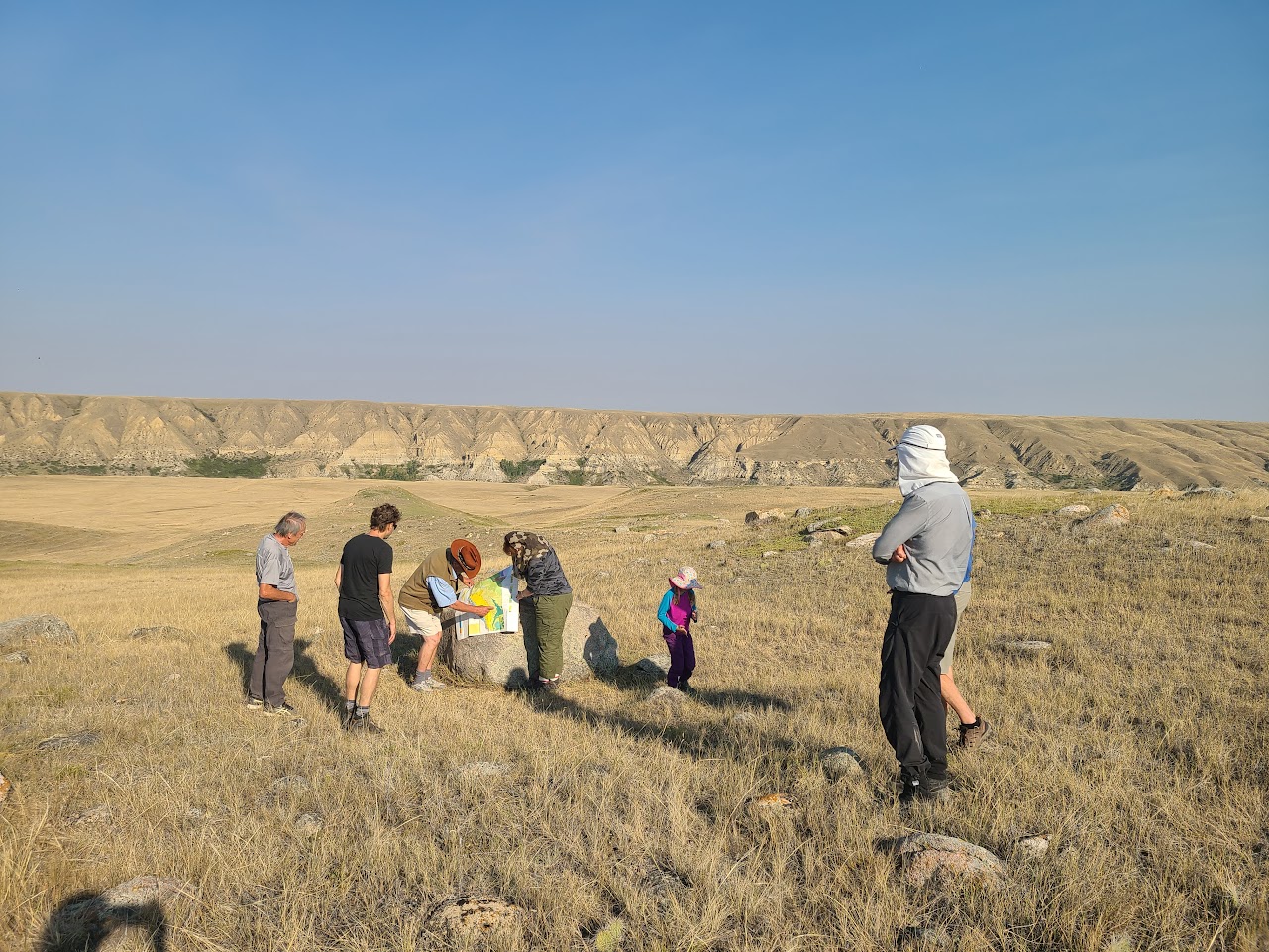
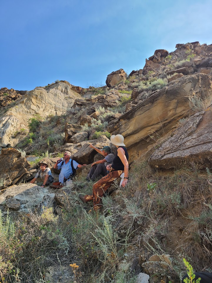
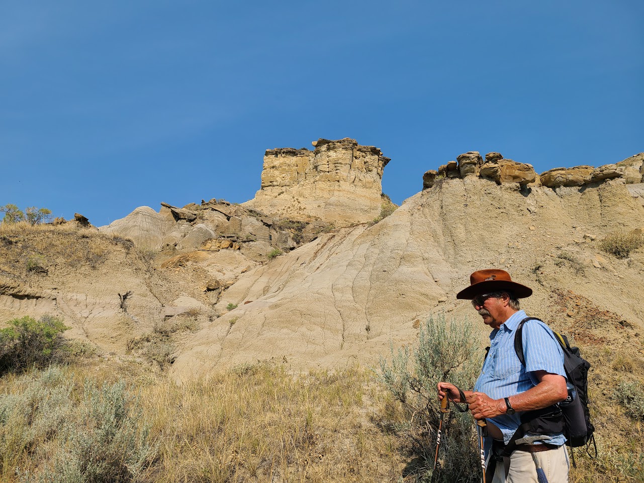
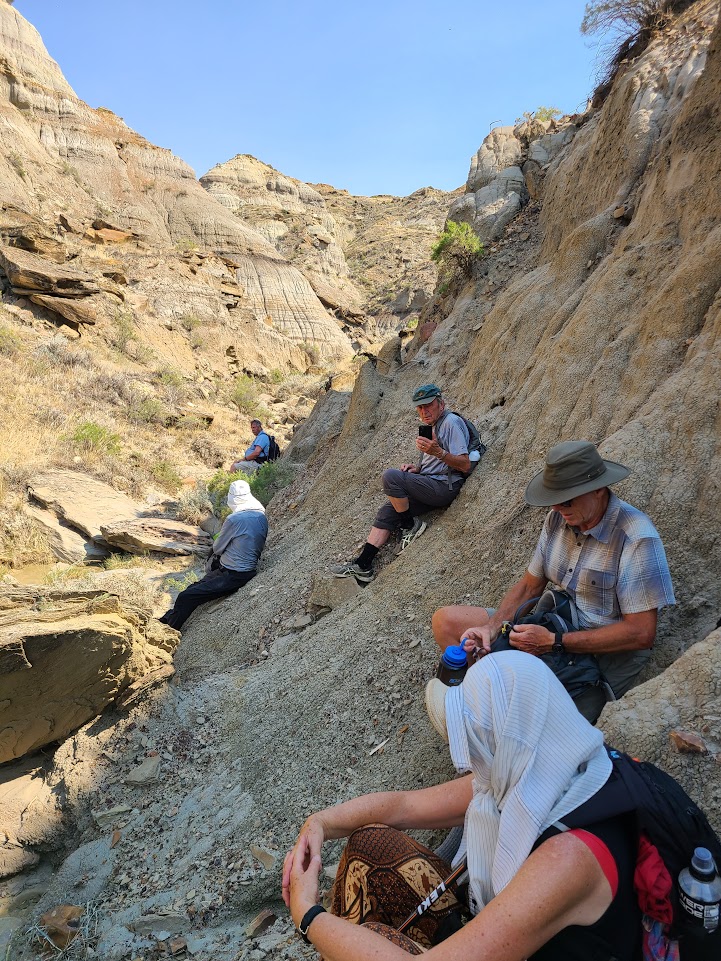
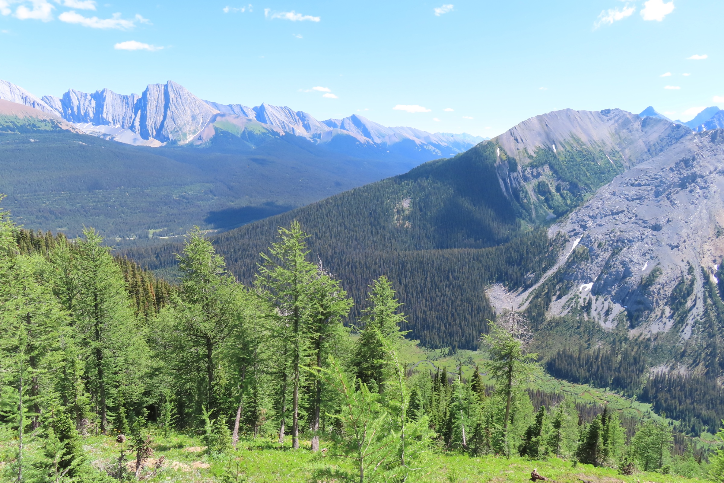
There was a heat warning in place for Medicine Hat as we gathered our group of 10 along Highway 41 and drove to the lip of the coulee. From the uplands we surveyed the river valley and Tako Koning, one of the geologists along on the trip described how the ground beneath us was from the Cretaceous period, when this area was terrestrial, as it is now. We also saw more history in the granite rocks dropped by retreating glaciers from the last ice age.
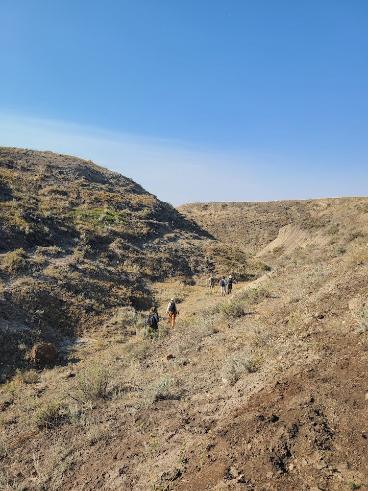
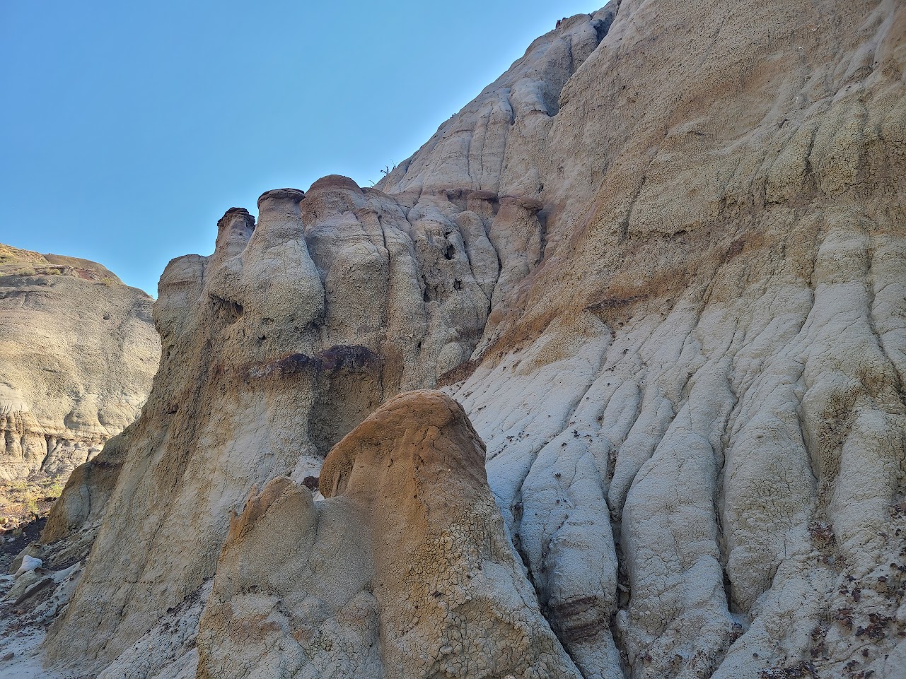
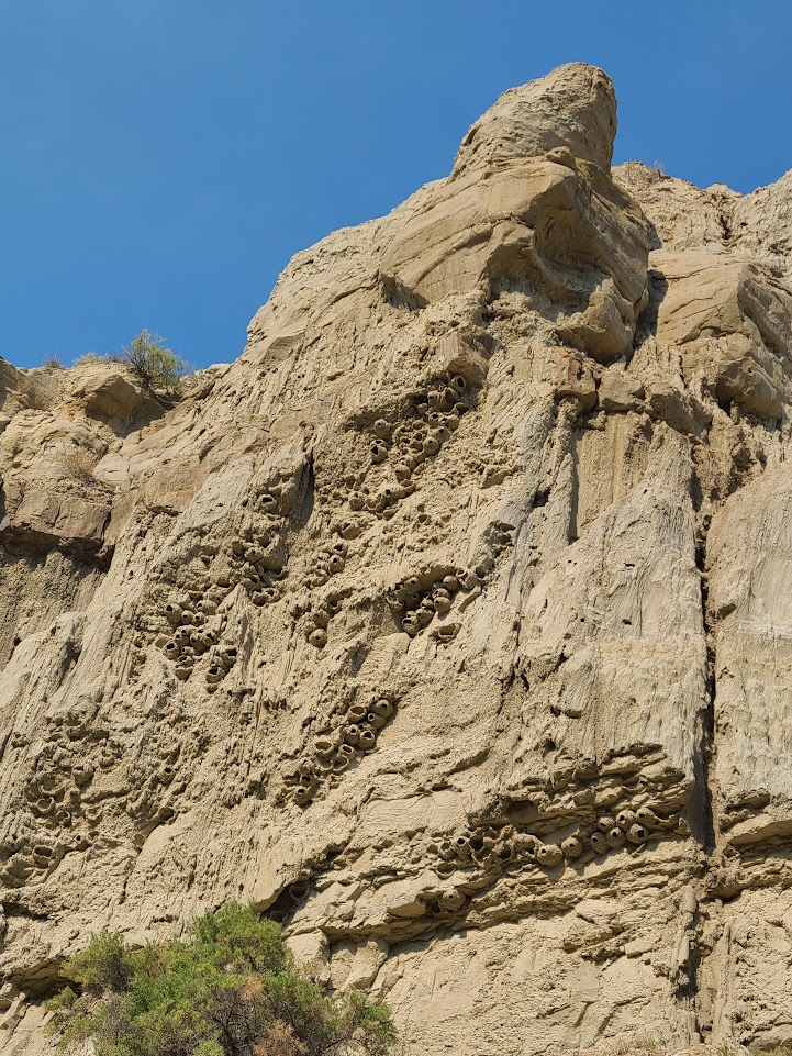
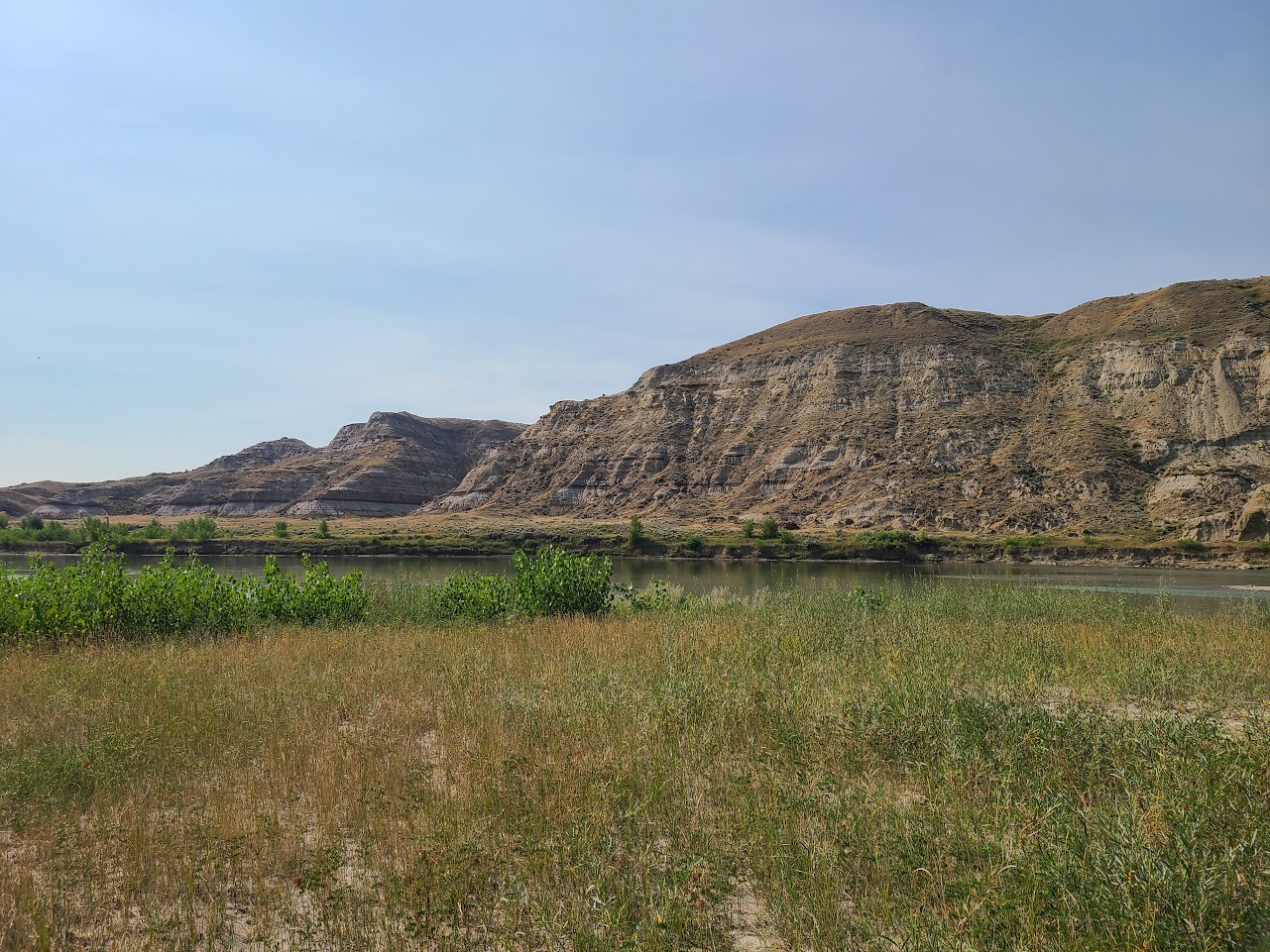
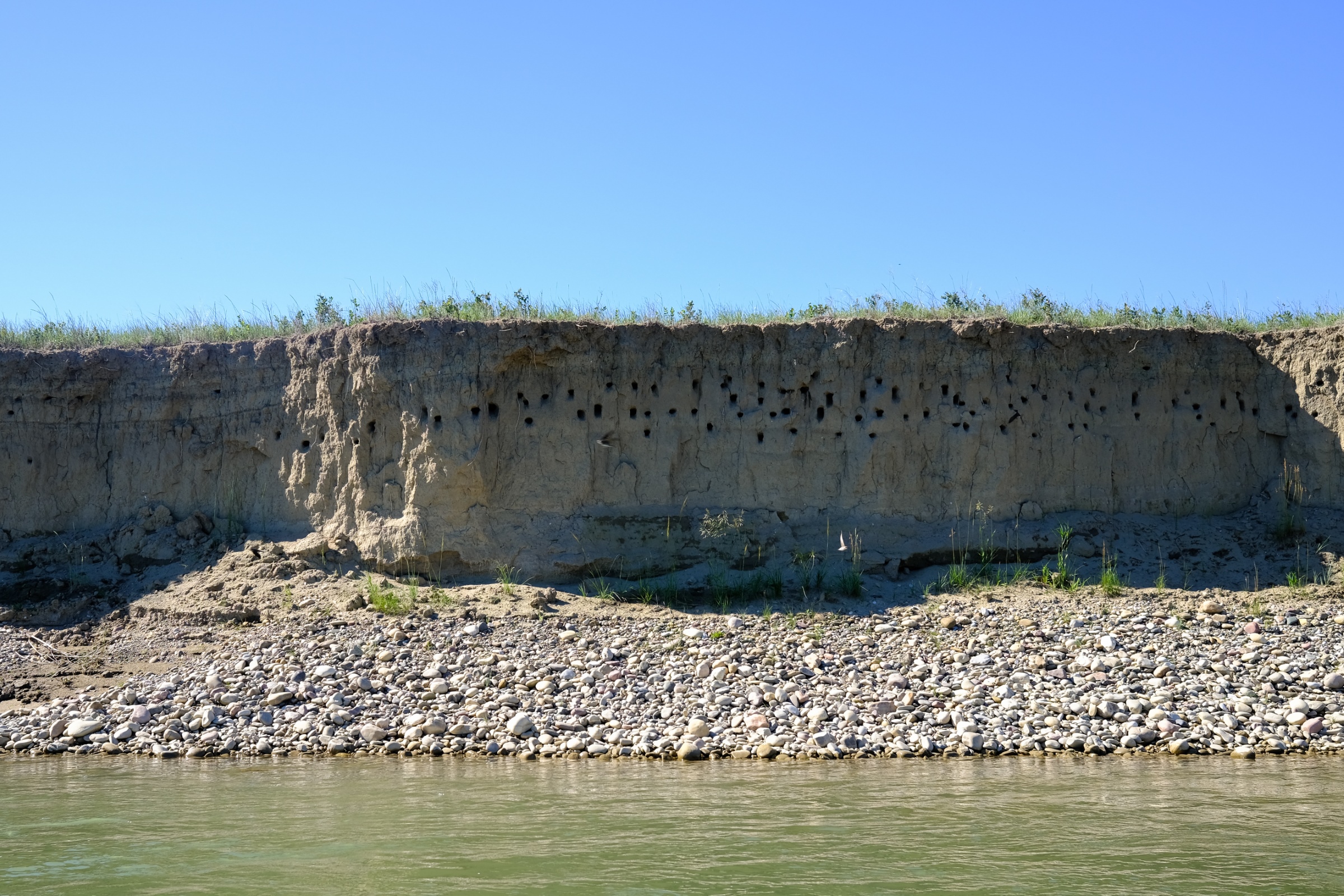
The temperature was quite pleasant as we headed into the coulee. Compared to the spring, when the coulee was lush and green, early September had given the landscape a more gold and ochre palate. Salt bush and prickly pear graced the steep coulee walls and, as we wended our way deeper, dramatic hoodoos rose above us. We passed a disused colony of cliff swallow nests as we dropped down towards the river, and the temperature began to soar.
Upon reaching the banks of the South Saskatchewan River the group found a shady refuge under the branches of a gnarled grandmother cottonwood tree for lunch. A couple folks (prompted by the 7 year old in the crowd) swam fully clothed in the river to cool off while others dunked various articles of clothing before heading back up the coulee.
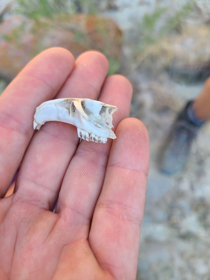
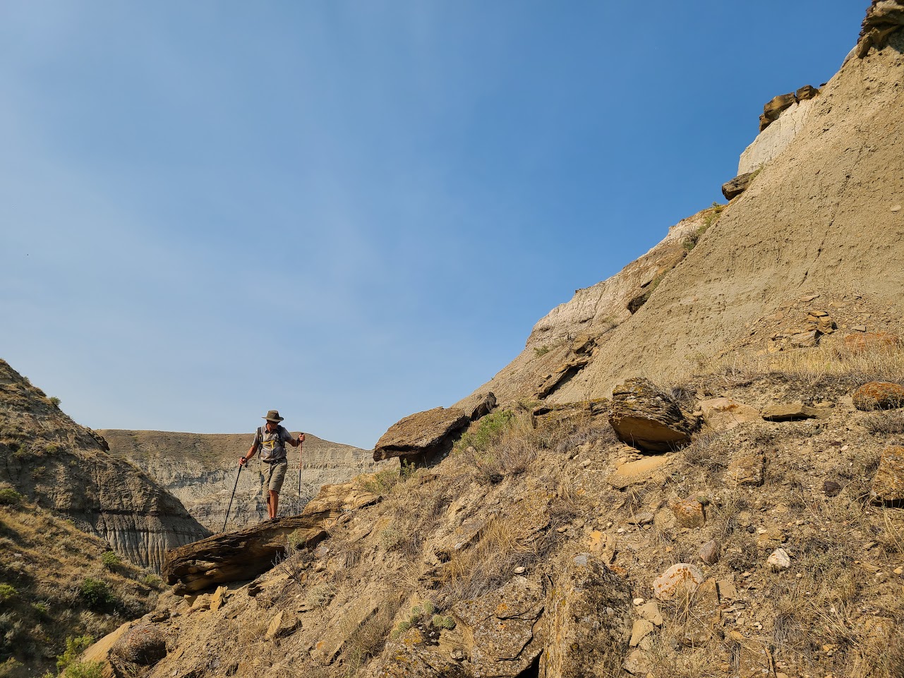
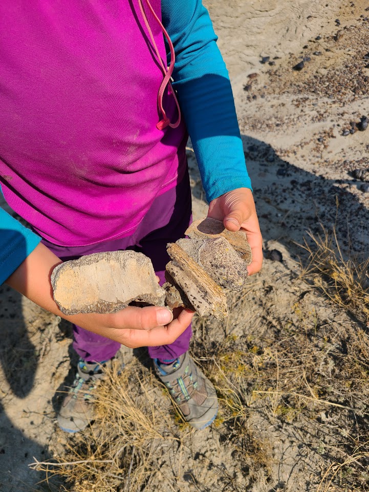
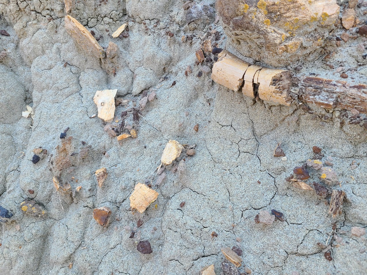
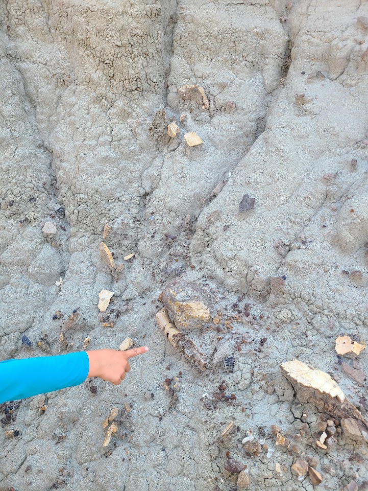
On the way back the sun was intense and high in the sky. The coulee provided very little shade at this time of day. The group moved slowly, taking advantage of what little shade we could for rest stops. This turned out to be advantageous because, at one of these stops, we found a few fairly large shards of fossilized bone on the ground. Looking up, there was a tantalizing bit of white sticking out of the side of a hoodoo. A couple of the group scrambled up to get a better look, and it was quite a few more bits of bone (see photos below).
Photos of the find were submitted to the Tyrell museum in Drumheller where they confirmed, “Yes, what you have found are indeed dinosaur bones. Congratulations on the find. Based on what is visible in the photos, they appear to be the bones of an ornithischian dinosaur, probably a hadrosaur (duck-billed dinosaur) possibly ceratopsian (horned dinosaur). Given the concentration of bones it likely represents either an area where the bones of multiple animals have become concentrated, or a single scattered skeleton.”
Back at the top of the coulee, on the sun-baked prairie, we were grateful for the cool refreshments provided by Heinz. We enjoyed them in the shade provided by the vehicles, whose thermometers were reading 40C! Folks agreed that it was a physically challenging day, but thoroughly worthwhile!
Beaver Dams in the Ghost: Hiking the Headwaters of Meadow Creek
Written on August 19, 2022, by Sean Nichols
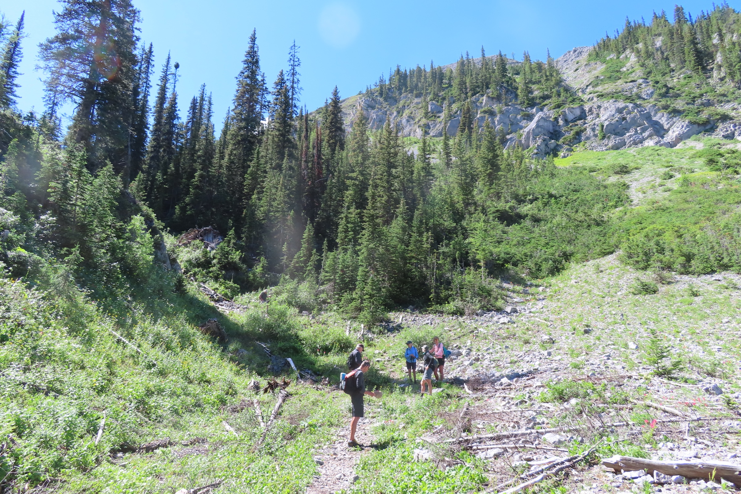
On August 17, Heinz and Kris Unger coordinated an adventure in to the headwaters of Meadow Creek in the Ghost wilderness areas north of Kananaskis. The group was small but the day memorable:
A small group of five started out with fording Waiparous Creek and walked through cool aspen and pine groves, at times along the edge of the escarpment above the deeply cut in meandering Meadow Creek. After about an hour’s walk we caught up level with the creek and crossed the creek on a major bridge, built to keep vehicles out of the creekbed. Some successful bioengineering work could also be observed.
Along the way the damage (deep ruts and water-filled “wallows”) from previous OHV use was clearly obvious. The lower section of the trail / track is now closed to motorized vehicles but for some sections further along, OHV is still allowed. However, we encountered three or four vehicles only, plus one angler on an ATV (he caught several brook trout and one Cutthroat – all released back into the creek).
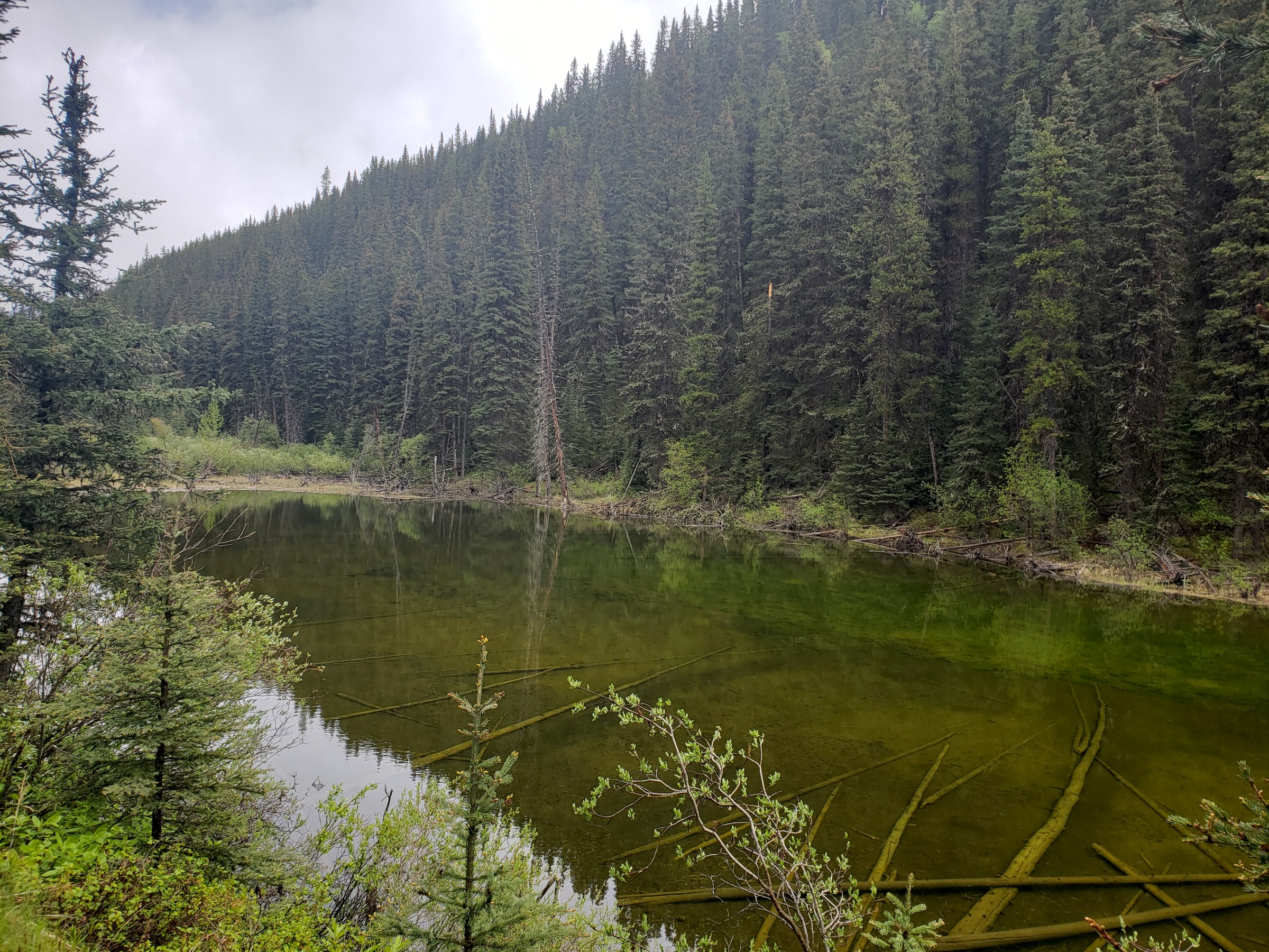
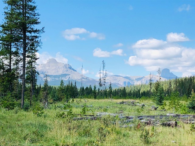
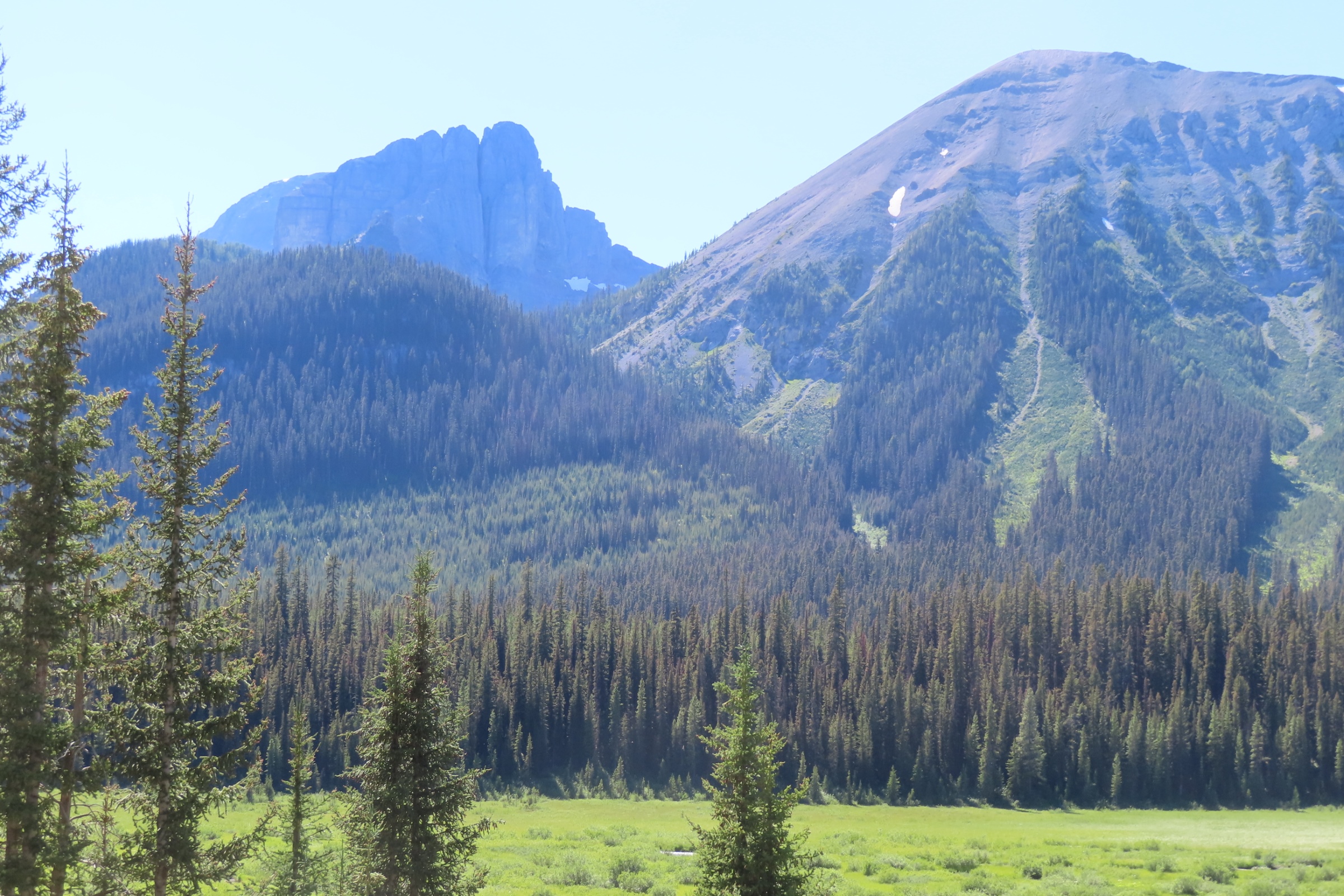
The highlight of the hike was a series of beaver dams, fairly recently built and beautiful clear ponds in the tall grass. That’s where we had lunch in a shady spot, taking in the views. The high mountains, especially Black Rock and Devils Head, form a beautiful backdrop, seeming quite close and rising almost vertically behind the forested ridges that line the wet meadows of upper Meadow Creek.
The cool breezes, the green meadows, the soft trail and the dark forests, all covered by a wonderful silence enhanced by rustling aspen leaves and gurgling streams rounded off a perfect day in nature.


Flowers and Strawberries in the sub-Alpine: A Hike to Tryst Lake in late Flower Season
Written on August 8, 2022, by Sean Nichols
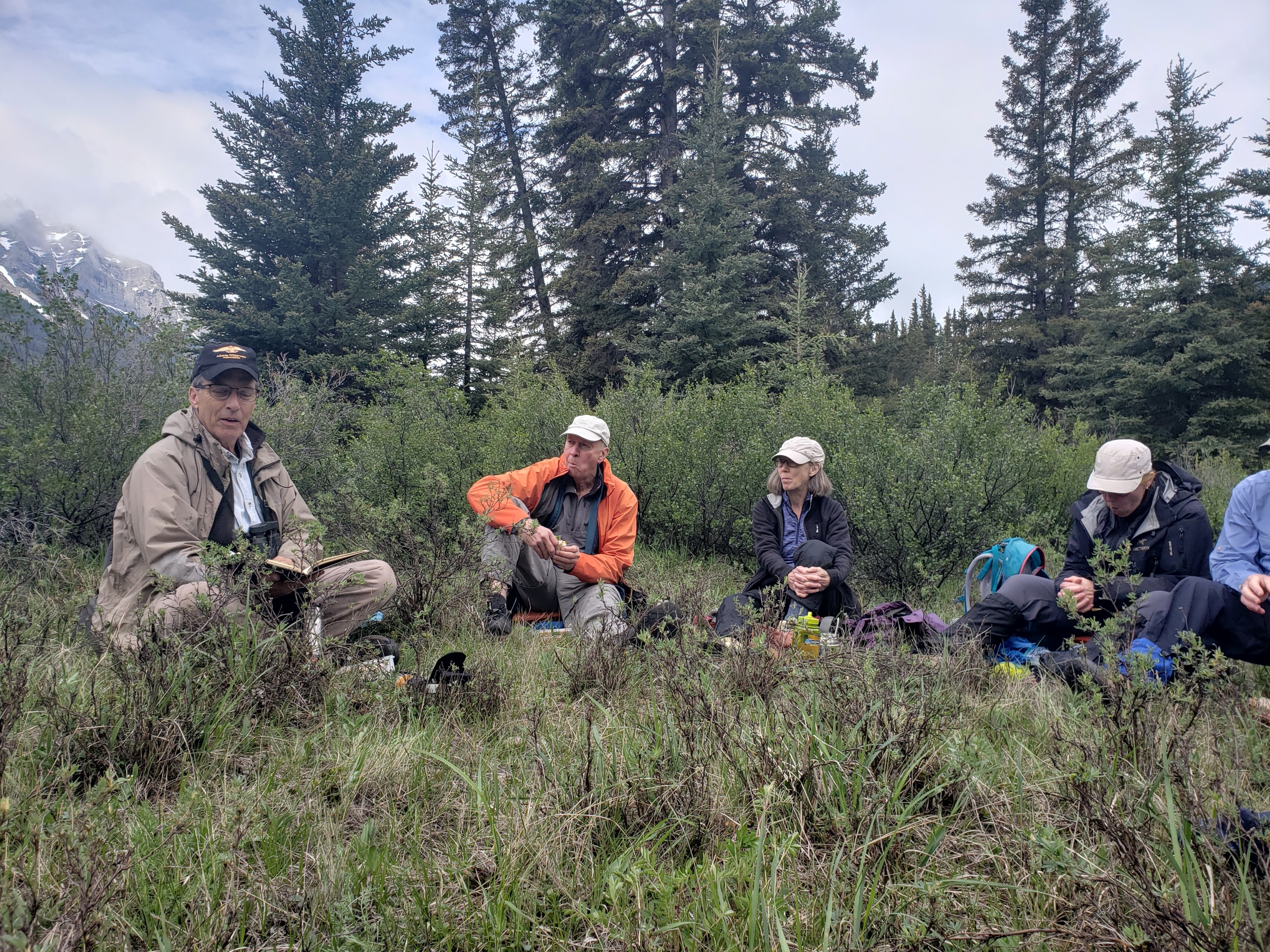
After a few weather-related reschedulings, we were happy to finally be able to hold our long-awaited hike to Tryst Lake in the Kananaskis sub-alpine. Despite concerns that the flowers might no longer be in bloom, it turned out to be the perfect day with the year’s earlier moisture leading to an elongated season. Coordinator Chris Saunders writes about this great outing:
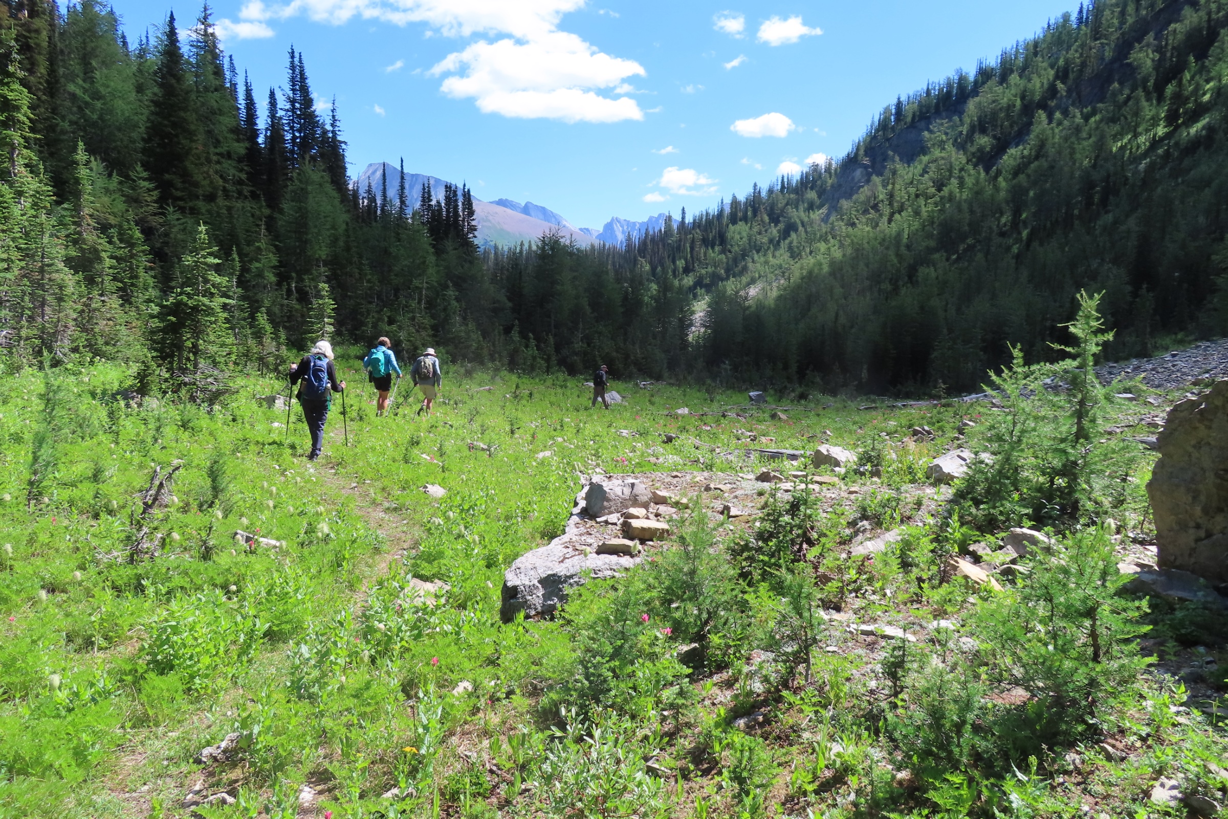
Weather conditions were perfect when 7 hikers met at the trailhead just off the Mount Shark road. From the start the group walked south along an old logging road, which is on a shoulder of the main Spray River valley, for 1.9 kilometres. There were lots of flowers and miniscule strawberries growing along the side of the trail. The group than took small trail to the west which follows a very attractive stream which is the outlet from Tryst Lake high above the main valley.
The lower part of the trail, with its damp conditions, supports many moisture-dependent species including some impressive cow parsnip and patches of bilberry. Further up the trail there is substantial avalanche damage which has destroyed the spruce trees and allowed willows to flourish. In the long narrow valley leading up to the lake there were carpets of flowers, mainly paintbrush in a variety of different colours, aster and arnica.
On reaching the lake, there was just enough clear dry land for the group to walk around the margin of the lake to the west end in order to have lunch in the boulder fields. A resident hoary marmot visited briefly. Lunch was brief because after a few minutes numerous insects descended on the group. It was always necessary to keep moving to void them. The vegetated area at the west end of the lake contained numerous flowers including forgetmenot, valerian, fleabane and many chalice flowers.
The second half of the hike involved returning to the east end of the lake and climbing a steep larch-covered ridge on the south side of the lake. From here the views to the south and east were stunning.
The route returned the group back the same way to complete a very pleasant day.


A Paleolontogical Treasure Hunt in our own Back Yard: Discovering Ordovician-Age 450 Million Years Old Fossils in the Tyndall Stone Downtown and Inner- City Calgary
Written on August 5, 2022, by Sean Nichols
Senior Petroleum Geologist Tako Koning has many passions in life, and it is fair to say that paleontology is one of them. This expert in many things is one of the finest guides one could imagine when it comes to discovering signs of prehistoric life… even embedded into the façade of a neighbourhood Safeway! On June 18 he led a field trip around NW Calgary to explore and showcase the 450-million year old fossils that can be found scattered throughout the inner-city neighbourhoods. Here he talks about how it went:
On Saturday afternoon, June 18 we had a nice group of 11 attendees on an AWA field trip to discover Ordovician-age fossils downtown Calgary and two inner-city areas. Why would this group want to spend their afternoon looking at fossils?
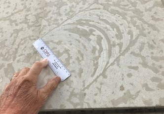
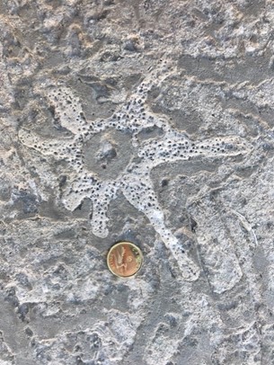
There are a number of reasons for this. These fossils are very old and are dated as having been deposited 450 million years ago. The fossils occur in a sedimentary layer called the Tyndall Stone which is quarried near to the village of Tyndall located 30 km northeast of Winnipeg. The fossils lived and died in a shallow-water tropical sea. Tyndall Stone is used as a beautiful decorative stone which clads buildings all over Canada. It is the most famous of Canada’s ornamental building stones. Another reason to go on this field trip is to view over a dozen of different species of fossils which were first living creatures ranging from algae, worms and crustaceans which lived in worm tubes, star fish, gastropods (snails), nautiloids, and an amazing variety of corals ranging from large coral-heads to small solitary rugose corals (“horn corals”), to single chain and double chain corallites. So going on this field trip is an opportunity to learn about biological life which occurred many years ago in a tropical sea unaffected by mankind since we were not part of the scene in the Ordovician.
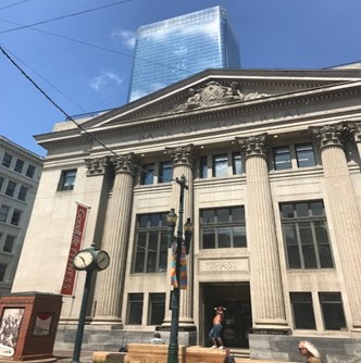
We first visited two historical buildings downtown which are clad in Tyndall Stone: the AGT building at 119-6 Ave., SW and the Bank of Montreal building on the Steven Avenue Mall. Then we spent an hour viewing ten blocks of Tyndall Stone in front of the Safeway Store in Kensington so we could see the fossils in five dimensions (from the top and from four sides). We then spent another hour at SAIT where Tyndall Stone clads the entire outside of the Senator Patrick Burns Building. I look forward to leading this field trip again next year for the AWA with a nice group of people.
The Oldman River: A New World Next Door
Written on July 19, 2022, by Sean Nichols
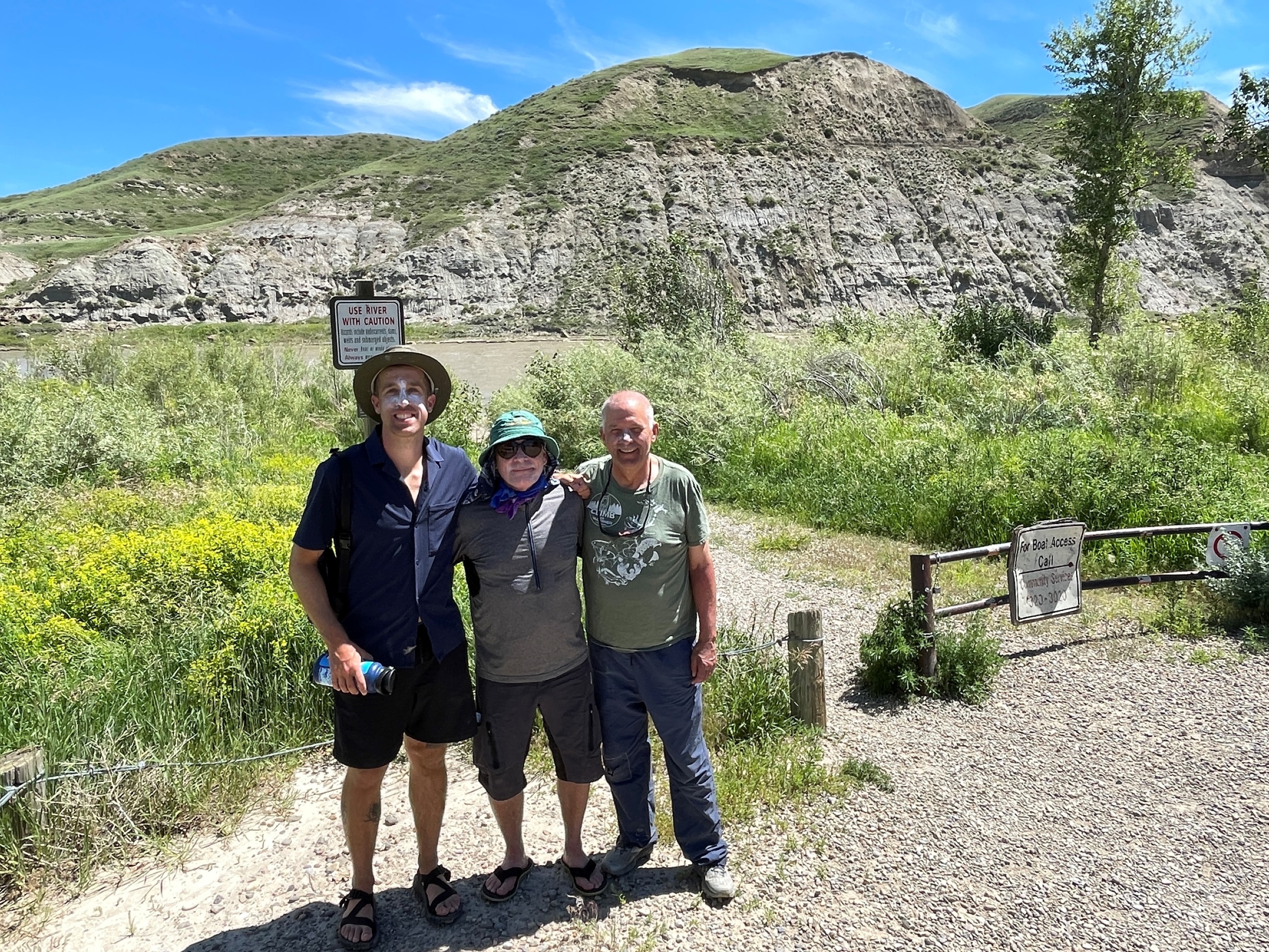
Adventure, natural beauty, and key moments in Canadian history. What a great combination. AWA President Jim Campbell, member Bob Patterson, and Conservation Specialist Phillip Meintzer found it all on the Oldman River between Fort MacLeod and Lethbridge. Marking Jim’s 70th birthday, the three of them set out on July 11th on a Paddling Adventure down the river. Jim and Phillip here share their perspectives on the trip.
AWA President Jim Campbell writes:
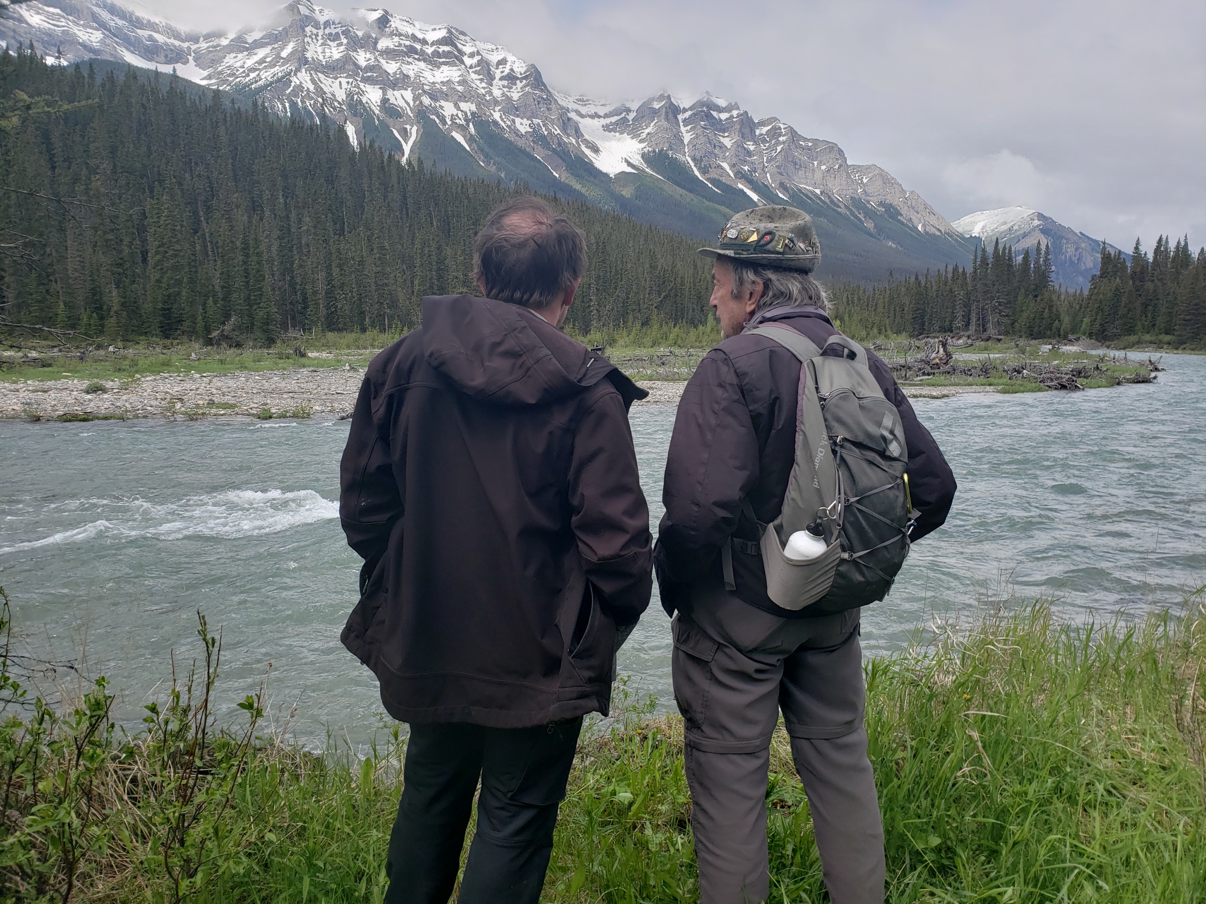
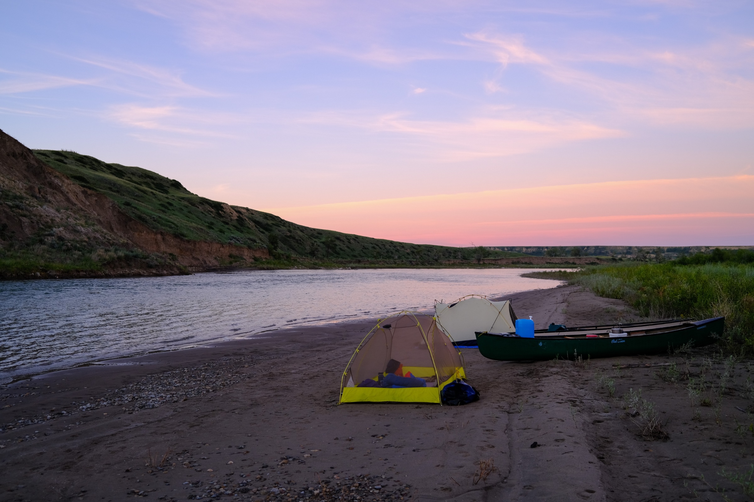
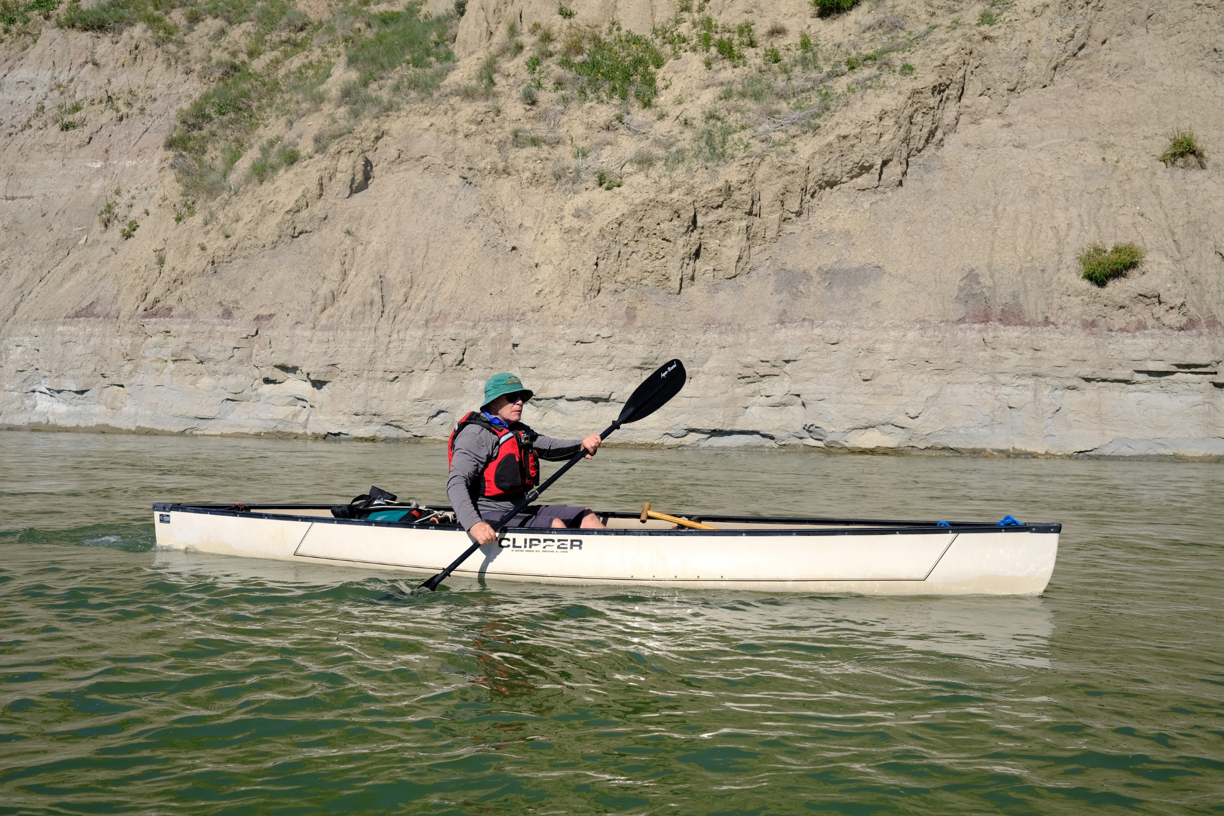
This was the 3rd annual Adventure for Wilderness for Jim Campbell and Bob Patterson, and this year we were fortunate to have AWA Conservation Specialist, Phillip Meintzer join us as we explored a stretch of the Oldman River, that offered many happy surprises over two days, and 90+ kilometres of paddling.
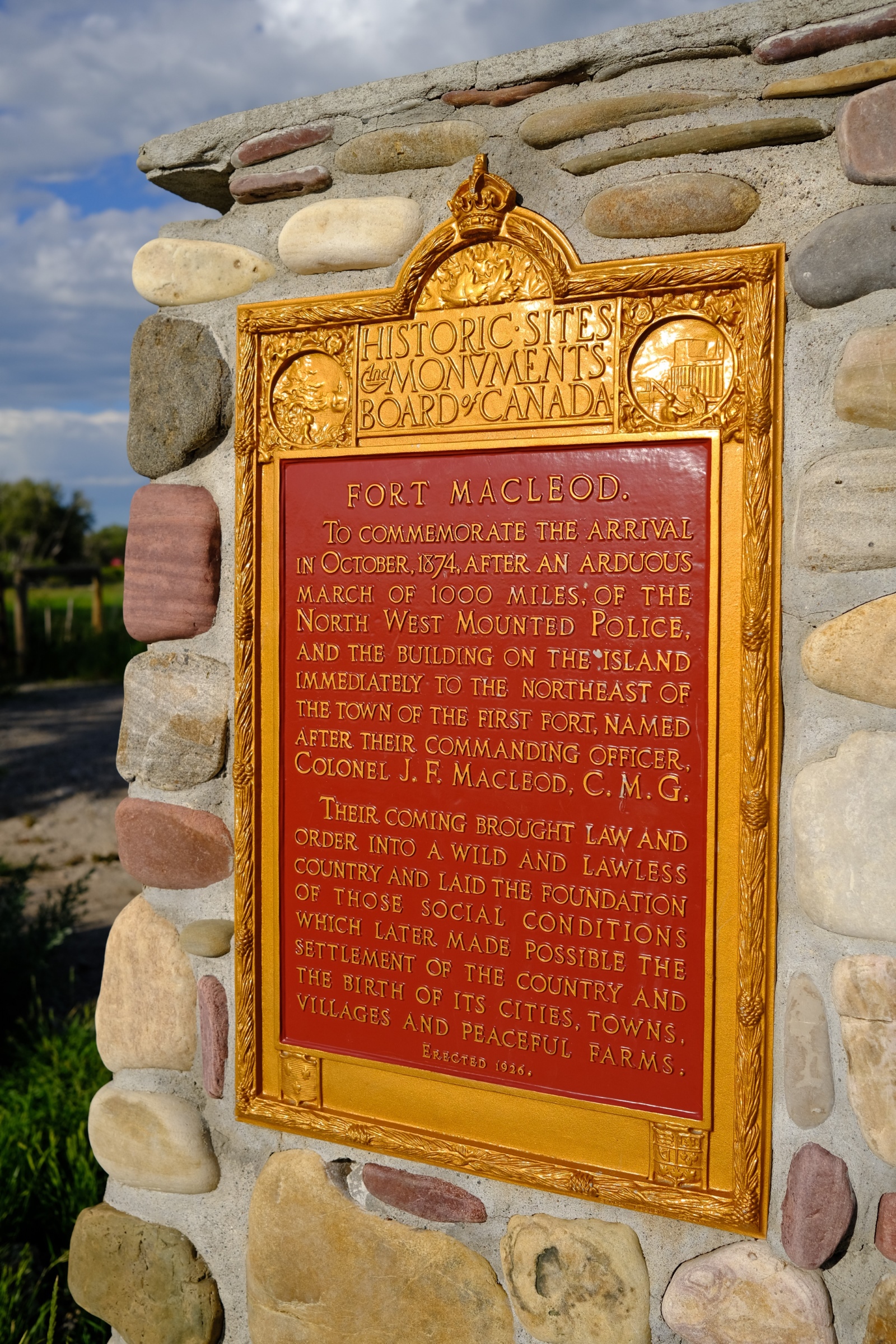
The first bonus was an evening in Fort MacLeod. Walking the historic main street and visiting the site of the original N.W.M.P. post brought surprises and reflections. Who knew the internationally renowned, Joni Mitchell, was born here? And the commemorative plaque placed in 1926 at the site of the original Fort MacLeod spoke of a different time and perspective. MacLeod’s Restaurant & Lounge with a delicious 2 for 1 pizza capped off the evening.
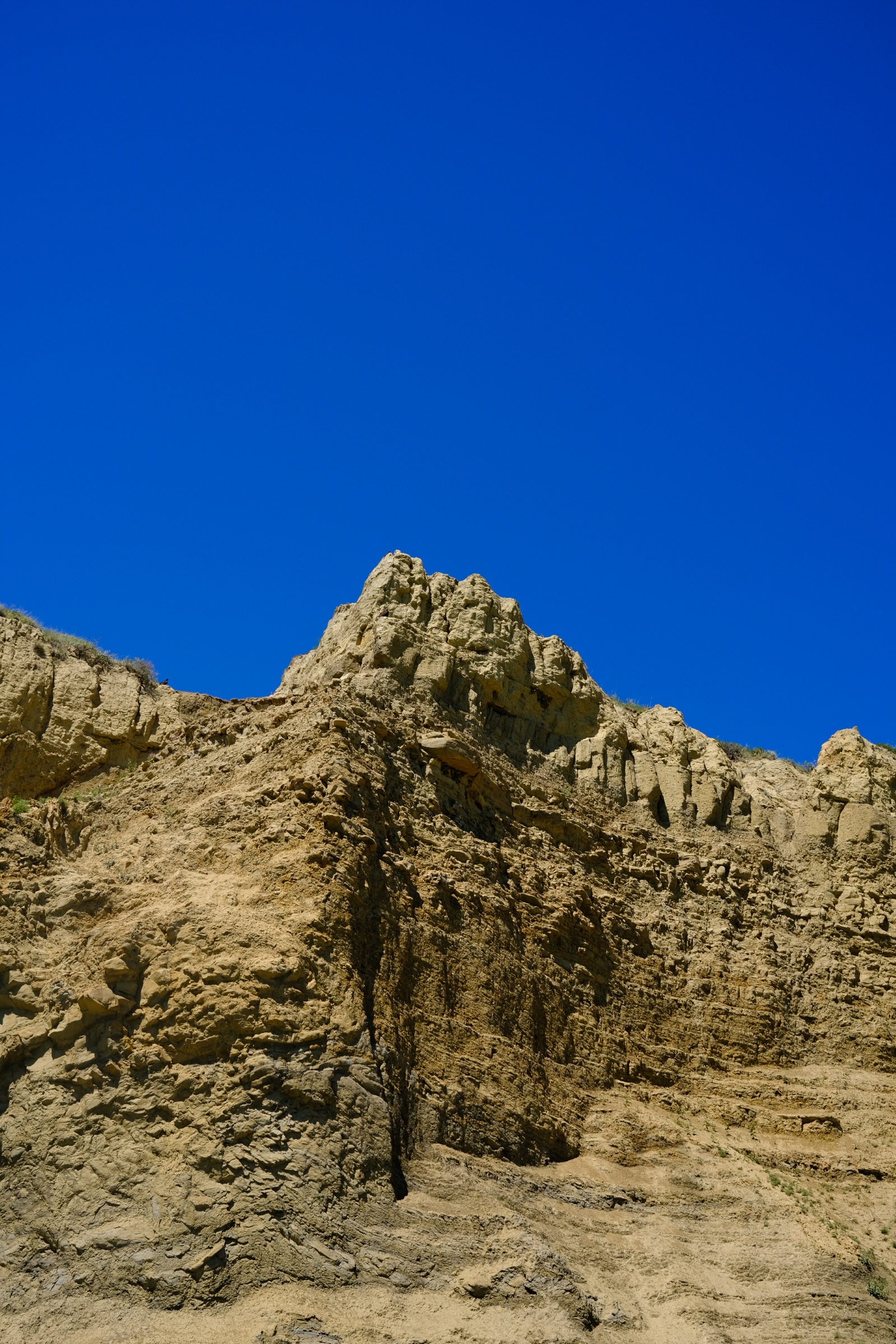
We launched on a sunny, warm morning from the Oldman River Provincial Recreation Area at the junction of Highways 2 and 3. Paddling by Fort MacLeod in good Class I water provided a clear view of the town, and why the original Fort was ultimately moved to higher ground.
Not long after that Phillip fortuitously looked back upstream and spotted a cow moose and her two calves crossing the river behind us. Another surprise and delight for the morning. The day rolled on with clear, fast water and great bird activity including an Osprey hovering over the river, and then plunging into the water to clutch its prize and fly close by over our heads. Signs of agriculture and irrigation also abounded drawing our thoughts to plans for three new reservoirs in this basin. How do we reconcile all the competing demands on this vibrant but vulnerable eco-system?
Ever innovative, Bob in his solo canoe switched to a kayak paddle and easily kept pace with Phillip and me. As we passed under the bridge to Monarch there was no sign of the campground mentioned in the guidebook from 1982, the only one we found that referenced this part of the river. We paddled on and at Kilometre 57 found a beautiful stretch of island shoreline to make camp.
Next morning dawned equally warm and sunny. A few more kilometres on a good Class II rapid with large standing waves helped stir us awake, and we paddled on ever watchful of what was around the next bend. Finally swinging north, we landed at Popson Park at the south end of Lethbridge where our new friend, Kirby England, met us for a quick shuttle back to Fort MacLeod. Thank you Kirby!
Thanks to all who so generously supported this Adventure for Wilderness. You can be certain your donations are deeply appreciated and will be well used in support of conserving Alberta’s wildlife and wild places.
P.S. If you do this stretch remember to bring your own water! Happy Paddling!
AWA Conservation Specialist Phillip Meintzer also shares his perspective on the trip:
Departing from the Oldman River Provincial Recreation Area outside of Fort Macleod on the morning of Monday July 11th, Jim, Bob, and Phillip set off on their journey towards Lethbridge to explore this reach of the Oldman River.
This section of the Oldman River is relatively under-paddled, or at least under-documented, which meant that the route felt like a genuine adventure into the unknown. The water levels and in-stream flows of the river were better than anticipated, which made for fairly quick and hazard-free paddling for the majority of the trip. Under cloudless skies and amid the warmest stretch of weather we have experienced so far this summer, the conditions couldn’t have been much better for two days on the water.
The trip covered roughly 92 kilometres in total – 57 on Monday, and the final 35 on Tuesday. Surrounded by impressive cliff faces with lush riparian areas, the group saw plenty of wildlife including three moose (a mother with two calves), two coyotes (one swimming), numerous pelicans, threatened bank swallows and their nesting sites, bald eagles, two beavers, and a few ospreys.
The trip finished just south of Lethbridge, where the crew pulled out at Popson Park and were picked up and shuttled back to Fort Macleod by Kirby England – a professional biologist and environmental science instructor from Lethbridge College.
This adventure was organized as a celebration of AWA President Jim Campbell’s 70th birthday and to raise awareness for water conservation issues in southern Alberta watersheds. The trip was a success, and it made us curious why more people don’t paddle this portion of the river?
Although water levels and water quality seemed to be better than the group was expecting – possibly due to recent rains across the prairies – we need to recognize that climate change will make good years increasingly less likely as we bounce between periods of droughts or flooding.

Then and now: Change and continuity in Banff’s Cascade Valley
Written on July 4, 2022, by Sean Nichols
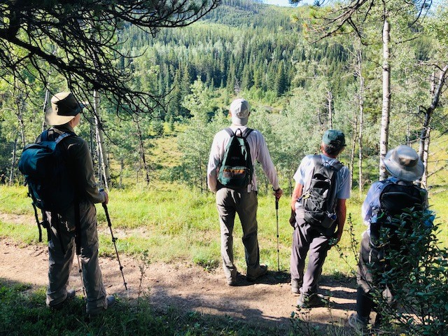
Despite a grim weather forecast, a group of intrepid adventurers spent the day with author Kevin Van Tighem, who recounted stories from his past adventures up the Cascade Valley and how things have changed over the past half-century. Devon Earl, AWA Conservation Specialist shares the day’s discoveries:
On the rainy morning of June 24th, 2022, a group of 11 adventurers and myself met in Banff National Park to hike the Cascade Fire Road with Kevin Van Tighem. Although the weather forecast was bleak, that didn’t stop this adventurous group from setting out on a 13 kilometer hike through bear country to explore and discuss the changing wilderness in Banff.
As we set off on our hike, the rain let up and we spent most of the day in cloudy conditions with breaks where the sun shone through the clouds. We made many stops along the way to identify bird calls, look at carnivore tracks and scat, and listen to Kevin’s stories about his early experiences in the area. Although there was evidence of a lot of bear activity in the area, we felt safe and secure in such a large group, with many hikers prepared with bear spray at their hips.
As we stopped for lunch next to the Cascade River, Kevin pulled out detailed journals that he had written in the ‘70s detailing his early adventures in the park. As we ate, he told stories of animals he encountered on his journeys, including hearing the howling of a wolf pack as he tried to sleep in a tent at night. It was fascinating to hear of these amazing encounters which happened not far from where we sat at that very moment.
On our return trek we were left to consider the amazing natural history of this area, and how humans and all our activities have changed the wilderness. We were also able to consider what has stayed the same, such as how getting out in the wilderness makes us feel connected to nature and all the beings that call this wilderness home.